-ad 189-

Exploring Bethesda and Montgomery County: A Map of the Area from 1878

Explore the area around Bethesda and Montgomery County, MD with this 1878 map. Learn why it was named Montgomery County and more! Click for a larger map.
-ad 188-
-ad 615-

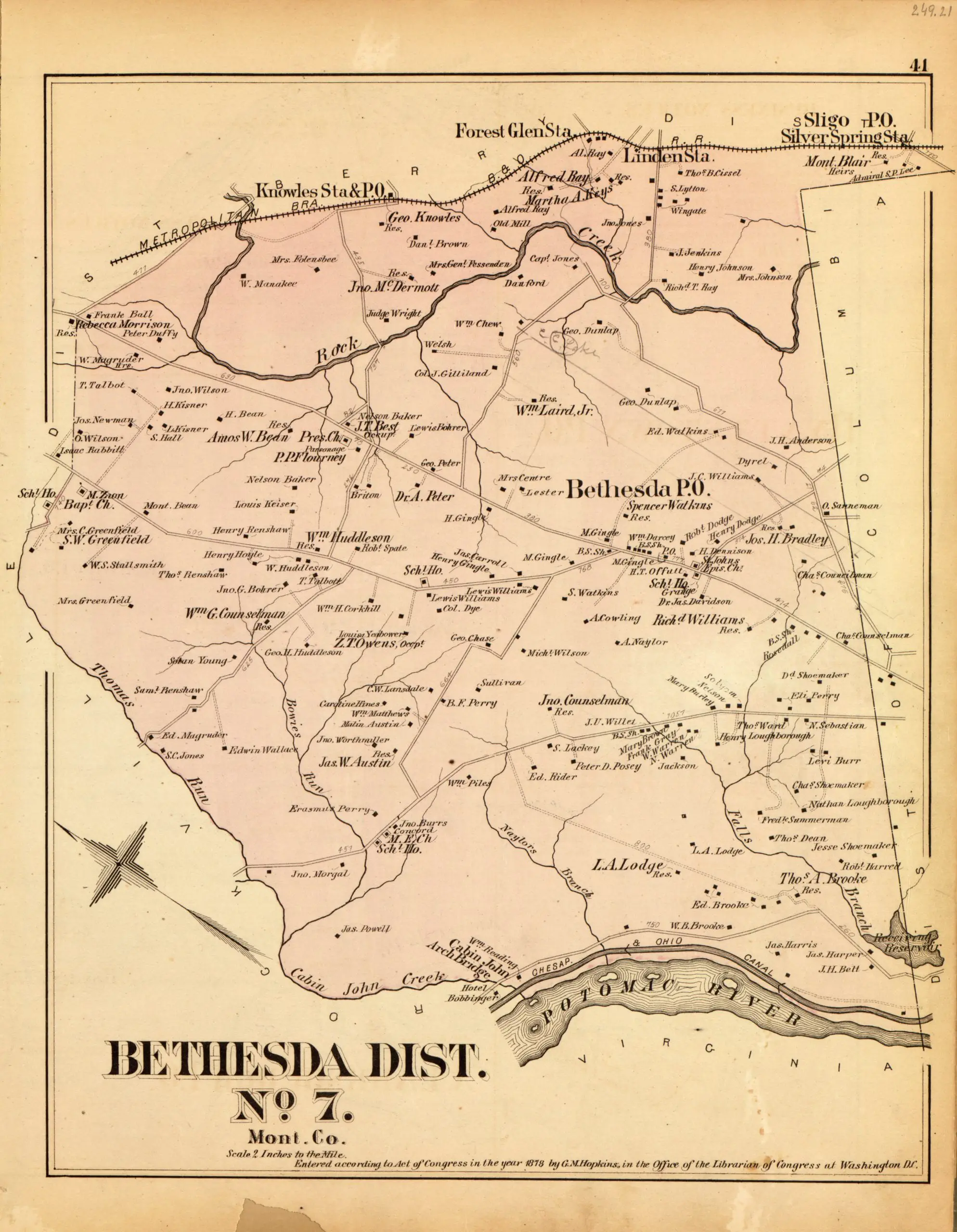
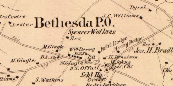
This is a great one. We finally dug up a few good maps of the surrounding area, outside the District line. This shows Bethesda and a chunk of Montgomery County (why is it named Montgomery County?). Click on it for a larger map.

Map of Bethesda District in 1878

Today's Recommendation

-ad 617-

Suggested Reading

Can You Support Us?

If you enjoyed this post and can help support our blog, please consider subscribing. Thank you.

-ad 616-

Thanks for reading a few Ghosts of DC posts today.

Support Us

We rely on donations and a small amount of ad dollars to support our efforts. Are you able to chip in a few dollars today to help our site?

JOIN OUR EMAIL LIST

Enjoy daily

Ghosts of DC stories