
The Old Glass House of Washington
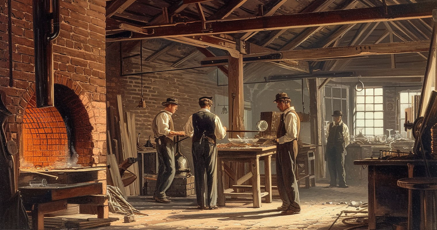
In 1807, two brothers named Andrew and George Way opened a glass factory on the Potomac, where the Lincoln Memorial stands today.
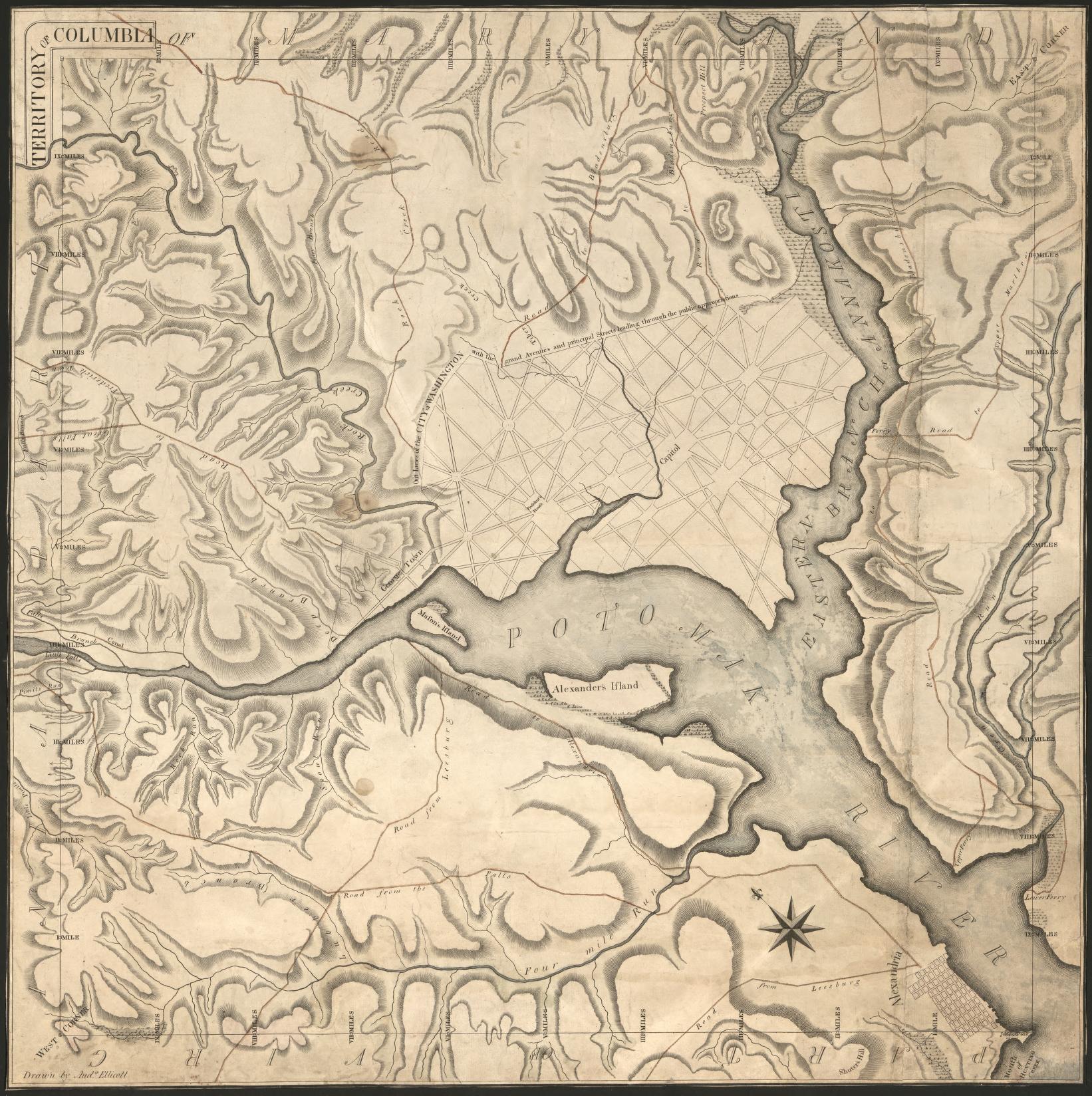
Washington, DC neighborhoods and buildings that aren’t there anymore. Murder Bay, the old Center Market, brownstones erased for federal office blocks.
In 1807, two brothers named Andrew and George Way opened a glass factory on the Potomac, where the Lincoln Memorial stands today.
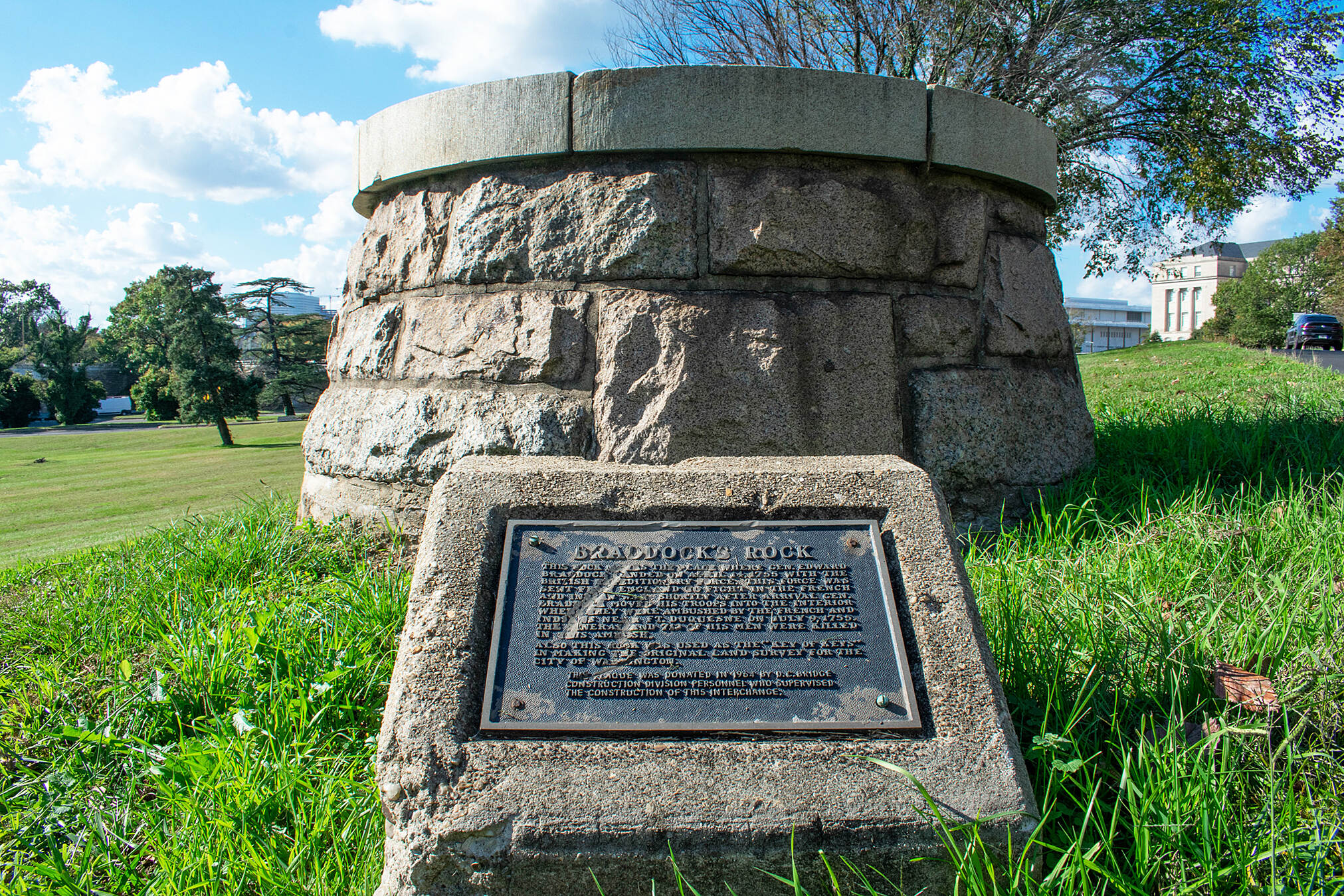
Braddock’s Rock was where General Edward Braddock reportedly camped on the Potomac in 1755, with a young George Washington along.
In 1910, Taft, Hannis Taylor, and Washington’s Board of Trade tried to undo the 1846 Alexandria retrocession. Virginia and a lame-duck clock stopped them
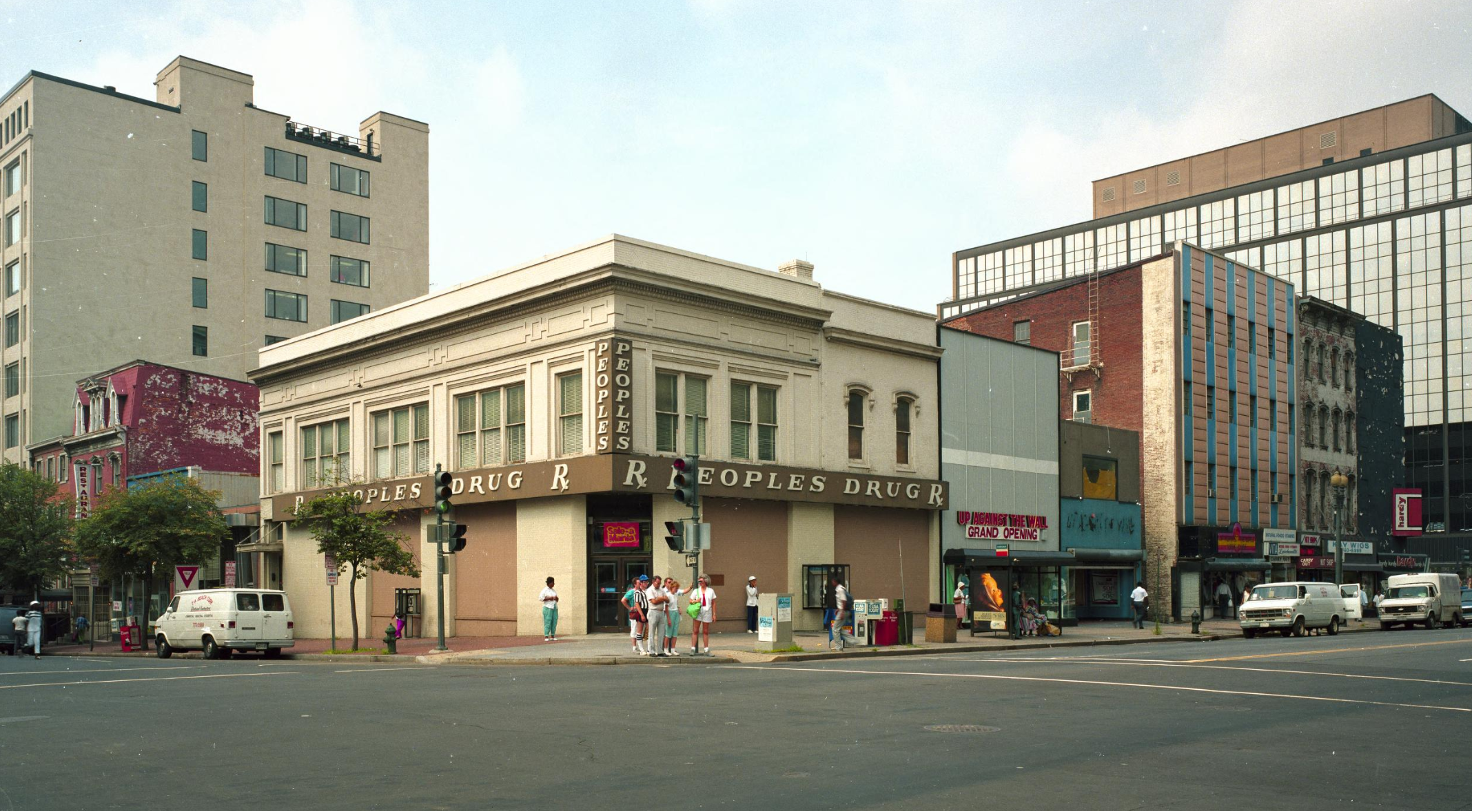
Peoples Drug was DC’s beloved pharmacy chain for over 80 years, from its first store at 824 7th St. NW in 1905 to CVS’s acquisition in 1990.
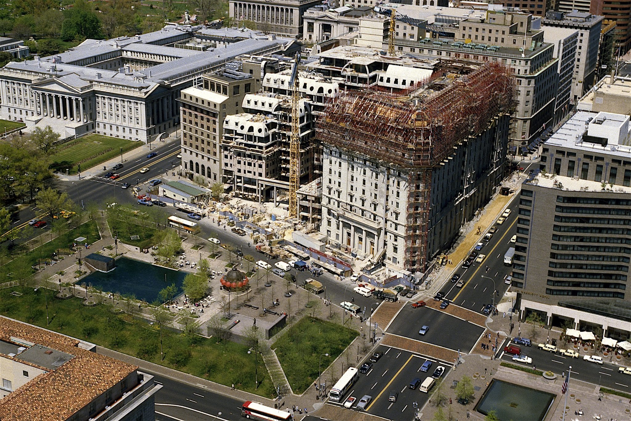
The Willard Hotel closed without warning in 1968 and sat empty for 18 years. How a $73 million renovation saved one of Washington’s most historic buildings.
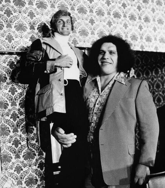
Wait, Andre the Giant tried out for the Washington Redskins? Did that really happen? You have to read more to find out the story.
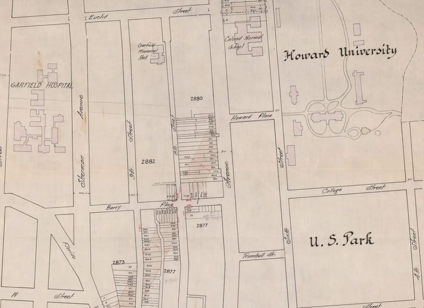
Take a look at what could have been! Howard University proposed extending Vermont Ave. from Florida Ave. to Georgia Ave. back in 1919. See the maps, read the letter of rejection, and check out the intersection today on Google Maps.
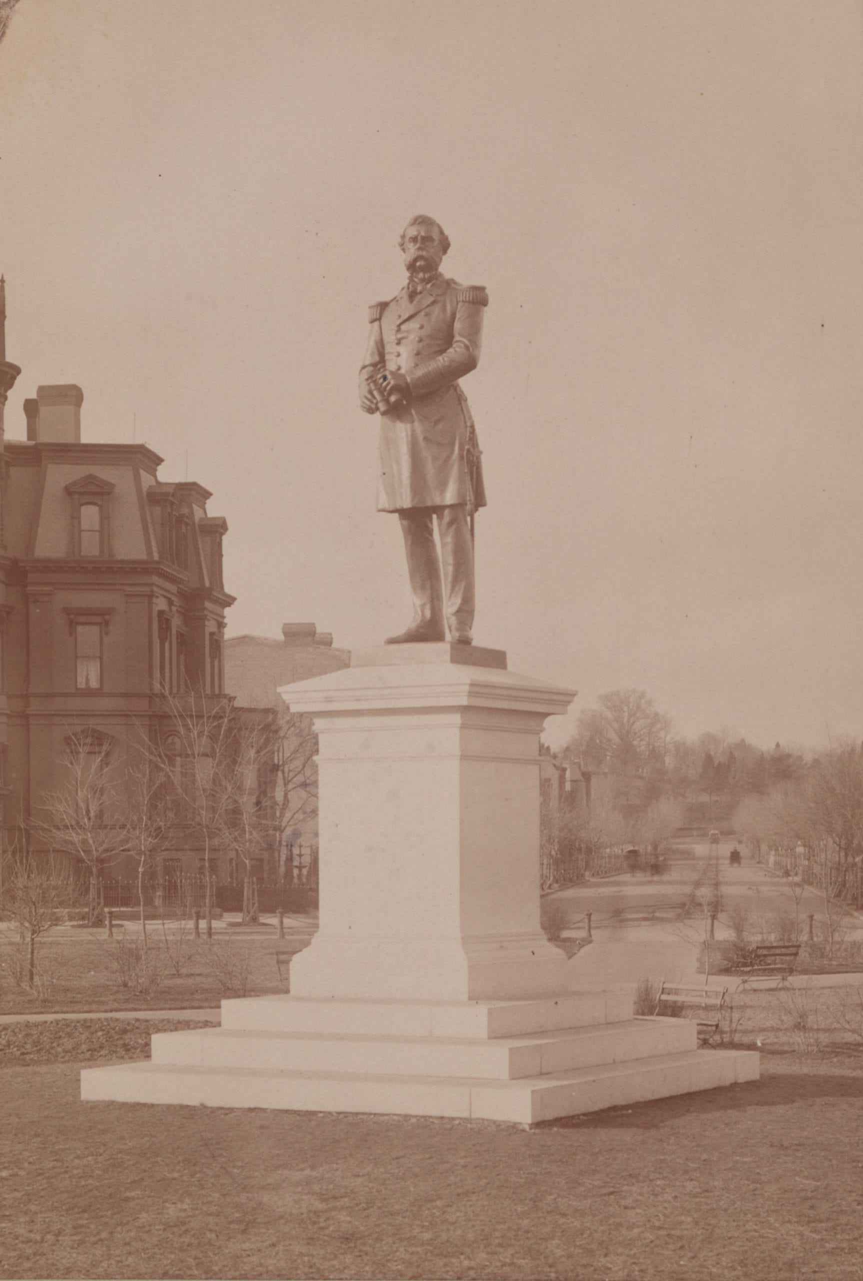
The original statue of Samuel DuPont sat for more than a generation at the center of Dupont Circle. Then it was removed because people thought it was ugly. Read the story to learn more.
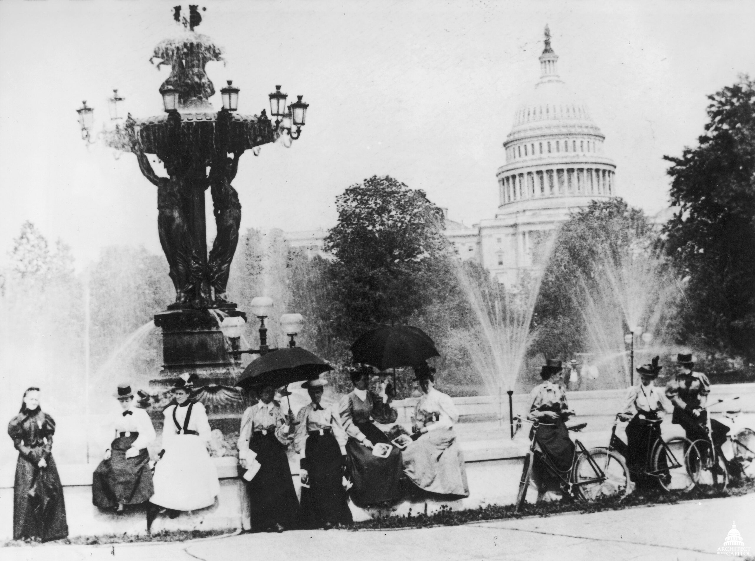
The Bartholdi Fountain on Capitol Hill was almost moved to Dupont Circle at the request of James Blaine. Until history intervened.