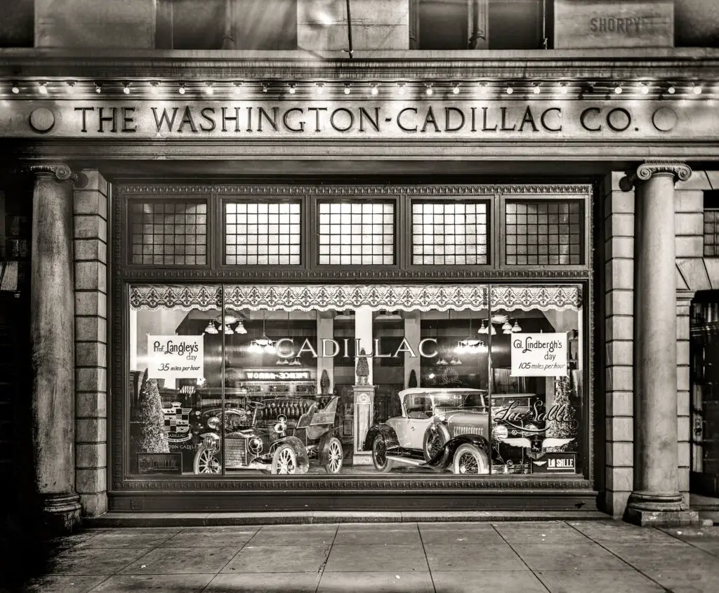
Learn the history of luxury automaker Cadillac's first major dealer showroom in downtown Washington DC. The Cook & Stoddard Company location on Connecticut Avenue was the go-to destination for politician bigwigs, businessmen, and auto enthusiasts to experience new Cadillac models in their prime from 1912 to the late 1920s.
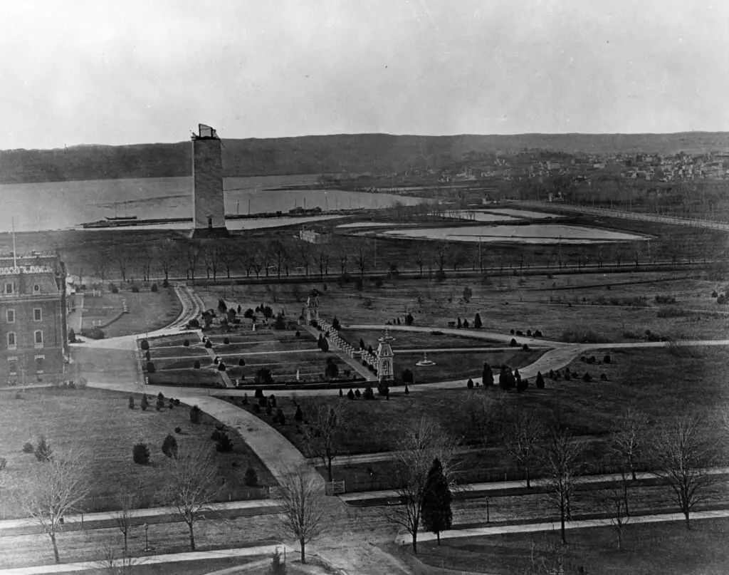
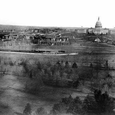
See what the Washington Monument looked like in 1877, as seen from the Tower of the Smithsonian (now the Smithsonian Castle). This stunning view shows the Monument under construction, a testament to the resilience of the nation.
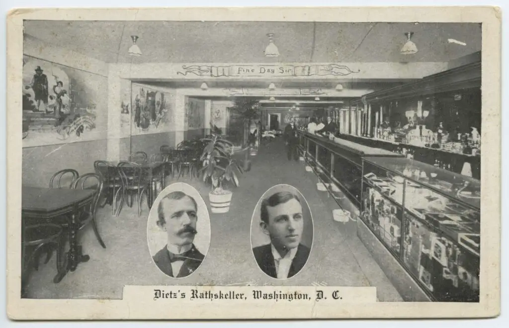
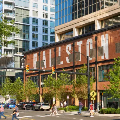
Before World War I, Dietz's Rathskeller was a popular beer joint in the heart of D.C. Learn about its history, explore the area today, and be amazed at what this spot has to offer!
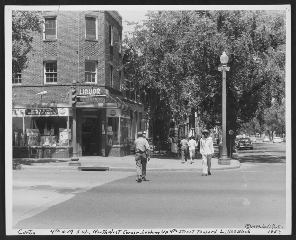
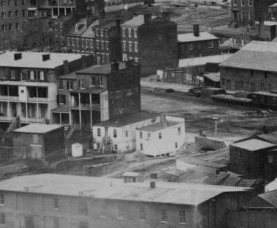
Take a look back at life in Southwest Washington in the 1950s with this photo of a corner store at 4th and M St. SW. See how the same corner looks today with a Google Maps embed.
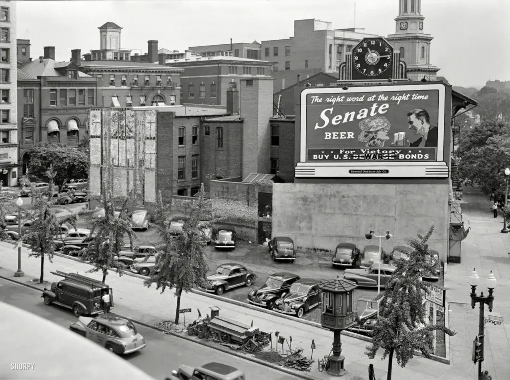
Explore a captivating 1942 photograph of Washington D.C. during a gasoline shortage, revealing the city's resilience and adaptation to wartime challenges through a focus on its streetcar control tower and altered transportation habits.
Take a look back at the 1886 Washington Nationals baseball season through three scorecards from games against the New York Giants, Boston Beaneaters, and Boston Beaneaters. See the advertisements, handwritten notes, and penciled notations on the scorecards.
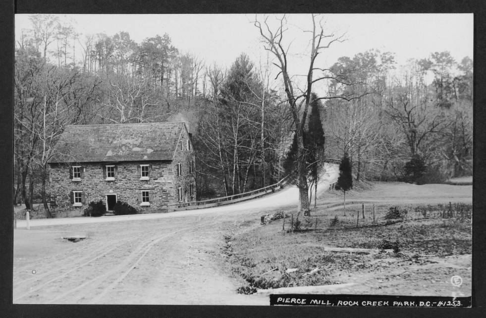
This Thanksgiving, take a look back at historical photos of Peirce Mill and the Rock Creek Park spring house in 1910. Amazingly, the structures look almost exactly the same today!
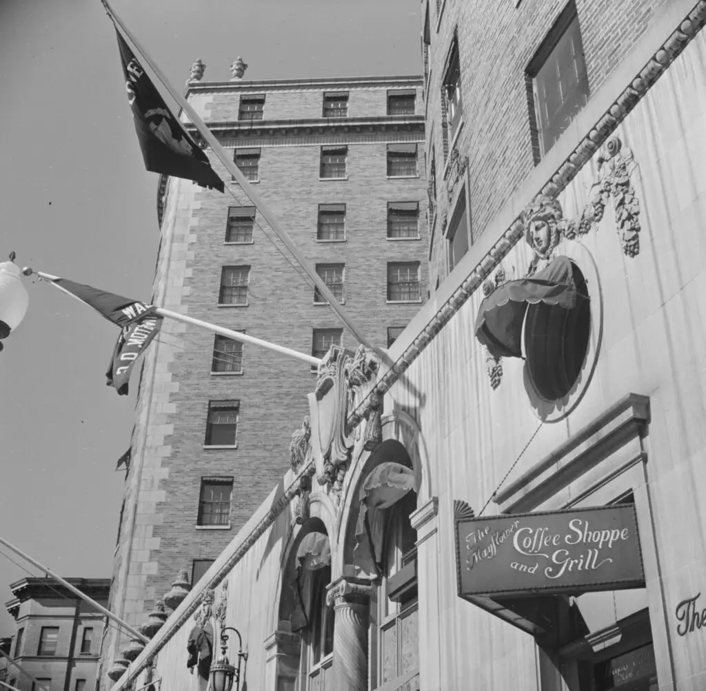
Take a look back at the 1930s Mayflower Coffee Shop and Grill in Washington, D.C., with a photo from the Library of Congress and an advertisement from The Washington Post.
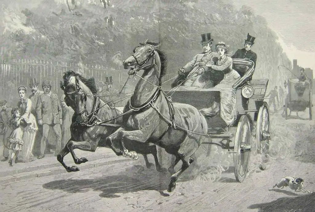
A wild story from The Washington Post in 1913 about a runaway horse & carriage in Washington DC. Read the full story, plus learn more about George Bowman, the liveryman, and Harry L. McCormick, who rescued the baby.
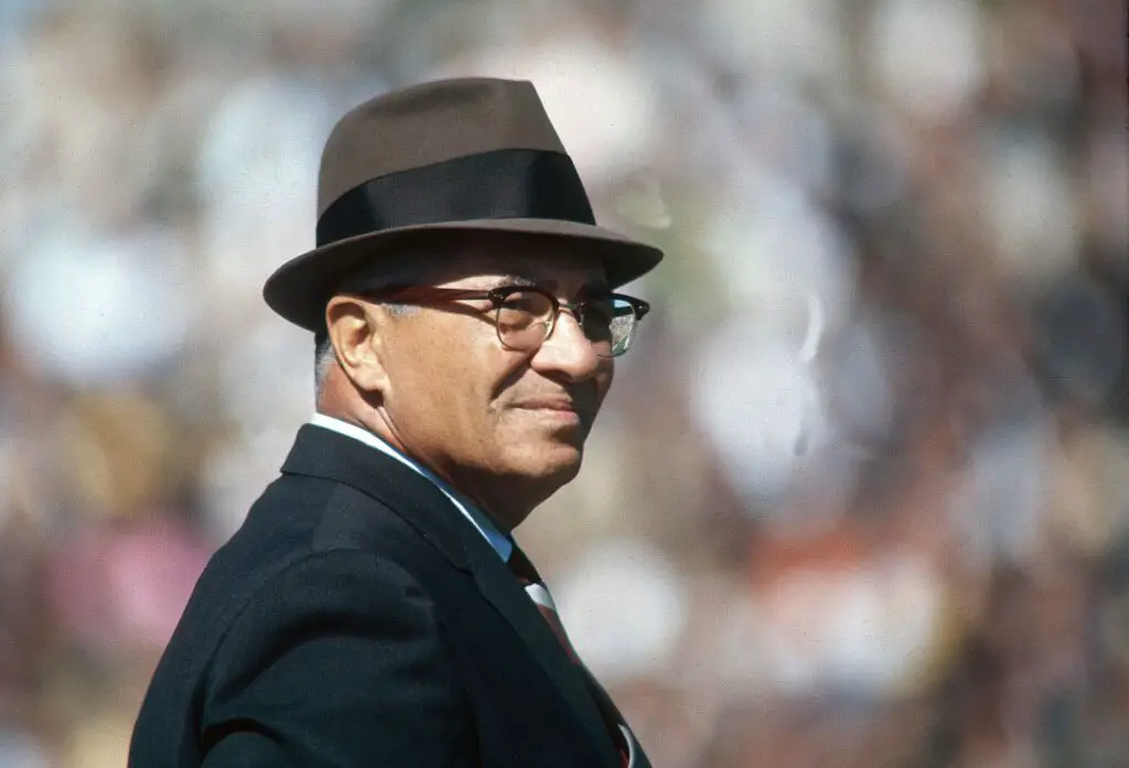
Reflecting on the life and legacy of Coach Vince Lombardi, from the Green Bay Packers to the Washington Redskins. Read about his impact on the team, and the Super Bowl, in this blog post.
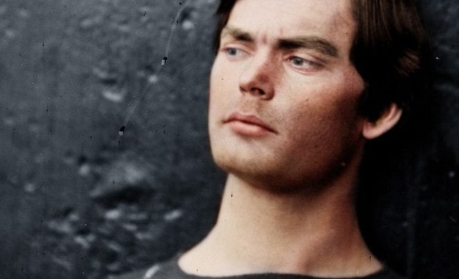
This portrait of Lewis Powell captures the likeness of the man who tried to kill Secretary of State William Seward in 1865. It's a powerful reminder of the human dimension of history and the power of images to evoke the past.