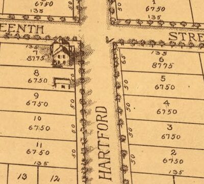
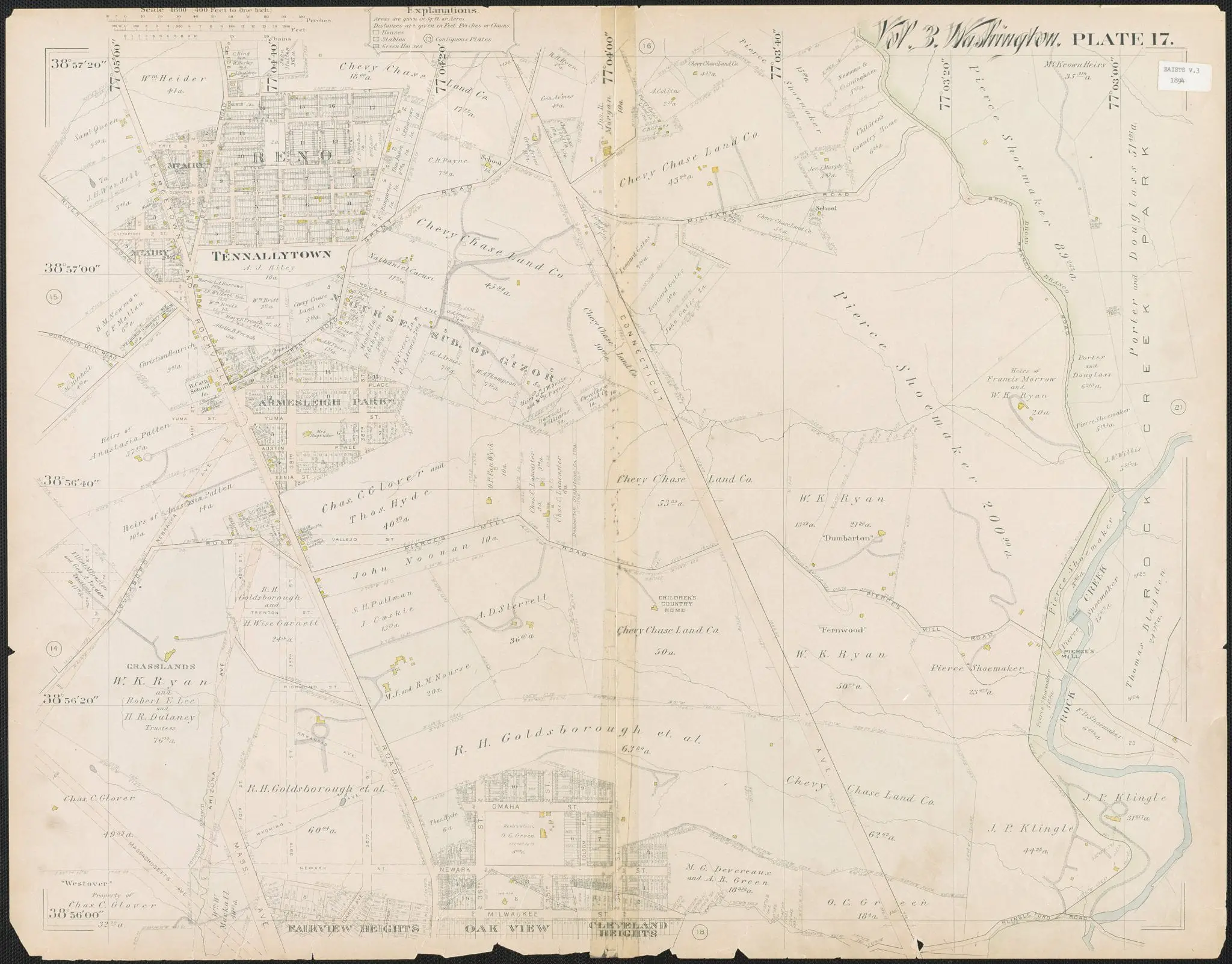
This map is so fascinating, showing Tennallytown (i.e., Tenleytown today) and Reno (long-since razed). It was done by G.M. Hopkins & Co. in 1894.
Make sure you click on it for a larger version to examine the details. I’ll point out a few things of note.
There’s a home diagonally positioned at 39th and Yuma listed as Mrs. Magruder’s, which still stands today. I believe it’s the oldest home in the area and is named “The Rest.” Today’s Fort Reno had a free-black community after the Civil War up until the area was condemned by the federal government to build Alice Deal Middle School and Woodrow Wilson High School. Two state streets — Wyoming and Arkansas — were planned for the area, between today’s Massachusetts and Wisconsin. Wyoming ended up near Adams Morgan instead and Arkansas to the east of Rock Creek Park.
After checking it out, share what else you notice in the map. Happy Friday to you!