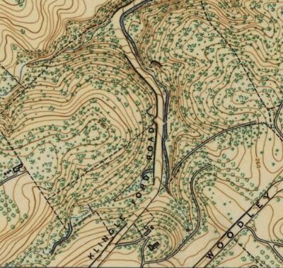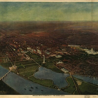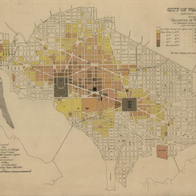
What a cool map. We posted one last week showing the area around Tenleytown as it looked on an 1892 map. The area covered in the map includes today’s Columbia Heights, Park View, and a little Mt. Pleasant.
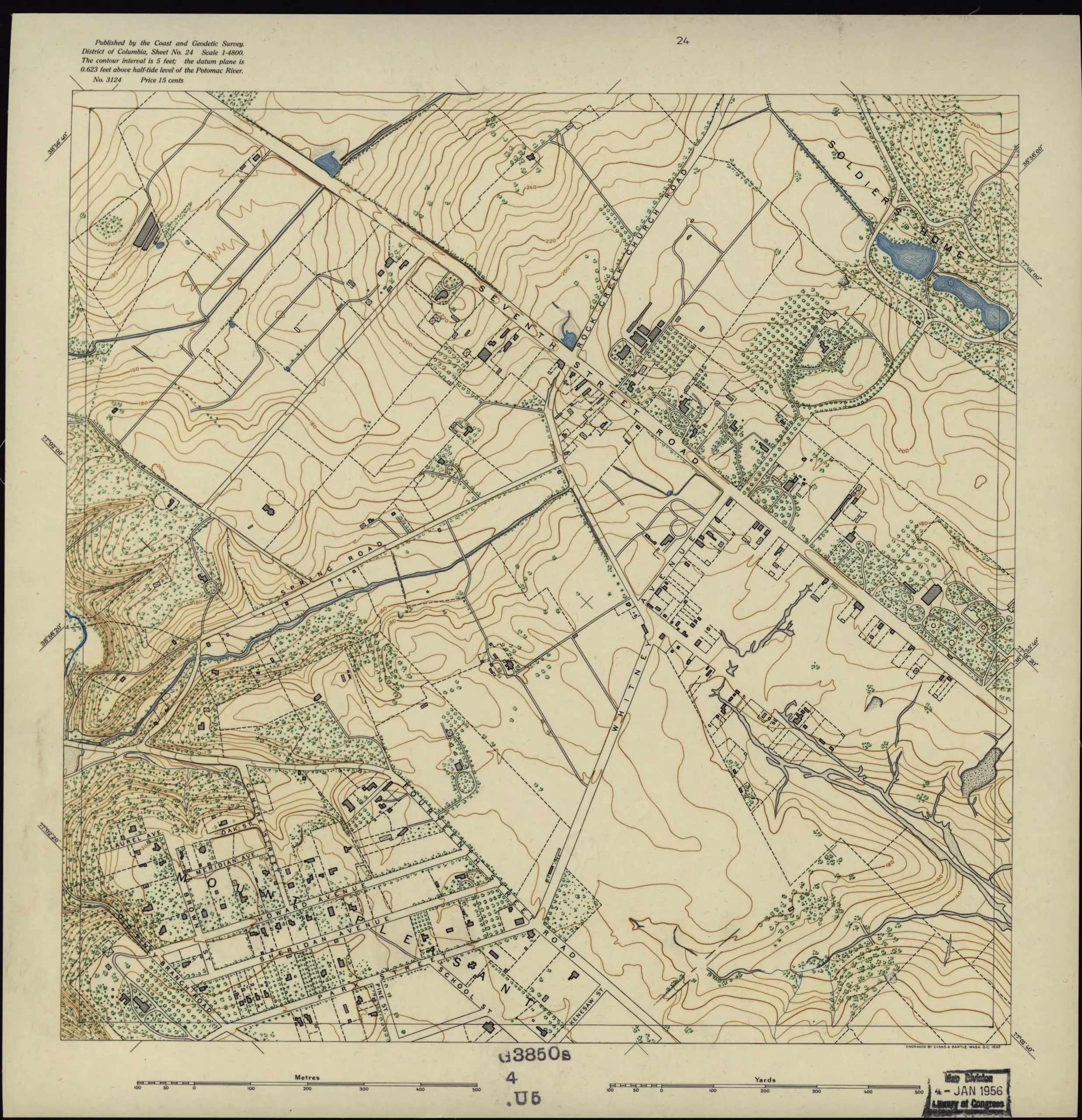
Covers District of Columbia outside former Washington city limits (Florida Avenue).
Source: Library of Congress
Also, check out this cool 1904 book entitled A statement of some of the advantages of beautiful Columbia Heights: a neighborhood of homes.