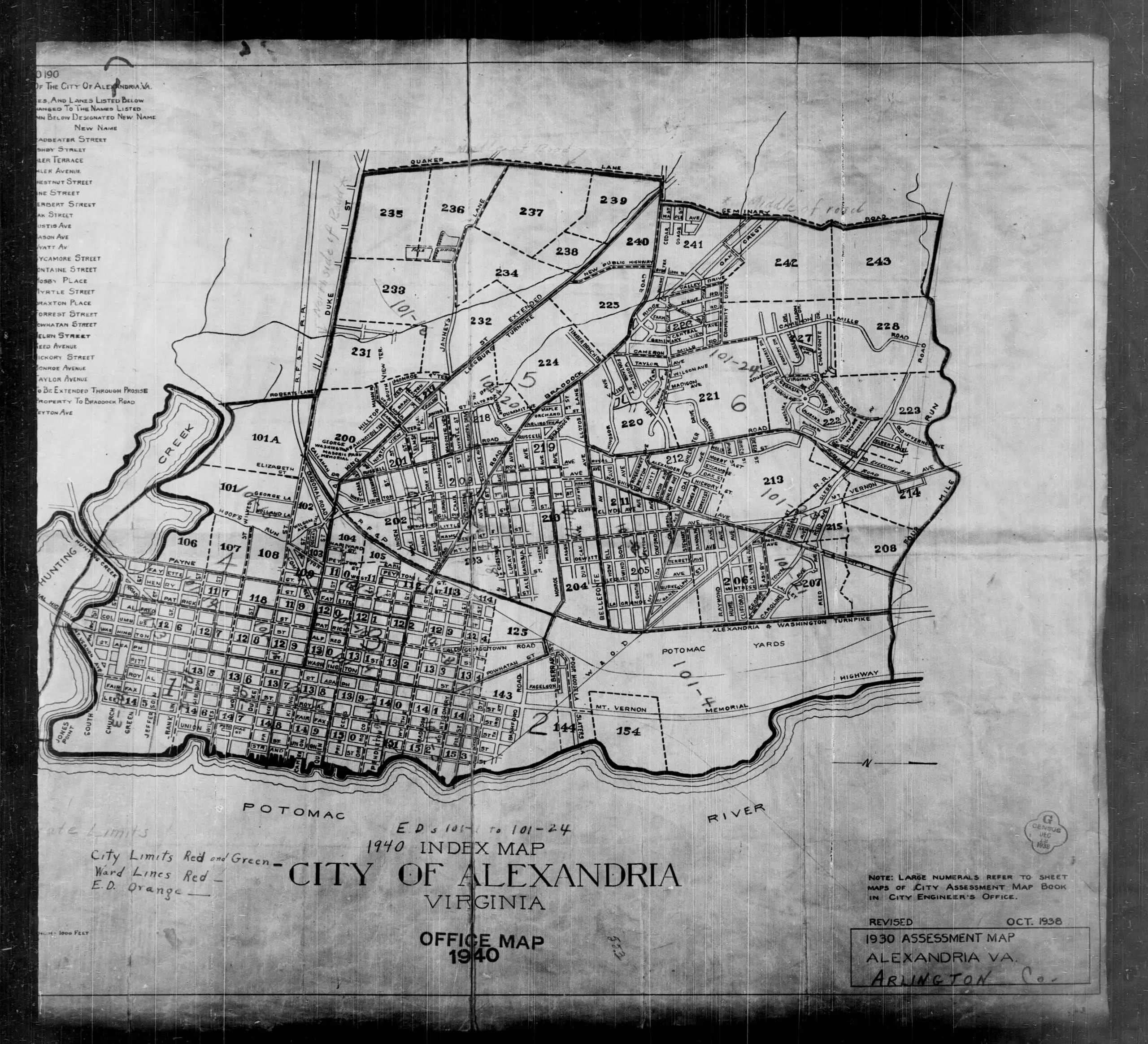
Neighborhoods
Northwest DC
Adams Morgan
Bloomingdale
Brightwood
Cathedral Heights
Chevy Chase
Chinatown
Cleveland Park
Columbia Heights
Crestwood
Dupont Circle
Friendship Heights
Glover Park
Logan Circle
Mt. Pleasant
The Palisades
Park View
Petworth
Sheridan-Kalorama
Tenleytown
Woodley Park
Georgetown
Northeast DC
Brookland
Deanwood
Trinidad
Woodridge
Southeast DC
Anacostia
Capitol Hill
Congress Heights
Navy Yard
Southwest DC
Waterfront
Maryland
Bethesda
Bladensburg
Gaithersburg
Hyattsville
Rockville
Silver Spring
Virginia
Alexandria
Arlington
Falls Church
McLean
Vienna
Lost Neighborhoods
Hell’s Bottom
Murder Bay
Swampoodle
Notable People & Places
People
Abraham Lincoln
Calvin Coolidge
Dwight D. Eisenhower
Warren G. Harding
John F. Kennedy
William McKinley
Franklin D. Roosevelt
Teddy Roosevelt
Officer Sprinkle
Woodrow Wilson
Places
The Capitol Building
Dulles Airport
Library of Congress
Washington Monument
The White House
The Best Of
Menu
Neighborhoods
Northwest DC
Adams Morgan
Bloomingdale
Brightwood
Cathedral Heights
Chevy Chase
Chinatown
Cleveland Park
Columbia Heights
Crestwood
Dupont Circle
Friendship Heights
Glover Park
Logan Circle
Mt. Pleasant
The Palisades
Park View
Petworth
Sheridan-Kalorama
Tenleytown
Woodley Park
Georgetown
Northeast DC
Brookland
Deanwood
Trinidad
Woodridge
Southeast DC
Anacostia
Capitol Hill
Congress Heights
Navy Yard
Southwest DC
Waterfront
Maryland
Bethesda
Bladensburg
Gaithersburg
Hyattsville
Rockville
Silver Spring
Virginia
Alexandria
Arlington
Falls Church
McLean
Vienna
Lost Neighborhoods
Hell’s Bottom
Murder Bay
Swampoodle
Notable People & Places
People
Abraham Lincoln
Calvin Coolidge
Dwight D. Eisenhower
Warren G. Harding
John F. Kennedy
William McKinley
Franklin D. Roosevelt
Teddy Roosevelt
Officer Sprinkle
Woodrow Wilson
Places
The Capitol Building
Dulles Airport
Library of Congress
Washington Monument
The White House
The Best Of
Support
-ad 626-
Published
January 11, 2013
in
GoDCers Love Maps
1930 Assessment Map of Alexandria
1930s
,
1940s
,
Alexandria VA
,
Arlington VA
Search
-ad 188-
Share on facebook
Facebook
Share on twitter
Twitter
Share on pinterest
Pinterest
More maps! Below is a great assessment map of Alexandria and
Arlington
County.
1930 assessment map of Alexandria
READ:
Plan for the Navy Yard in 1881
-ad 617-
Recommended for You
The Last New Year’s Eve Before Prohibition
Beautiful 1913 Night Photo of Pennsylvania Ave.
1886 Plan to Fill In and Build Over Rock Creek
1895 Bird’s Eye View of Brookland
Colorized Photo of Lewis Powell, Lincoln Conspirator
Photos of 1940s Boarding House Living
What Is the History of CIA’s Langley Headquarters?
Man Killed and Gunman Seized in Daylight Brawl
-ad 618-
Today's Featured Posts
The Crazy Family Problems of Real Estate Man William Matteson
Streets of Washington Circa 1921
Incredible Photo of State, War, Navy Building
Boys Find 10-Pound Bomb on Playground
Jim Henson and the Birth of the Muppets
Three Things About the O Street Pumping Station
-ad 619-
Search
-ad 615-
Metro’s 17-Foot Long “Experimental Station” in 1968
Why Is It Named Trinidad?
Map of Washington Subdivisions in 1961
The Story of Russian Oligarch Oleg Deripaska’s Mansion
Robert Todd Lincoln at His Father’s Memorial Dedication
Remember Au Pied de Cochon?
Video Visualizing Early Washington, D.C.
Abraham Lincoln in Color (1865)
Senior Prom at the White House
Lips That Touch Liquor Shall Not Touch Ours
-ad 616-
Best of Ghosts of DC
Wow. Stunning Black and White Photo of the Capitol
Map of Original Land Owners in Washington City
Why Is There No J Street in Washington, DC?
Prince George’s Plaza in 1959
Unbuilt Three Sisters Bridge Across the Potomac
Metro Trains Were Almost Bright Red!
-ad 189-