Explore the history behind Washington, D.C.’s indoor smoking ban—from smoky bars and political battles to the 2007 law that cleared the air. Discover how health advocacy, public support, and city council debates transformed the District into a smoke-free capital.
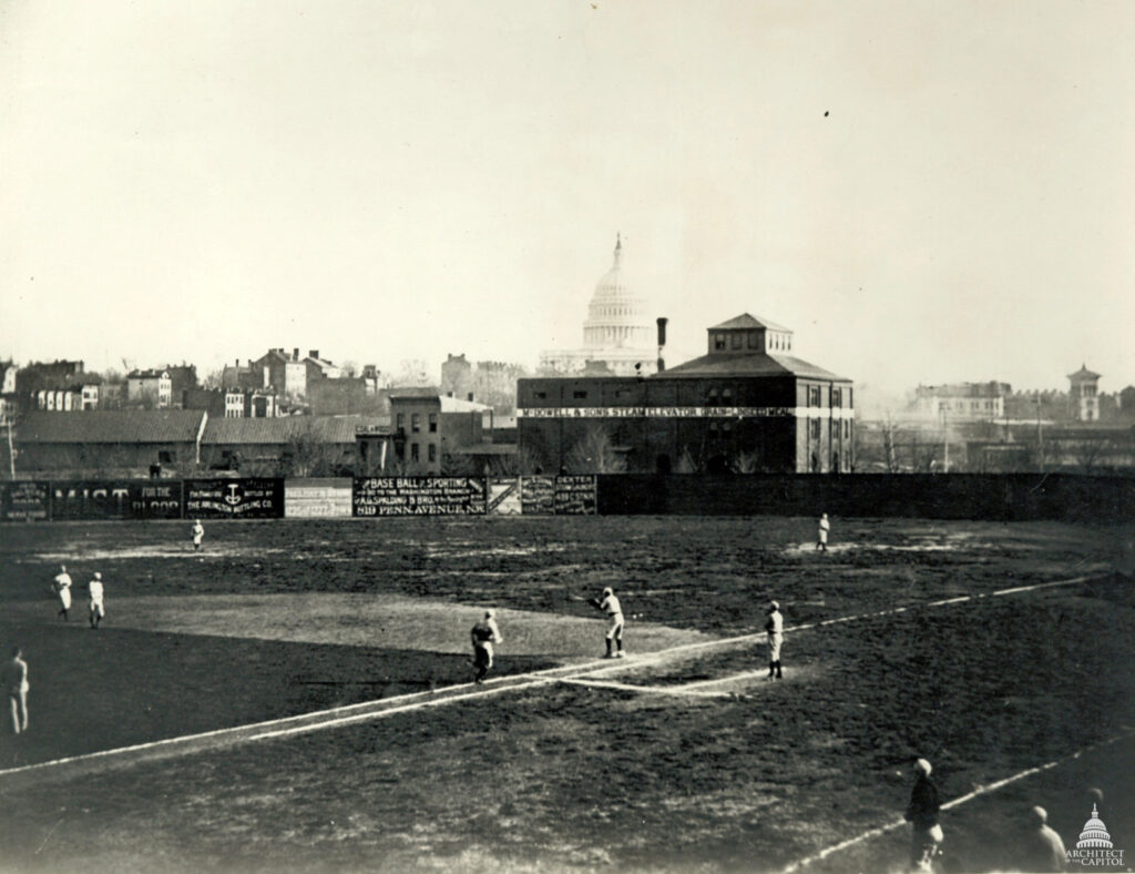
A fatal pitch during a 1912 church baseball game at 14th and A Streets NE claimed the life of George S. Hiett. This forgotten tragedy unfolded against a backdrop of neighborhood games, citywide injuries, and the shadow of the Titanic.
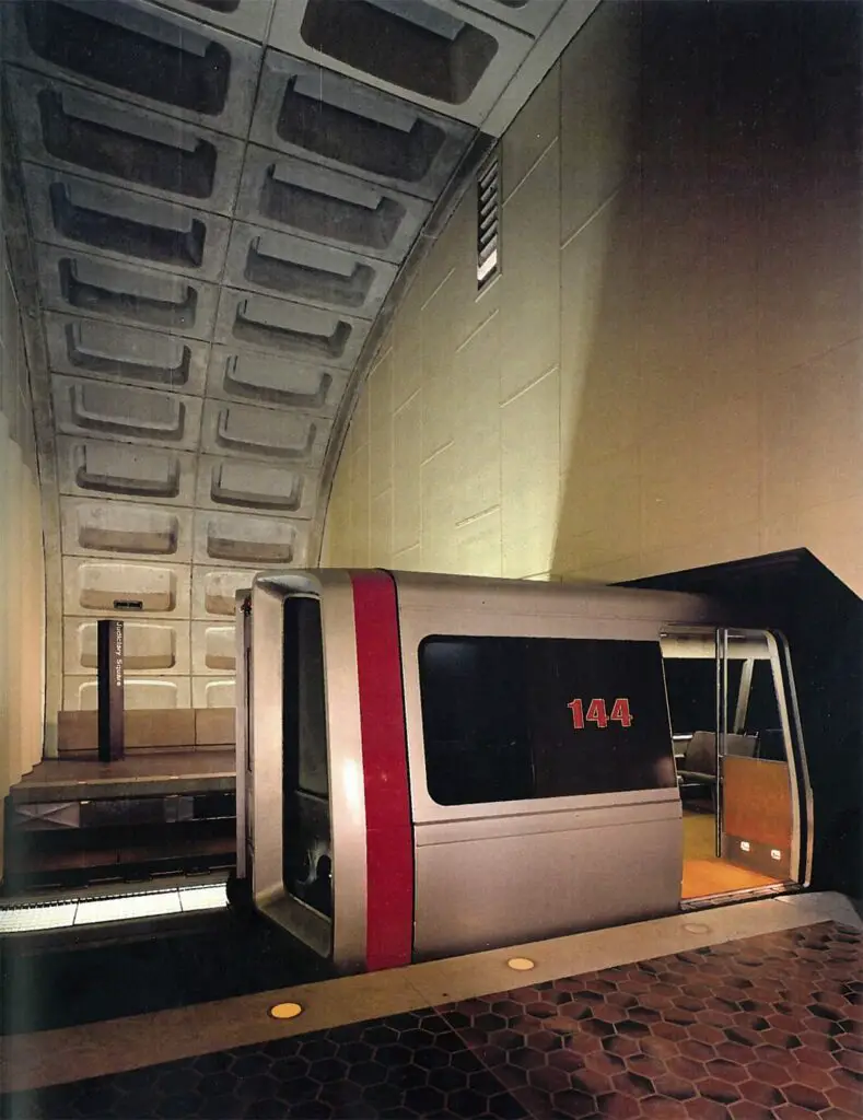
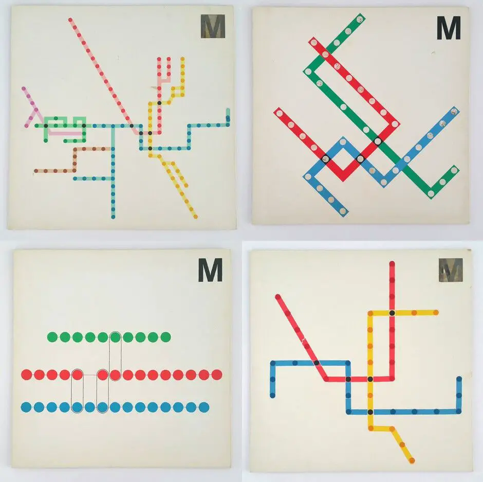
Explore the legacy of Massimo Vignelli, the visionary designer behind the Washington Metro's iconic look. Discover how his philosophy of simplicity and functionality shaped the visual identity of D.C.'s public transit system.
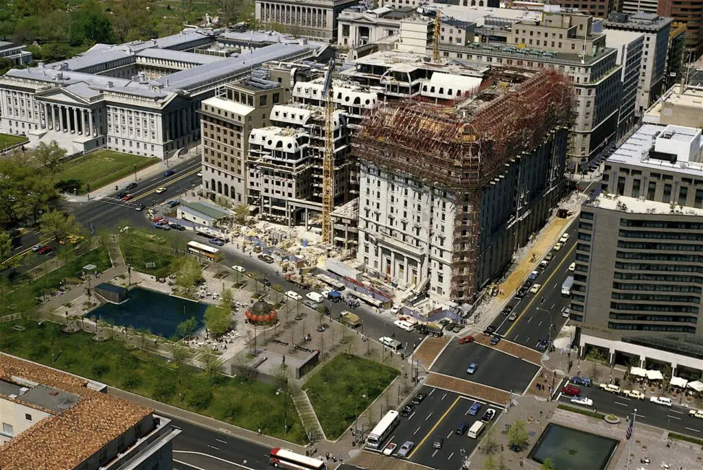
Take a look back at the Willard Hotel's major renovations in the 1980s with this aerial image of the iconic Washington, D.C. hotel. Learn more about the history of the Willard Hotel with this post!
WMATA spent $69,000 for the sample station in May 1968. After just a few weeks of construction, it measured 64 feet in width, 30 feet in height, and just 17 feet in length. It marked a key milestone in the capital subway project - a massive planning and engineering effort that started in the 1950s.
Learn about the history of D.C. public elementary schools Janney, Gibbs, Eaton and Watkins. We explore the background behind their names and the people they were named for.
This is an unexpected and disappointing article from 1977 about a small group of sixth-graders and a third-grader smuggling marijuana and liquor to and from an elementary school in Montgomery County. Interestingly, this occurred just a few days before President Jimmy Carter implemented the first civil rights law for people with disabilities.
Take a look back in time to 1919 Washington, D.C. with this photo of 15th and Pennsylvania. See the old Riggs Bank building in the background, now the PNC Bank building.
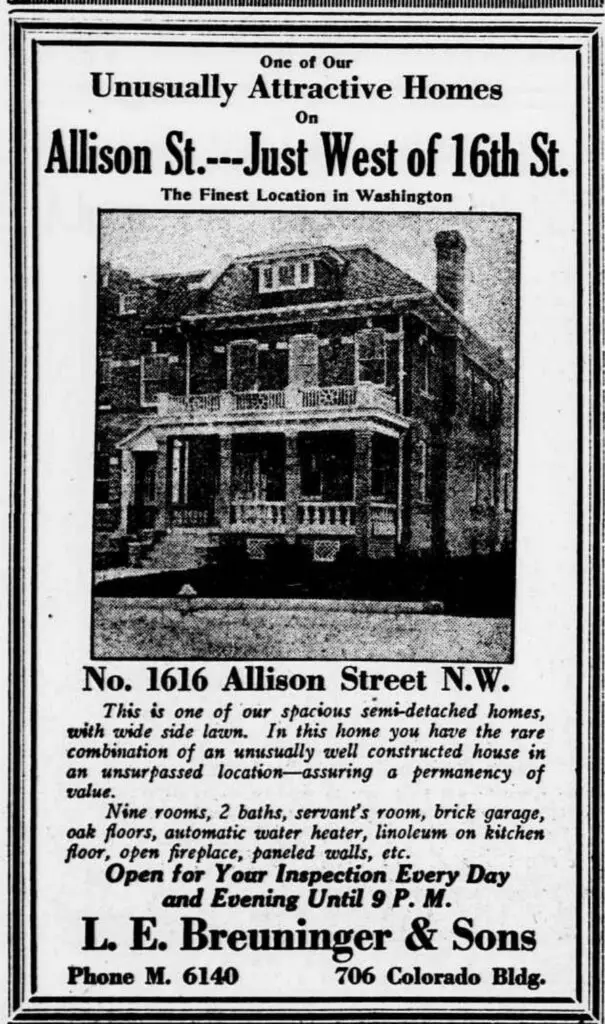
This is an old ad from The Evening Star printed on Saturday, November 11th, 1922. It's a home for sale in Crestwood at 1616 Allison St. NW. Check out the Google Street View today and see the past come alive!
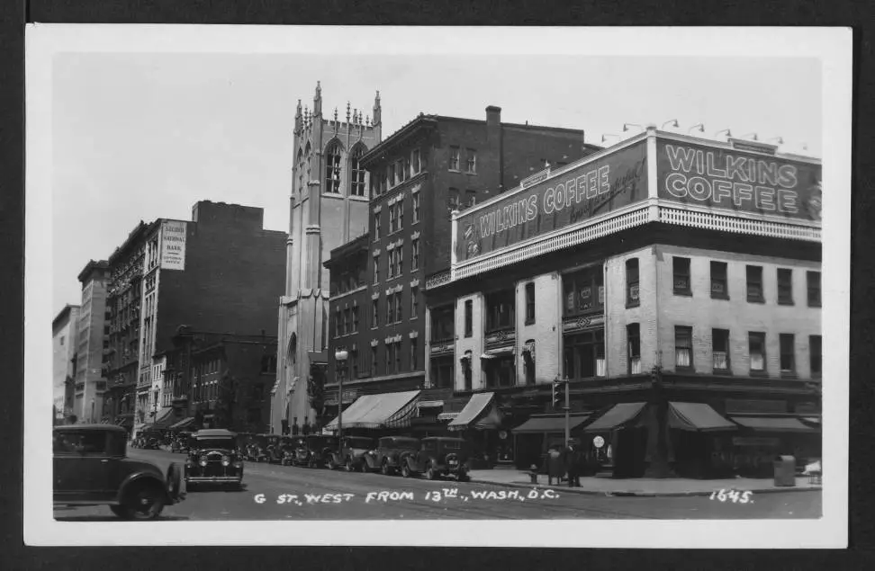
Take a look back in time at this photo of the Metro Center area in Washington, D.C. in 1930. Don't miss the Wilkins Coffee sign and a photo of Robert DeNiro's doppelganger from the same era.
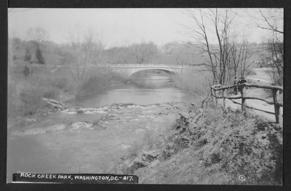
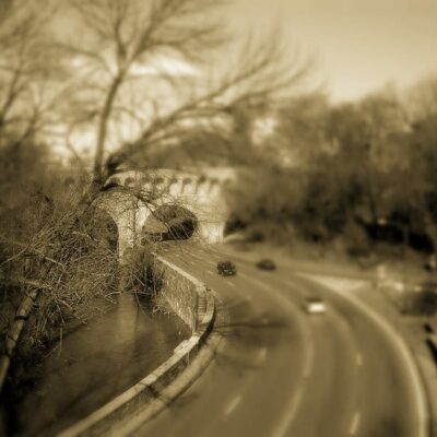
Take a look back in time to explore the Harvard St. Bridge in Washington, DC. This bridge crosses Rock Creek Park and has been a part of the city since 1909. See a photo of the old bridge and learn more here.
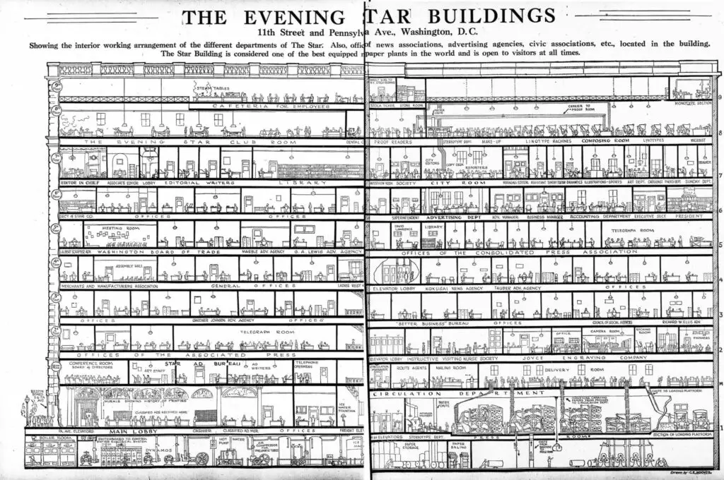
Check out this amazing cutaway drawing of the Evening Star Building at 11th and Pennsylvania Ave. NW. We posted a great photo of it some time ago, but this was something we had to share. The image was printed in the Evening Star on May 10th, 1922.
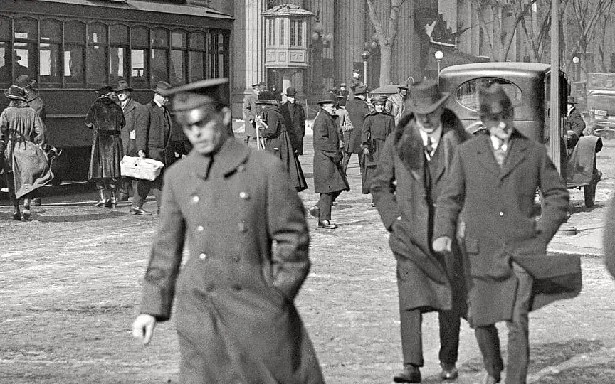
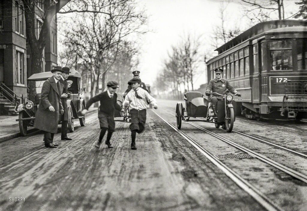
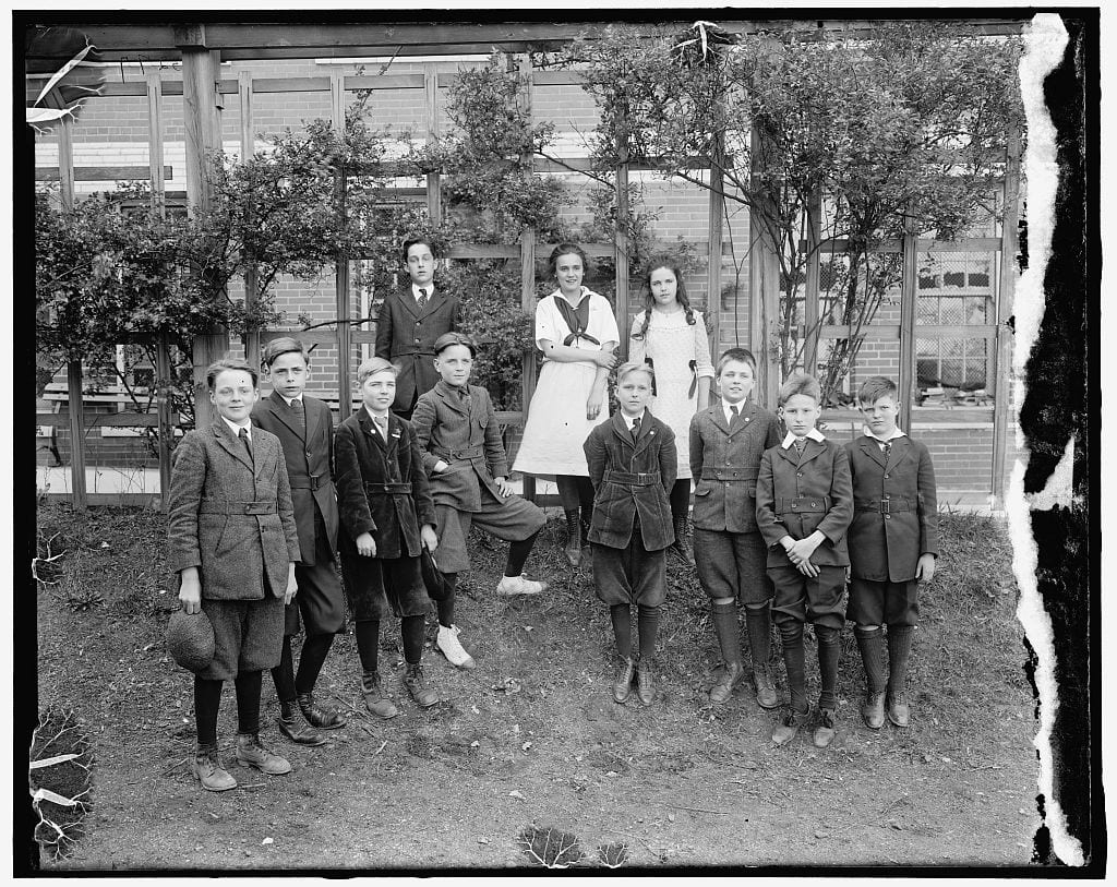
Investigate a 1922 street scene in Washington, D.C. with this photo. We'll explore clues to figure out exactly where it was taken. Join us to uncover the mystery!
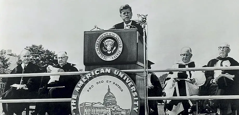
Check out the best commencement speeches ever given in Washington, DC from President John F. Kennedy to Ken Burns, Tony Snow and others. See the full lists from NPR and Vox.com.