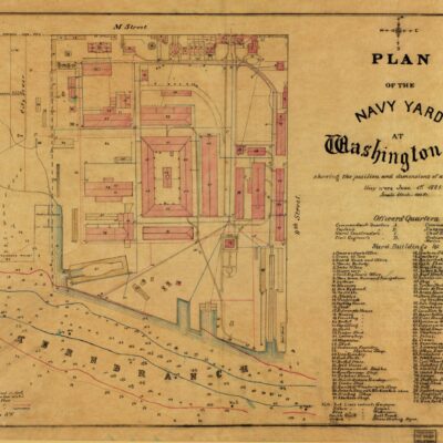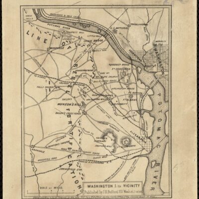
Now this has to be one of the best maps we’ve come across recently. It shows Washington in the 1850s, marking all the buildings, roads, and rural property owners. It’s really fascinating to see all the large plots of land outside Boundary Street.
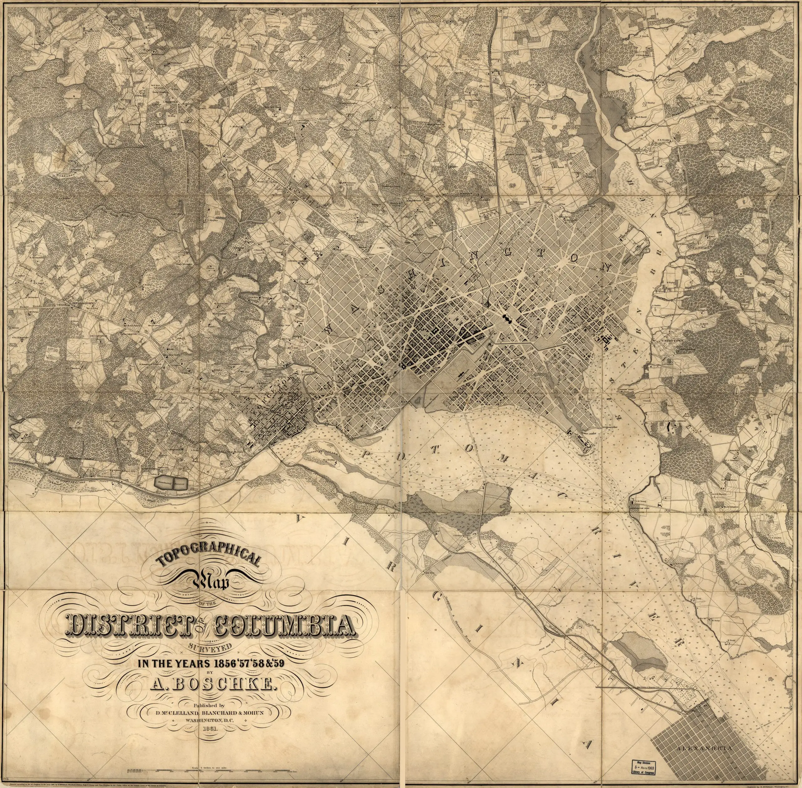
Source: Library of Congress