
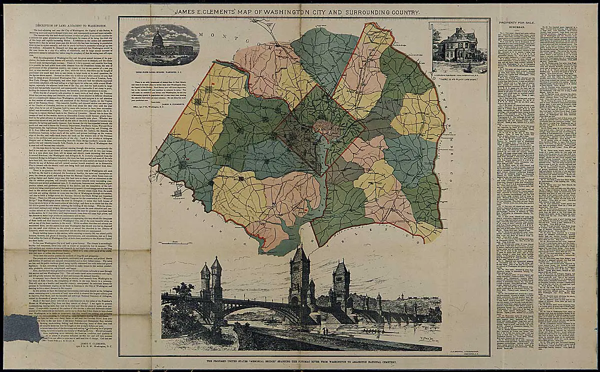
Here’s a good find from the National Archives. It’s a map of the D.C. area in 1894. Also, you’ll notice the Ulysses Grant Memorial Bridge, which was never built.
Source: U.S. National Archives
The Ulysses Grant Memorial Bridge marked on this 1894 map was just the first of nine major designs proposed for that crossing. We’ve traced the full 140-year fight to build Memorial Bridge.
Would love to read this but magnifying the image does not help. Any chance you can produce an image that one can read?
Click on the image