
Take a look at this Civil War map of D.C. and it’s surroundings. Click on it for greater detail and you’ll be able to see all the fortifications around the city (i.e., Fort Totten, Fort Lincoln, etc).
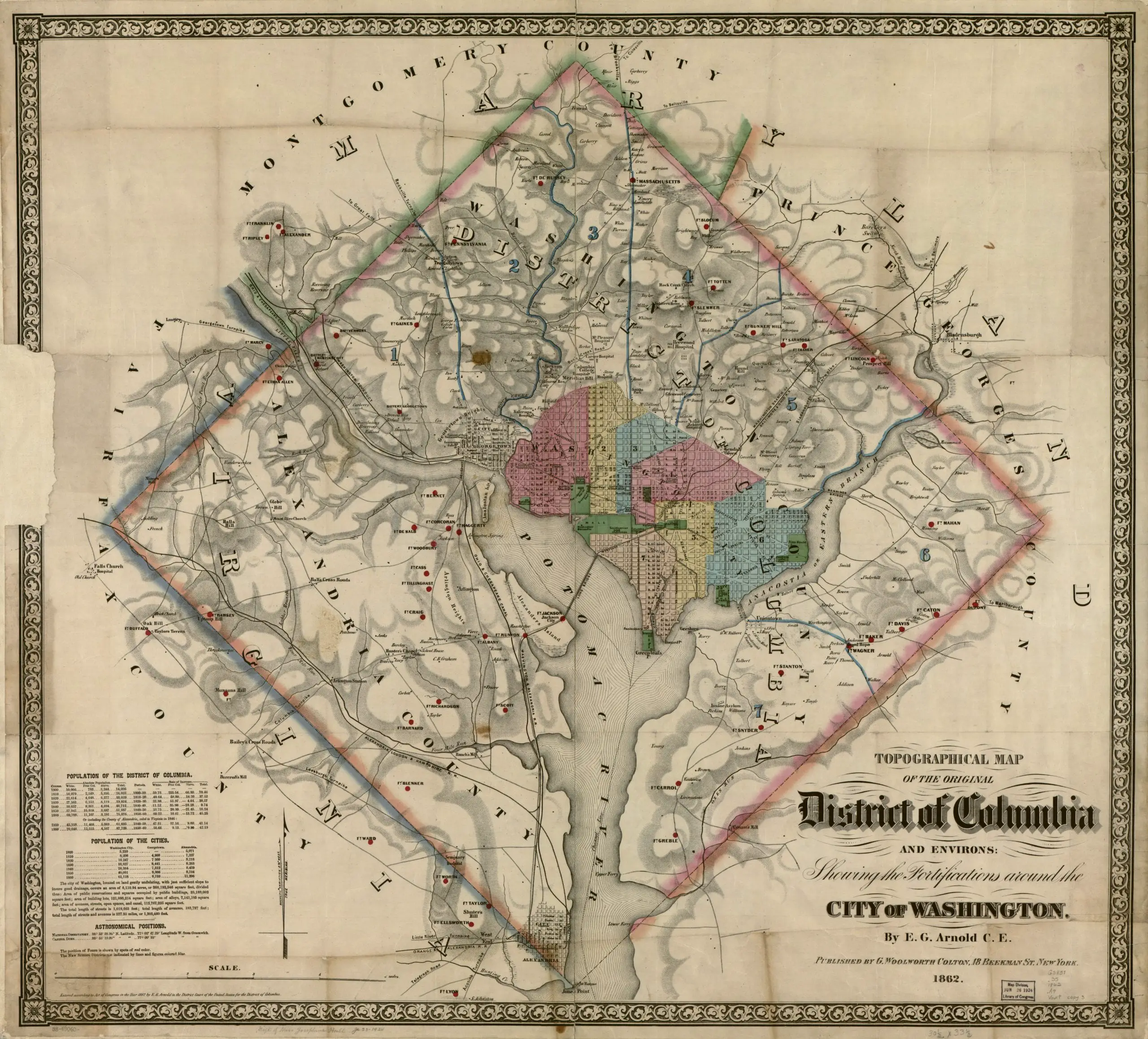
Take a look at this Civil War map of D.C. and it’s surroundings. Click on it for greater detail and you’ll be able to see all the fortifications around the city (i.e., Fort Totten, Fort Lincoln, etc).
Comments are closed.
Did they forget Ft Stevens?
Ft. Stevens is called Ft. Pennsylvania on this map.
Fort Stevens is Fort Massachusetts on the map. Fort Pennsylvania became Fort Reno.
I just walked my dog on the earthworks at Fort DeRussy two days ago.
Oops, you’re right.
The map leaves out Fort Bayard (at River Road and Western Avenue). It also leaves out Battery Kemble.
I’m from Hyatsville and while looking at the fortifications I was excited to see Queen’ s Chapel in NE. The road next to it is likely the precursor to what is now Michigan Ave which becomes Queens’ s Chapel Rd! At the DC MD border It runs right through land owned by a Mr Magruder, right about where Magruder Park is. Not a fortification observation, but this is what i love about old maps.