
The Duo Who Built D.C.’s First Freeway: Archie Alexander, Maurice Repass, and the Whitehurst Story
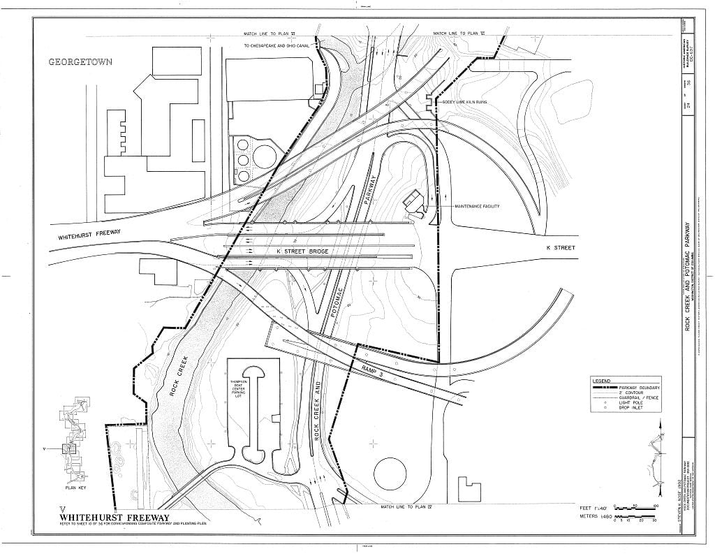
A four-year-old cut the ribbon on the Whitehurst Freeway on October 8, 1949. It was Washington’s first elevated highway.
Georgetown is one of Washington’s oldest neighborhoods, predating the federal city itself. These posts explore its colonial-era streets, Federal rowhouses, working waterfront, and the characters who shaped one of DC’s most enduring communities.
A four-year-old cut the ribbon on the Whitehurst Freeway on October 8, 1949. It was Washington’s first elevated highway.

Discover the real-life inspiration for St. Elmo’s Bar from the iconic 1985 movie. Georgetown’s The Tombs played a starring role in shaping this classic spot.
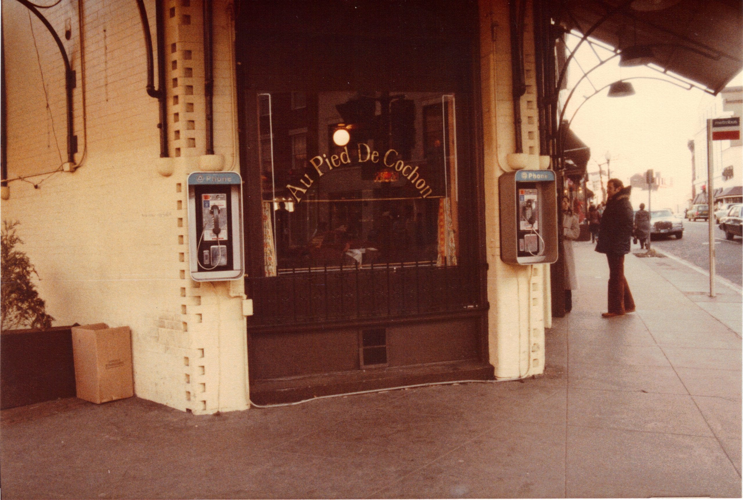
Au Pied de Cochon, a 24-hour French bistro at 1335 Wisconsin Avenue NW, hosted one of the Cold War’s strangest KGB defections in 1985.
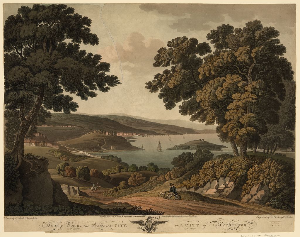
Cows in the streets, a well overflowing near the White House, and woods where the Capitol stands. John Davis saw Washington in 1799 before it was a capital.
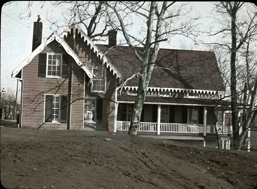
This cottage sat atop the Exorcist Stairs in Georgetown. Emma Dorothy Eliza Nevitte Southworth wrote more than 60 novels in the latter part of the 19th century and was one of the most widely read authors of that era.
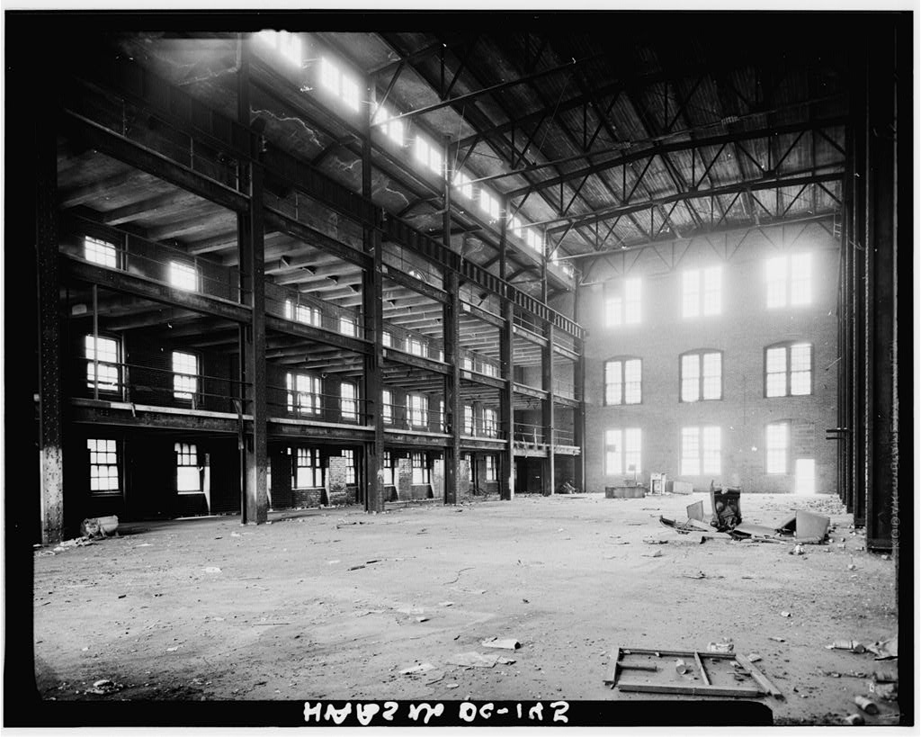
These haunting 1967 photos show the inside and outside of the old Capitol Traction Company Powerhouse, previously located on the Georgetown waterfront.
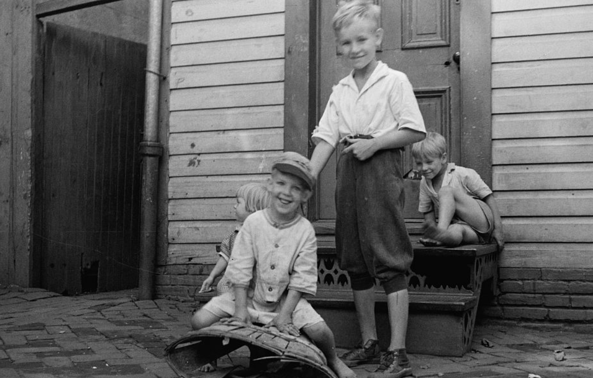
Take a look at this fascinating series of photos taken by Carl Mydans in September 1935 in Georgetown, Washington, D.C. These images show a very different side of Georgetown from what we’re used to today, with children playing on the street and cars parked on the side of the road.
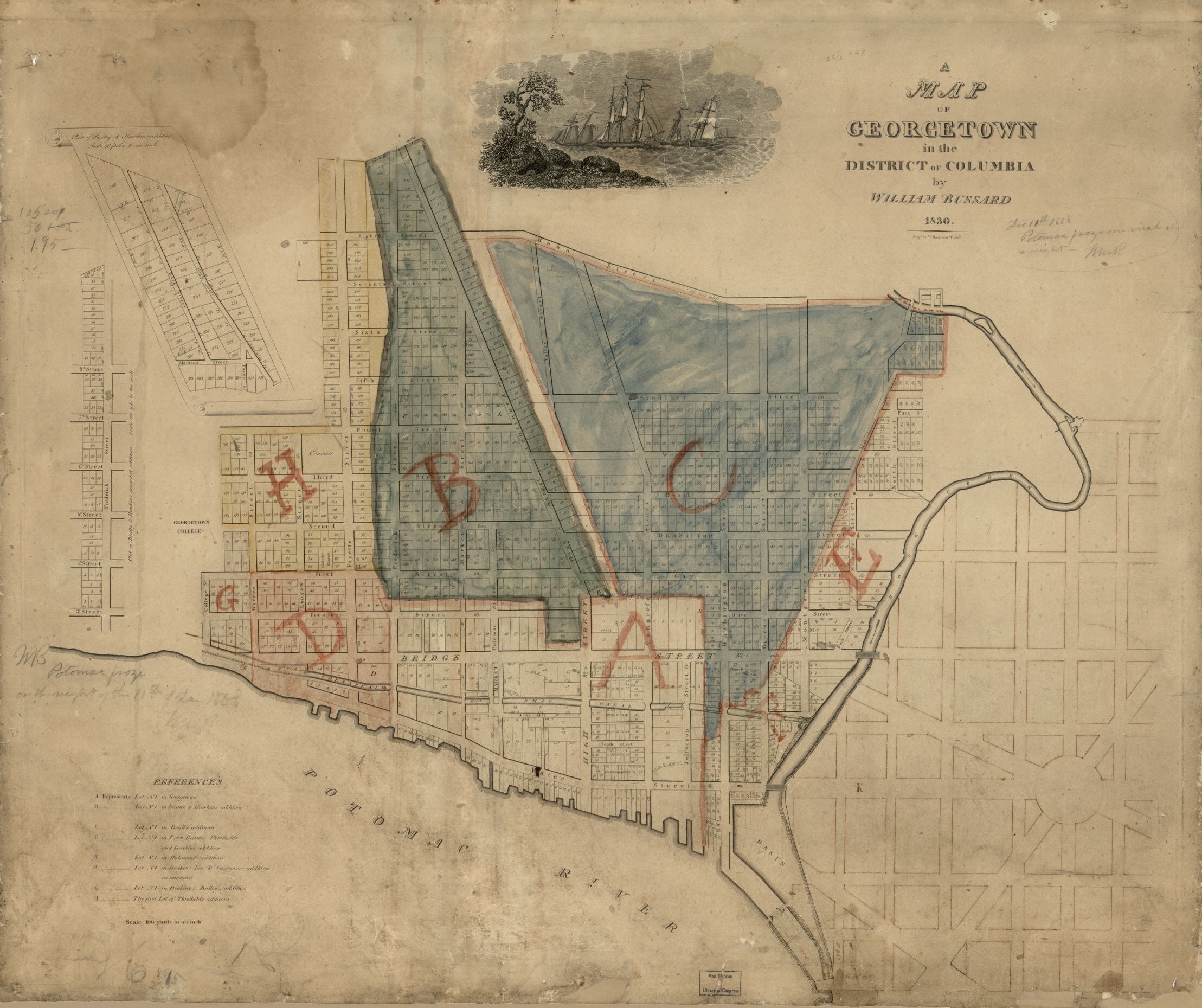
Take a peek into the past with this old map of Georgetown from 1830. You’ll notice the street names have since changed – Wisconsin Ave. was High St. and M St. was Bridge St. – and see the east-west numbered streets
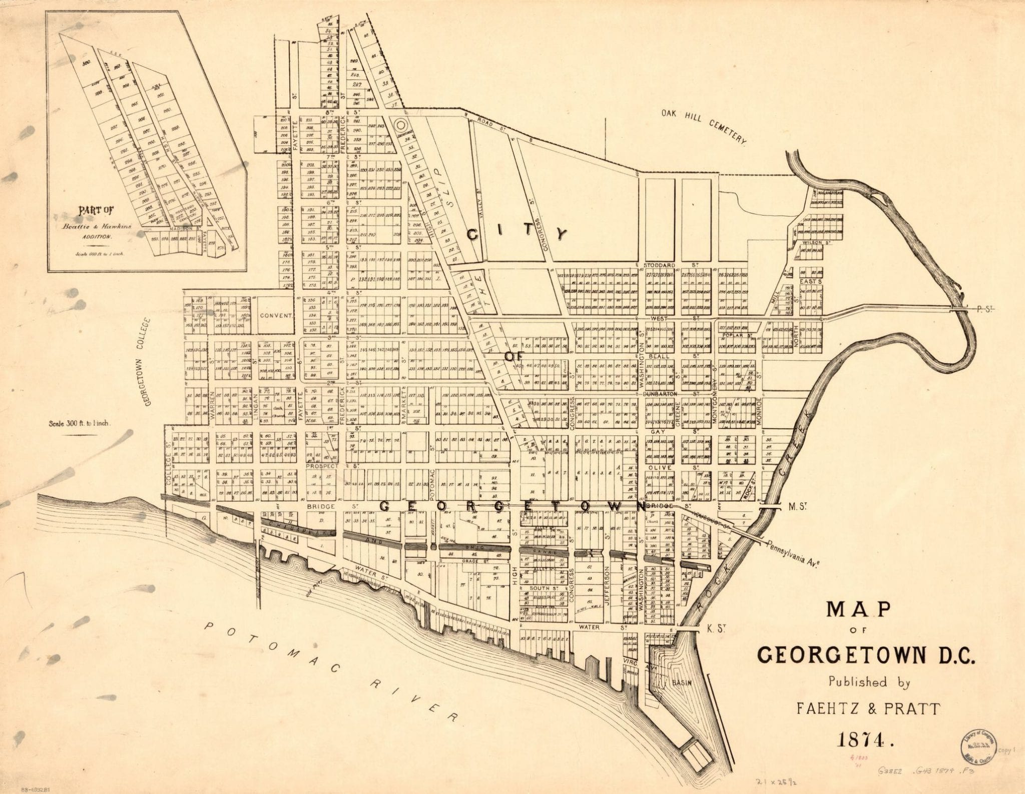
Take a closer look at this detailed map of Georgetown from the Library of Congress. Click on the image for greater details and find out more about this historic map.