
1892 Map of Smallpox, Cholera, and Measles Deaths
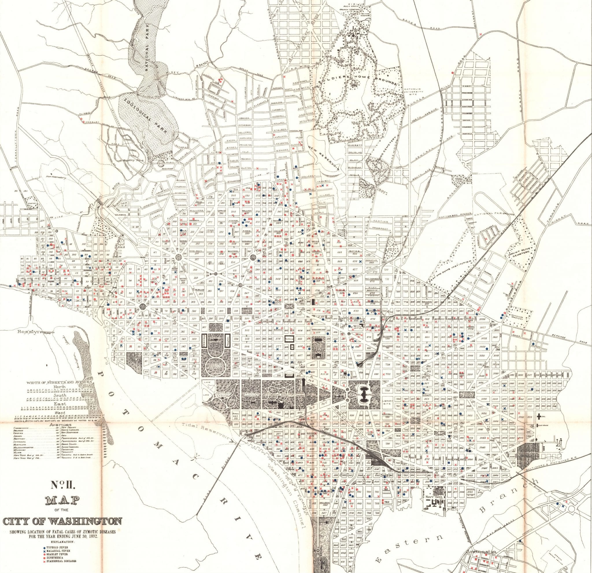
What is a zymotic disease? This is a map of deaths due to this disease in 1892. Find out what that means.
What is a zymotic disease? This is a map of deaths due to this disease in 1892. Find out what that means.
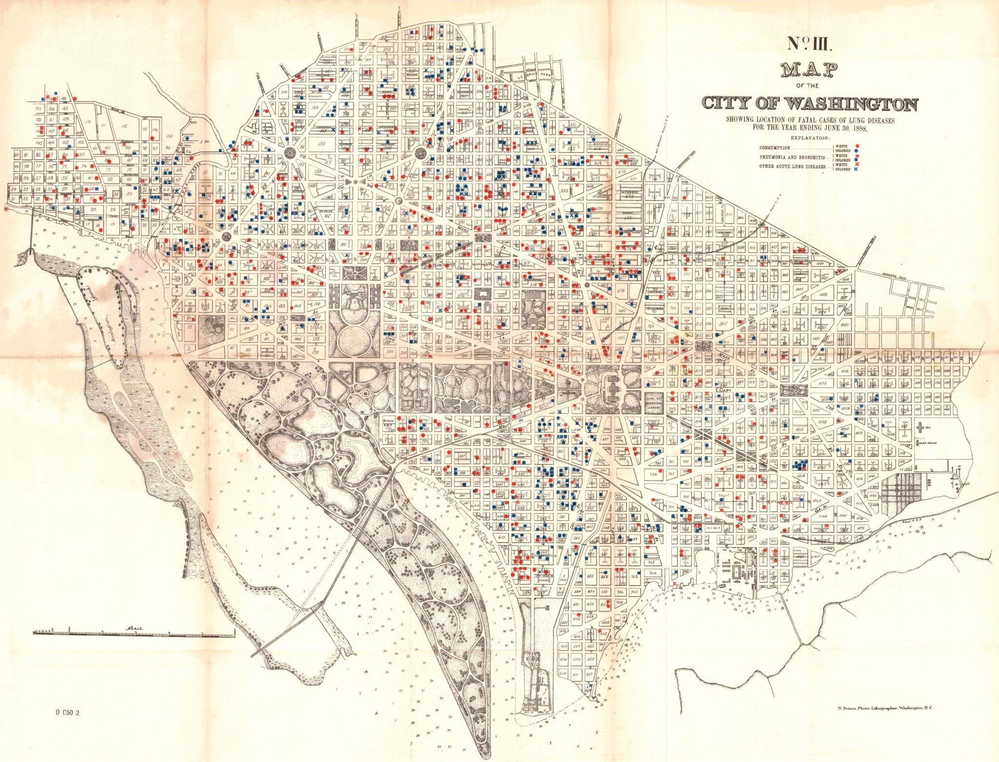
What a sad map of the District. This shows the deaths in Washington from lung disease in 1888.
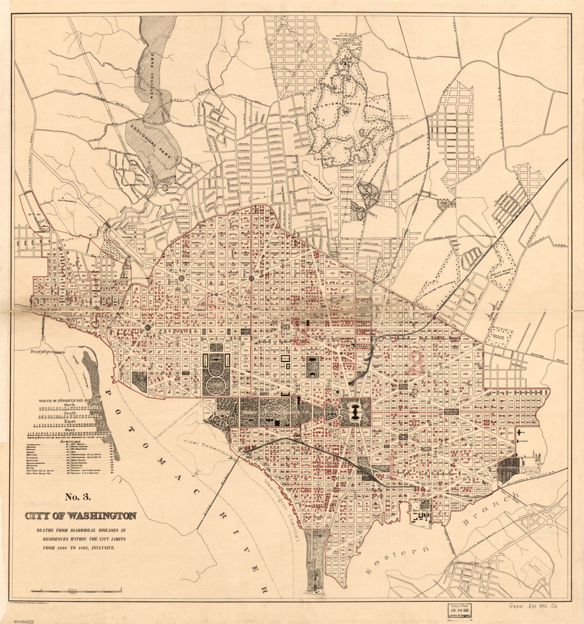
An 1890s map of Washington, DC and deaths related to diarrhea, heavily concentrated in Swampoodle and Murder Bay.
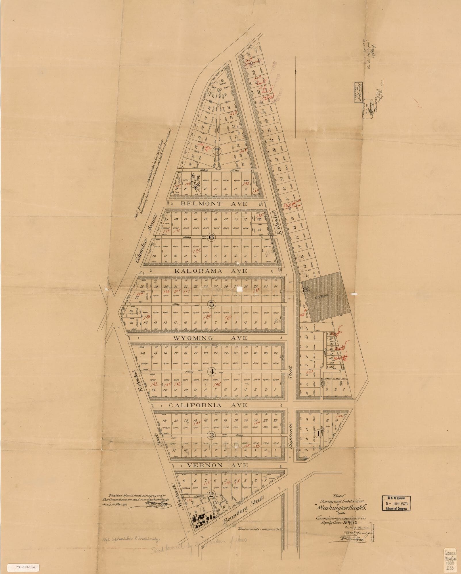
Adams Morgan didn’t exist in 1888. Read this story to learn the history of how it came to be known as Adams Morgan. We also have a great map showing Adams Morgan when it was very rural.
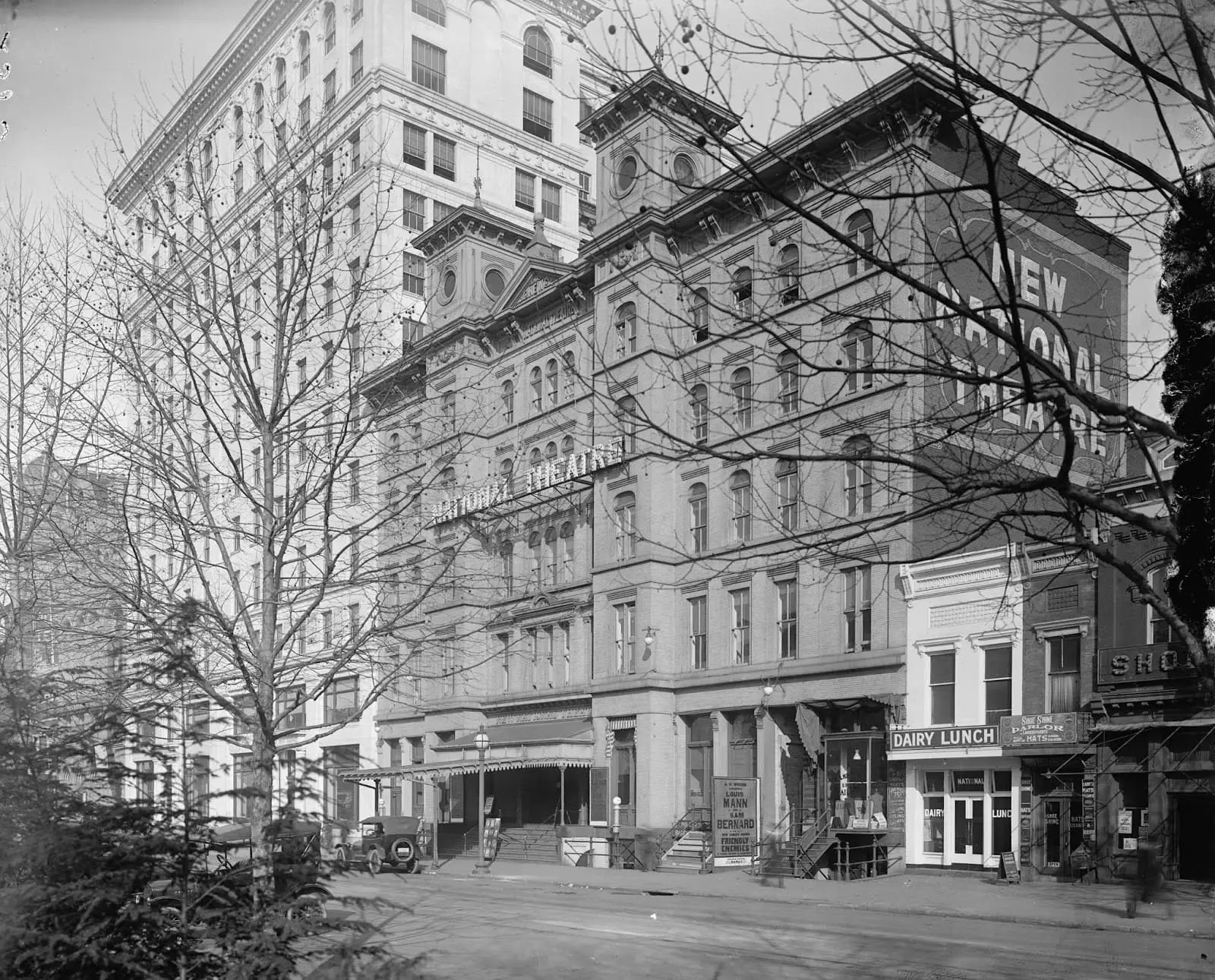
A scene was enacted just outside the National Theatre last night at the close of the performance which may end in a divorce suit.
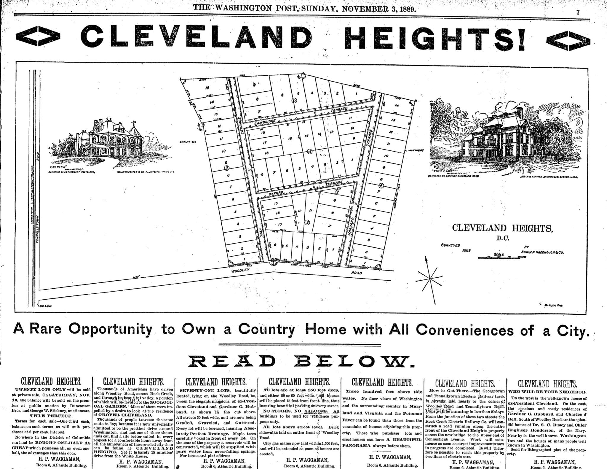
At the time, Grover Cleveland lived north of the city in a lovely old estate called Oak Hill. Eventually, the neighborhood that grew up around his home was named for him: “Cleveland Park”.
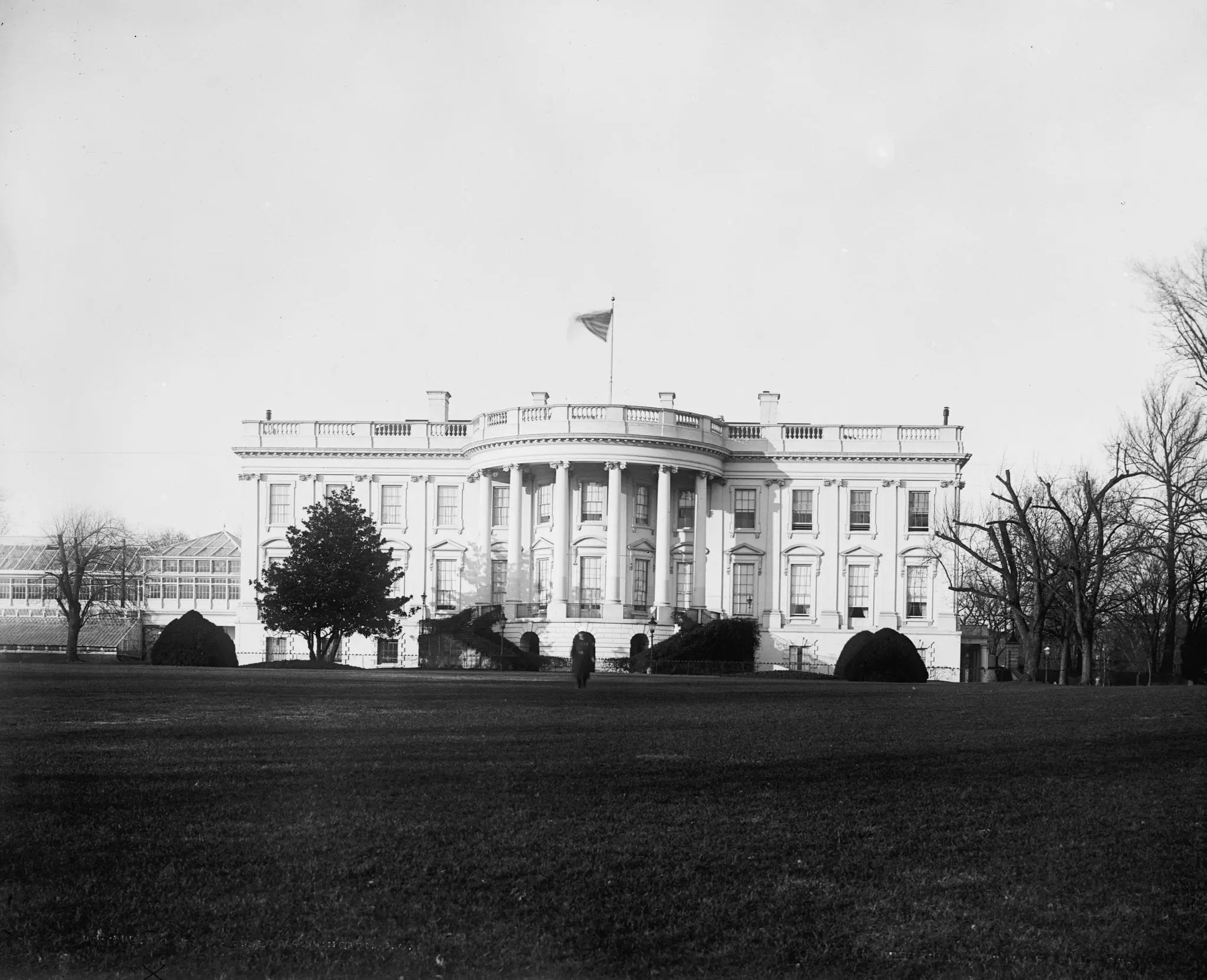
This amazing old photo of the White House is from the 1880s. Take a look at this unique view of the President’s Mansion from the south. Source: Library of Congress.
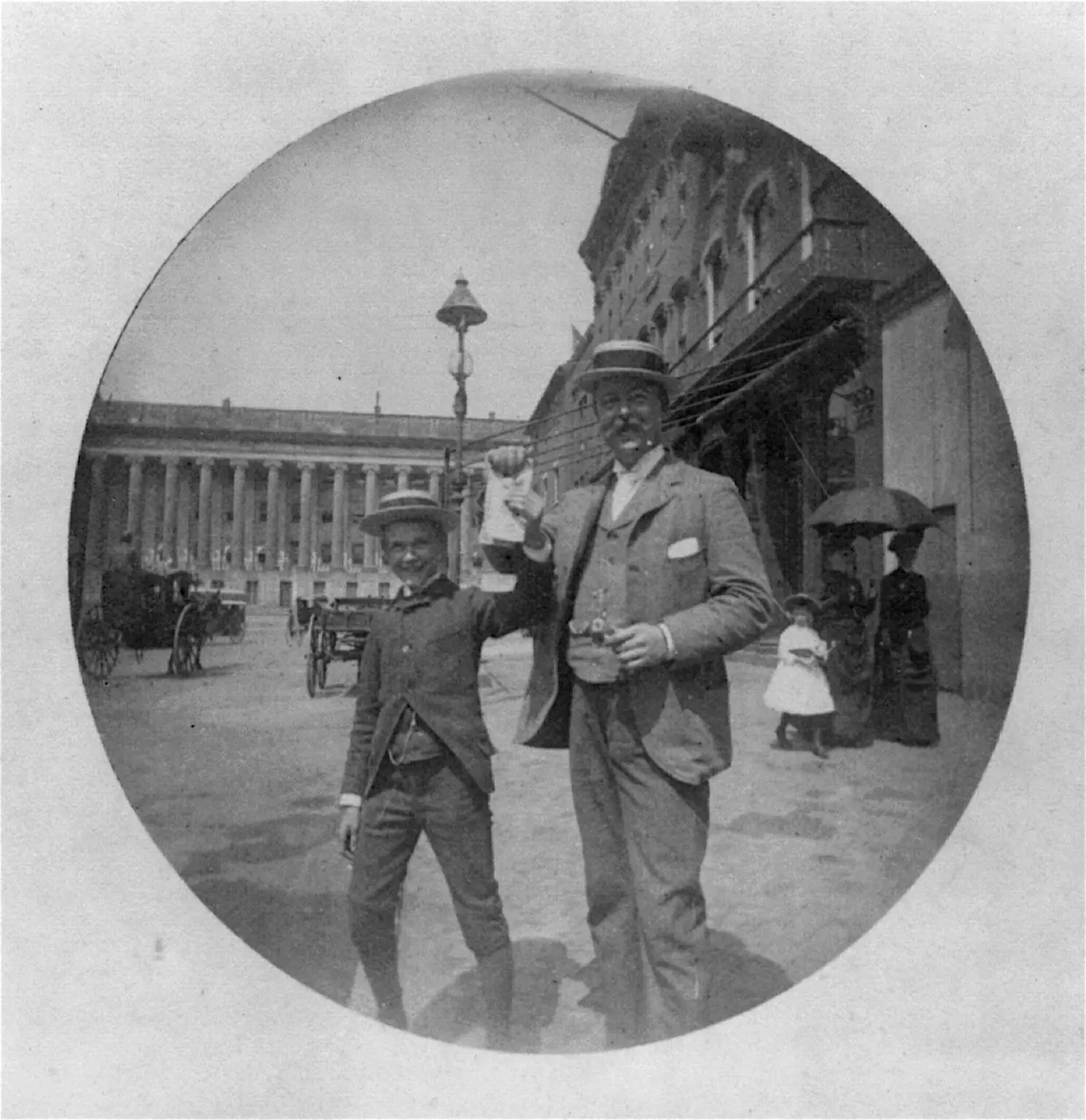
Take a look at this fascinating photo from 1885! Uncovering the past, this photo from the Library of Congress shows a man and a boy in summer straw hats happily displaying some unidentifiable papers on F Street.
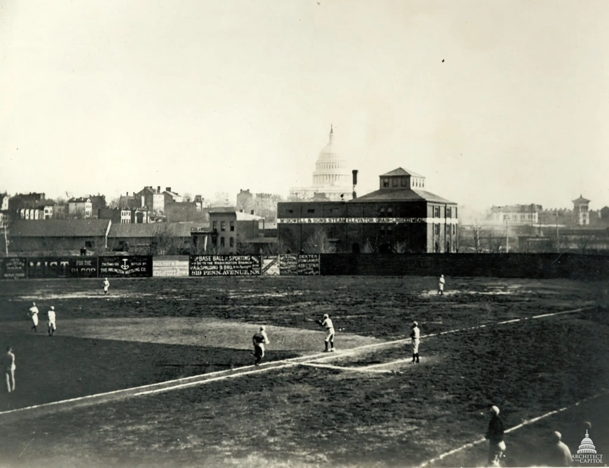
This old photograph from the 1880s shows the Washington Nationals playing at Swampoodle Grounds. Click on the image to see amazing details. Source: Architect of the Capitol.
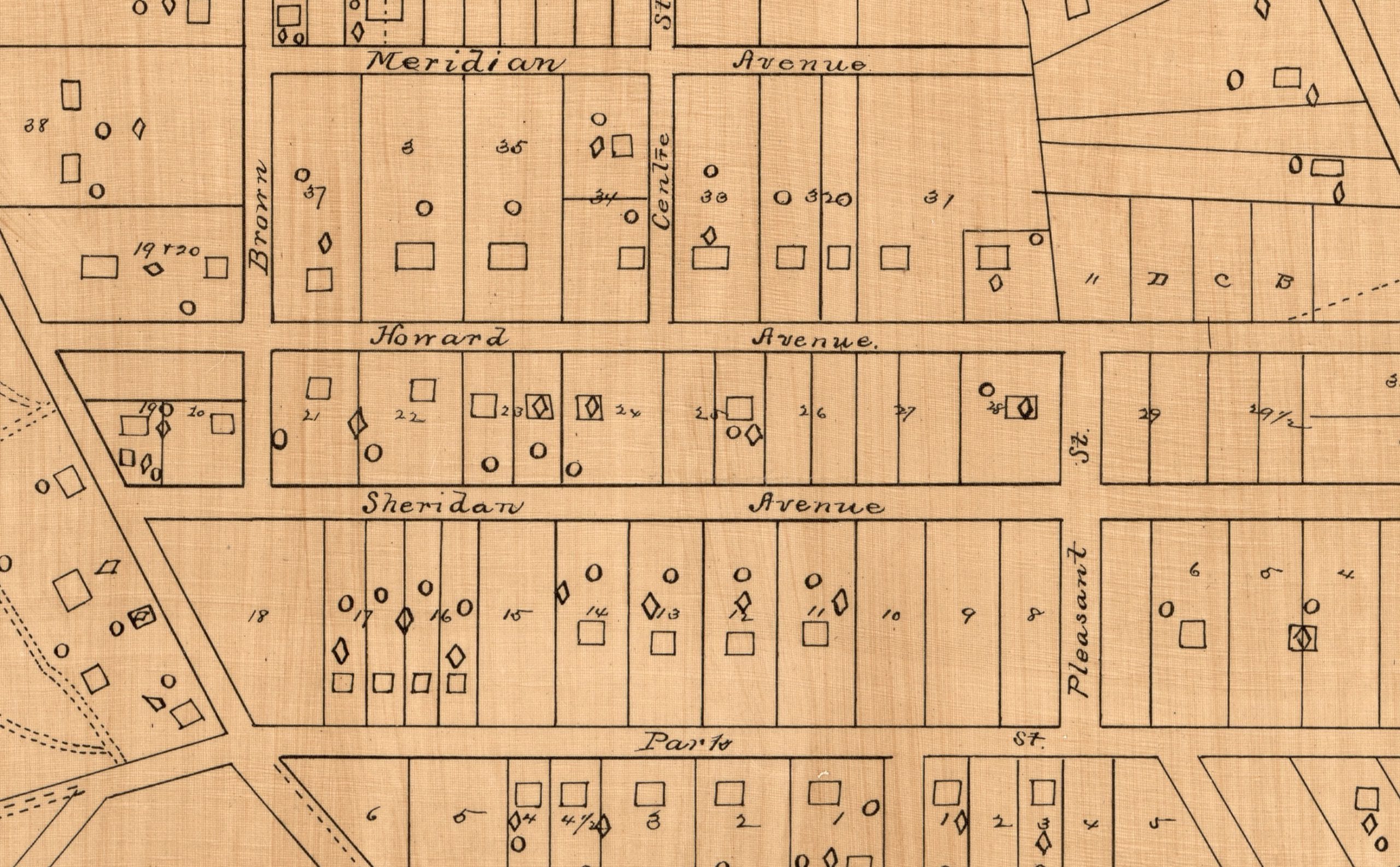
Discover the origins of Columbia Heights in this 1885 map. It shows what would become the northern part of Columbia Heights and points to the street name changes that took place. Click through to view the full-sized map!