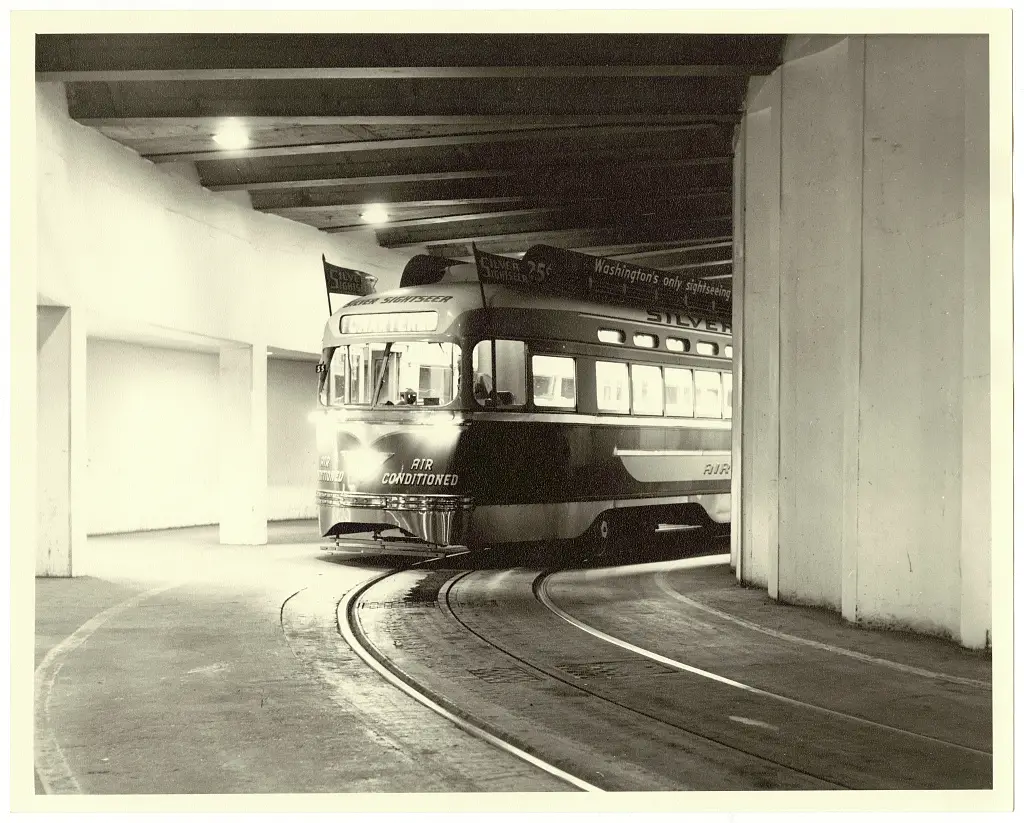
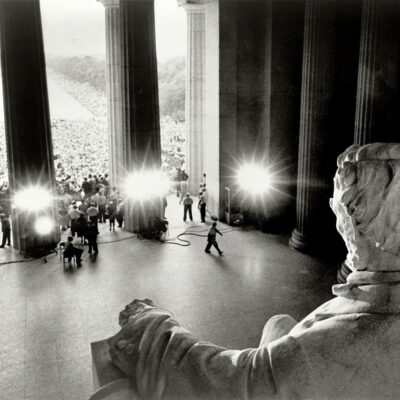
The Silver Sightseer streetcar gave cool, narrated tours of Washington D.C.'s famous landmarks in the late 1950s. Read about this one-of-a-kind, air-conditioned trolley that was specially decorated before it tragically burned down years later when the streetcar system closed.
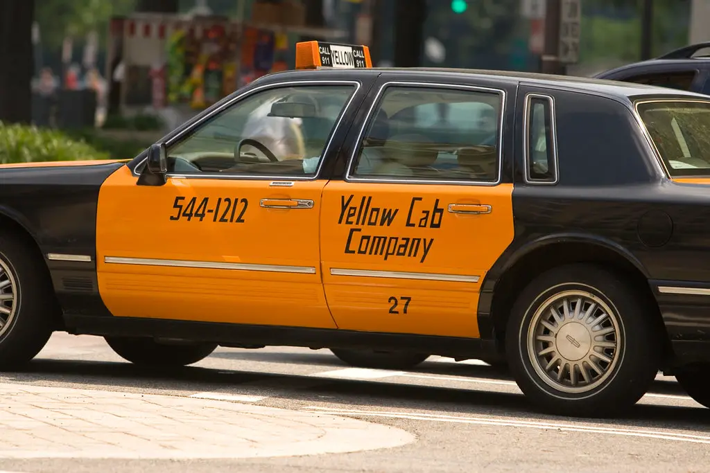
For 70+ years, DC taxis used zone fares, but proposals for meters instead sparked endless debates. This history explores DC's zone system, the battle over meters vs. zones, and how meters finally replaced zones in 2008.
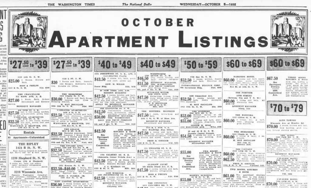
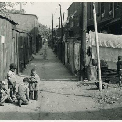
Delve into 1930s Washington D.C. apartment listings and discover how the Great Depression and the presidential campaign influenced living conditions. Explore affordable rents, modern amenities, and the challenges faced by residents in this historic era.
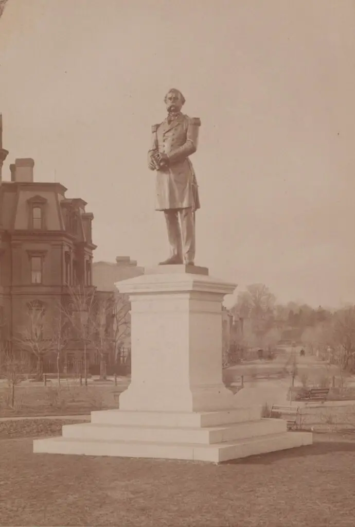
The original statue of Samuel DuPont sat for more than a generation at the center of Dupont Circle. Then it was removed because people thought it was ugly. Read the story to learn more.
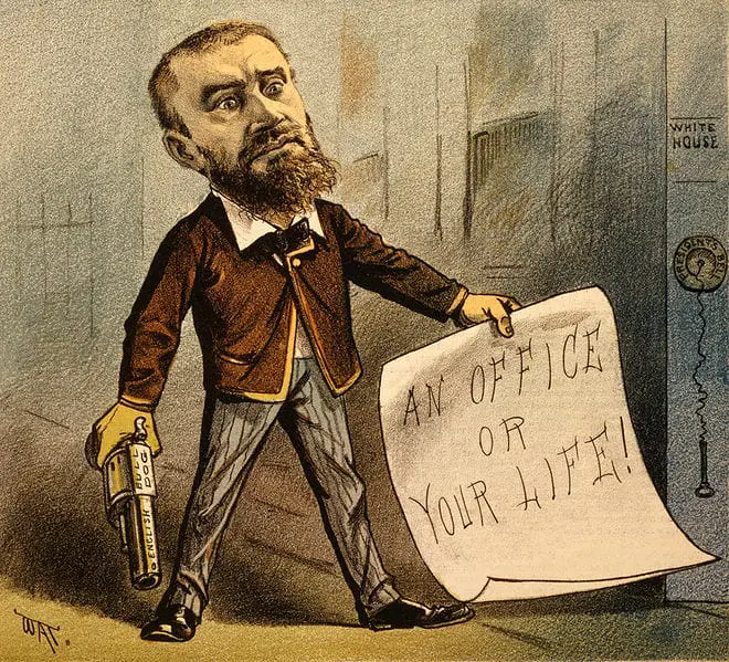
Learn about Charles Guiteau's time in Washington before he assassinated President James Garfield. He believed he had played a major role in Garfield's election victory, for which he should have been rewarded with a consulship.
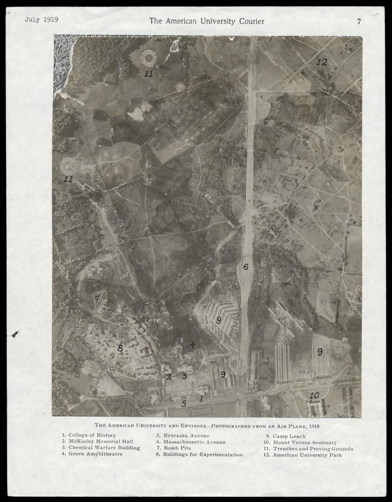
Discover the forgotten history of Camp Leach, America's first military chemical weapons facility located on the grounds of today's American University in upper northwest D.C. Nearly 100,000 employees worked here during World War I. Find out more about this historic site.
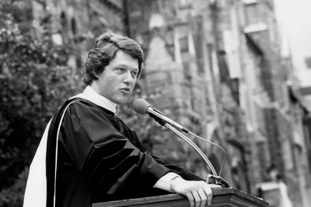
Take a rare look back in time at the then-governor of Arkansas, and Georgetown graduate, Bill Clinton delivering the commencement speech at Georgetown for the graduating class of 1980.
Take a look at an old building on 14th St. in Logan Circle, DC in 1942 and today. The US government froze sales of all new automobiles in January 1942, and this building was an automobile dealership at the time. See the photos and find out what's happening on the block today.
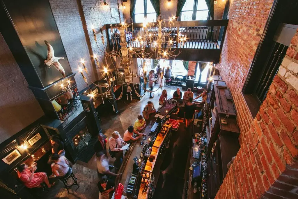
Delve into the past of Chez Billy in Petworth with this exploration of the address's history, from ice cream to seafood to Caribbean food. Learn about the building's place in political and African diplomatic history too.
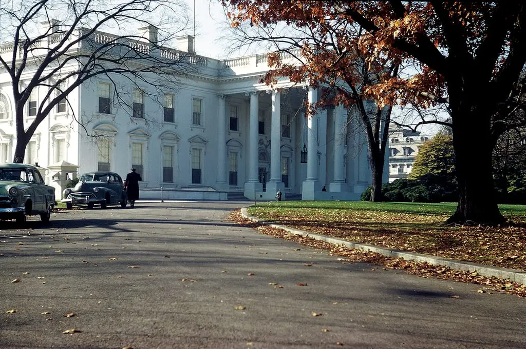
Take a look back in time with these incredible photos of the White House taken in 1950. Click the link to see more photos taken by my grandfather with a Leica 111c 35mm camera.
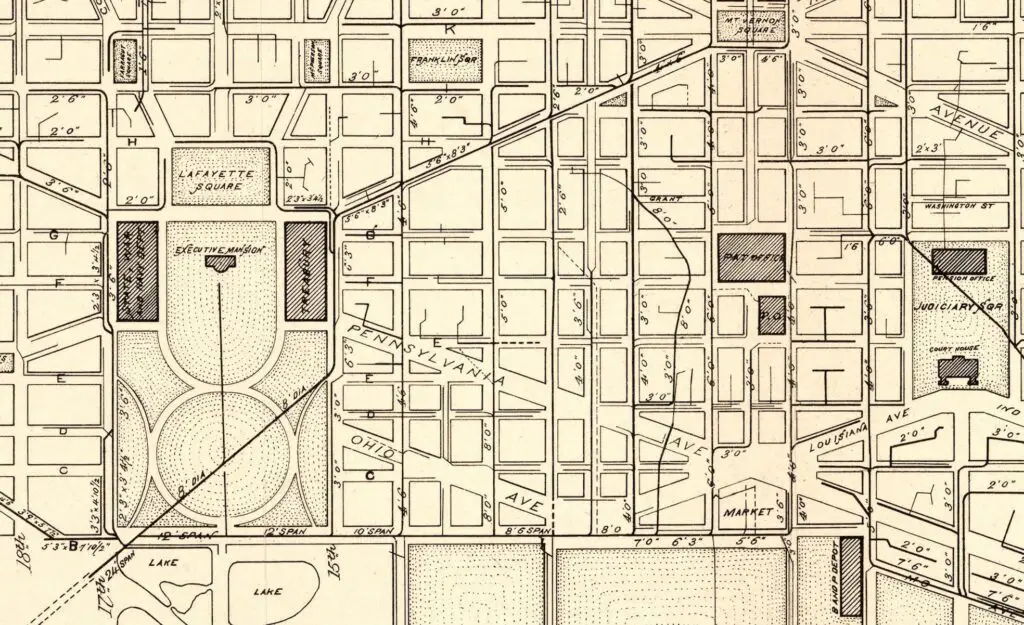
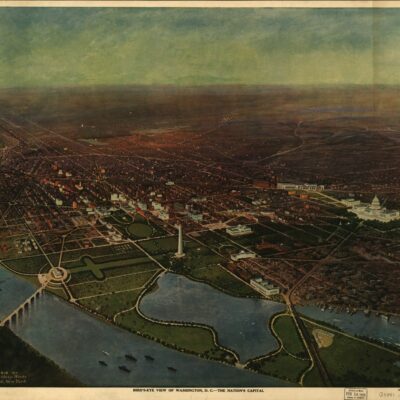
Explore these fascinating maps of Washington DC from 1885, which may not seem interesting to you at first, but are sure to draw your attention once you click on them and see the details.
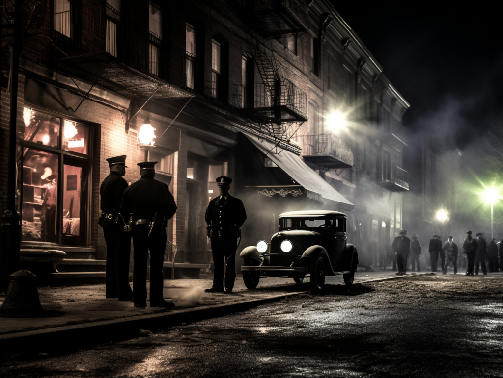
Discover the amazing, true story of a Prohibition raid gone wrong in Adams Morgan in 1928. Read about the raid and subsequent legal problems for the proprietors, the trial, and the bizarre disappearance of a jury member!
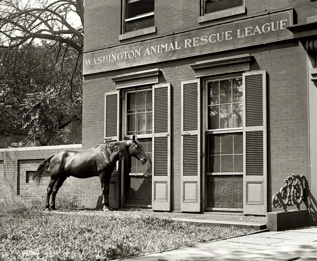
Learn about the Washington Animal Rescue League and how they have been helping animals for over 100 years. Learn how you can help with a donation today!