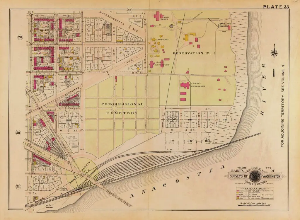
Congressional Cemetery is a must-visit for DC history buffs. Learn about its tremendous history and explore the area with a 1915 map. Visit their website to learn more!
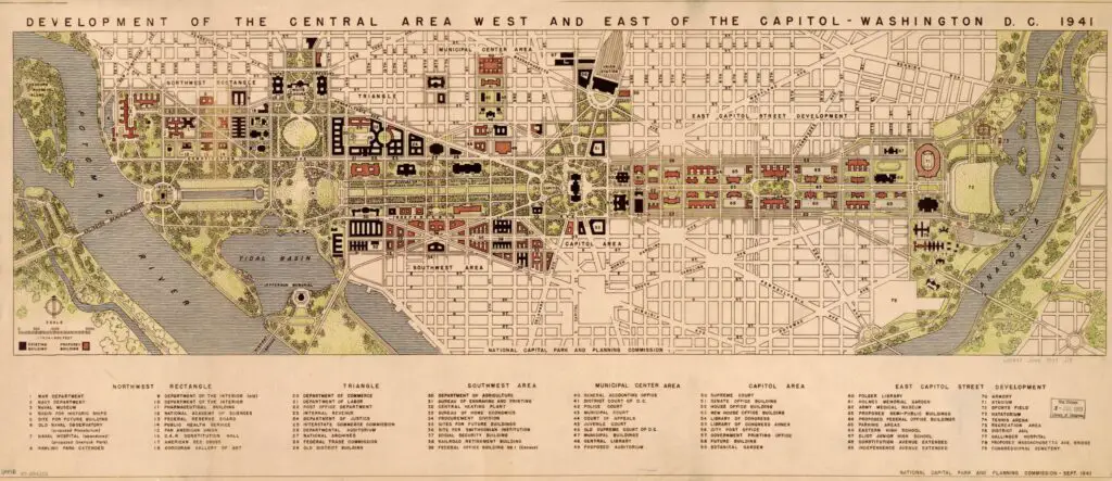
Take a look back in time to see Washington, D.C. just before World War II with this 1941 map. Get a glimpse into the history of the city with this unique artifact.
Take a journey back in time to explore the 1903 Baist Map of Spring Valley and American University Park. Check out how many large properties there were up there, prior to subdividing it.
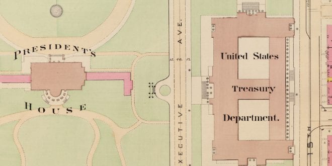
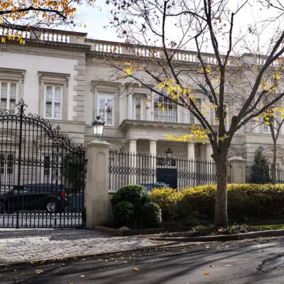
GoDCers love old Baist maps so much that they're giving you a two-for-one deal! Check out the historic photos of the east and west sides of the White House in 1903!
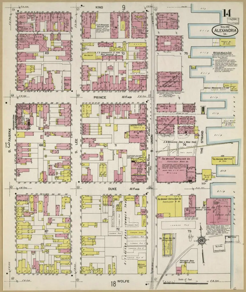
Take a look at the amazing transformation of Alexandria's waterfront from 1912 to today! Dive into the past by comparing a 1912 Sanborn fire map to a modern Google Maps view.
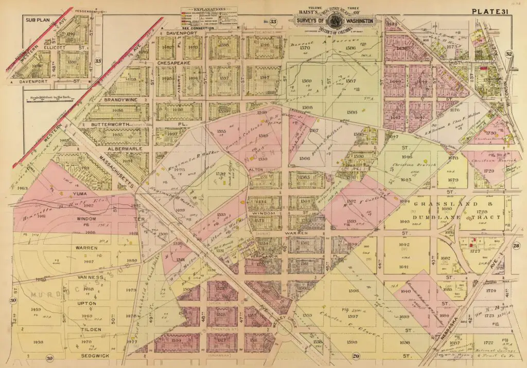
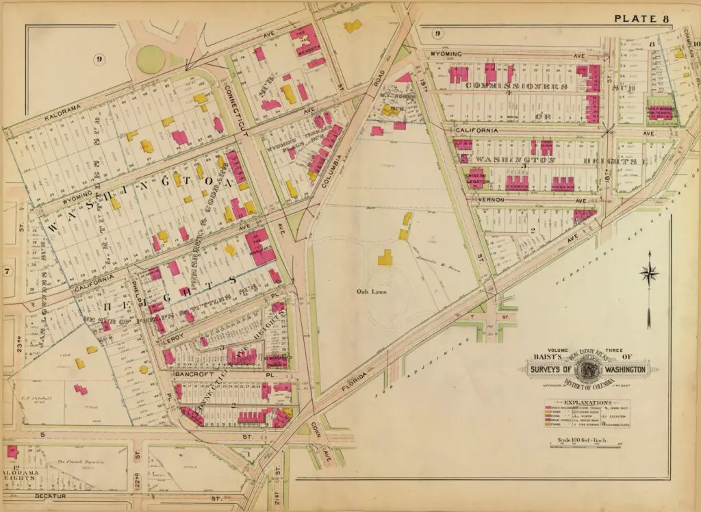
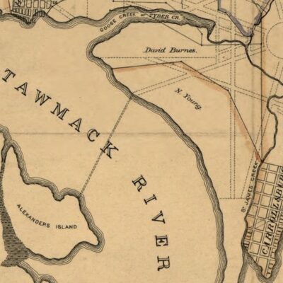
Explore what Washington Heights (Adams Morgan) and Kalorama looked like in 1903 with this map of the area just north of Boundary Street (Florida Avenue).
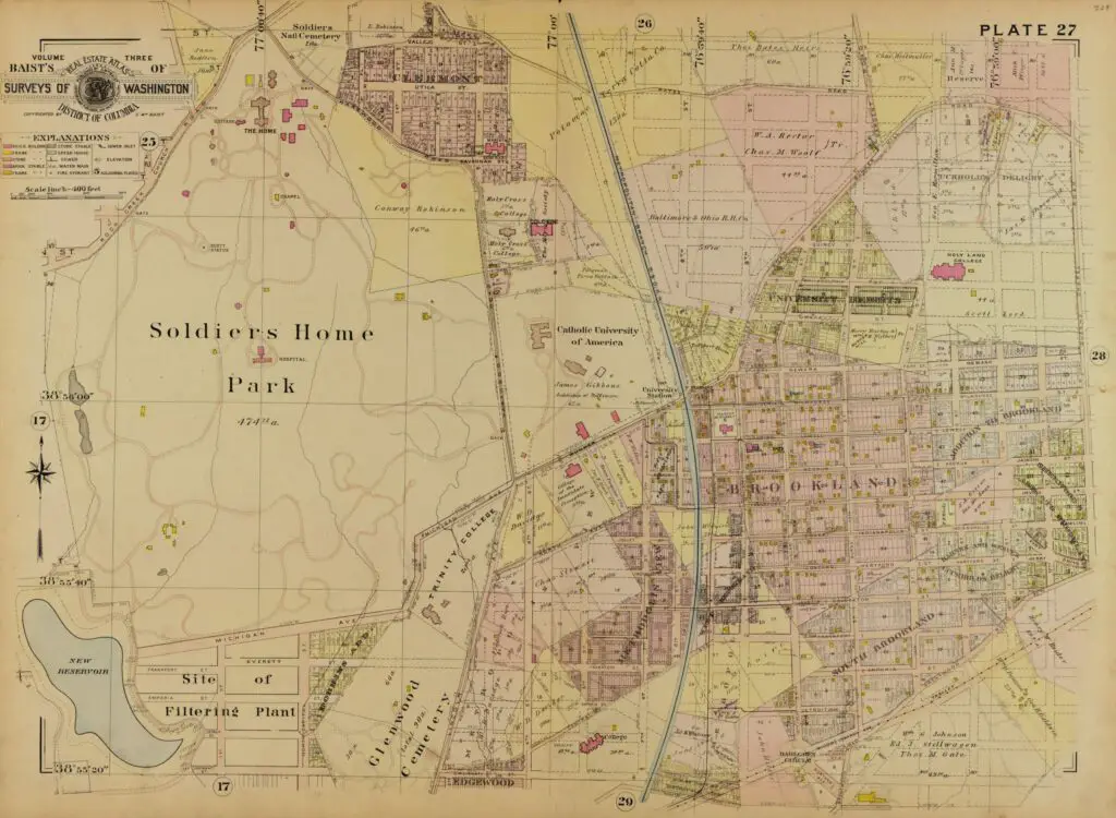
Explore the history of Brookland through an old map from 1903. See what the area looked like and how it has changed over the years. Discover the stories behind the map!
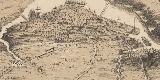
Explore a rare bird's eye view of Washington, DC from 1861, uncovered by one of the first GoDCers, John. Check out the original online at the Boston Public Library site!
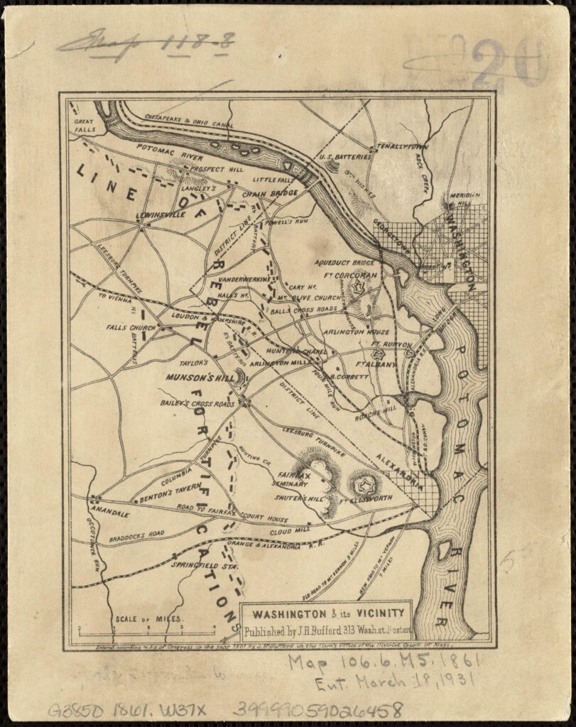
Happy Saturday GoDCers! We uncovered an incredible Civil War map of the rebel fortifications just west of D.C. in the Boston Public Library archives. Check out the original here!
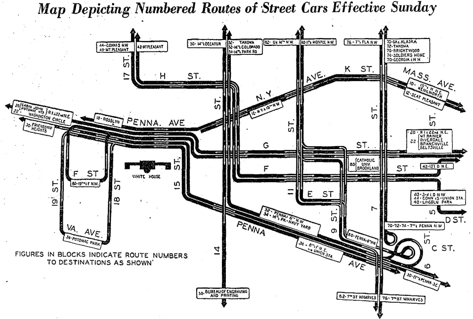
Take a look into the past with this fascinating map that shows the major streetcar routes of 1936. Explore the history and uncover the secrets of this incredible route map.