-ad 189-

Posted In GoDCers Love Maps

1935 map of D.C. juvenile delinquents
1935 Map of Juvenile Delinquents in Washington
This is a map from 1935, plotting all the residences housing a juvenile delinquent, according to the Juvenile Court of the District of Columbia.
1930 assessment map of Alexandria
Exploring Alexandria and Arlington County Through an Assessment Map
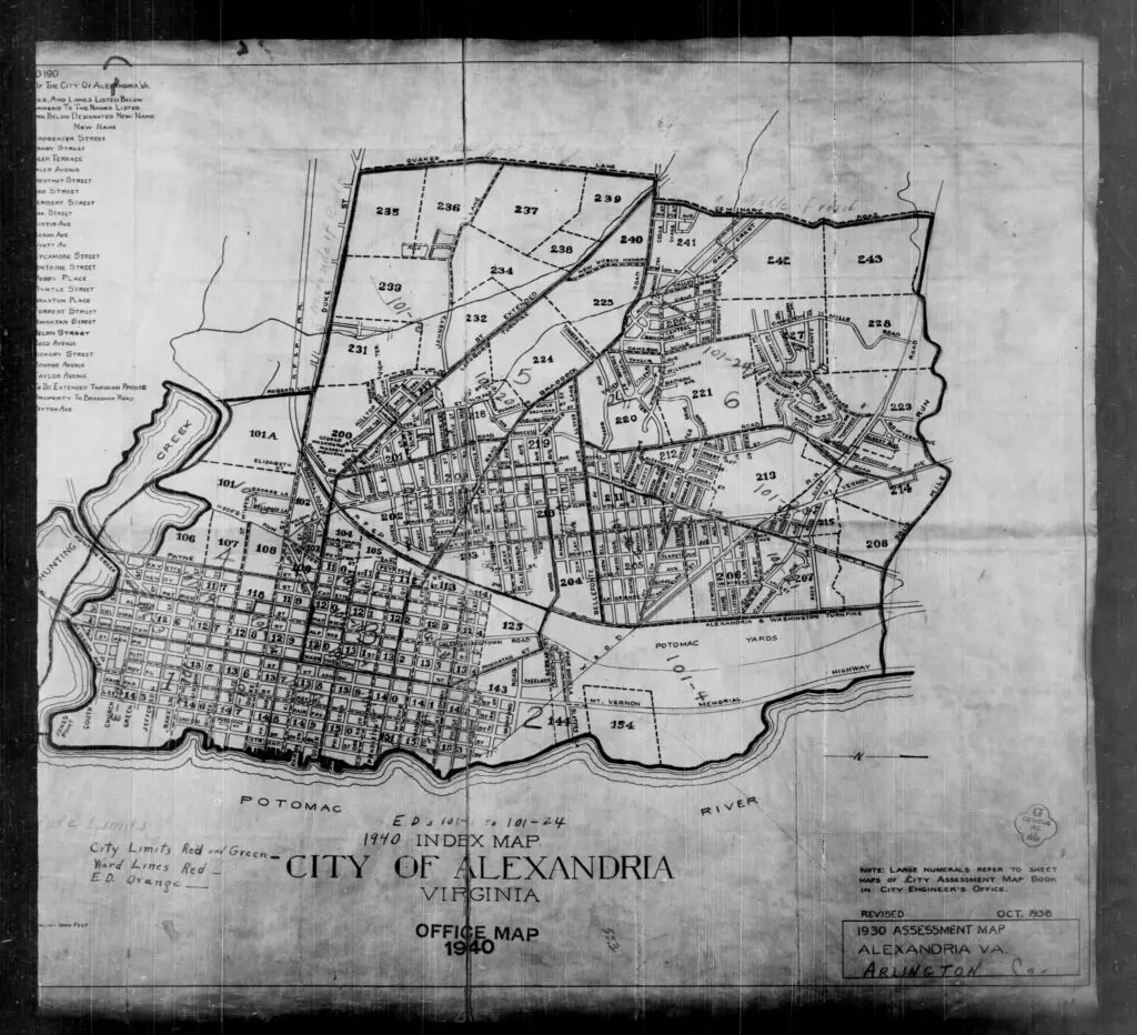
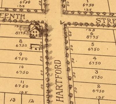
Discover what Alexandria and Arlington County looked like in 1930 with this assessment map. Get a closer look at the area's buildings and geography in this detailed map!
Sanborn fire insurance map of Washington Circle in 1888
The Sanborn Fire Map of Washington Circle in 1888
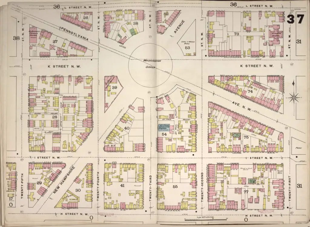
Take a look at the astonishing Sanborn Fire Map of Washington Circle in 1888. See the residential structures, many of them frame structures, that were there at the time.
Anacostia and Good Hope Road in 1916
A Look Back in Time: How Good Hope Road in Anacostia Looked in 1916
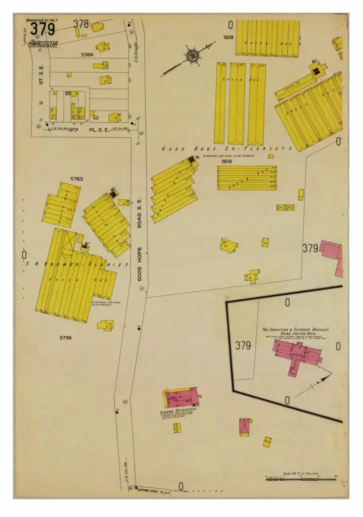
Take a look back in time and explore how Good Hope Road in Anacostia looked in 1916. See the amazing photos and learn more about the history of this area.
1909 map of D.C. waterfront in southwest
Celebrating our First Birthday with a Look at the Transformation of Washington's Waterfront
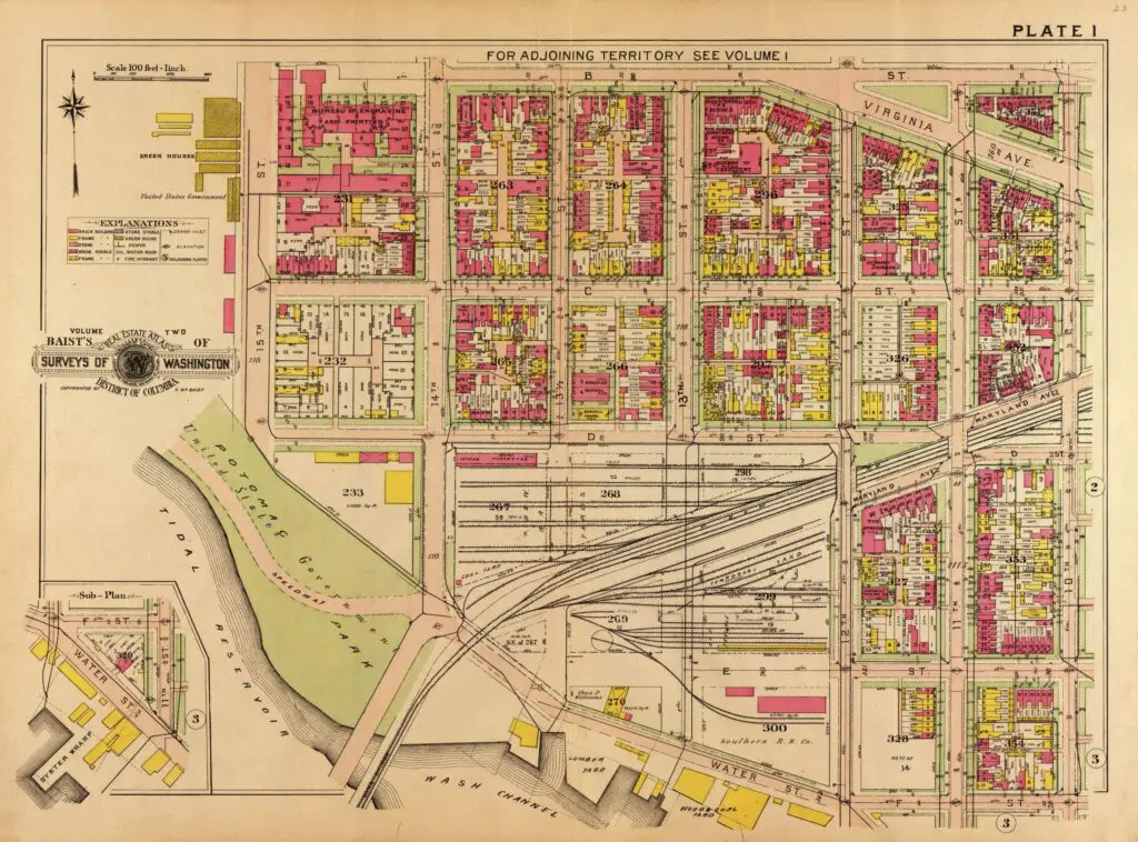
Celebrate our first birthday by taking a look at how much the Washington waterfront has changed since 1909. See the ambitious development projects that are transforming the area and the map of the waterfront from 1909.
Topographical sketch of the environs of Washington, D.C. : (survey of locality for public park & site for a presidential mansion) / to accompany report of N. Michler, Major of Eng'rs, Bvt. Brig. Gen'l U.S.A.
Exploring the Origins of Rock Creek Park: A Topographical Map from 1866
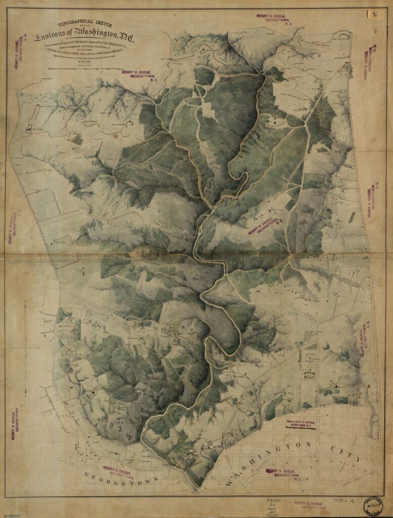
Discover the origins of Rock Creek Park with this topographical map from 1866. Learn more about the Senate Resolution of July 18th, 1866 that led to the creation of this beautiful park.
1907 Baist real estate atlas of Anacostia
Exploring Anacostia History with a 1907 Baist Real Estate Atlas
Take a look at this 1907 Baist real estate atlas to explore the history of Anacostia in Washington D.C. See how the area has changed over the years!
Screenshot 2012-12-22 at 11.51
A Fascinating 1883 Bird's-Eye View of Washington DC
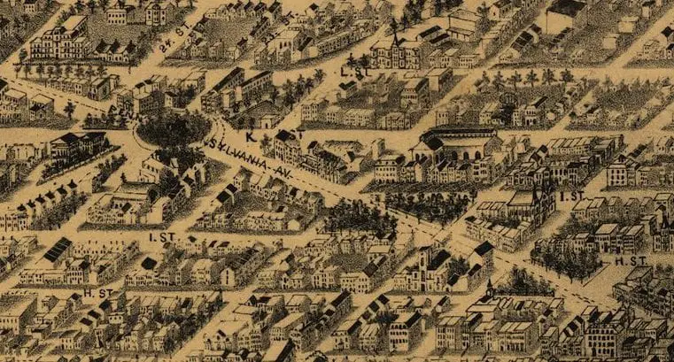
Delve into a fascinating 1883 bird's-eye view of Washington DC, courtesy of the Library of Congress. Click to explore the incredible detail of this image.
Cadastral map of planned residential subdivisions in what is now the inc. town of Chevy Chase Village (Montgomery County, Md.).
Exploring History: Map of Chevy Chase, Section 2 from 1890
Check out this amazing map of Chevy Chase, Section 2 from 1890. Discover the history of this incredible place with us at the Library of Congress!
1749 map of Alexandria
Unbelievable Discovery – George Washington's 1749 Map of Alexandria
Discover an incredible map of Alexandria drawn by George Washington in 1749. Unbelievable discovery from the Library of Congress website.

Enjoy daily

Ghosts of DC stories.