-ad 189-

Posted In GoDCers Love Maps

1907 map of Washington Heights
1907 Map of Washington Heights (Adams Morgan) and the National Zoo
1907 map of Washington Heights, the area which would become Adams Morgan.
1907 map of Kalorama
Exploring Kalorama Through Time: A Comparison of the 1907 and Present-Day Maps
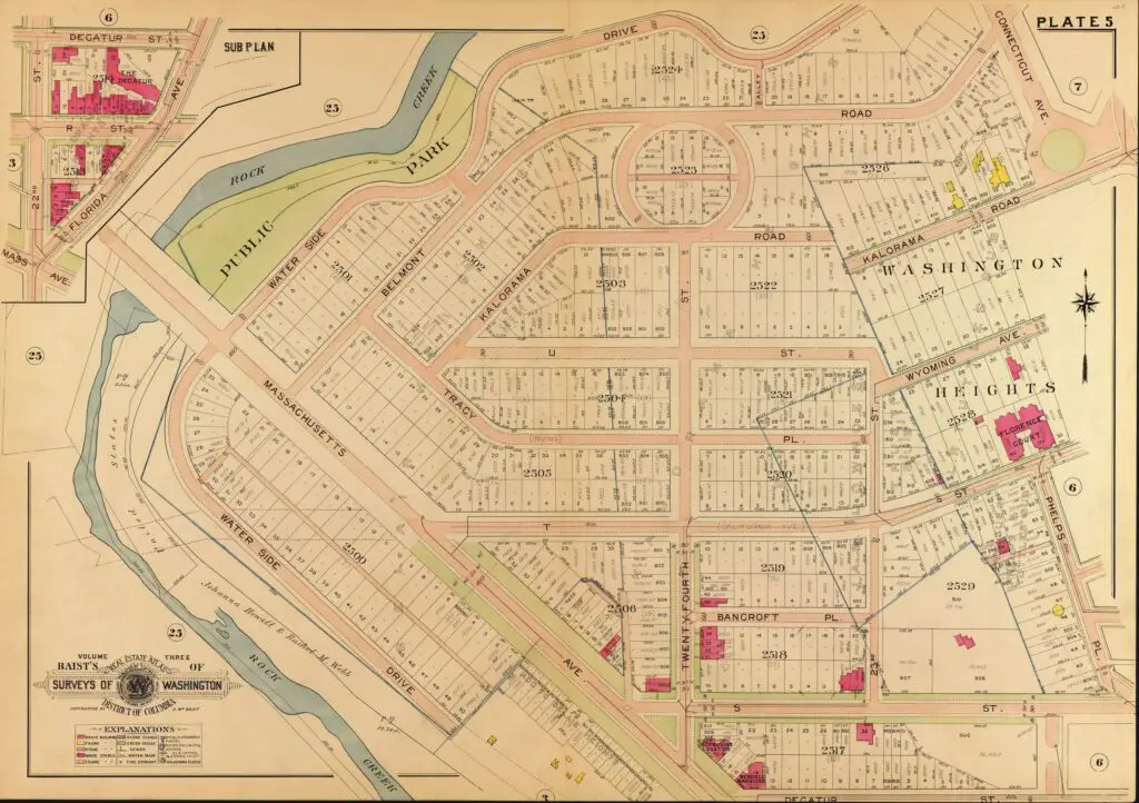
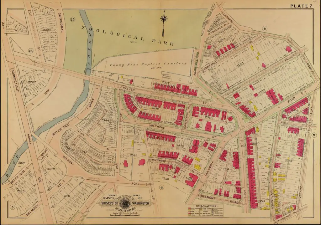
Take a look at the amazing transformation of Kalorama over time. From an empty lot in 1907 to a bustling, vibrant neighborhood worth over $200 million today - explore the comparison of these two maps!
1888 map of Lafayette Square
It's Friday and GoDCers Love Maps: Explore an 1888 Map of Lafayette Square and Farragut Square
It's Friday and GoDCers love maps! Check out this amazing 1888 map of Lafayette Square and Farragut Square. See the area in a whole new way!
Fort Pennsylvania and encampment at Tennallytown near Washington, D.C. / drawn for Mr. George Baker by W.E. Cushing, Providence, R.I., 1862.
Exploring History with an 1862 Drawing of Fort Pennsylvania at Tennallytown
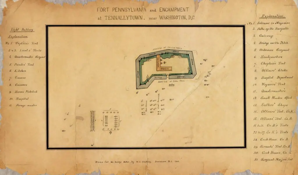
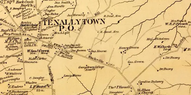
Discover a fascinating piece of history with this 1862 drawing of Fort Pennsylvania at Tennallytown during the Civil War. Learn more about this important fort from the perspective of the time.
1903 map of Eastern Market
Exploring Eastern Market: A Side-by-Side Comparison of a 1903 Map and a Google Map
Take a look at the past and present of Eastern Market with this side-by-side comparison of a 1903 map and a Google Map. Learn more about the history of this DC neighborhood!
map of Alexandria County in 1879
Exploring Alexandria County in 1879 Through the Library of Congress Map Collection
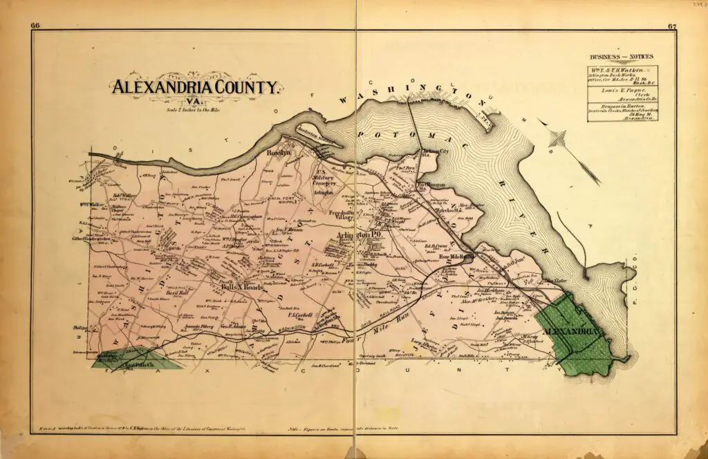
Dive into the past and explore Alexandria County (now Arlington County) in 1879 with this awesome map from the Library of Congress map collection. GoDCer Tim will love it!
Screenshot 2020-01-05 at 10.20
1800 Plan of Washington and Capitol Hill Lots
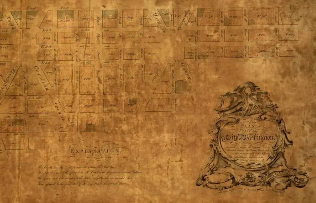
Plan of part of the city of Washington : on which is shewn the squares, lots, &c., divided between William Prout Esq'r and the Commissioners of the Federal Buildings, agreeably to the deed of trust / laid down from a scale of 200 feet pr. inch by N. King, 1800.
1890 B&O Railroad Map
Exploring the 1890 Baltimore and Ohio Railroad Route from Washington to Rockville
Take a journey back in time with this 1890 map of the Baltimore and Ohio Railroad route from Washington to Rockville. Explore the history of this iconic railroad and its impact on the region.
Screen Shot 2013-02-26 at 10.35
Love These! Rural Maps of Washington in 1879
Rural maps of the District of Columbia in 1879 including Rock Creek, Tenallytown, Uniontown and Potomac City.
1907 map of Rock Creek Park
A Glimpse into the Early 20th Century: A 1907 Map of Rock Creek Park
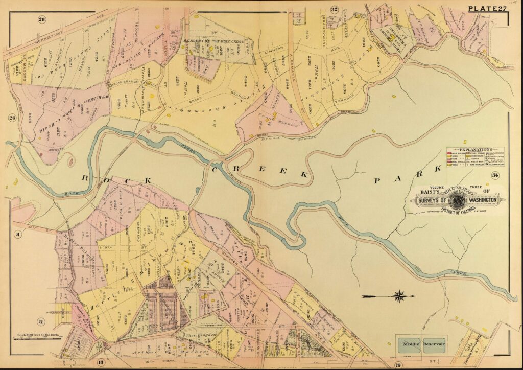
Explore a fascinating 1907 map of Rock Creek Park and get a glimpse into the large tracts of land that were present in the early 20th century. The map is oriented looking west.

Enjoy daily

Ghosts of DC stories.