
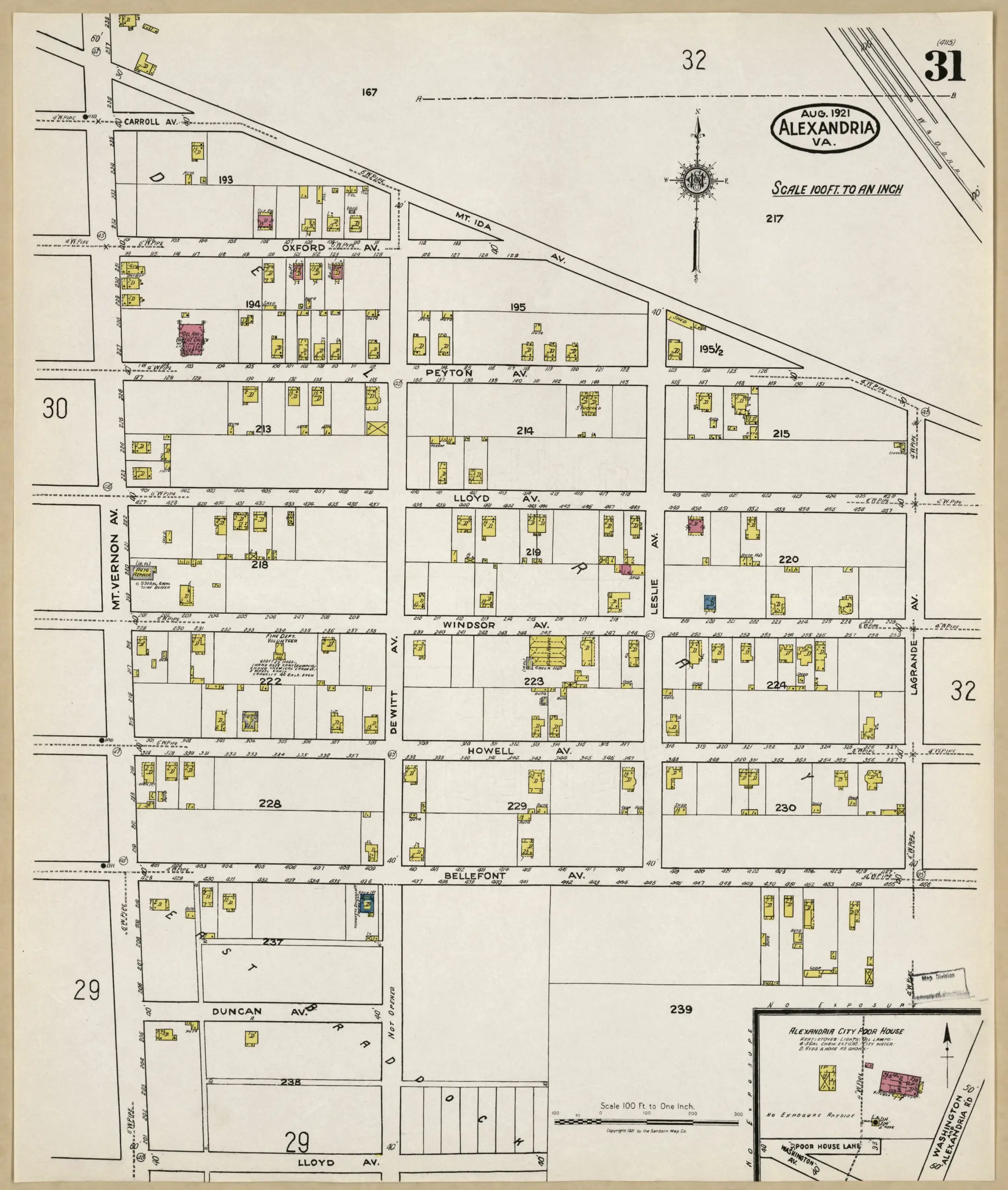
Check out this old map of Del Ray north of Alexandria from back in 1921. It’s amazing to see how undeveloped the area was. The yellow structures are wood frame buildings and the pink ones are brick.
Here’s a map of the same area today.
[googlemaps https://maps.google.com/maps?f=q&source=s_q&hl=en&geocode=&q=Del+Ray,+Alexandria,+VA&aq=0&oq=del+ray,&sll=38.804835,-77.046905&sspn=0.024246,0.040941&gl=us&ie=UTF8&hq=&hnear=Alexandria,+Virginia&ll=38.804835,-77.046921&spn=0.011384,0.020471&t=m&z=14&output=embed]
Your marker on the Google map is centered on Old Town Alexandria, not Del Ray, which is north of the railroad tracks.
The following is from an historical marker in Del Ray.
The Town of Potomac was formed around two subdivisions, Del Ray and St. Elmo. Other subdivisions followed through the 1920’s, but only one (Del Ray
Section 2 by David N. Rust, Jr) was sold with houses.
All the rest were sold simply as lots and the owners built their own houses, often considerably later than the land purchase. The result is a wide change of architecture that reflects the dynamic evolution of styles between 1894 and 1930, including Folk Victorian, Colonial Revival, Arts and Crafts, Foursquare, and even row houses of various types. The presence of so many well-preserved styles within such a small area helped it receive designation as a state and national historic district.