Skip to content
The Best Of
Neighborhoods
Southwest DC
Waterfront
Maryland
Gaithersburg
Rockville
Bethesda
Hyattsville
Silver Spring
Bladensburg
Virginia
McLean
Falls Church
Alexandria
Vienna
Arlington
Southeast DC
Congress Heights
Navy Yard
Capitol Hill
Anacostia
Northeast DC
Trinidad
Woodridge
Deanwood
Brookland
Northwest DC
Tenleytown
Park View
Friendship Heights
Brightwood
Crestwood
Sheridan-Kalorama
The Palisades
Logan Circle
Petworth
Glover Park
Bloomingdale
Georgetown
Woodley Park
Dupont Circle
Columbia Heights
Cleveland Park
Adams Morgan
Mt. Pleasant
Chevy Chase
Cathedral Heights
Chinatown
Lost Neighborhoods
Hell’s Bottom
Swampoodle
Murder Bay
Notable People & Places
Places
Washington Monument
Library of Congress
The White House
The Capitol Building
Dulles Airport
People
Franklin D. Roosevelt
Calvin Coolidge
Officer Sprinkle
Dwight D. Eisenhower
Warren G. Harding
William McKinley
Abraham Lincoln
John F. Kennedy
Teddy Roosevelt
Woodrow Wilson
Published
April 19, 2013
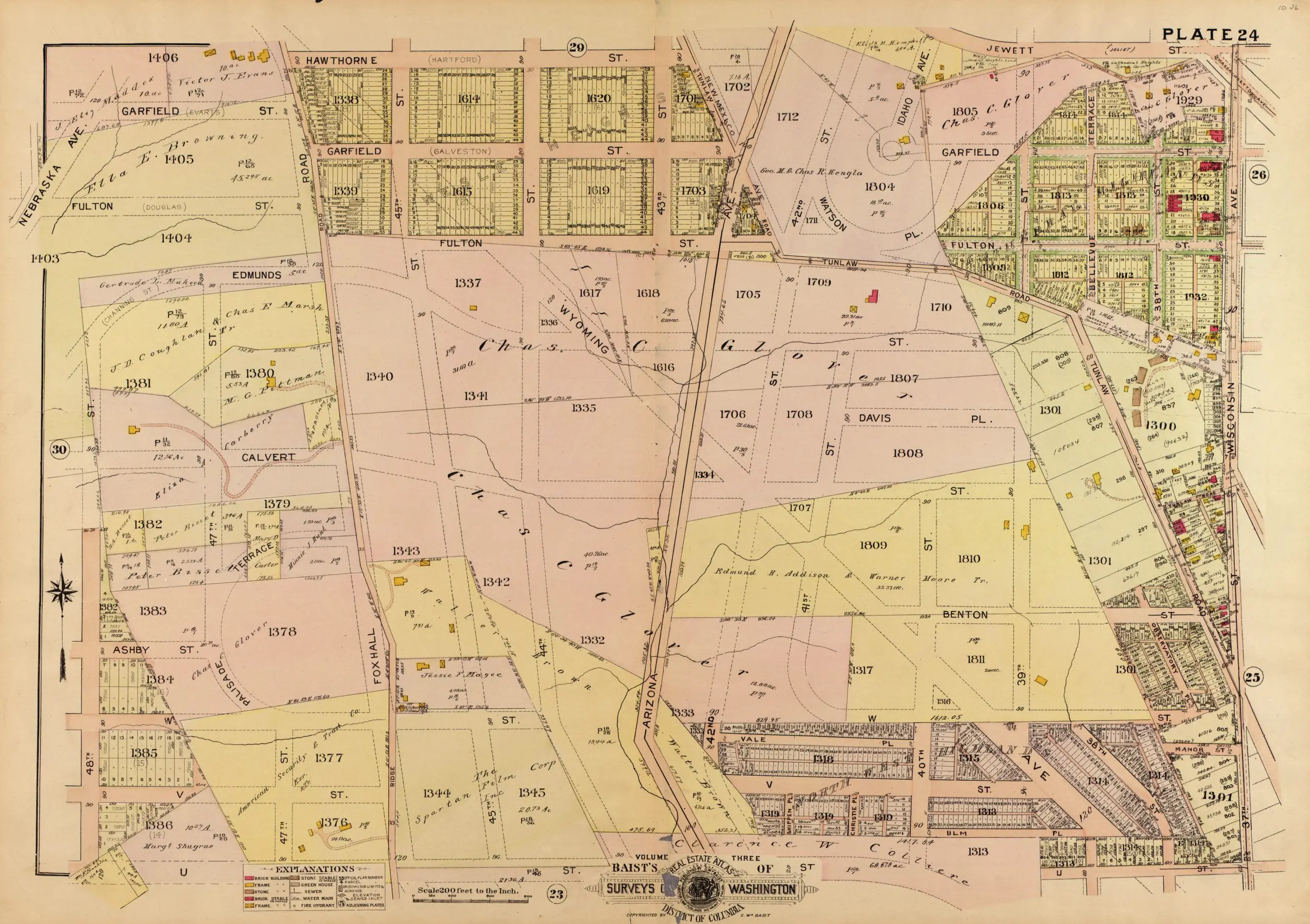
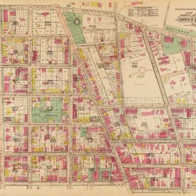
Exploring Foxhall Crescent in 1921: A Map of a Very Rural Area
Take a look at this 1921 map of Foxhall Crescent, a very rural area in Washington, DC. Learn more about the history of this area and explore the map to see what it looked like in 1921.
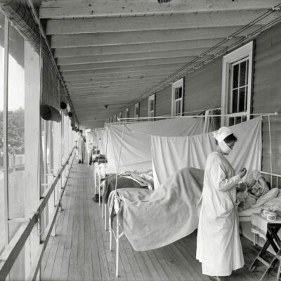
A Closer Look at the Victims of Washington, DC's 1918 Spanish Flu Pandemic
Andrew J. 'Cy' Cummings: A Larger-Than-Life Figure in Chevy Chase
No posts found
This is a map of a very rural Foxhall Crescent in 1921.
1921 map of Foxhall Crescent
More For You
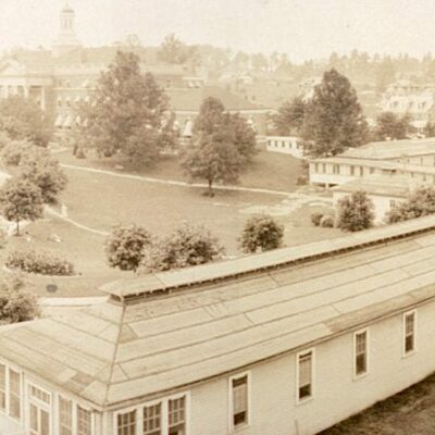
Take a Look Back in Time: A Panoramic Photo of Walter Reed Hospital from 1919
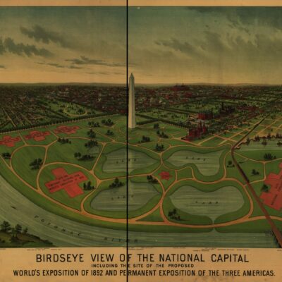
Exploring the Unbuilt Washington World's Fair of 1892
No posts found
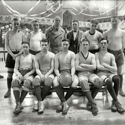
The 1923 Catholic University Basketball Team - A Photo from the Old Gymnasium
A Photographic Tour of the Willard Hotel in 1921: A Spectral View of Pennsylvania Avenue at 14th Street
No posts found
Exploring Three Stories From the National Arboretum in Northeast D.C.
Explore Georgetown in 1915 with this Baist Real Estate Atlas Map
No posts found
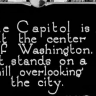
Discovering a Lost Ford Motor Company Film from 1922
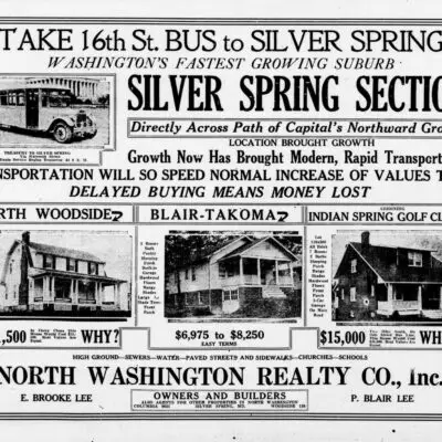
Buy a Home in 1925 Silver Spring
No posts found
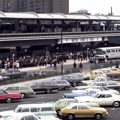
When Did Metro Open in D.C.?
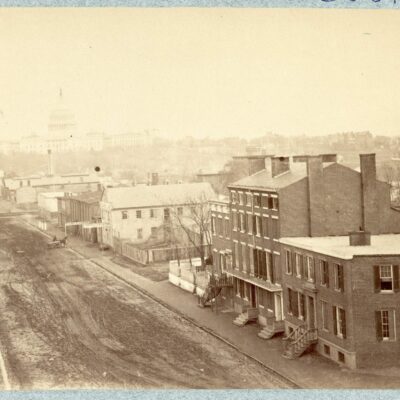
A Look at Maine Ave. SW in 1865, Right Around the Time of President Lincoln's Assassination
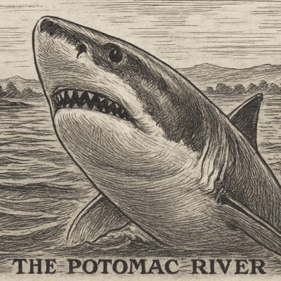
Shark Attacks in the Potomac in 1911?
No posts found
1886 Plan to Fill In and Build Over Rock Creek
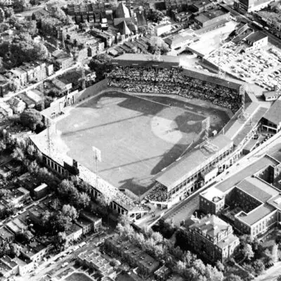
Where Was Griffith Stadium in Washington?
Three Sisters Island Legend in the Potomac
No posts found
What Is The History of Tysons Corner?
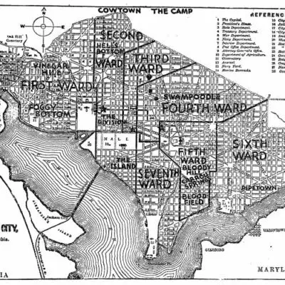
Exploring Washington's Lost Neighborhoods of the Late 19th Century
1890s Map of Diarrhea Deaths in Washington
No posts found
Popular Posts
Shaw, Mt. Vernon Square, and Dupont Circle: A 19th-Century Property Value Comparison
No posts found
Drunk Guy Falls Off Key Bridge Railing
1935 Map of Juvenile Delinquents in Washington
Why Is There No J Street in Washington, DC?
1891 Map of Street Sweeping
No posts found
Enjoy daily
Ghosts of DC stories.
SUBSCRIBE
No thanks.