When Rayful Edmond III walked out of federal prison on July 31, 2024, he had been inside for 35 years. He was 60 years old. He had gone in at 24.
Five months later, he was dead.
Edmond died on December 17, 2024, of a suspected heart attack. He was 60. And even in death, the name still carries weight in certain parts of Washington. If you grew up in DC in the late 1980s, you know exactly who that is. If you didn’t, here’s what you missed.
The Kid from M Street NE
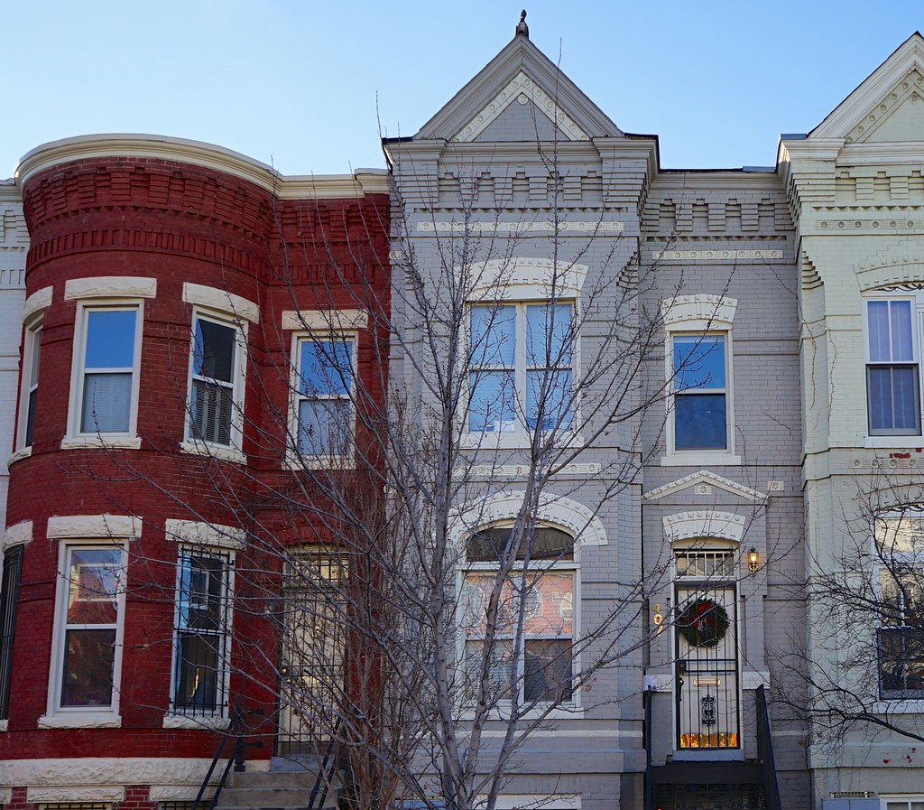
Rayful Edmond III was born on July 26, 1964, and grew up in his grandmother’s house at 407 M Street NE, about a mile from the U.S. Capitol. The neighborhood bore almost no resemblance to the gentrified blocks that surround Capitol Hill today. His family was large and tight-knit. His mother, Constance “Bootsie” Perry, was a constant presence.
Juan Williams spent weeks interviewing Edmond for a landmark Washington Post profile published on June 24, 1990. He described him as “a street-smart, cunning young man from a large, tight-knit family, a family that exposed him to gambling and drug dealing at a young age and in which he was ‘spoiled to death — it was cool because I was the little baby brother — I was king. I had anything I wanted.’”
At Dunbar High School, Edmond was voted “Most Popular,” “Mr. Sophomore,” “Mr. Junior,” and “Best Dressed.” He enrolled at UDC, attended classes for a week, and dropped out. He tried cooking. That didn’t work out.
By 1986, when he was 22, he was running a multimillion-dollar cocaine operation.
The Strip
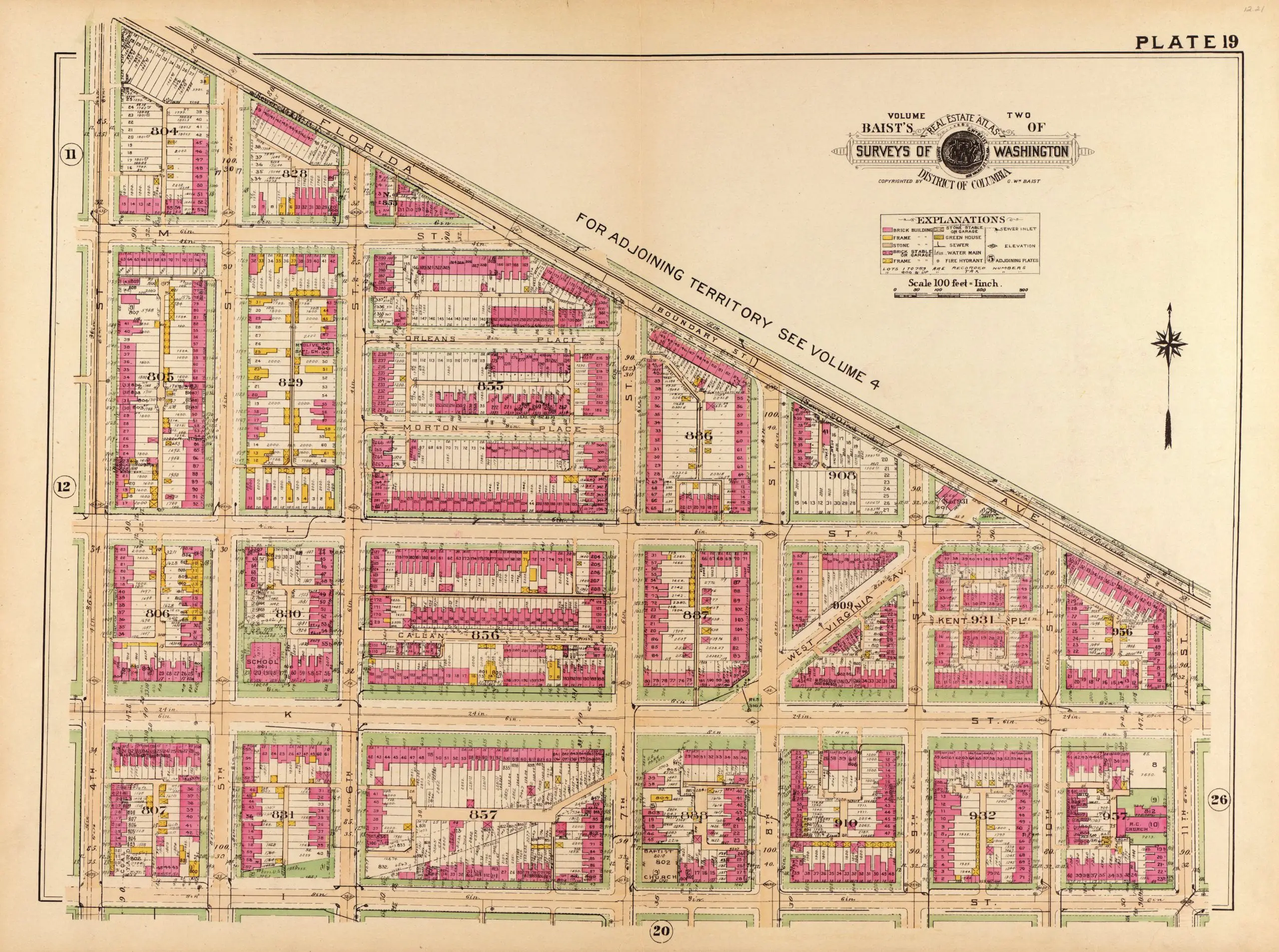
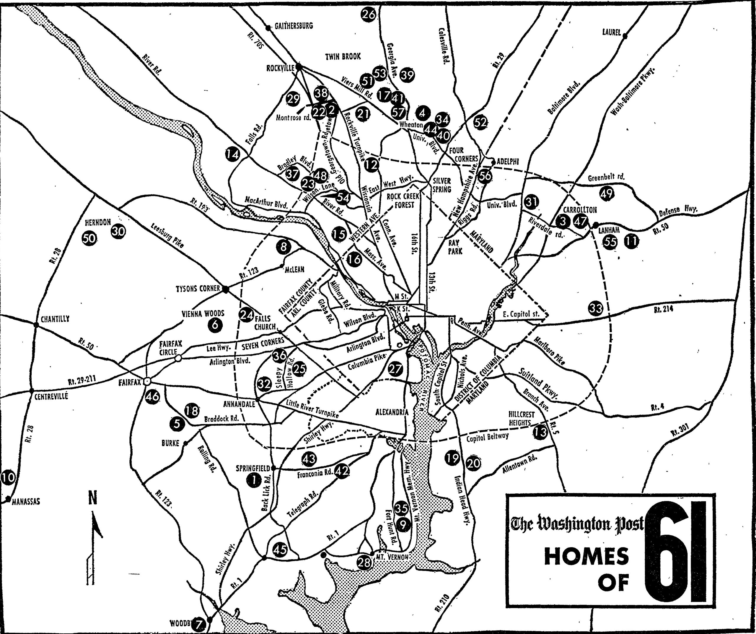
Edmond’s operation centered on Morton and Orleans Place NE, a stretch of blocks just off Bladensburg Road that became known, simply, as “the Strip.” At its peak, it was unlike anything Washington had seen.
His organization eventually numbered more than 150 people. According to the Washington Post’s investigation, they occasionally brought as much as 1,700 pounds of Colombian cocaine a month into the city, sourced through Los Angeles suppliers. On the busiest nights, his employees carried out as many as 30 transactions a minute.
Read that again. Thirty transactions a minute.
From his grandmother’s house at 407 M St. NE, Edmond directed his staff as they stored coke and cash in apartments throughout the neighborhood, processed the cocaine for street sales, and packaged both the shake (powdered cocaine) and crack for his street dealers. One woman who testified for the government said she remembered selling $25,000 worth of cocaine on the Strip in just two hours.
U.S. Attorney Jay B. Stephens alleged at the time of the arrest that Edmond controlled between 20 and 50 percent of all the cocaine coming into Washington. Drug sales “sometimes totaled $2 million a week,” according to the Washington Post. The demand was so overwhelming that buyers were driving in from across the region, and the gridlock of cars trying to reach the Strip was so bad that the city had to send officers specifically to manage traffic.
Neighbor traffic jams. Caused by drug buyers. In a residential neighborhood in Northeast DC.
Prosecutors also linked Edmond’s organization to 30 homicides.
The Life
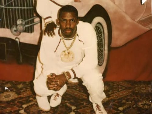
Edmond knew how to spend money. And he was enthusiastic about it.
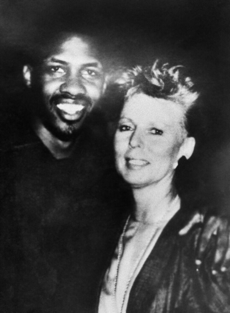
He wore a $45,000 diamond-covered Rolex, a 3-carat diamond stud in his ear, and a $15,000 diamond-covered cross around his neck. He owned a Jaguar convertible with gold-inlaid hubcaps and a white Range Rover. He flew to Las Vegas for Sugar Ray Leonard fights, took limos to Atlantic City for Mike Tyson bouts, and made shopping runs to Trump Plaza and Gucci in New York.
In one day, he and a friend walked into Hugo Boss in Georgetown and spent $25,000. He authorized a friend to buy $21,000 worth of furniture for his house in a single month. In July 1987, he handed a young friend $64,226 so the kid could go buy Edmond a new Porsche.
He was 22.
Henry Beharry, who owns a jewelry store on 14th Street NW, told the Washington Post exactly what their business relationship was: “He’d come in here and buy dozens of [gold earrings] for all those girls. Everyone who comes in my store is like a friend. No one comes behind the counter. This is no charity. This is a business. No freebies. Paying customers only. I did business with Rayful. That’s it. That’s the truth.”
He was never married, but he had two children by two different women and was engaged to a third.
And the kids on M Street NE thought he was something to behold. He handed out $100 bills. He took friends shopping at pricey Georgetown boutiques. Williams wrote that “the impressionable poor children who lived near him seemed to love him, believed he was ‘The Man.’ They gawked at Edmond, his fabulous clothes, his glittery girls, his stylish cars and the famous basketball players who were his friends.”
Edmond’s own take: “Those kids will still tell you I’m a great guy. They say, ‘We love him. We wish he was still home’ … Even now, if I call somebody and their kid answers, they all want to talk to me.”
The Georgetown Connection
Here’s the part that still gets people talking.
Rayful Edmond was a regular at Georgetown Hoyas basketball games during the Patrick Ewing era, when Georgetown was one of the best programs in the country and coach John Thompson Jr. was a genuine DC institution. Not nosebleed seats. Courtside.
Williams tracked down the details. Edmond enjoyed hanging out with Georgetown players including Alonzo Mourning and John Turner, a 6-foot-7 forward on the team. According to Turner, Coach Thompson eventually gave him a choice: quit hanging around with Edmond, or get off the team. A Georgetown spokesman later told Williams that Turner left voluntarily. Either way, Turner transferred.
The image of DC’s most notorious drug dealer sitting courtside at Hoya games became one of the defining details of the whole story.
The Arrest
The law had been closing in since December 1987, when a photograph of Edmond with Alta Rae Zanville was seized in a raid at an apartment she rented for him. In May 1988, four men were arrested in Los Angeles for offering an undercover officer $1 million for a cache of cocaine. They began to talk. The name they gave was Rayful Edmond.
On April 18, 1989, Washington Post reporter Sari Horwitz broke the story of his arrest. He was 24. Prosecutors charged him under RICO, the same statutes used against organized crime families. A May 1989 indictment named 14 co-conspirators.
One of the most damaging pieces of evidence was Alta Rae Zanville herself, 48, who had agreed to wear a hidden microphone for the government. The conversations she captured were played to devastating effect at trial.
When Edmond was arrested at a girlfriend’s house and taken to D.C. Jail, he didn’t think he’d be in long. There were reports he was so well-regarded by jail guards that they let him order pizza and have visits from his girlfriends. At his arraignment, he said nothing more than his name.
The Trial
The 56-day trial that began in mid-September 1989 was unlike anything Washington had ever seen.
The U.S. Marshals Service deployed security measures that had never been used in a District criminal case before. Marshals wore business suits instead of their usual uniforms, making them impossible to identify in a crowd. Snipers were positioned on rooftops around the courthouse. The jury was kept anonymous from day one, the first anonymous jury in Washington history. Jurors were sequestered for the entire trial.
One prospective witness was shot before the trial began. The home of another witness was firebombed during the proceedings.
Edmond never testified. He sat separated from the spectators by bulletproof glass and watched as witness after witness took the stand. He sat quietly as his best friend Royal Brooks testified about the cocaine and the millions he’d moved. He remained quiet as Zanville’s recorded conversations were played for the jury.
On the fifth day of deliberation, the jury found Edmond guilty. Three months later, in March 1990, his mother Constance “Bootsie” Perry was convicted of drug conspiracy charges for her role in the operation. Ten other family members were found guilty of being party to Edmond’s operation.
Rayful Edmond III was sentenced to life in prison without the possibility of parole.
He was 26 years old.
His reaction, as he told Juan Williams: “Not paying taxes, maybe that, maybe getting my taxes evaded. Three years’ sentence and I be going home.”
He genuinely believed he’d appeal his way out.
Life at Marion
Juan Williams visited Edmond at the federal penitentiary in Marion, Illinois in the spring of 1990, just months after sentencing. According to Bureau of Prisons records, Edmond had entered BOP custody on February 16, 1990 at USP Marion, the highest-security federal prison in America at the time. He found a 25-year-old in faded prison-issue clothes and heavy gauge metal handcuffs who was allowed to be in the common area of his unit for just two hours a day. He could get outside once a week, alone, for an hour. He could use the phone once a month for 20 minutes.
Williams wrote about the interview conditions in the June 24th, 1990 Washington Post:
He shuffles along a dark corridor of the prison, head down, trying to make conversation with uniformed guards who have little to say to him. One guard is in front of him, one behind him and another next to him. The guards halt, force the prisoner to turn right and then guide him into a tiny interview room. The gray metal door shuts hard behind him, and then there is a loud pop. The electric lock is engaged. There is no doorknob — no getting out. He sheepishly sticks his young hands through a small opening in the metal door and waits. A guard unlocks the handcuffs.
Most days Edmond wore just a T-shirt and underpants, watched TV, wrote four or five letters a day in a very neat script, did 400 push-ups along with sit-ups and squats, and slept. He’d only had two visitors since arriving at Marion: a reporter and a lawyer.
And yet he was planning a nightclub. In detail. Big movie screens in one room, pool tables in another, a bar, a dance floor, a dress code of “casual shoes, slacks and a jacket.” “I could just put my name up there,” he told Williams, “and people just come because they say, ‘Oh, that’s Rayful’s club.’”
He put his situation in these terms:
“I’m going through the hardest … Probably harder than anybody else been through, but I don’t let it bother me. I just try to be me, just be Rayful … Life’s about being free and living in the streets … If you ever did any time, you know it ain’t nothing like being free once you been here. If I ever went home, I would never come back.”
Williams closed his portrait with Edmond’s simple wish. The pampered kid from M Street, the wheeler-dealer who’d wanted to be admired by everyone, now had one thing he wanted: “I just wish I was just, you know, just like anybody else, just be right in with the crowd.”
It may have been true. It may have been hype. With Edmond, Williams noted, “it’s always a little hard to tell.”
Still Dealing from Inside

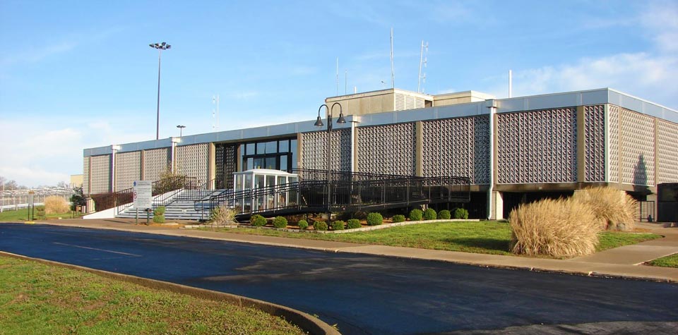
On September 27, 1990, about seven months after entering Marion, Edmond was transferred to USP Lewisburg, a high-security federal penitentiary in central Pennsylvania.
And within a month of arriving, he was back in business.
On October 21, 1990, a telephone monitor submitted a written report that “Edmond was talking to Squirrel about what seemed to be drug deals,” according to the Department of Justice’s Office of Inspector General, which later conducted a sweeping investigation of the case. The monitor also noted that “Edmond says just because he is locked up doesn’t mean he can’t get what he needs.”
The BOP flagged him. The FBI was notified. And then, essentially, nothing happened.
Edmond was talking on the phone “all day long” and arranging drug deals on the telephone “almost every day,” he later admitted to OIG investigators in a 1998 interview, including conference calls to Colombia. He said he arranged to have drugs brought into Lewisburg 50 or 60 times. He had no concern about being caught because he knew most calls weren’t being monitored. And he had learned how to speak in code on a prison telephone.
He gave the OIG investigators an example of how it worked: “You should see my new girlfriend. She is six feet tall. She lives down where we used to live on 22nd street.” Translation: he had six kilograms of cocaine to sell for $22,000.
At Lewisburg, Edmond met and formed a working relationship with Osvaldo Trujillo-Blanco, a Colombian inmate. After Trujillo-Blanco’s release from Lewisburg, he became Edmond’s main cocaine supplier, with Edmond connecting buyers in the Washington DC area to Trujillo-Blanco’s network in Medellín, Colombia. Edmond also worked alongside Freddy Aguilera, later described by federal prosecutors and the DEA as “one of the most significant drug traffickers currently incarcerated in the United States” and a Cali cartel leader, who was running his own cocaine importation ring from Lewisburg at the same time.
In August 1991, a former FBI informant at Lewisburg finally reported Edmond’s prison dealing to the FBI. In April 1992, the FBI and DC Metropolitan Police began six months of court-authorized interceptions of telephones in Edmond’s cellblock. In October 1992, Trujillo-Blanco was assassinated in Colombia, cutting off Edmond’s main cocaine supply. The FBI suspended its investigation.
Then in April 1994, a new informant reported that Edmond was still dealing. The FBI began a new undercover operation. When agents eventually confronted Edmond with evidence of years of drug trafficking from behind bars, he offered to cooperate. By July 1994, he had begun cooperating with the FBI.
What happened next involved a bureaucratic standoff that landed on the desk of a federal official named Merrick Garland.
The Bureau of Prisons objected to allowing Edmond to cooperate with investigators, citing safety concerns and institutional security. The dispute was referred to Merrick Garland, then serving as Principal Associate Deputy Attorney General. Garland overruled the BOP. In November 1994, Edmond signed a release stating he believed himself safe in the general population at Lewisburg, resolving the standoff.
The Plea Deal and What Came After
In 1996, Rayful Edmond III pleaded guilty in the United States District Court for the Middle District of Pennsylvania to conspiracy to possess with intent to distribute five or more kilograms of cocaine, covering his conduct at Lewisburg from approximately January 1991 through July 1994. His sentencing guidelines range was 360 months to life. Judge Malcolm Muir sentenced him to 360 months (30 years), to be served consecutive to the life sentence he was already serving.
He was now facing life plus 30.
The plea agreement included an important bargain: in exchange for his cooperation, any benefit would flow not to Edmond’s own sentence, but to his mother’s. Constance “Bootsie” Perry, who was serving her own drug conspiracy sentence, eventually had her sentence reduced to time served.
In 2002, Edmond appeared in a Washington courtroom to testify against former associate Rodney Moore. The Washington Post was there to cover it.
By 2005, a DVD docudrama about his life had started circulating around DC. The Washington Post ran a feature about it on July 22nd of that year. His name had never really left the city’s consciousness.
And his cooperation continued to pile up results. According to court documents, it ultimately included testimony at criminal trials that resulted in the conviction and guilty pleas of several defendants; background that led to wiretaps and the prosecution of more than 100 individuals; information related to cold-case homicides; and information that contributed to the reform of federal prison telephone procedures.
In February 2021, United States District Court Judge Emmet G. Sullivan (in the original DC case, No. CR 89-162) reduced Edmond’s life sentence to 20 years, citing his substantial assistance and the relevant sentencing factors. In August 2021, the Pennsylvania court reduced his 360-month sentence to 324 months under a sentencing guidelines amendment. In November 2022, a further court ruling reduced the Pennsylvania sentence again, to 288 months.
Between the DC sentence now standing at 20 years and the Pennsylvania sentence now at 288 months, Edmond had served far more time than the reduced sentences required. On July 31, 2024, Rayful Edmond III walked out of federal prison. He had been inside from age 24 to 60.
Five Months
That’s how long he had.
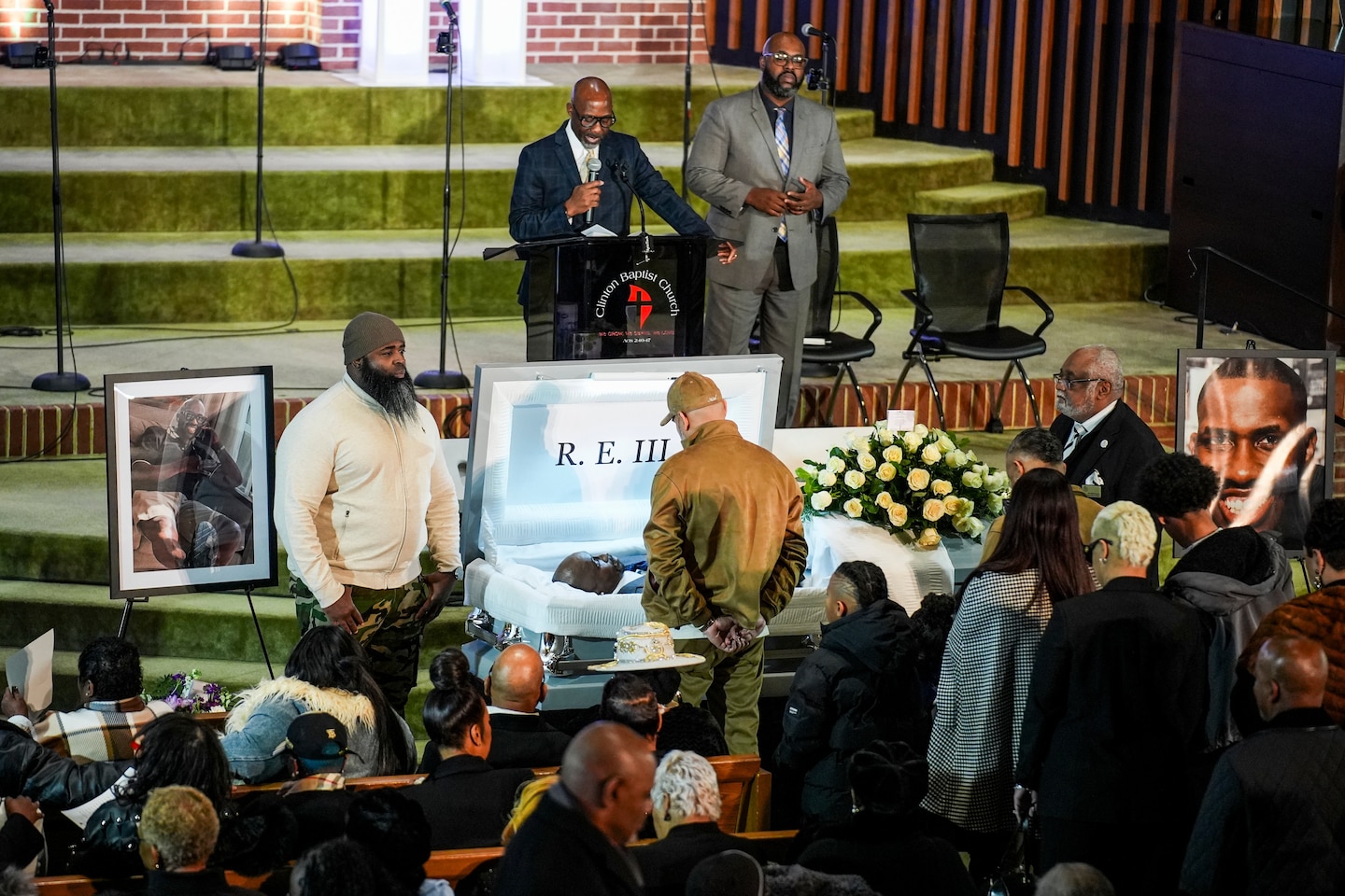
On December 17, 2024, Rayful Edmond III died of a suspected heart attack. He was 60 years old. His funeral was held on January 21, 2025, at Clinton Baptist Church in Clinton, Maryland. His mother Constance “Bootsie” Perry survived him.
The coverage was extensive. Local stations ran long segments. Former trial attorneys gave interviews. People who had been children in Northeast DC during his reign showed up on social media to talk about what that name had meant on their blocks.
His story was one of those DC stories that refuses to become history while anyone who lived through it is still alive.
If you want to see where the Strip was, the intersection of Morton and Orleans Place NE still exists, off Bladensburg Road in Northeast. The neighborhood has changed dramatically. The open-air market is long gone. The traffic jams of drug buyers are a distant memory.
The crack epidemic Edmond helped fuel destroyed families and entire blocks that took decades to recover, if they recovered at all. He was 24 when it fell apart. He was 60 when he died, with five months of freedom to show for 35 years inside.
Juan Williams asked him back in that 1990 Marion interview: “Rayful, you are only 25. How do you deal with the idea of being in jail for the rest of your life?”
His answer: “I’ll be out couple years from now, probably two years.”
He wasn’t out for another 34 years from that conversation.