Posted In Faces & Places of Yesterday

View of commercial building on the northeast corner of B Street (later Constitution Avenue) and 7th Street NW. An automobile in the foreground has an Esso advertising cover on its spare tire that reads, "ESSO THE GIANT POWER FUEL." - February 1st, 1931
Why Is Constitution Avenue Called What It Is Today?
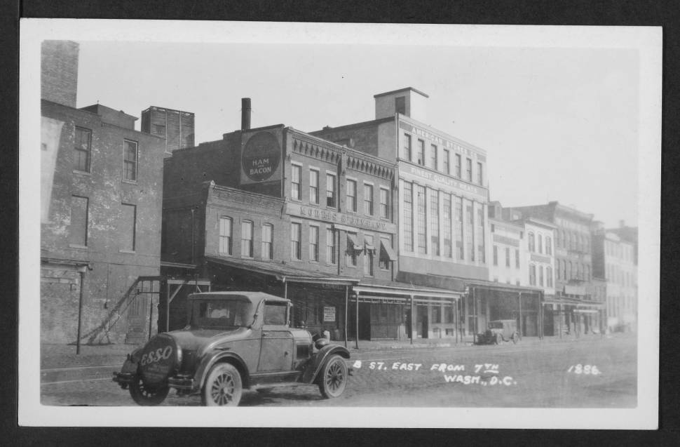
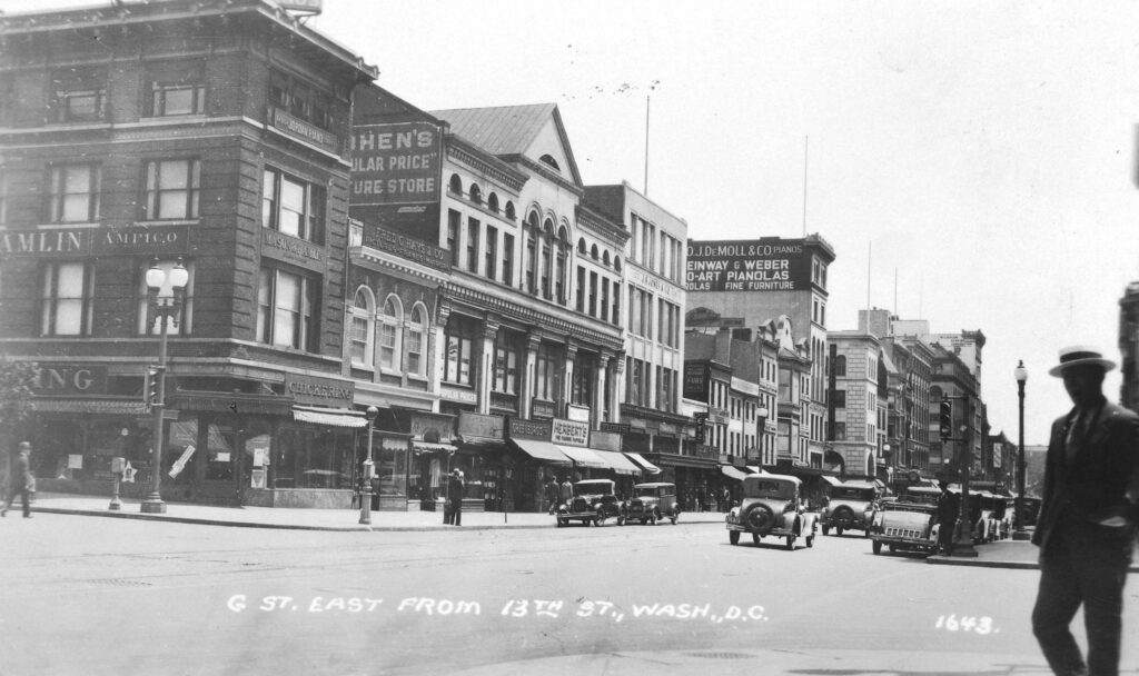
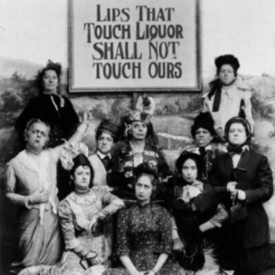
Back in 1931, Constitution Avenue was called B Street. Read this blog post to find out why it was renamed Constitution Avenue and when it happened. View the vintage images to get a feel of what it was like back then!
View of Constitution Avenue NW looking towards Center Market, which occupied the northeast corner of 9th Street NW. Many produce stalls are visible on the northwest corner of that intersection and horse-drawn vehicles are on the cobblestone street.
Exploring the History of Center Market Through This Cool Old Photo
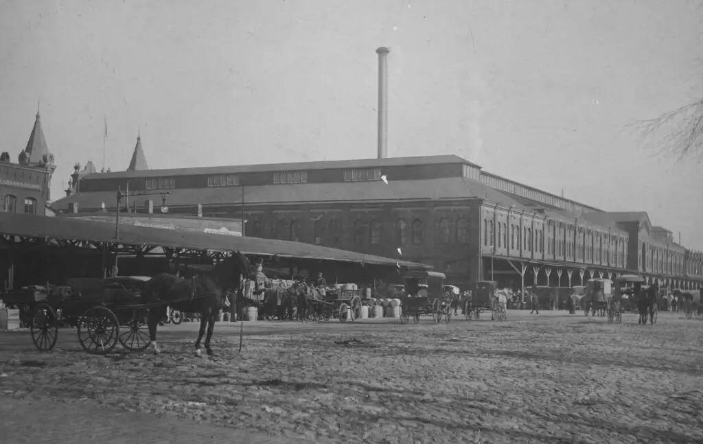
Take a look at this cool old photo of Center Market, which occupied the northeast corner of 9th Street NW. See the many produce stalls and horse-drawn vehicles in the cobblestone street!
View looking west on New York Avenue NW from 13th Street and taking in the New York Avenue Presbyterian Church and the commercial buildings on H Street NW between 13th and 14th Streets. The time on the church steeple clock is 10:55 a.m.
A Photograph of New York Avenue Presbyterian Church with the Time Precisely at 10:55 a.m.
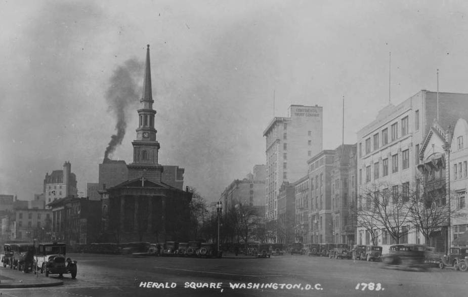
Take a look at this photograph taken of the New York Avenue Presbyterian Church in Washington D.C. precisely at 10:55 a.m. Click for a larger, more detailed version.
Expansive view of Center Market taken from an elevated position on the northeast corner of Indiana Avenue and 7th Street NW. A statue of Major General Winfield Scott Hancock is prominnent on the right side of the image which also features pedestrians, streetcars, horse and carriages, bicycles, and automobile traffic.
A Glimpse into Washington, DC in 1913: An Incredible Scene from Center Market
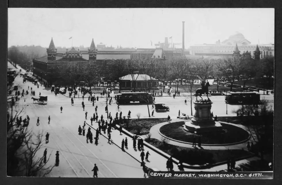
Take a look at this incredible scene from Center Market in Washington, DC in 1913! See pedestrians, streetcars, horse and carriages, bicycles, and automobile traffic all in one photograph. An amazing glimpse into DC's past!
View of a group of hikers walking alongside Rock Creek to the left and an embankment that leads up to the right upon which can be seen a row of buildings. Location is to the west and downhill from the 2800 block of Adams Mill Road NW.
Exploring the National Zoo's Historical Entrance at Rock Creek Park
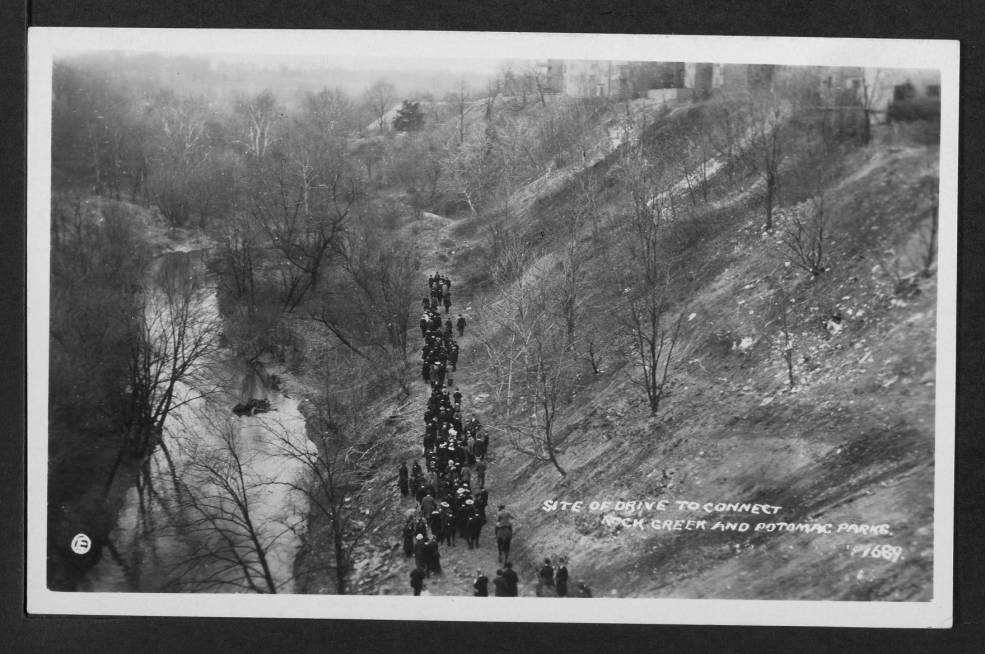
Take a journey through history with us and explore the historical entrance to the National Zoo in Rock Creek Park. Learn more about the area and its past with us today.
600 block of G Street NW
Exploring the 600 Block of G Street in Washington, DC Through Photos
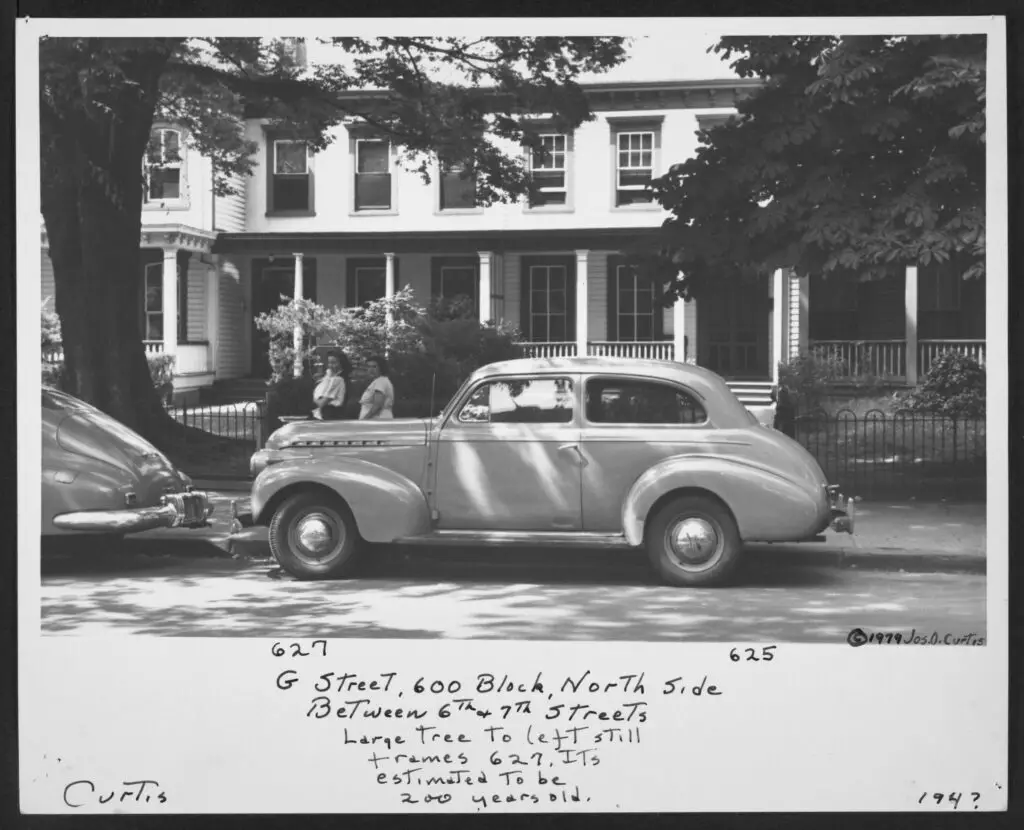
This is a cool old photo from the 1940s showing the 600 block of G St in Washington, DC, which has been torn down. See more photos from the area and learn about the DC Public Library's Dig DC project.
13th and G St.
A Blast from the Past: An Incredible Old Photo of G St. at 13th St. from May 25th, 1930
Check out this amazing old photo of G St. at 13th St. in Washington, DC taken on May 25th, 1930. An incredible blast from the past! Source: Dig DC
1858 plan of the Navy Yard
A Look Back at the Navy Yard in 1858: Exploring the Historic Plan
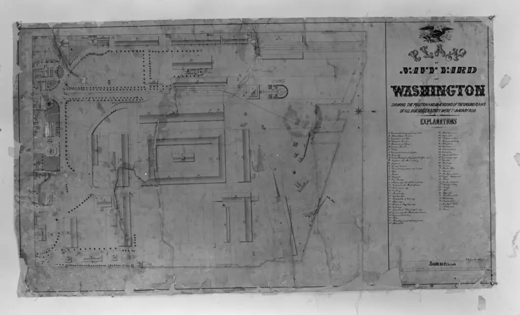
A glimpse into history with a look at the 1858 plan for the Navy Yard. Discover the fascinating details of this historic document, with images and more!
1810 Shepherd St.
A Look at 1810 Shepherd St. in Washington, DC: Then and Now
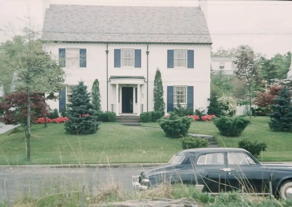
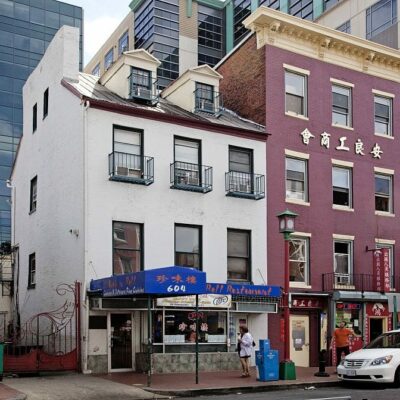
Take a look at 1810 Shepherd St. in Washington, DC, from the 1950s to today. See how the building has changed over the years. Check it out on Ghosts of DC!
Three men with bicycles on bridge near Pierce Mill, Washington, D.C.
Exploring the Past: A Look at a Photo from the 1880s-1910s
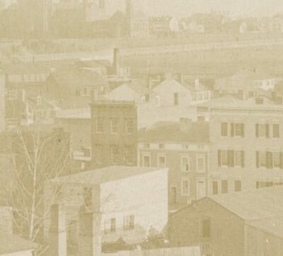
Take a look back in time with this amazing photo from the 1880s-1910s. We can't quite tell the direction of this shot, but we think it's looking east toward Mt. Pleasant. Source: Library of Congress.

Enjoy daily

Ghosts of DC stories.