Skip to content
The Best Of
Neighborhoods
Southwest DC
Waterfront
Maryland
Gaithersburg
Rockville
Bethesda
Hyattsville
Silver Spring
Bladensburg
Virginia
McLean
Falls Church
Alexandria
Vienna
Arlington
Southeast DC
Congress Heights
Navy Yard
Capitol Hill
Anacostia
Northeast DC
Trinidad
Woodridge
Deanwood
Brookland
Northwest DC
Tenleytown
Park View
Friendship Heights
Brightwood
Crestwood
Sheridan-Kalorama
The Palisades
Logan Circle
Petworth
Glover Park
Bloomingdale
Georgetown
Woodley Park
Dupont Circle
Columbia Heights
Cleveland Park
Adams Morgan
Mt. Pleasant
Chevy Chase
Cathedral Heights
Chinatown
Lost Neighborhoods
Hell’s Bottom
Swampoodle
Murder Bay
Notable People & Places
Places
Washington Monument
Library of Congress
The White House
The Capitol Building
Dulles Airport
People
Franklin D. Roosevelt
Calvin Coolidge
Officer Sprinkle
Dwight D. Eisenhower
Warren G. Harding
William McKinley
Abraham Lincoln
John F. Kennedy
Teddy Roosevelt
Woodrow Wilson
Published
July 3, 2013
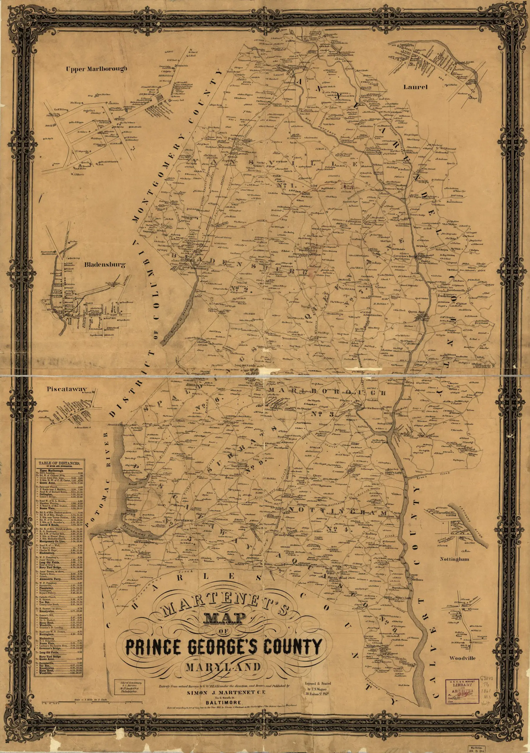
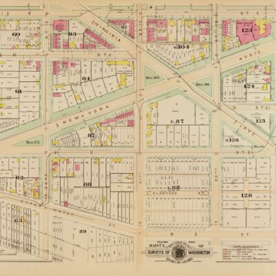
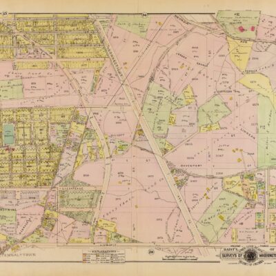
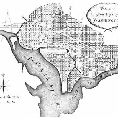
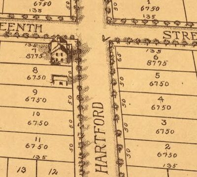
Detailed 1861 Map of Prince George’s County
Detailed 1861 map of Prince George's County, Maryland.
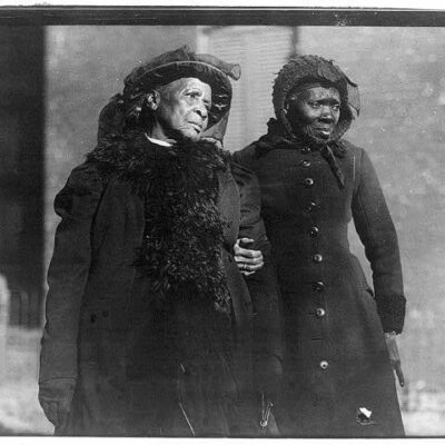
A Curious Old Photograph from 1925: Mildred Billert and Hazel Bowman of Ned Wayburn's Revue
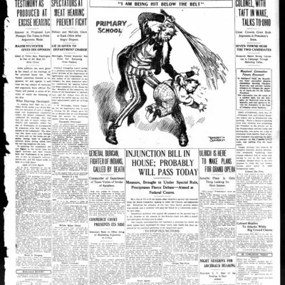
In the Paper: Washington Times - Evening Edition - May 14th, 1912
No posts found
Here is a great old map of Prince George’s County, done in 1861.
Martenet’s Map of Prince George’s County,
Maryland
Source:
Library of Congress
More For You
1916 Convention of Former Slaves in Washington
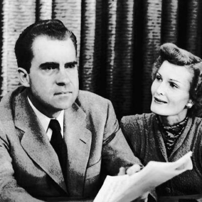
Senator Nixon Signs Discriminatory Restrictive Covenant
No posts found
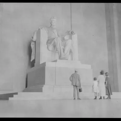
The Government Shutdown Isn't Stopping This Family from Enjoying the Lincoln Memorial
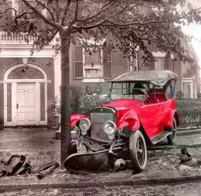
Senator Boies Penrose's Winton Six Wreck in Washington, DC, 1920
No posts found
Explore DC in 1903: A Map of the Department of State Location
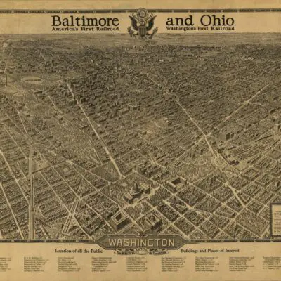
The Coolest Map of Washington, DC Ever: A 1921 Baltimore & Ohio Railroad Map
No posts found
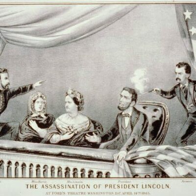
The Program for April 14, 1865 at Ford's Theater - The Night President Lincoln Was Assassinated
Exploring the Past: An Old Map of Chevy Chase
No posts found
Washington Was Originally Named Rome, Maryland
Why Is There No J Street in Washington, DC?
Robert Todd Lincoln Attends Dedication of Lincoln Memorial
No posts found
1917 Film Footage of 180-Mile Journey Down Chesapeake and Ohio Canal
A Striking Portrait of Lewis Powell: The Man Who Tried to Kill Secretary of State William Seward
Why Is It Named Trinidad?
No posts found
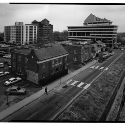
A Trip Down Memory Lane - Exploring the "Lawyers' Row Block" in Arlington from the Early 1990s
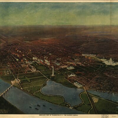
A Bird's Eye View of Washington, Looking Toward the Northeast
Why Is It Named Reston?
No posts found
Popular Posts
1895 Bird's Eye View of Brookland
No posts found
A Rare Look at the Dupont Circle Metro Station - Vintage Photos of Washington, D.C.
When Did Metro Open in D.C.?
More 1964 Photos of The Beatles in Washington, D.C.
What Is the History of CIA's Langley Headquarters?
No posts found
Enjoy daily
Ghosts of DC stories.
SUBSCRIBE
No thanks.