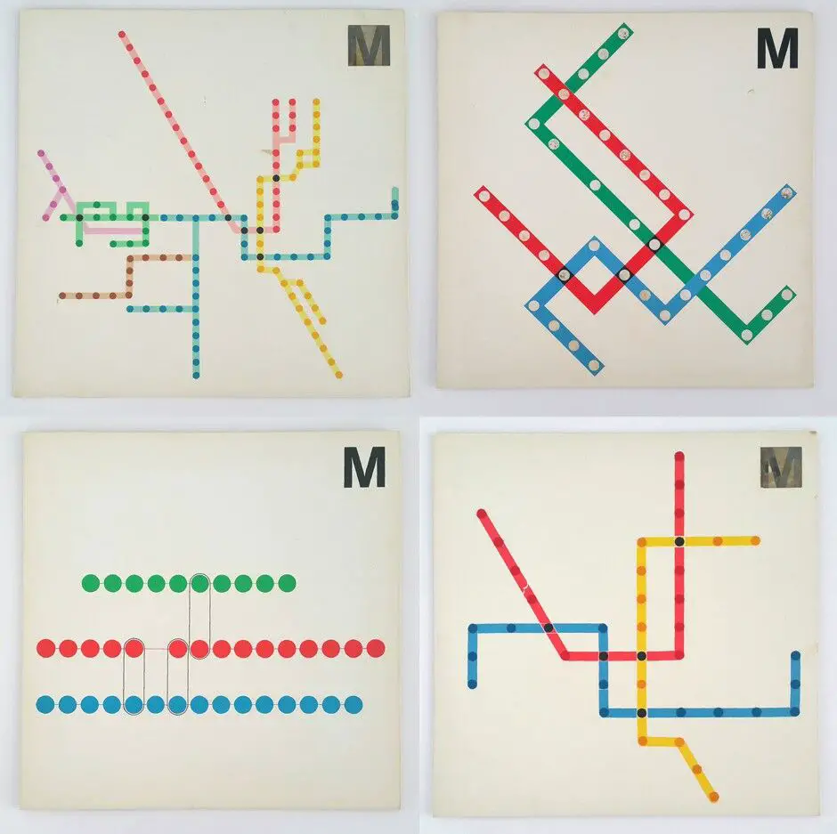
Explore the legacy of Massimo Vignelli, the visionary designer behind the Washington Metro's iconic look. Discover how his philosophy of simplicity and functionality shaped the visual identity of D.C.'s public transit system.
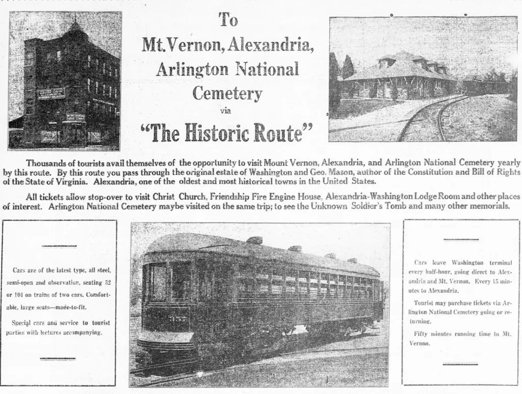
Electric railways drove Arlington's transformation from rural to suburban between 1892-1941. This history shows how rail paved the way for the county's growth.
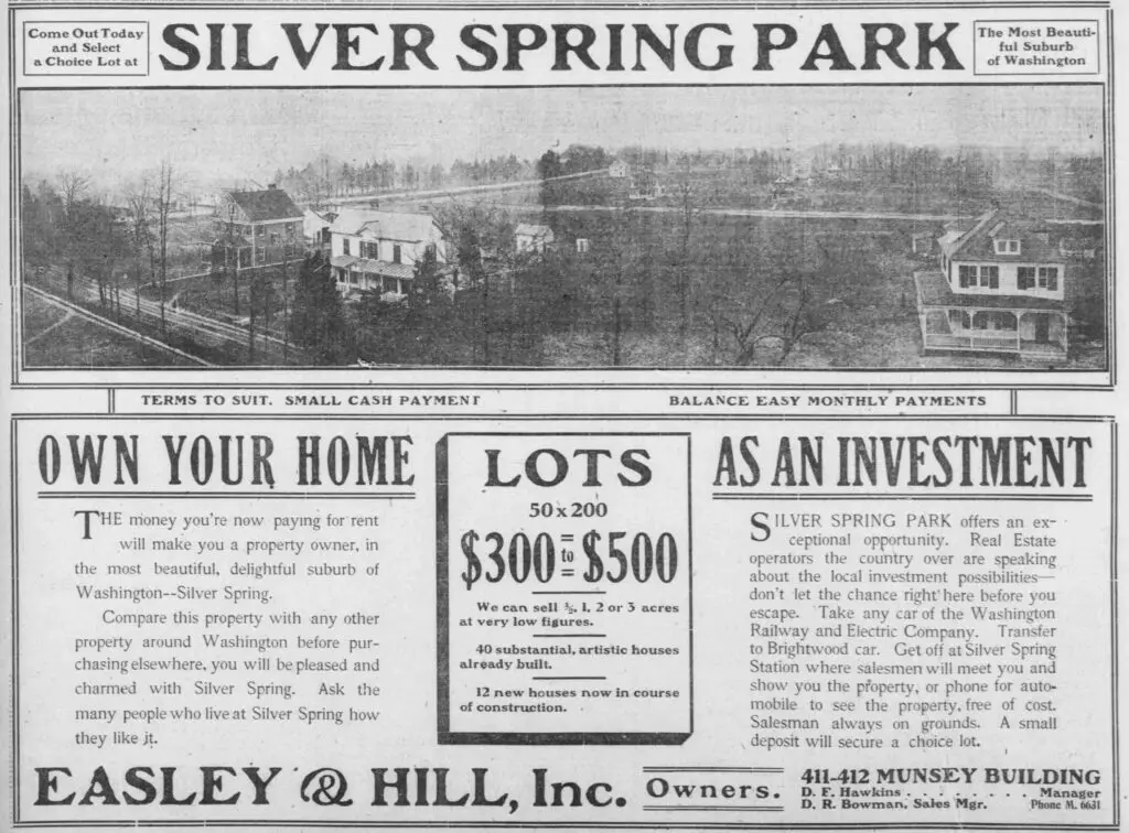
Take a look back to 1907 with this advertisement for Silver Spring Park, printed in The Washington Times. See the history of the park and its attractions and offerings in this vintage ad.
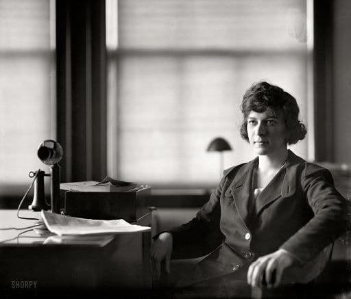
Pauline Floyd was a pioneer and an excellent role model for women pursing a career in law. She was the youngest female lawyer admitted to practice before the Supreme Court.
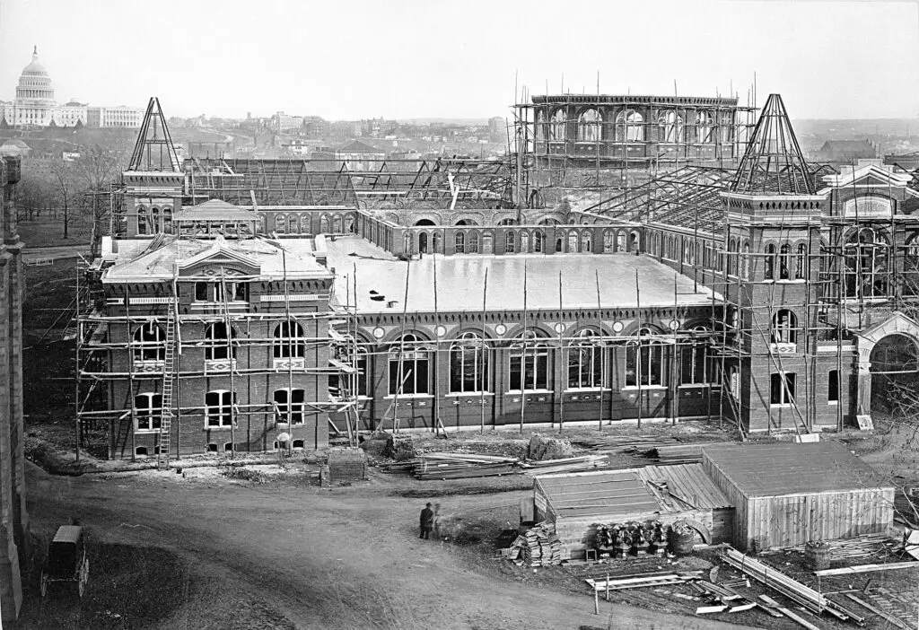
Take a journey through time and explore the construction of the Arts and Industries Building on the Mall in Washington, DC. From the 1879 photo to the 1878 rendering to the finished product, see it all!
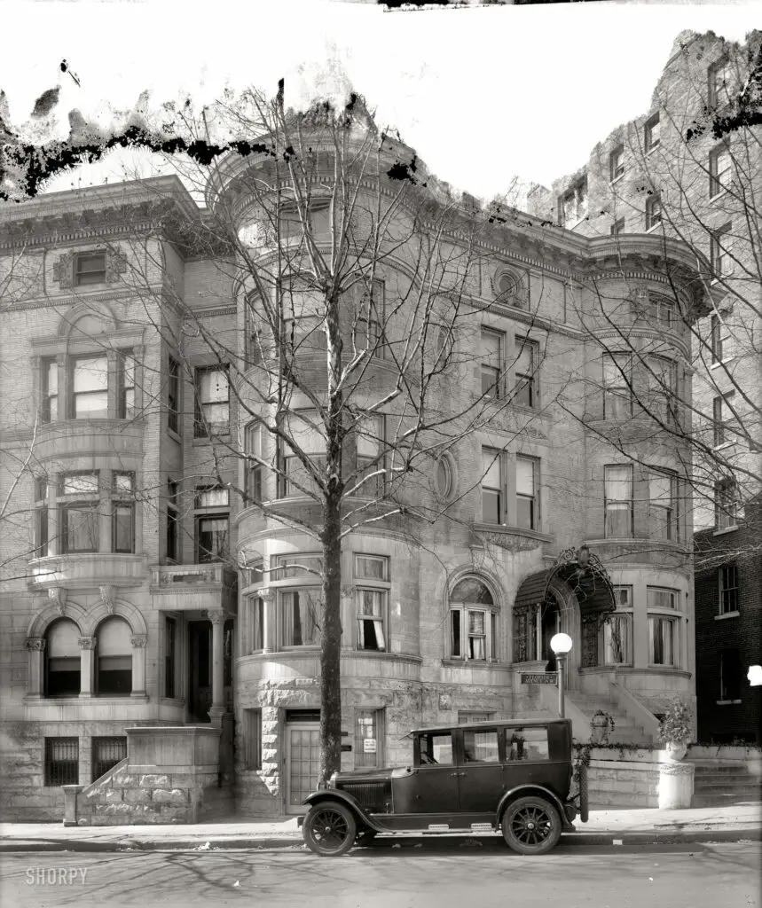
Get a glimpse of the beautiful Russia House building in Washington D.C, from a 1925 photo to how it looks today on Google Street View. Learn more about this majestic building!
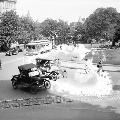
Read the story of Queen, the wild dog of Potomac Park who was slain in 1913. Learn about Queen's reign of terror over pedestrians and motor car drivers, and the efforts to shoot her that ultimately failed.
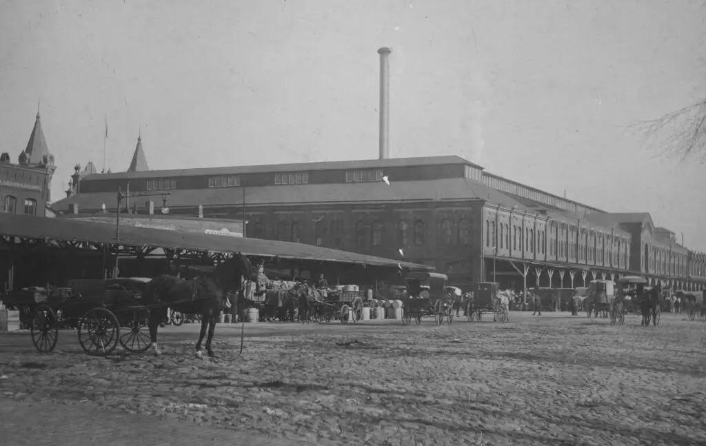
Take a look at this cool old photo of Center Market, which occupied the northeast corner of 9th Street NW. See the many produce stalls and horse-drawn vehicles in the cobblestone street!
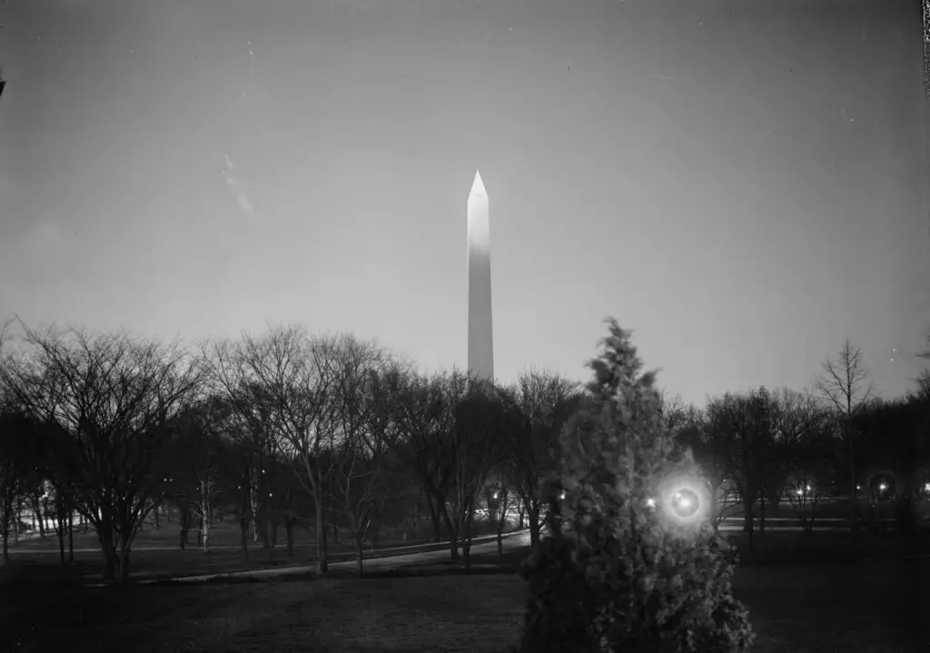
Behold the majestic Washington Monument at night! Learn more about this incredible structure and its history from the Ghosts of DC blog. Photo from the Library of Congress.
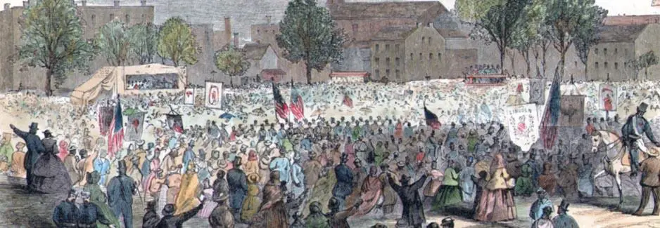
This week marks the 152nd anniversary of the D.C. Emancipation Act, which ended slavery in the District of Columbia and ultimately freed almost 3,000 slaves in Washington. Celebrate with a parade and other events, and read the transcript of the bill here.
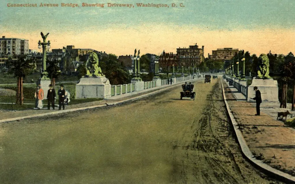
Take a look back in time with this great collection of D.C. postcards, featuring the Connecticut Avenue Bridge in 1911. Read up on the bridge's history on Wikipedia.
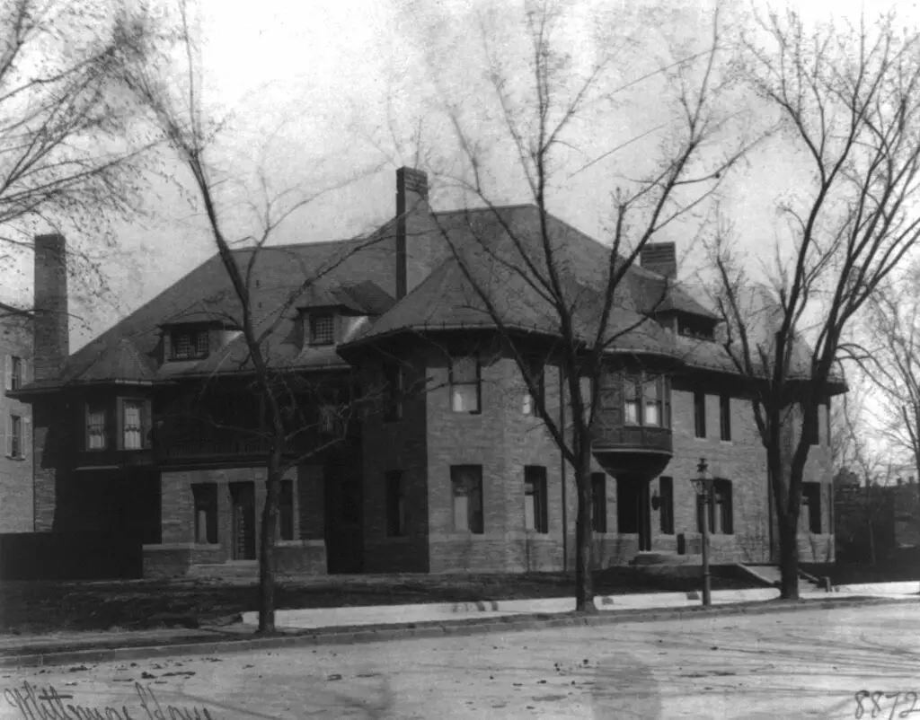
Take a look back in time to 1900 and explore the Whittemore House and the Women's National Democratic Club with these beautiful historical photos. Check out the websites to learn more about the amazing history of these locations!