
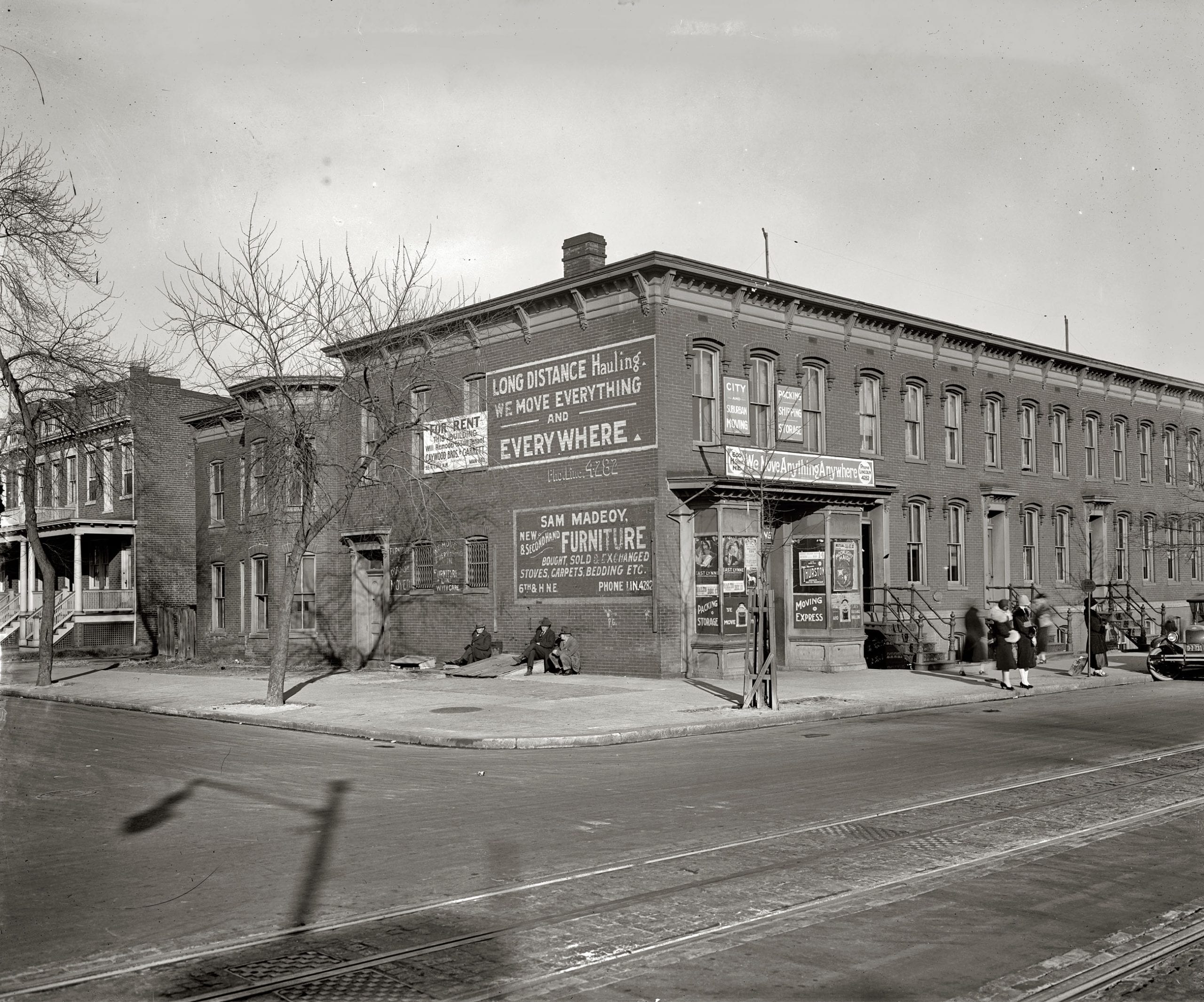
This is a great old photo from 1925, showing today’s booming H St. in a much different light.
Source: Shorpy
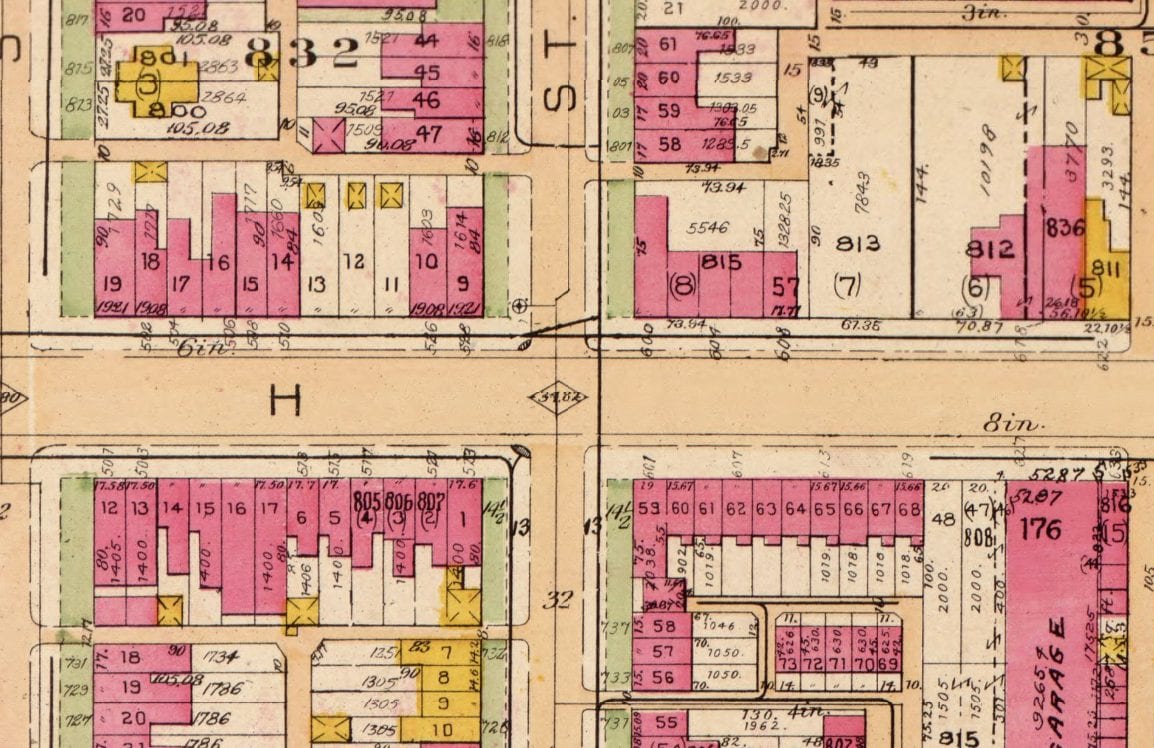
Check out the Baist map of the intersection from 1921. 600 H St. is the building on the northeast corner of the intersection. The above photo is taken from the southwest corner and you are looking toward the northeast. The shadow falling in the same direction makes me assume that the sun is behind us and lower in the sky. Plus, the women appear to be wearing heavier coats, so this is probably taken in the late fall, or winter.
Here is the same block today on Google Street View.
Great pic! FWIW, I guess google isn’t live-streaming yet, because that’s not how that corner looks now — Murry’s was demolished last year. http://www.popville.com/2014/11/first-murrys-now-h-street-self-storage-building-completely-demoed-on-h-street/
Always amazing how much the city changes and how much remains intact. Bet that great looking 2-story brick corner building with the repeating doorways got razed after the ’68 riots. That’s a shame; it would be a nice set of offices or restaurants today.
Of course, now they have a huge new building planned for the Murray’s and storage building lot to maximize rent and ROI. But that’s change, for better or worse.
I believe that started life as a Safeway in mid 70’s
I like the down homey look of 1925 better. Today the area just looks cold.