Skip to content
Ghosts of DC

Ghosts of DC

  • The Best Of
  • Neighborhoods
    • Southwest DC
      • Waterfront
    • Maryland
      • Gaithersburg
      • Rockville
      • Bethesda
      • Hyattsville
      • Silver Spring
      • Bladensburg
    • Virginia
      • McLean
      • Falls Church
      • Alexandria
      • Vienna
      • Arlington
    • Southeast DC
      • Congress Heights
      • Navy Yard
      • Capitol Hill
      • Anacostia
    • Northeast DC
      • Trinidad
      • Woodridge
      • Deanwood
      • Brookland
    • Northwest DC
      • Tenleytown
      • Park View
      • Friendship Heights
      • Brightwood
      • Crestwood
      • Sheridan-Kalorama
      • The Palisades
      • Logan Circle
      • Petworth
      • Glover Park
      • Bloomingdale
      • Georgetown
      • Woodley Park
      • Dupont Circle
      • Columbia Heights
      • Cleveland Park
      • Adams Morgan
      • Mt. Pleasant
      • Chevy Chase
      • Cathedral Heights
      • Chinatown
    • Lost Neighborhoods
      • Hell’s Bottom
      • Swampoodle
      • Murder Bay
  • Notable People & Places
    • Places
      • Washington Monument
      • Library of Congress
      • The White House
      • The Capitol Building
      • Dulles Airport
    • People
      • Franklin D. Roosevelt
      • Calvin Coolidge
      • Officer Sprinkle
      • Dwight D. Eisenhower
      • Warren G. Harding
      • William McKinley
      • Abraham Lincoln
      • John F. Kennedy
      • Teddy Roosevelt
      • Woodrow Wilson

Loudoun County

Discovering a Civil War-Era Map of Fairfax County

December 20, 2021October 10, 2013 by ghostsofdc

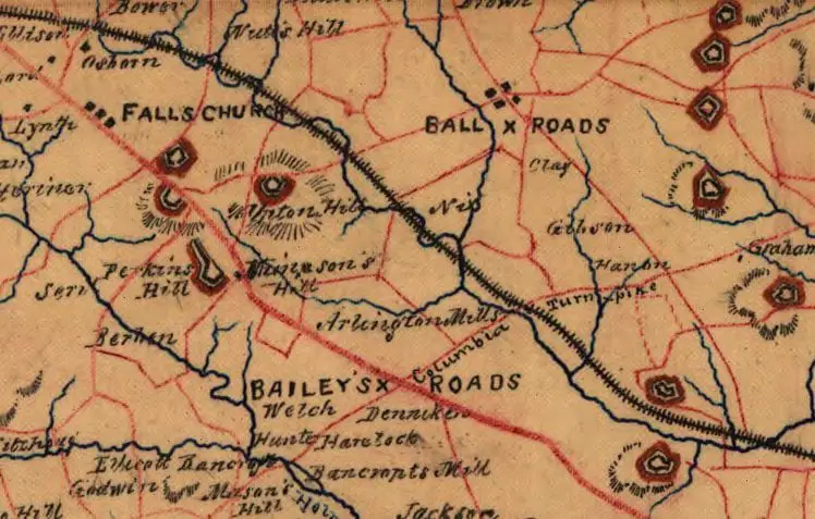
Explore a Civil War-era map of Fairfax County, Virginia, copied by J. Paul Hoffmann and approved by S. Howell Brown in 1864. Discovered at the Library of Congress.

Categories GoDCers Love Maps Tags 1860s, Fairfax County, Loudoun County, The Civil War

A Look Back at the Intersection of King Street and Market Street in Leesburg

December 27, 2019October 4, 2013 by ghostsofdc
Loudon National Bank and King Street

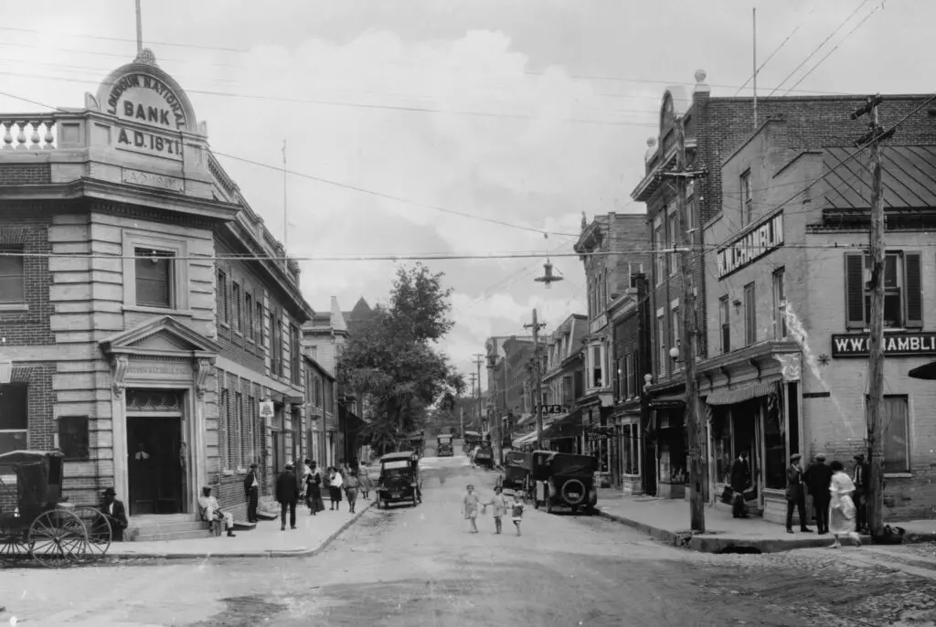
Take a trip back in time and explore the intersection of King Street and Market Street in Leesburg today. See what the area looked like around 1920 with a look at the historic photo and Google Street View.

Categories Faces & Places of Yesterday, Then and Now Tags 1920s, Leesburg VA, Loudoun County

A Look Back at the Methodist Church on Market St. in Leesburg, VA

December 27, 2019October 3, 2013 by ghostsofdc
Market Street and M.E. Church, south, Leesburg, Va.

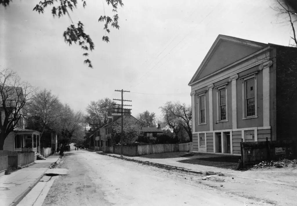
Take a look back at the Methodist Church on Market St. in Leesburg, VA with an old photo and Google Street View. See how the building has changed over time!

Categories Faces & Places of Yesterday, Then and Now Tags 1920s, Leesburg VA, Loudoun County
© 2026 Ghosts of DC • Built with GeneratePress