
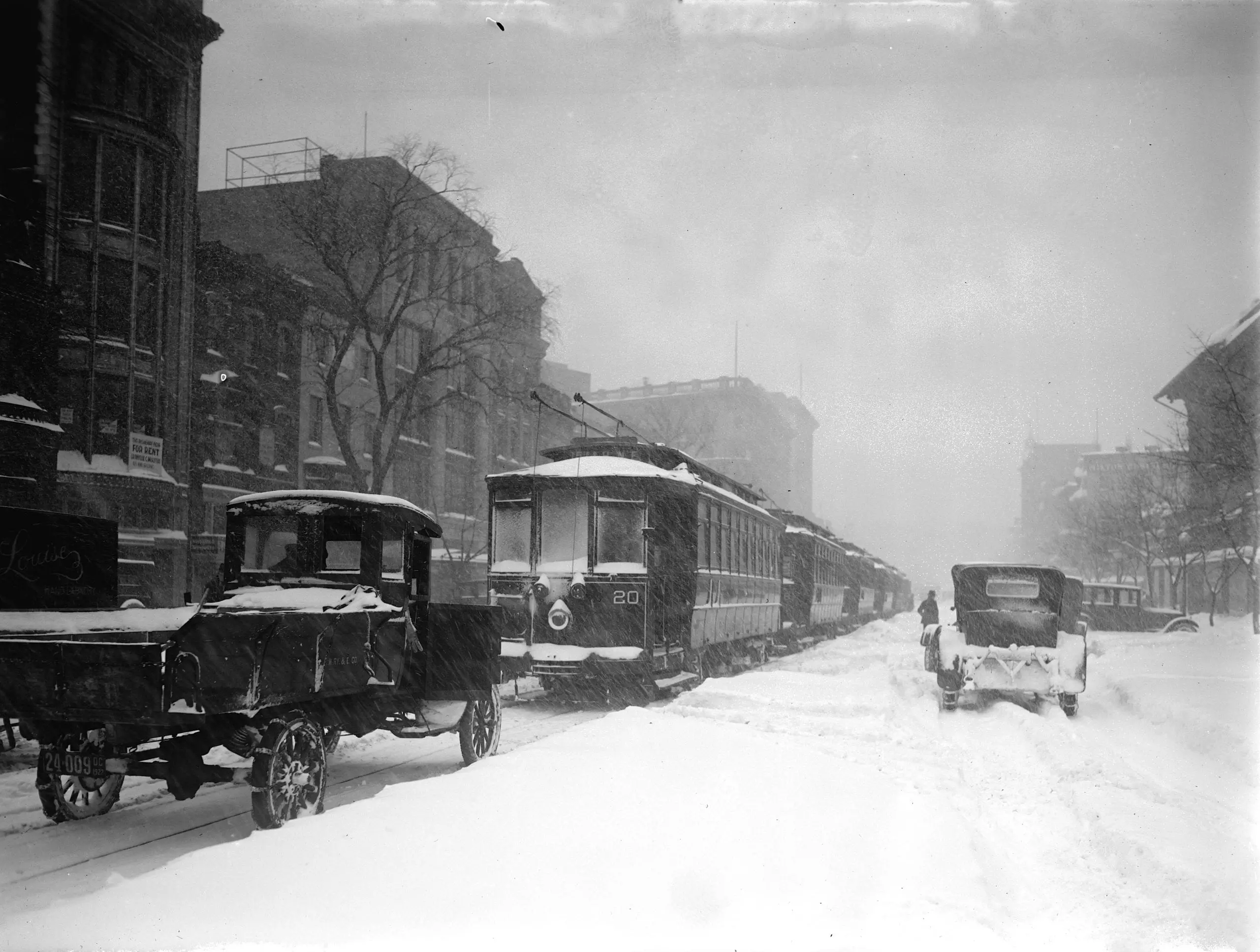
This is a photo of the massive storm that hit Washington, dumping so much snow on the city that the roof of the Knickerbocker Theater collapsed, killing 98 people.
Source: Library of Congress
This is a photo of the massive storm that hit Washington, dumping so much snow on the city that the roof of the Knickerbocker Theater collapsed, killing 98 people.
Source: Library of Congress
Comments are closed.
Appears the 20 line ran from Union Station out to Cabin John… if I’m reading the old trolley map correctly: I believe via Penn west of the White House & G Street east. I’d guess at this being Penn… any other discernible hints?
It appears that the number 20 is actually the vehicle number, not the route number. The route sign appears to be 15th & H st NE. Also the street looks too narrow to be Penna Avenue; could be H St. But then again I could be wrong.
There is an interesting map on the Washington & Georgetown Wikipedia page that I wonder could be helpful – though my RR/trolly history of DC is limited. There is a line that ran on H from the starburst to the White House via Mass and NY I think – which seem to be expect from the buildings that can barely be seen.
http://en.wikipedia.org/wiki/Washington_and_Georgetown_Railroad
Ahh yes, 20 is definitely the car number… just spotted the 8 in the same place on the next car. Guess it’d also be unwise to put the route number on a vehicle as a permanent feature rather than one that’s interchangeable.
The rent signs aren’t of much help. The only Louise Hand Laundry I know of is at 1405 12th NW from 1918 onward, and this certainly isn’t 12th St. I see at right a sign reading “Milton” but can’t quite make out the second word… Milton Glass? Doesn’t turn up anything in Google when I try crossing it w/ DC.