
Ghosts of DCThe lost and untold stories of Washington

Try an address, a neighborhood, a name or a year, like “14th and U” or “1968.”

Not sure where to start?

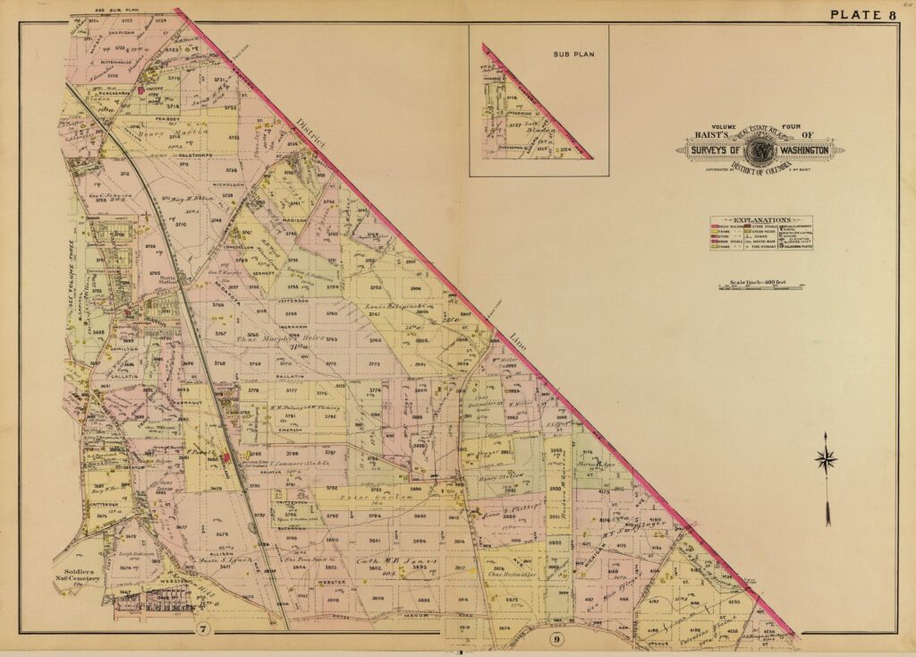
1907 Map of Northeast Washington, DC When It Was Rural

A 1907 Library of Congress map shows the rural landscape of Northeast Washington.

Posted 1 min read

This is really cool. Check out how rural northeast was in 1907. Amazing.

1907 map of northeast D.C. (Library of Congress)

The Email

Lost Washington stories, in your inbox.

The newest story, plus a few from the archive.

Free. Unsubscribe anytime.

We use AI to help research, write and edit stories across our sites. Here’s how we use AI.Suggest a correction

Pass it on

Know someone who’d like this?

Send it to them.

Email it
1906 map showing the original boundary milestones of the District of ColumbiaRead nextWashington DC Boundary Stones: The 40 Original Markers Ellicott and Banneker Set in 1791The 40 sandstone markers Ellicott and Banneker planted in 1791 and 1792 still stand at the original corners of Washington, D.C. Here is where to find them.Keep reading10 min read