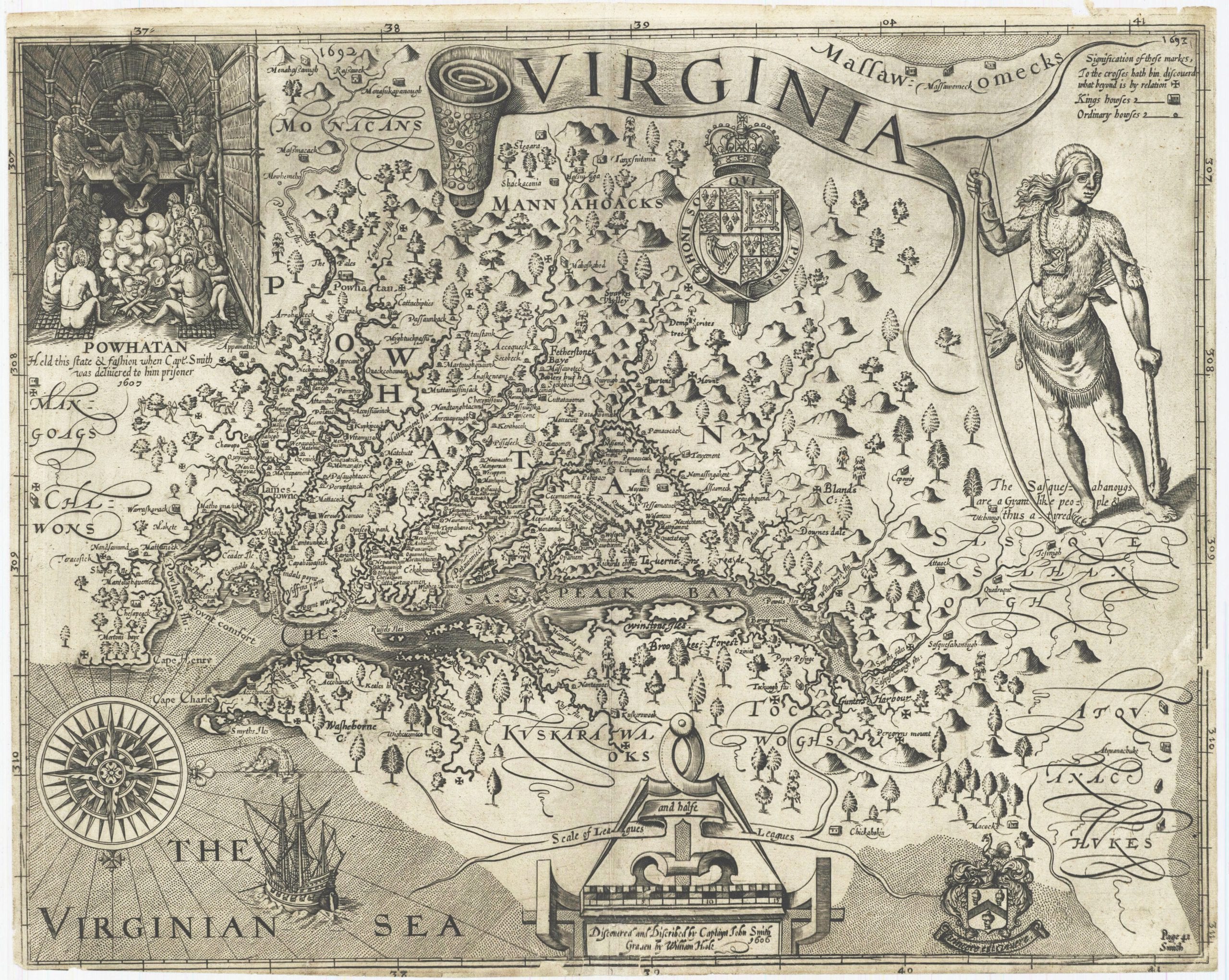
Anacostia takes its name from the Nacotchtank, the Algonquin-speaking people who lived along the Eastern Branch of the Potomac when Captain John Smith sailed up the river in 1608.
Smith was well received. The Captain’s oldest map, published in 1612, marks the area as Natcotchtank.
In 1621 a small sailing vessel, the Tiger, headed up the Potomac from Jamestown, Virginia, with 26 men aboard. The goal of the trip was to trade corn with the Native Americans Captain Smith had met. The Nacotchtank ambushed the group and all the men were killed or taken prisoner. Henry Fleet was among those taken captive, and he remained with the tribe for five years, learning their language, customs, and way of life.
From Nacostine to Anacostia
After returning to Jamestown, Fleet made a few more journeys up the river to trade with his former captors. On one trip in 1632, he described the journey in detail. An entry of importance in the journal was the first reference to the area by the anglicized name Nacostine, rather than Natcotchtank.
The next step in the etymology appears in reports sent to Rome by the Jesuit fathers accompanying Leonard Calvert, the first Proprietary Governor of the Colony of Maryland, especially Father Andrew White. These reports use the form Anacostines, or Anacostans.
That “A” may not be a European addition at all. In a paper read to the Columbia Historical Society on December 16, 1919, Charles R. Burr argued the A-form was likely closer to the original word, and that the Nacotchtank themselves often dropped prefixes when they spoke.
White knew the local language better than almost any Englishman of his day. He learned the Algonquian dialect spoken around the Potomac so he could preach in it. Five pages of prayers in his hand, written in English, Latin, and Piscataway between 1634 and 1640, survive at Georgetown University.
So what did Nacotchtank actually mean? The most widely repeated answer is “a town of traders.” Burr traced the name to the Algonquian Anaquash(e)tan(i)k. The National Park Service gives the same reading today.
It fits. Burr described the villages along the Eastern Branch as lively trading posts, visited by Iroquois traders from as far away as present-day New York.
John Smith’s map below is worth a long look. Click for the full-size version.
By the mid to late 1600s, the Colony of Maryland was increasingly encroaching on the Nacotchtank’s lands, driving the people living south of the Anacostia River across it. Trade with the settlers grew, and the bargain ran heavily in the settlers’ favor. The Nacotchtank were described in contemporary accounts as kind and trusting, and the land they occupied along the Eastern Branch had an excellent climate, abundant forests, roaming game, and rich fishing grounds.
One great fault of the tribes was their taste for the liquor bartered by the white settlers, for which they slowly traded away their game, forests, streams, and ultimately their land. As the settlers pushed the natives off their ground, friction followed, exacerbated by the Nacotchtank’s consumption of alcohol. The chief and his warriors raided the white settlements, plundering and terrorizing them.
Anacostia in maps and photos
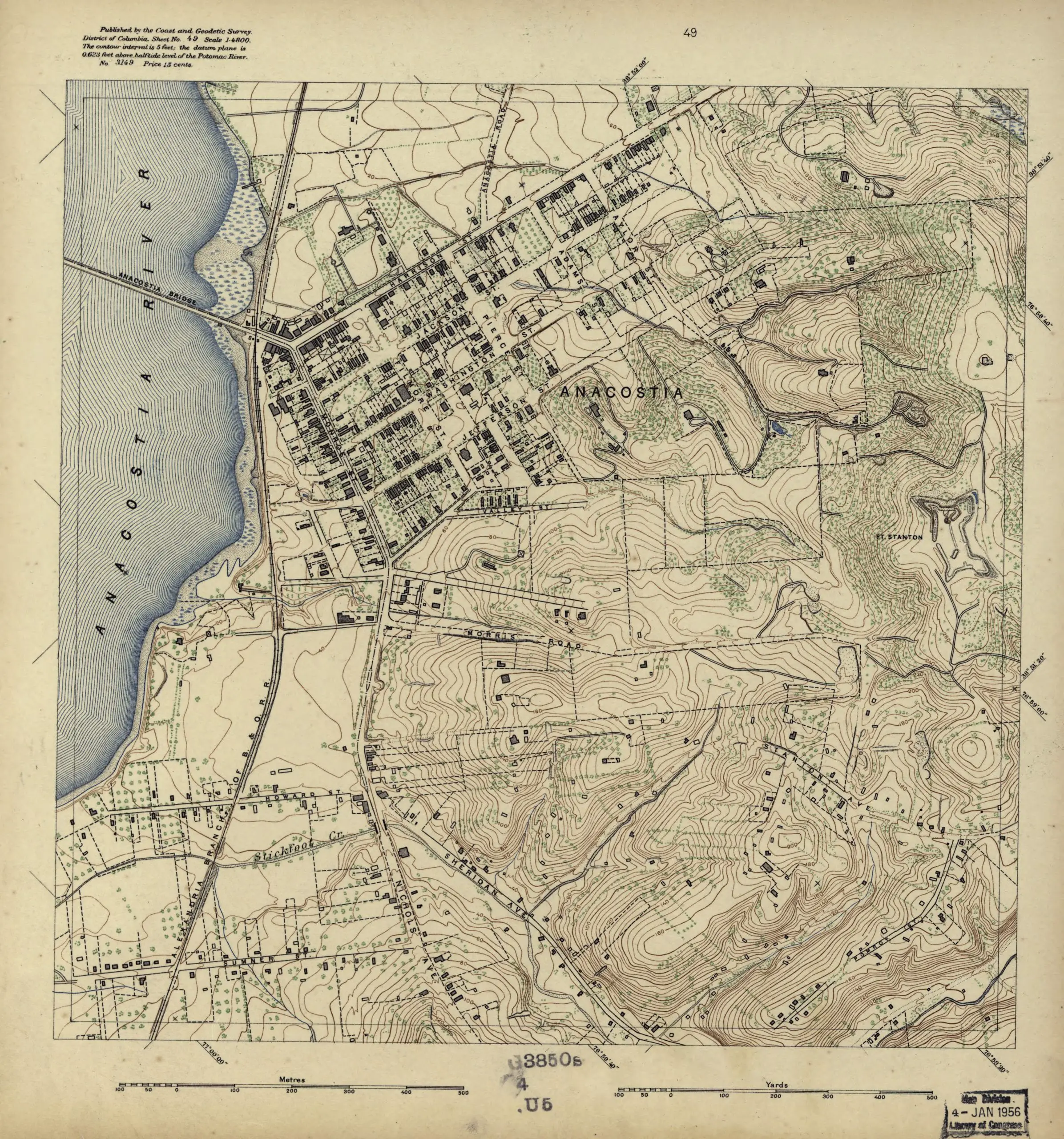
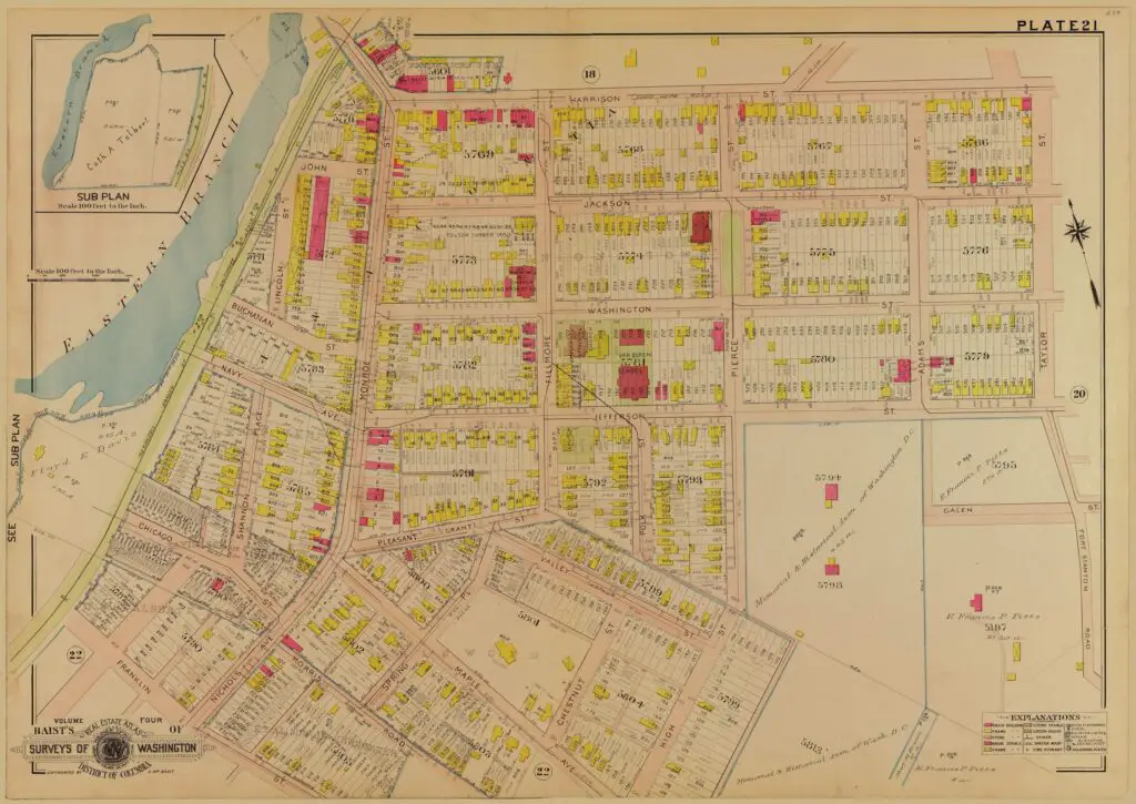
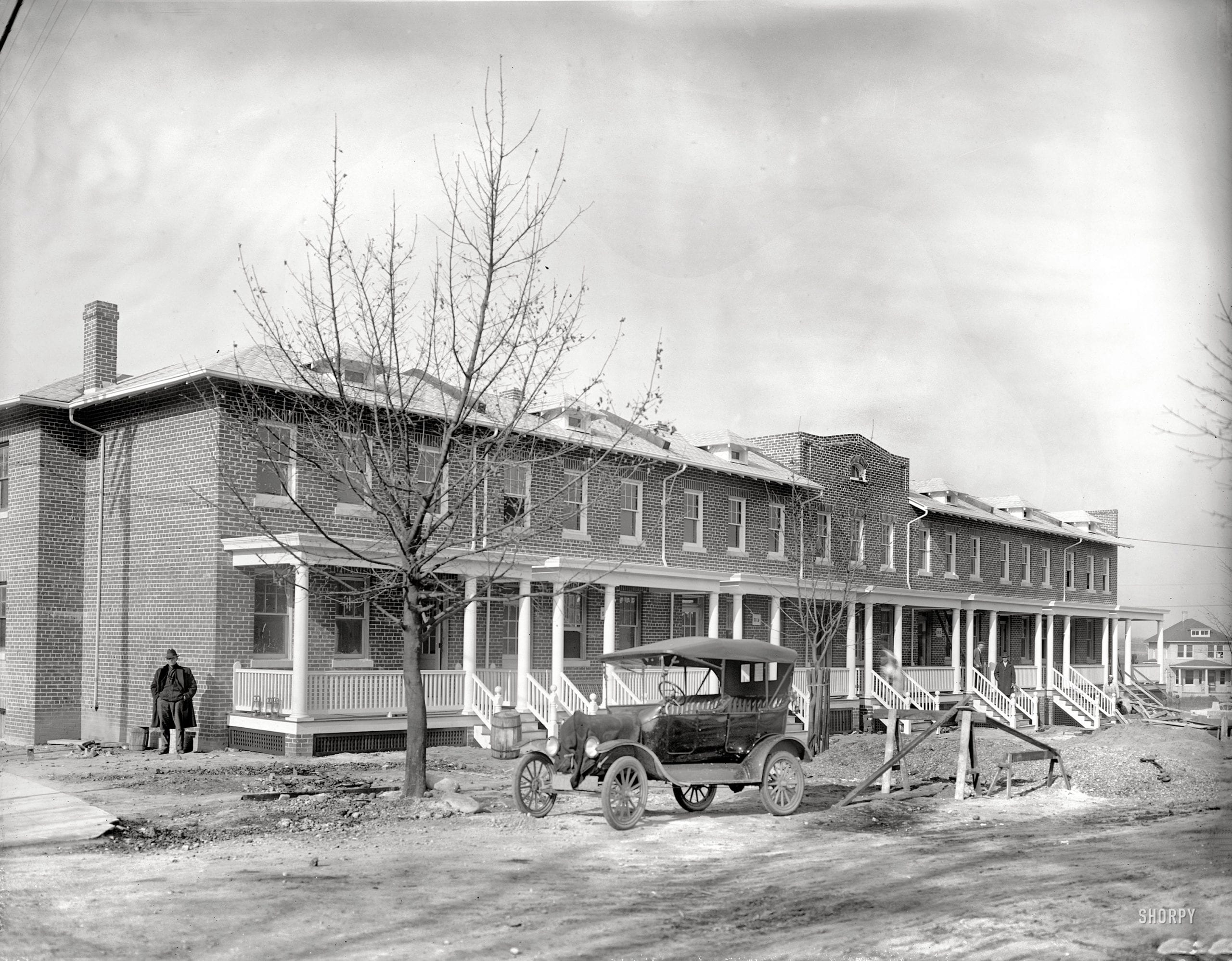
By the late 19th and early 20th centuries the neighborhood the Nacotchtank had inhabited bore little resemblance to the woodland river country John Smith found. A handful of surviving maps, photographs, and newspaper ads show what Anacostia looked like as it was being platted, sold, and built up.
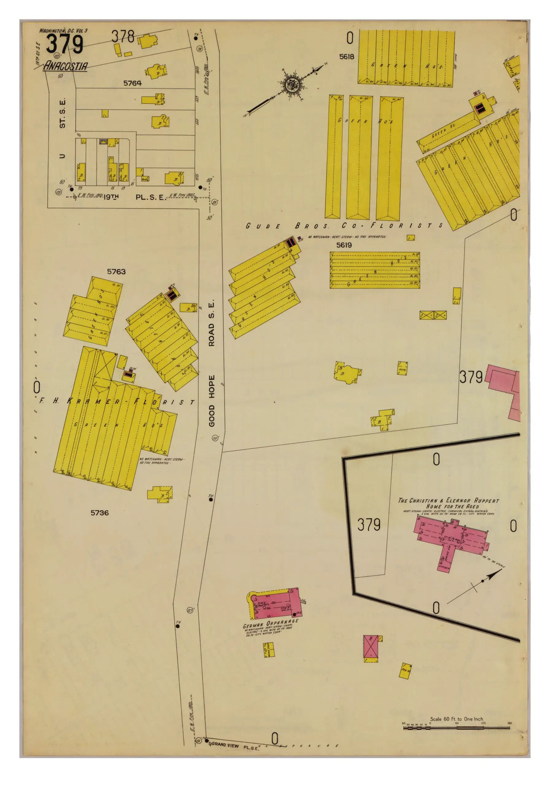
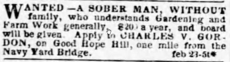
The newspapers of the period are their own kind of map. A Washington classified ad from February 27, 1857 wanted a sober gardener, without family, for $200 a year plus room and board, at Good Hope Hill in what is now Anacostia. The site was later occupied by the German Orphan Home.
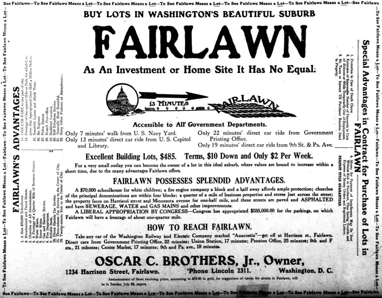
Half a century later, an ad in the Washington Herald for the Fairlawn development across the Eastern Branch made the racial sorting of the real-estate market unmistakable. Reading it now is a hard window into how Washington’s developers wrote and sold a neighborhood in 1911.
Stories from the neighborhood
Once the name was settled, Anacostia kept generating stories. A 1938 plane crash remains one of the worst aviation disasters in Washington history. The 1933 wreck of the Crescent Limited happened during the Chesapeake and Potomac Hurricane, when a passenger swam to safety and walked home. The 1939 Anacostia High School Indians were the underdogs of the DC public-school baseball league.
The Anacostia Bank at 2021 Nichols Avenue was decked head-to-toe in flags for a 1918 wartime parade. The Big Chair, long billed as the world’s largest chair, has stood on the same avenue since 1959. President Grover Cleveland visited Frederick Douglass at Cedar Hill in 1886. A Washington correspondent’s letter from 1886 described the violence on the streets of Old Anacostia. And the Anacostia Flats are where the Bonus Army camped in 1932, until MacArthur, Patton, and Eisenhower drove them out with bayonets.
For an overhead look at the neighborhood and the city beyond it, see this set of 1960s aerial photographs taken from the east.
Thanks to Armand for prompting a closer look at Father Andrew White’s role in this story.
We dug this one up with help from AI and checked it against the original records below. Here’s how we use AI.