-ad 189-

Exploring Washington’s Street System with Maps from Greater Greater Washington

Explore Washington's street system with maps from Greater Greater Washington. See L'Enfant's plan, State streets, Numbered streets, Lettered streets, and Alphabet streets. Courtesy of Flickr user tracktwentynine.
-ad 188-
-ad 615-

Okay, this isn’t exactly a history post, but it very much is related to your knowledge of our city. We came across some great maps of city streets while browsing one of our favorite sites, Greater Greater Washington. Below are a few maps from Flickr, courtesy of Matt Johnson (who, by the way, has some really amazing photos that you should check out).

L'Enfants plan
L’Enfant’s plan
State streets in DC
State streets in DC
-ad 197-
Numbered streets in DC
lettered streets in DC
alphabet streets
alphabet streets


-ad 199-

Source: Flickr user tracktwentynine
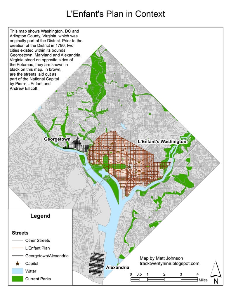
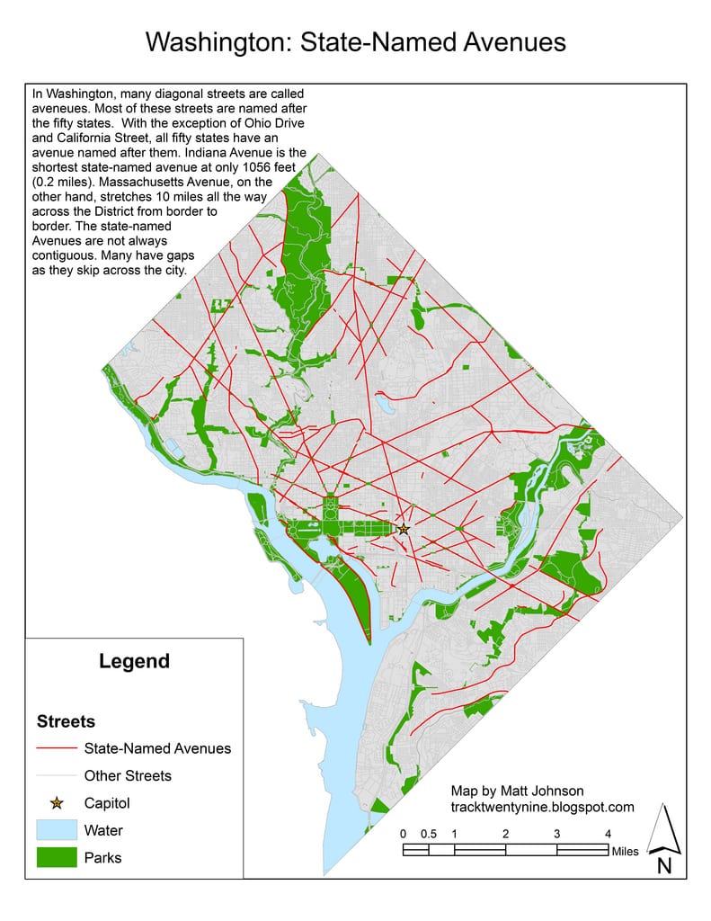
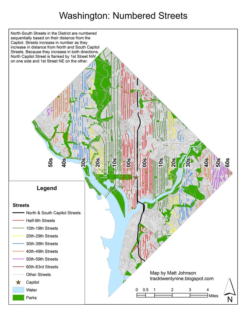
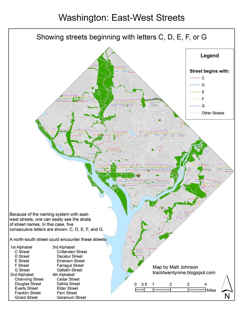
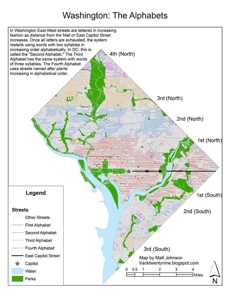
Today's Recommendation

-ad 617-

Suggested Reading

Can You Support Us?

If you enjoyed this post and can help support our blog, please consider subscribing. Thank you.

-ad 616-

Today's Recommendation

JOIN OUR EMAIL LIST

Enjoy daily

Ghosts of DC stories