
This is a really interesting look at a neighborhood, where today, the total value of the properties hovers probably somewhere near $200 million.
This map is from 1907 and shows the area completely subdivided, with almost no buildings. Totally fascinating.
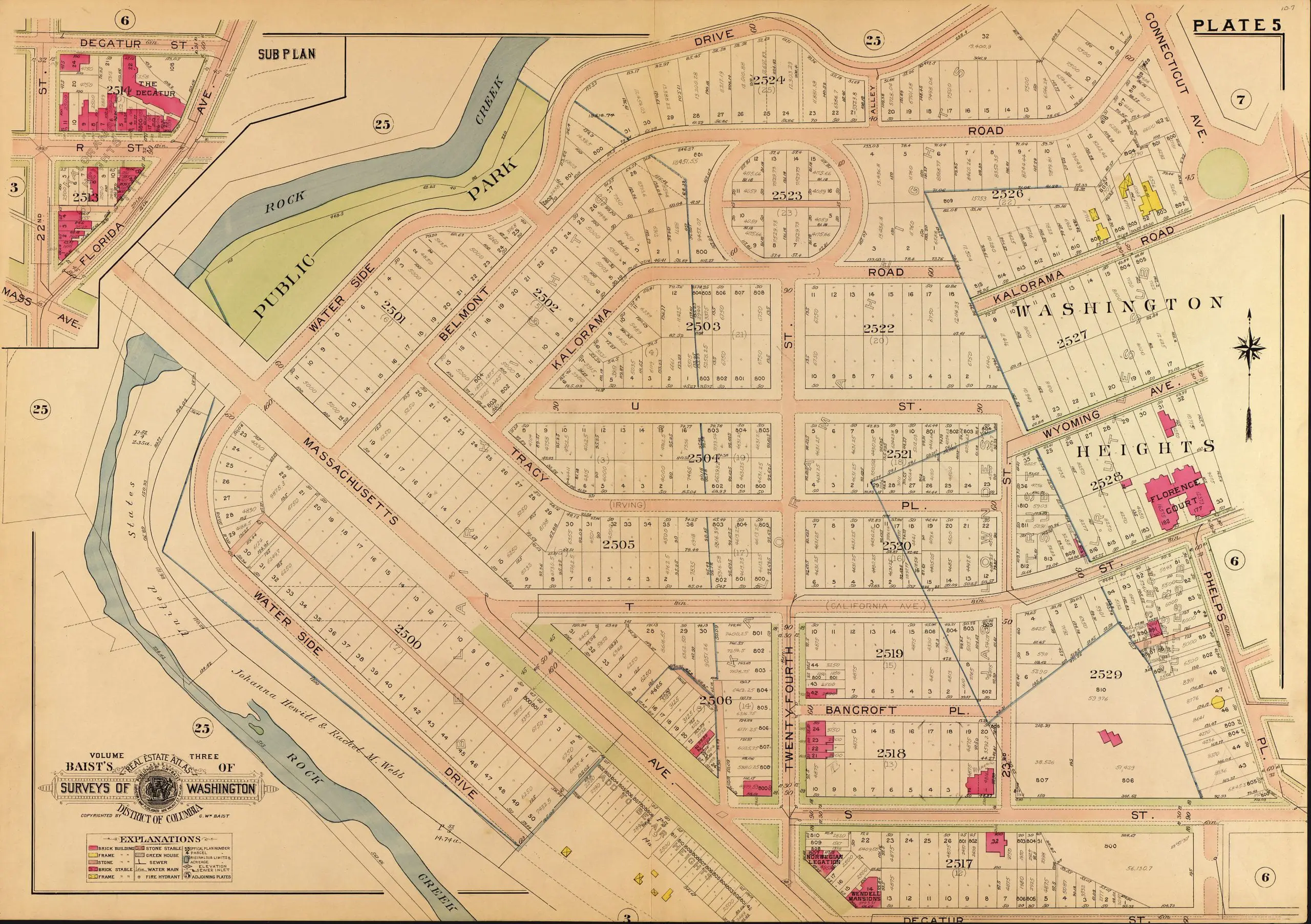
It looks like U St. became Wyoming Ave. and T St. became California St.
What’s up with Kalorama Road not hooking up with itself? Also, vertical changes aren’t shown — nowadays Waterside Drive is at the bottom of the cliff, and Belmont Road is at the top, with a good fifty to seventy feet of vertical separation. Also, that stretch of Belmont between Kalorama Circle and Connecticut Ave. no longer exists — did it ever?