Skip to content
Ghosts of DC

Ghosts of DC

  • The Best Of
  • Neighborhoods
    • Southwest DC
      • Waterfront
    • Maryland
      • Gaithersburg
      • Rockville
      • Bethesda
      • Hyattsville
      • Silver Spring
      • Bladensburg
    • Virginia
      • McLean
      • Falls Church
      • Alexandria
      • Vienna
      • Arlington
    • Southeast DC
      • Congress Heights
      • Navy Yard
      • Capitol Hill
      • Anacostia
    • Northeast DC
      • Trinidad
      • Woodridge
      • Deanwood
      • Brookland
    • Northwest DC
      • Tenleytown
      • Park View
      • Friendship Heights
      • Brightwood
      • Crestwood
      • Sheridan-Kalorama
      • The Palisades
      • Logan Circle
      • Petworth
      • Glover Park
      • Bloomingdale
      • Georgetown
      • Woodley Park
      • Dupont Circle
      • Columbia Heights
      • Cleveland Park
      • Adams Morgan
      • Mt. Pleasant
      • Chevy Chase
      • Cathedral Heights
      • Chinatown
    • Lost Neighborhoods
      • Hell’s Bottom
      • Swampoodle
      • Murder Bay
  • Notable People & Places
    • Places
      • Washington Monument
      • Library of Congress
      • The White House
      • The Capitol Building
      • Dulles Airport
    • People
      • Franklin D. Roosevelt
      • Calvin Coolidge
      • Officer Sprinkle
      • Dwight D. Eisenhower
      • Warren G. Harding
      • William McKinley
      • Abraham Lincoln
      • John F. Kennedy
      • Teddy Roosevelt
      • Woodrow Wilson
1907 map of Petworth

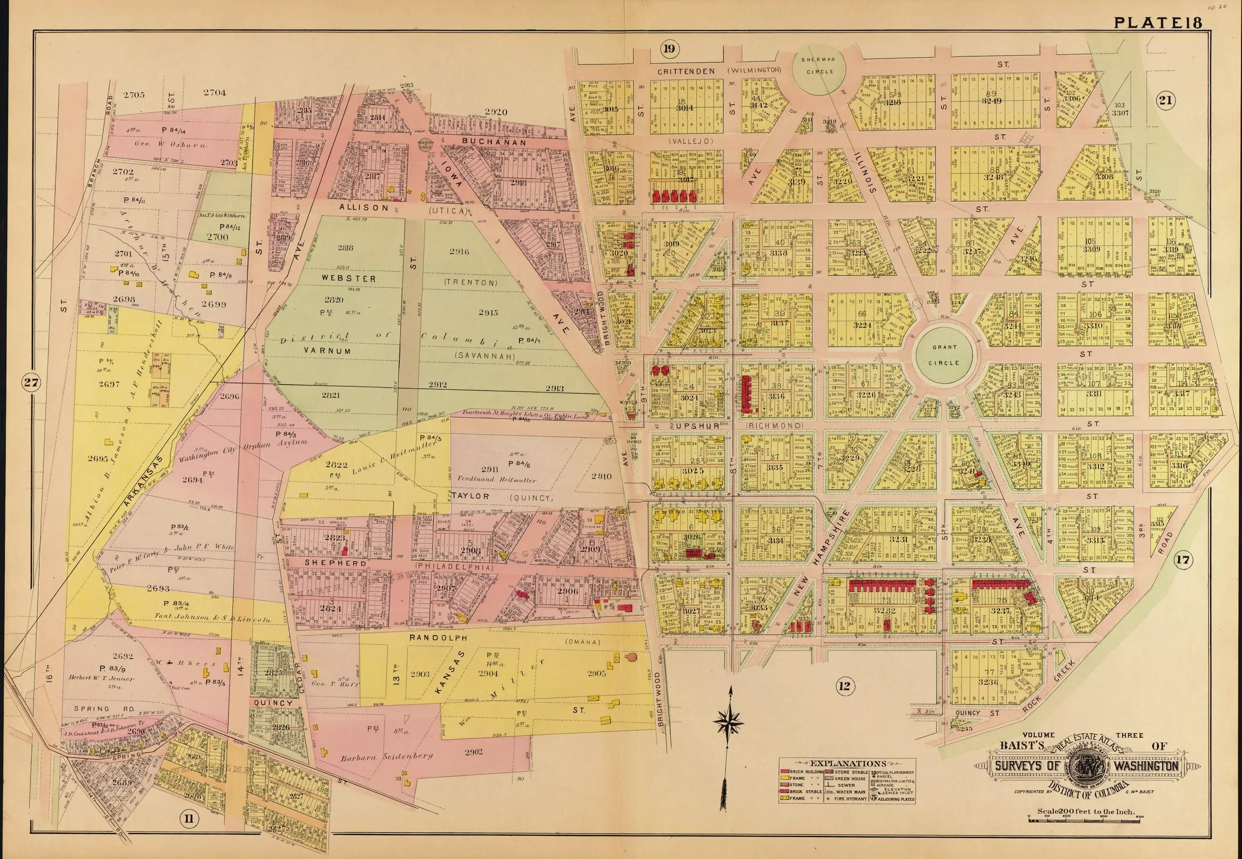
A Look at a 1907 Map of Petworth

December 25, 2023April 15, 2013 by ghostsofdc

Check out the map of Petworth in 1907. And then look how rural it was to the west. Amazing.

1907 map of Petworth
Categories GoDCers Love Maps Tags 1920s, Petworth
Exploring the Past Through Historic Photos of Washington, DC’s Engine Company No. 24
An Amazing Old Photograph of the Library of Congress Inside the Capitol Building in 1866
© 2026 Ghosts of DC • Built with GeneratePress