
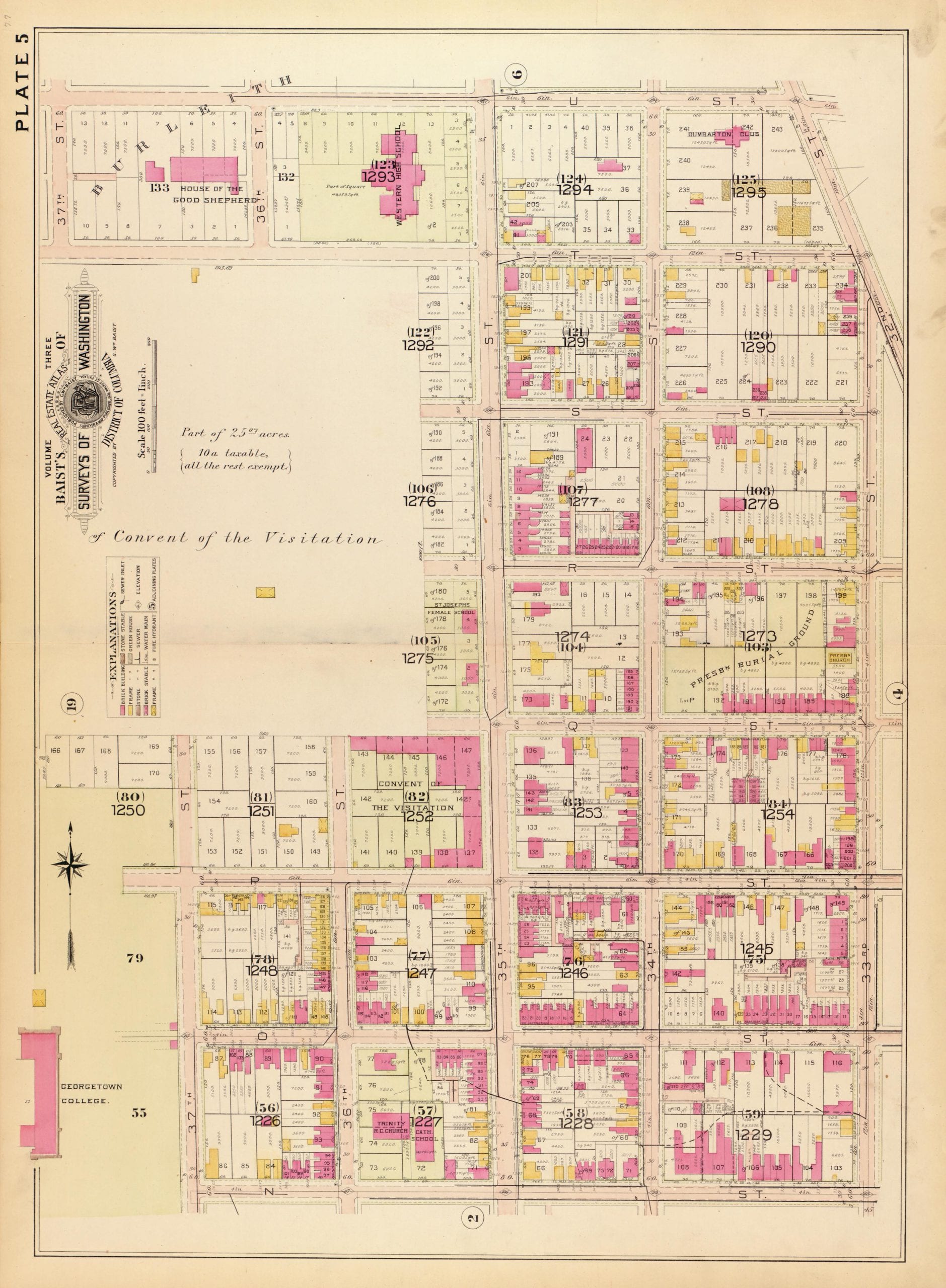
These are amazing. Take your time studying them because there are so many incredible details in them. Click on them for larger versions.
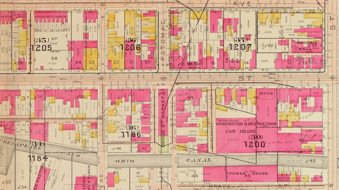
Below is one showing the waterfront. This one is pretty cool.
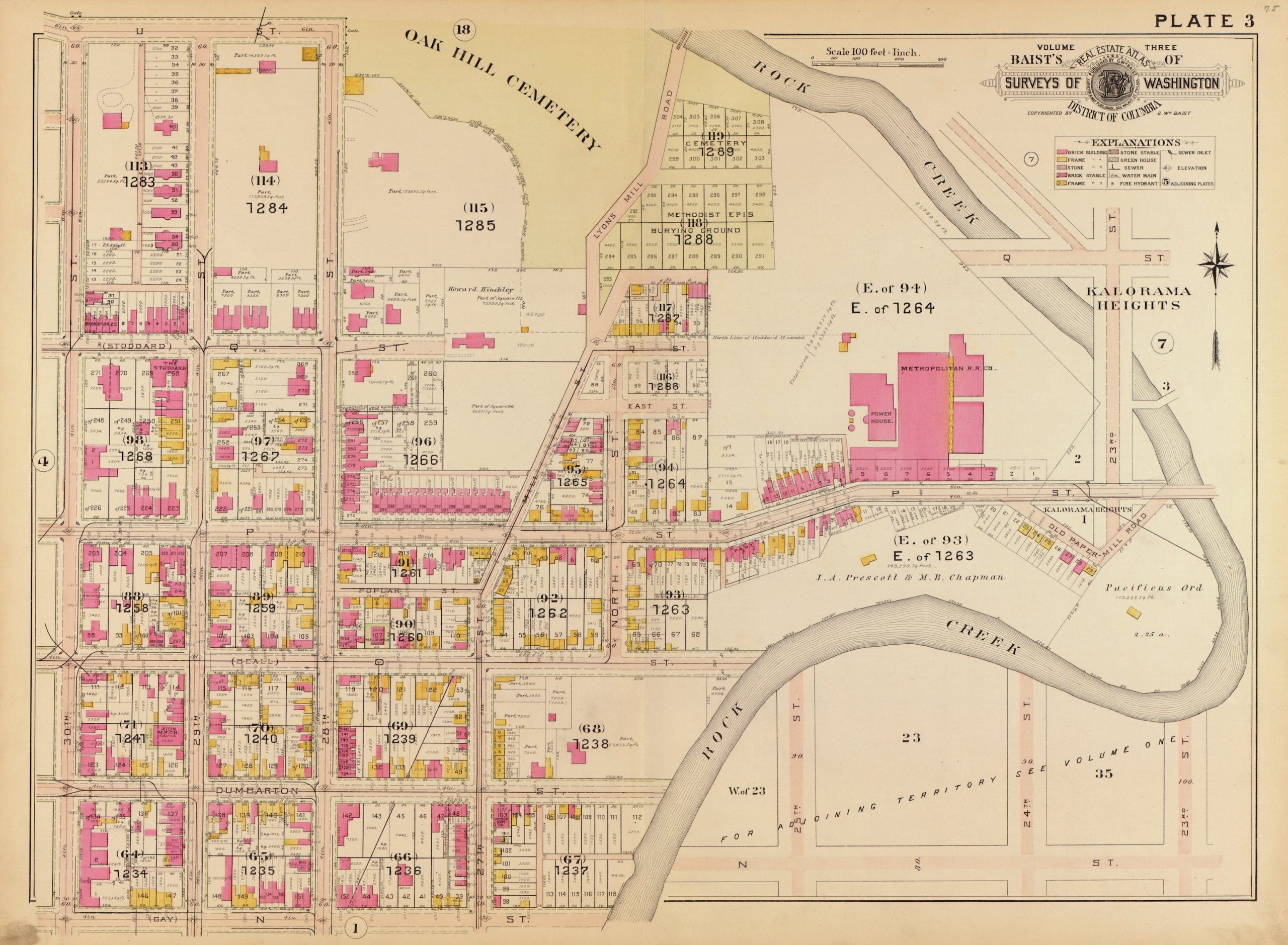
Here’s one showing upper Georgetown and a little of Rock Creek. You’ll also notice there is no bridge over Q St.
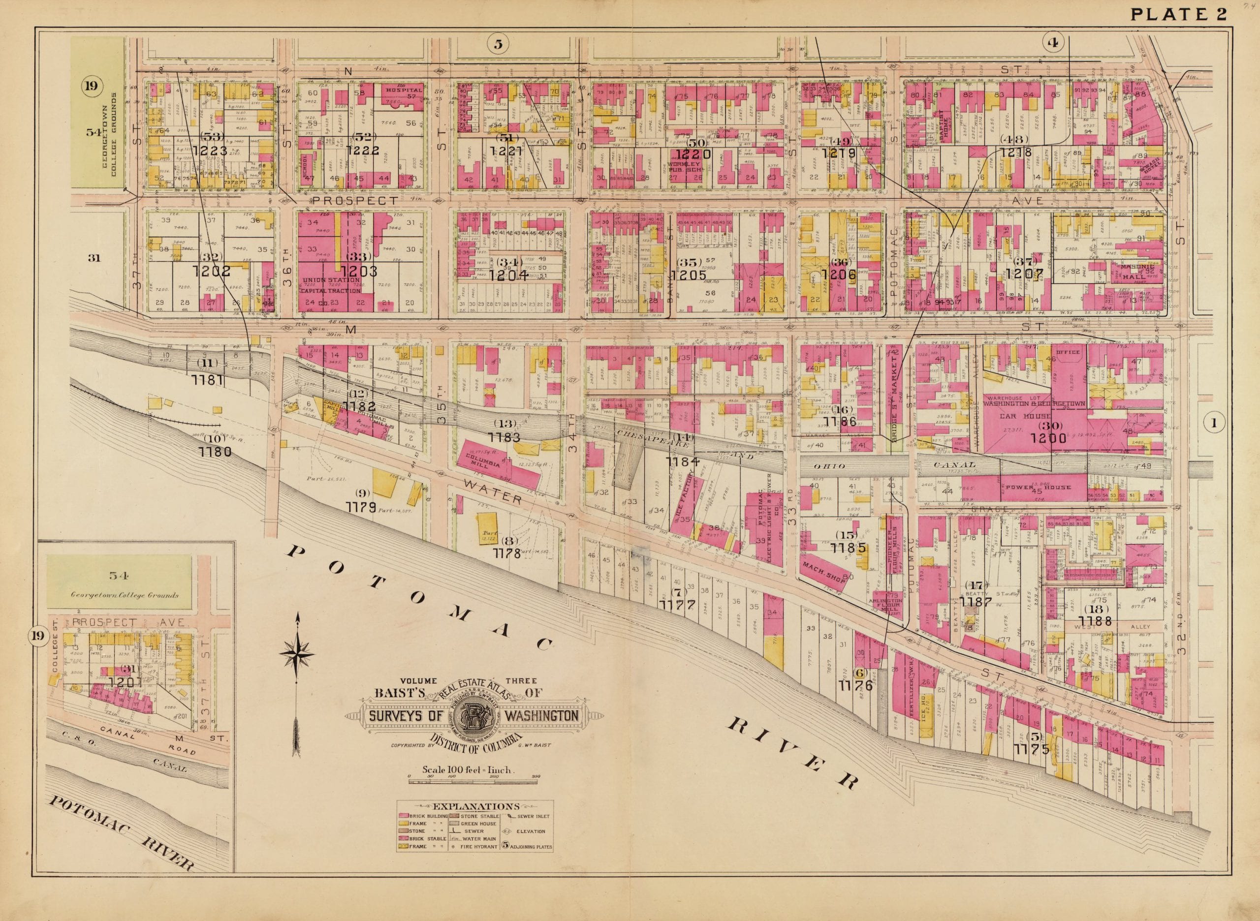
Here’s a view up what is Wisconsin Ave.
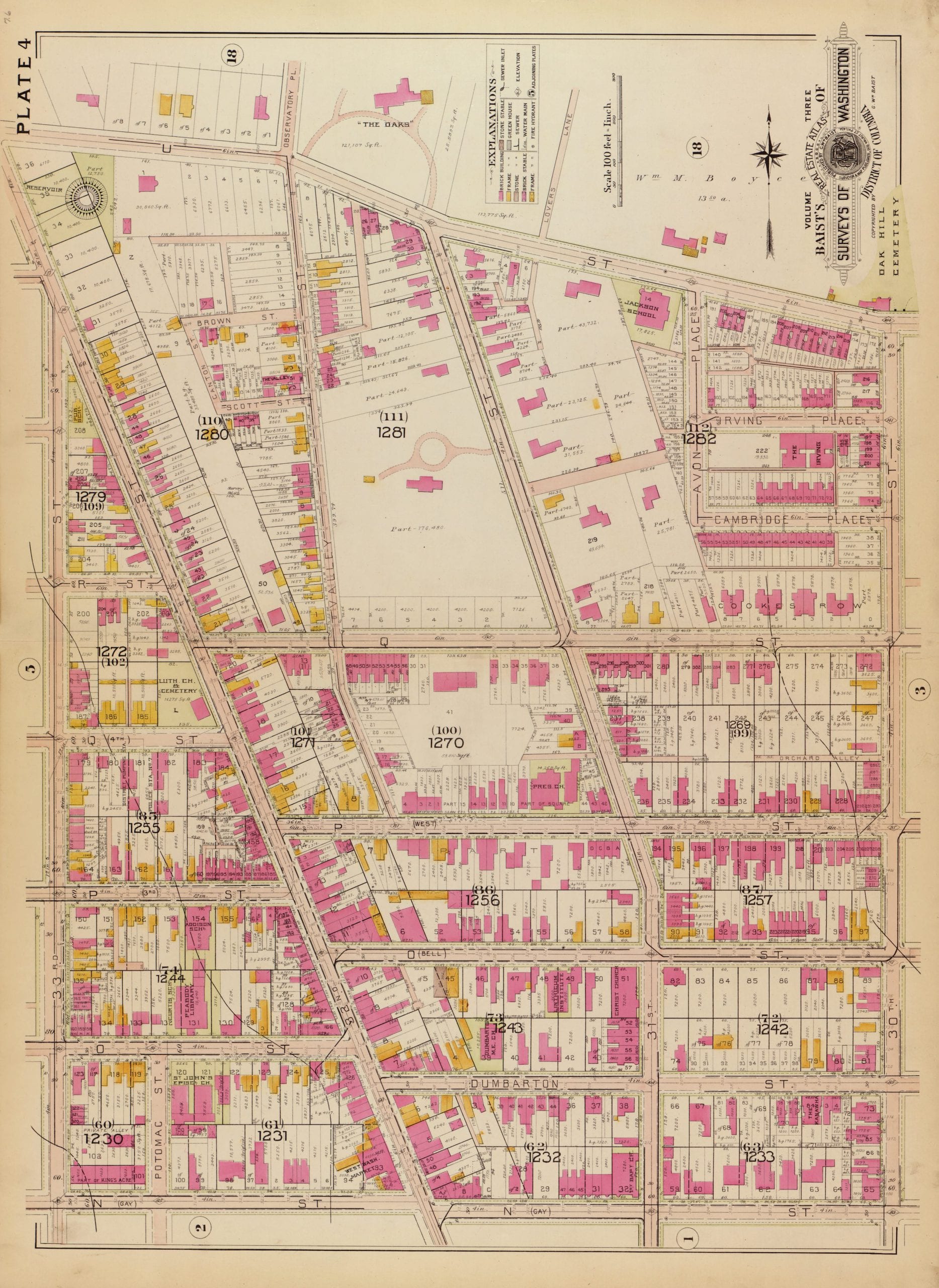
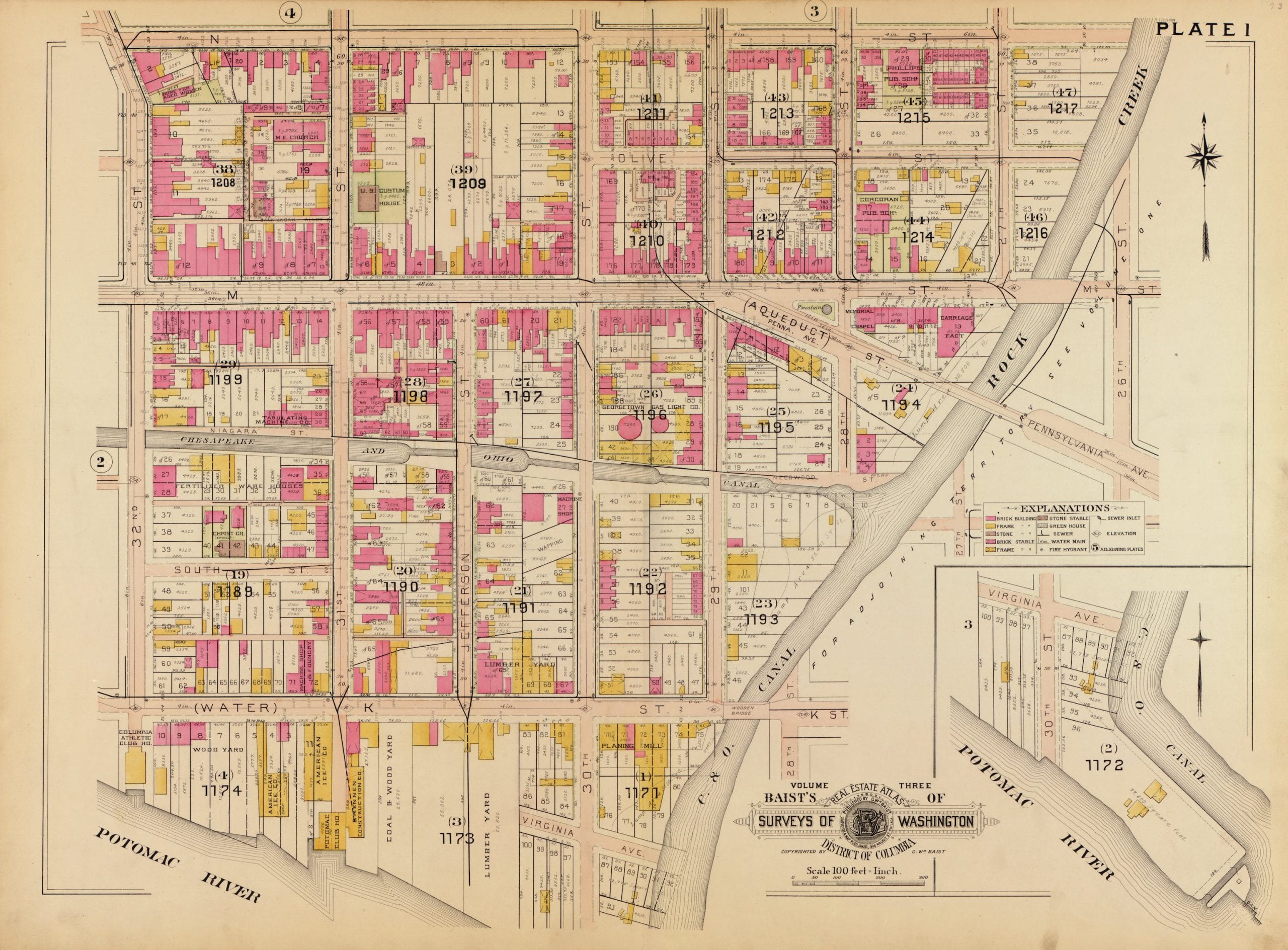
This shows western Georgetown up to the college.
Source: Library of Congress
Take a look through all of these maps. See what you can find and add your comments below. A lot of the buildings still stand today and have been repurposed.
My Great Grandmother lived at 1024 31st. Street. (First Map) and I have the 1900 Census records, and it shows 7 of their children at that time. They are listed at 1022 in 1910 Census, however her husband had passed away by then, and had more children by then too. My grandmother was only 4 years old when listed in the 1900 Census. There are still a few old buildings on 31st. Street however I can’t tell if they are the right numbers I’m looking for. I found that the Google link says it’s in one place but clearly it’s not the right numbers.
Loved the old maps of Georgetown where my father, grandmother, great-grandfather and great-great-grandfather were born. Dad was born at 1321 33rd Street in 1919 (map 4) and graduated from Western High in 1937. Fond childhood memories of summers spent with my grandmother in Georgetown — daily walks through the alley to pray in the chapel at St. John’s Episcopal Church, window shopping on Wisconsin Ave and lunches at the Little Tavern at Wisconsin and N. My parents and a sister were married at St. John’s. I couldn’t locate the playground where my Dad was a lifeguard and where I used to go to the pool and run through the sprinklers. There was always pie eating contests and other fun stuff on my birthday (July 4) every year. Then I realized the park must have been built where map 4 is marked “Presbyterian Burial Grounds” which was at 34th and Volta. Thanks for posting these maps; they brought back some wonderful memories!
That first map in the 1173/1174 block shows the location of the American Ice Company which was featured in a previous post.
https://ghostsofdc.org/2013/10/15/georgetown-flood-march-1918/