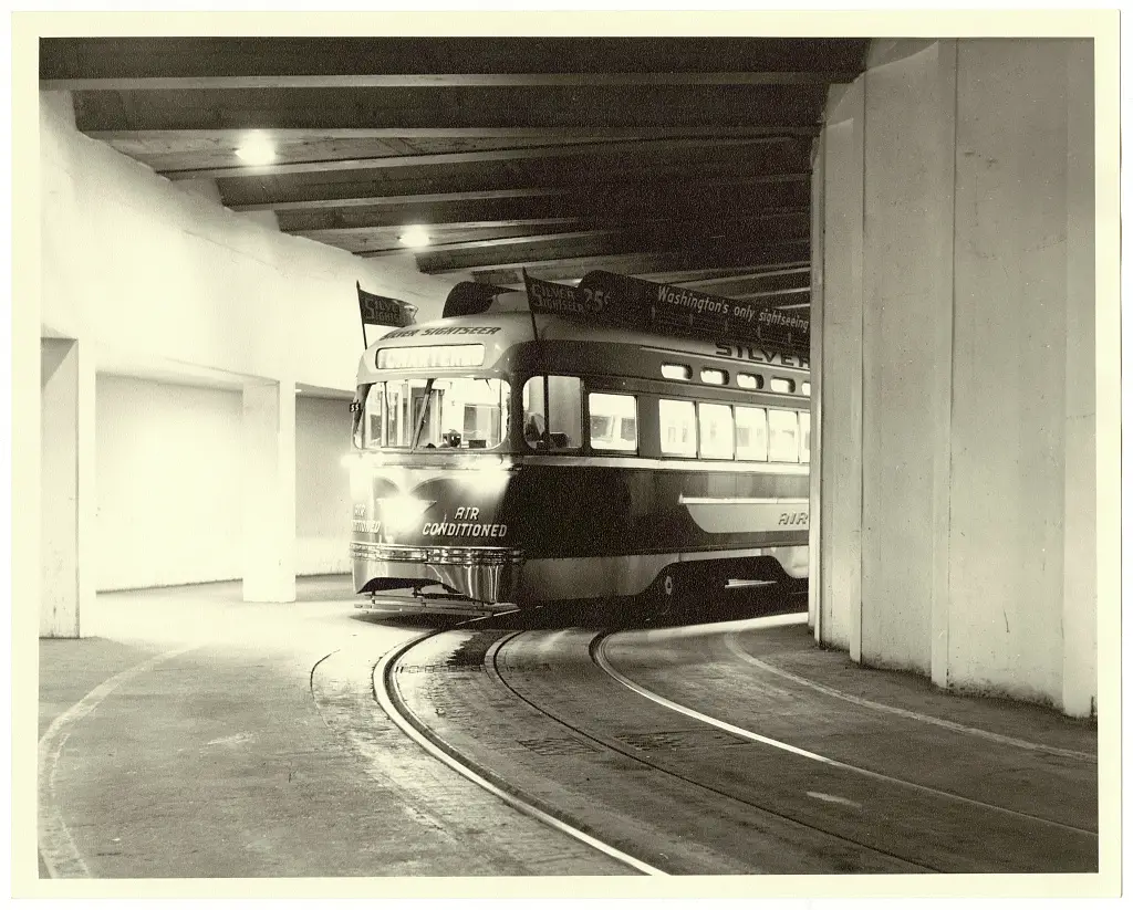
The Silver Sightseer streetcar gave cool, narrated tours of Washington D.C.'s famous landmarks in the late 1950s. Read about this one-of-a-kind, air-conditioned trolley that was specially decorated before it tragically burned down years later when the streetcar system closed.
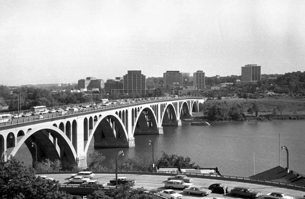
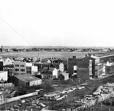
Take a journey back in time to 1964 with this photo of Rosslyn, DC, taken from Georgetown. Get a glimpse of what the city looked like over half a century ago.
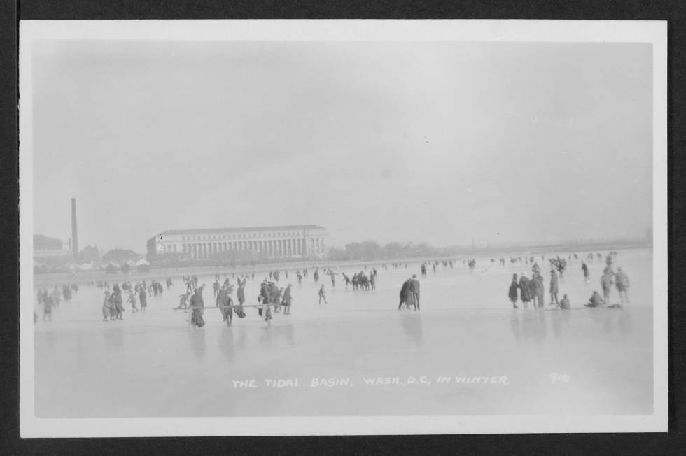
Discover the frozen Tidal Basin of the past with this fascinating historical photo. See the Bureau of Engraving and Printing in the distance, and learn about the history of ice skating and walking on the Tidal Basin. Read on to learn more.
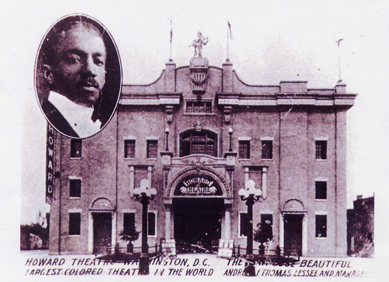
The Apollo in New York, the Pearl in Philadelphia, the Uptown in Baltimore, and the Howard Theatre in Washington were the preeminent African-American venues for stars like Duke Ellington, Ella Fitzgerald, and the big bands of the 1930s to rock and roll and the Motown sound.
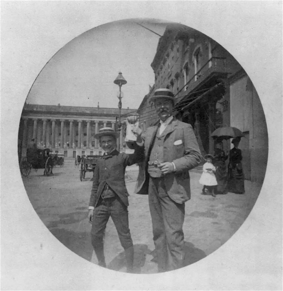
Take a look at this fascinating photo from 1885! Uncovering the past, this photo from the Library of Congress shows a man and a boy in summer straw hats happily displaying some unidentifiable papers on F Street.
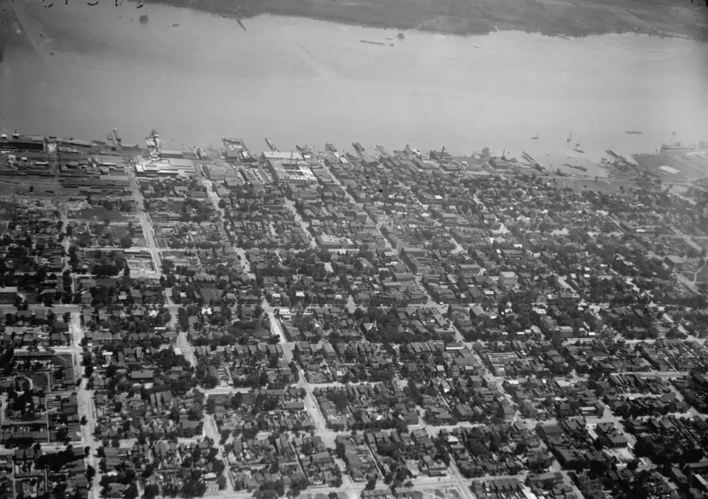
This incredible old photograph shows Alexandria, Virginia as seen from the air in 1919. Click on the image to see some amazing details. Source: Library of Congress.
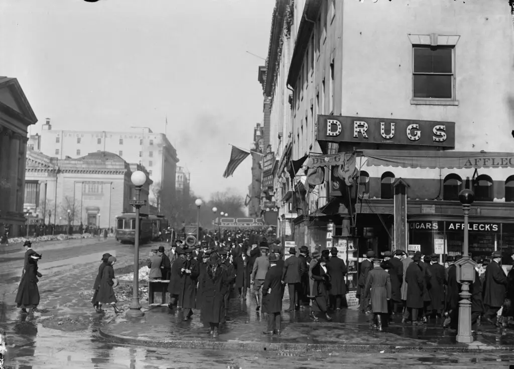
Take a trip back in time to see F Street in the 1910s with this incredible old photo. Also, check out photos of F Street from different eras, such as the 1870s, 1860s and the Civil War.
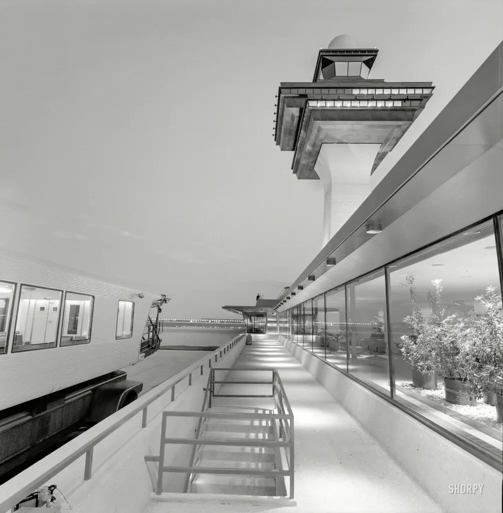
Take a trip back in time to the elegant and romantic Dulles Airport of the 1960s. Explore the mobile lounges and control tower in photos taken by Balthazar Korab.
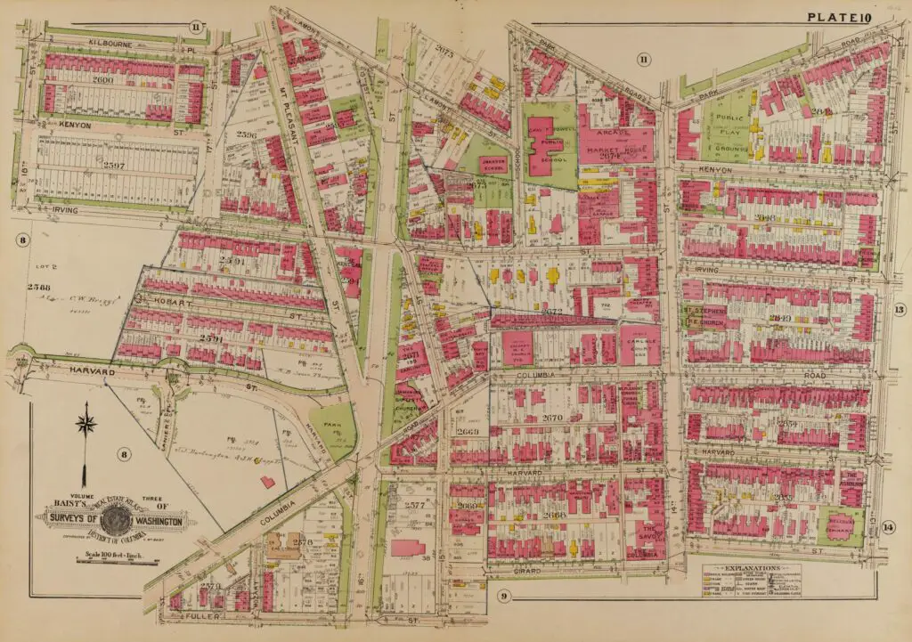
Take a journey back in time with this old map of Columbia Heights and 16th St. NW. Click on it for a larger version and explore to see what you recognize. Who knows, maybe you'll see your place. There are quite a few buildings still standing!
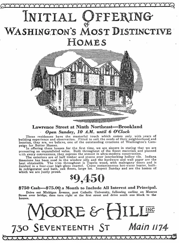
Take a look back to 1926 and an old real estate advertisement for Brookland, as found in The Washington Post. Read on to learn more about this historic advertisement!
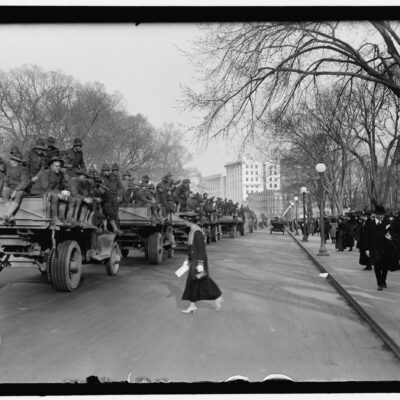
Discover the amazing story of how Geronimo and five other Western Indian chiefs attended and celebrated Teddy Roosevelt's inaugural parade in Washington, DC in 1905. Click the image for a larger version.
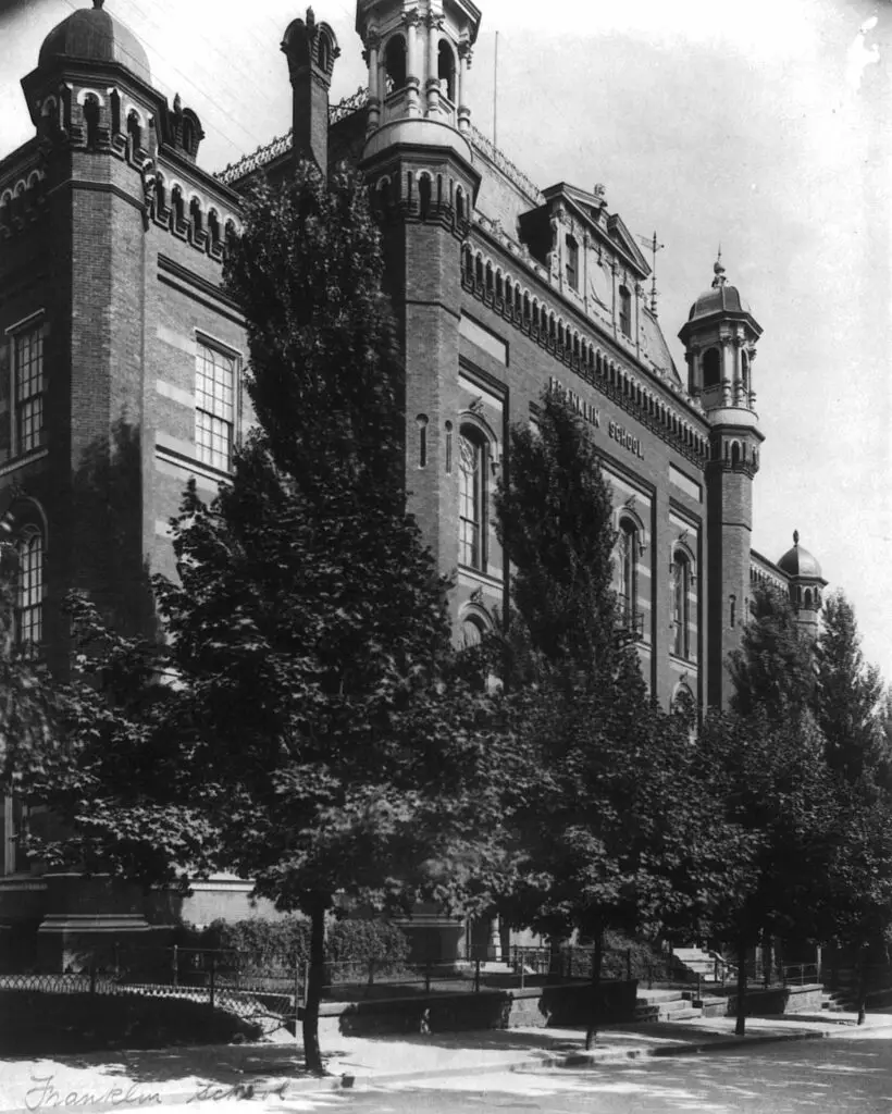
Take a look back in time with this old photo taken by Frances Benjamin Johnston at the turn of the 20th century. See it for yourself and uncover a piece of history!
Take a journey into America's past with this old film from the U.S. National Archives. Keep an eye out for landmarks and share your finds in the comments. Discover our nation's history today!
Incredible image of President Obama's Inauguration in 2009. Don't miss our other posts on Presidential inaugurations with old film footage, photographs and more.