

On the night of March 18, 1936, anti-aircraft searchlights swept the mud of the Washington Monument grounds. Under them, nearly 2,000 men were racing to build a wall of sandbags before the Potomac got there.
The river was coming up fast, and the morning Post told readers the city was bracing for “the worst flood since 1889, when fish were caught on Pennsylvania avenue.” Fish on Pennsylvania Avenue! That was the flood everybody measured against, and this one looked like it might match it.
So Washington built a sandbag dike across the National Mall, overnight.
A Wall Across the Mall Overnight
C. Marshall Finnan, superintendent of National Capital Parks, was at the March 18 emergency conference where officials ordered the dike, and his agency ran the job.
Fifteen hundred men started late that day, when the river was expected to reach 17 feet above low water at Key Bridge. That night the Weather Bureau raised its forecast to 19 feet, close to 1889’s mark, when the flood did $1,000,000 in damage here.
Another 450 men from the Civilian Conservation Corps (CCC) were summoned from Chopawansic, Virginia.
The line started near 17th Street, on the slope just west of the Washington Monument, and ran northwest to just short of Constitution Avenue NW. From there it wrapped around the back of the Navy and Munitions Buildings and came back up to Constitution Avenue between 21st Street NW and Henry Bacon Drive NW.
Those were World War I temporary offices, and Constitution Gardens and the Vietnam Veterans Memorial stand on their site today.
The parkland along the Mall had been filled and raised above old flood levels, so parks officials figured a wall 6 feet high would do. Sandbags faced the river, with dirt behind them and more sandbags on top.

Ninety trucks shuttled back and forth to steam shovels, and more than 10,000 cubic yards of dirt went into the wall. Some of it came out of the site of the new Federal Reserve building at 21st Street and Constitution Avenue NW (talk about recycling).
Searchlights, Coffee Trucks and “Old Man River”
By that night the crew had grown to 1,950 park employees and CCC youths. Searchlights lit them as they worked, and the Post sent a reporter out to watch.
Thirty men of Battery A, 260th Coast Artillery, an anti-aircraft unit of the District National Guard, ran two portable searchlights all night off truck generators. That kept the steam shovels digging along Constitution Avenue.
The District’s own fire department didn’t have lights like that, so the Riverdale, Maryland, rescue squad came down with 3,000-watt lamps. The Post said they gave the workers “a flood of light as brilliant as the day.”
Tractors roared across the mud banks between the Monument and the Lincoln Memorial while police and Reserve Corps officers held the crowds back. The Post’s reporter got a little carried away, writing that “Like men from Mars moved the cranes and tractors.” Here’s how he described the crews:
Always they were busy, and they stopped only when the coffee trucks rolled around, and they sat in relays on the ramparts they had built …
He thought they looked like soldiers in battle. Some of the young guys shouted that they’d build the dike so high the river would run the other way.
Among the park workers were groups of Black men, some of whom had worked Mississippi River levees in flood time. One of them looked toward the lighted Lincoln Memorial and sang “Old Man River.” Remembering the Mississippi, he told the reporter, “We had bigger floods then, boy.”
And then he spoke to the Potomac itself: “River, I’m not afraid of you. We got you down, river.”

Crowds at the Water’s Edge
Thousands of Washingtonians had gone down to the waterfront that day “to see the boiling waters of the Potomac surge by.” Finnan closed the Potomac Park roads at 6 p.m., but the fish markets and seafood restaurants on the wharves stayed open, and their tables were full.
One kid in boots wasn’t going anywhere. A policeman told him, “Stand back, buddy, there’s a flood coming.” The youngster had his answer ready: “That’s why I’m here. I want to see it.”
Moving the Files Upstairs
Behind the dike sat the brand-new Federal Triangle, and nobody wanted the river in it. A short levee already guarded the Monument grounds. The Post said it rose 14 feet above mean low water and had been designed to protect $100,000,000 worth of new Federal buildings.
But that levee didn’t close off the low parkland to the west, toward the Lincoln Memorial. That’s the gap the sandbags filled, tying into the levee at 17th Street and Constitution Avenue NW.
That night Navy Department employees were called in to carry records from the first floor to the second, and files came out of the basement of the old Post Office Department Building.
According to the Washington Daily News, crews dug up newly planted turf around the Internal Revenue Building to weigh down tarpaulins over the skylights, and the Justice Department building was barricaded. At Constitution Avenue and 16th Street NW, water from an old sewer bubbled up into the street, and crews anchored six manhole covers and sandbagged it, the Evening Star reported.

“Look at That River Go!”
On March 18, 1936, President Franklin D. Roosevelt named an emergency flood committee chaired by Secretary of War George Dern.
He was supposed to leave at 3 p.m. on March 19 for his annual fishing cruise off Florida. The Star reported that he put it off instead, and on March 20 he delayed it again.
At noon on March 19 he sent home government employees who lived in Virginia and Maryland. Highway Bridge, the old steel truss road bridge to Virginia at the 14th Street crossing, had closed, and the traffic was going to be awful.
Shortly before 2 p.m. that day, Roosevelt climbed into his official car with Dern and went to look at the flood himself. One sight of the Potomac and, according to the Star, out came the amazed exclamation: “Look at that river go!”

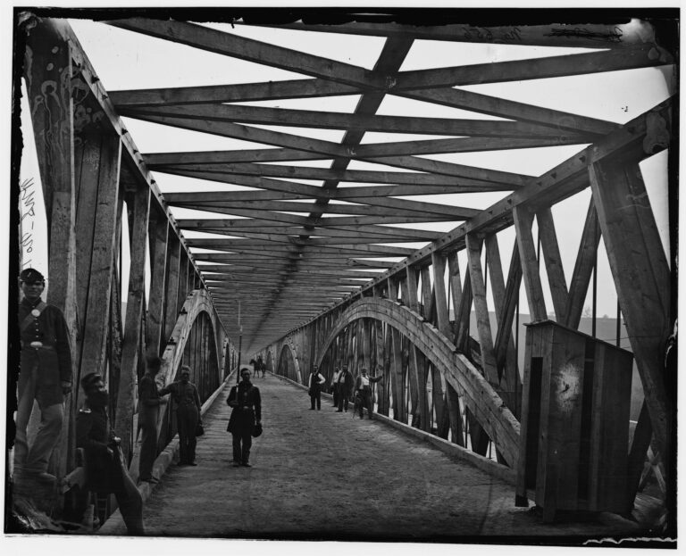
The night before, Col. Dan I. Sultan, the District’s engineer commissioner, had closed Chain Bridge. A Post reporter who walked out on it found the bridge swaying and vibrating, with spray hitting its floor.
Arlington’s normal water supply came across in mains under the bridge. At 1 p.m. on March 19 that supply was shut off to ease the strain, and other sources were tapped.
The Crest
The river crested on the evening of March 19, 1936, about 7 p.m. by the Post’s count and between 6 and 7 by the Star’s. Writing the next day, the Post’s Edward T. Folliard sounded like a war correspondent:
The Flood of 1936, as it will be known to history, reached a thundering crest in Washington at 7 o’clock last night and then began to recede.
The Post had the peak at 18.5 feet above normal low water at Key Bridge, one foot below 1889. The Star said the largest volume of water on record flowed past the city.
The Tidal Basin went over its walls, and the water lashed the cherry trees, swirled around the John Paul Jones statue and ran up 17th Street to the Lincoln Memorial pools. Folliard noted that John Paul Jones was in so deep that if he came to life “he would have no trouble swimming.”
And then the water hit the dike.
Near Constitution avenue, the yellow overflow collided with the sand-bag dike which had been erected the night before and there halted. Uncle Sam’s vast real estate holdings in the Federal Triangle were safe.
It held! About a day after the first shovels went in, the wall did exactly what it was built to do.
The rest of the low ground wasn’t so lucky. Most of East Potomac Park, golf course and all, went under, and people were rowing boats across Washington-Hoover Airport. The river also poured over the Navy Yard, the Army War College reservation, Bolling Field and the Naval Air Station.

Georgetown and Southwest Get Soaked
Crowds lined Key Bridge that night and watched water rush over the second-floor ballroom of the Washington Canoe Club. In Georgetown, K Street, also known as Water Street, was under 6 feet of water in places, and onlookers chuckled at water near the tops of the “No Parking” signs.
In Southwest the flood swamped the District Morgue, so bodies had to be moved to private undertakers, and it flooded Harbor Police headquarters too. Upriver, Mrs. Eva Dell Myers spent a terrifying night at her island home in the Potomac opposite Glen Echo before W. E. Swainson and John McCann rescued her.
As the river fell, the Post put the damage at more than $250,000 and counted 120 homeless families.
From Sandbags to a Permanent Levee
On March 25, 1936, Finnan asked for Works Progress Administration (WPA) projects that included turning the emergency levee along Constitution Avenue into a permanent, sod-covered dike.
That year WPA workers leveled the northwest part of the Monument grounds to get ready for a bigger flood control dike, according to the Park Service’s history of the grounds.
By 1938 a flood control dike stood along Constitution Avenue, and the National Park Service dates the Potomac Park levee system to 1939. The Park Service adds that a removable post-and-panel closure across 17th Street, between Constitution Avenue NW and Independence Avenue SW, was installed in 2014 and is test-assembled each year.
It guards the same 17th Street edge of the Monument grounds where the 1936 sandbag line began.
Lost Washington stories, in your inbox.
The newest story, plus a few from the archive.
Free. Unsubscribe anytime.
AI helped research and write this story and colorize and crop the featured photograph. Colors are interpretive; the full black-and-white original appears in the article. Here’s how we use AI.Suggest a correction