
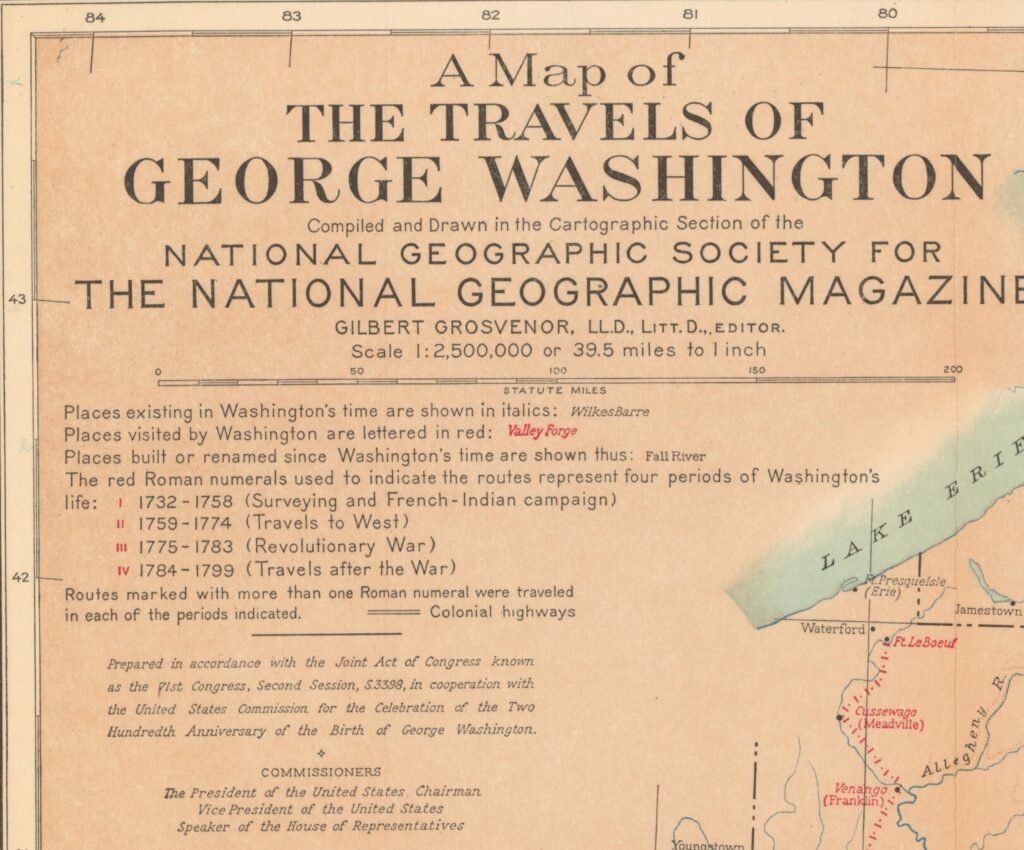
This map traces almost everywhere George Washington went in his 67 years. Every town he visited is lettered in red, from Savannah, Georgia, which he reached on his Southern tour in 1791, to Kittery, Maine.
National Geographic published it in January 1932, a month before the 200th anniversary of Washington’s birth on February 22.

How to Read the Map
The red Roman numerals along each route mark four periods of Washington’s life. I covers 1732 to 1758, his surveying years and the French and Indian War. II is 1759 to 1774, his travels west. III is the Revolutionary War, 1775 to 1783. IV is 1784 to 1799, his travels after the war, including his tours as president.
Places that existed in Washington’s time are in italics. Places built or renamed later are in plain type, and old names often come with the modern one in parentheses.
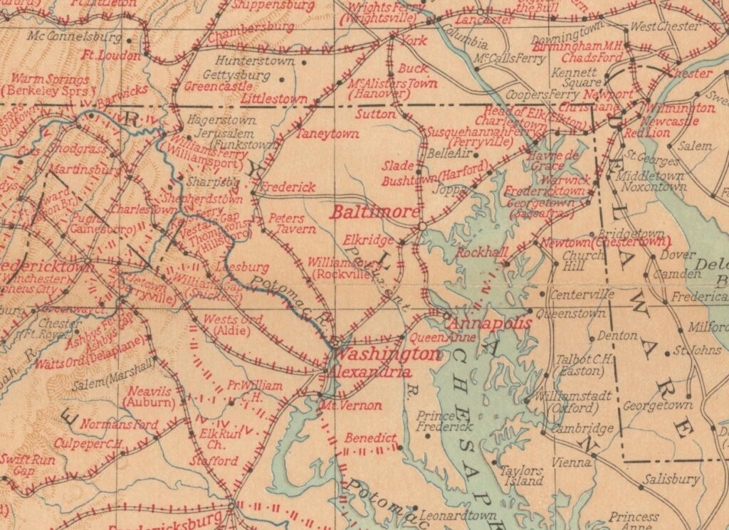
Around Washington, DC
The densest tangle of routes on the whole map is right around here. Mount Vernon, Alexandria, Fredericksburg and Annapolis were the towns of Washington’s everyday life, and the routes between them are packed with numerals from every period of his life.
Look closely and Rockville shows up under its old name, Williamsburg. Winchester is Fredericktown.
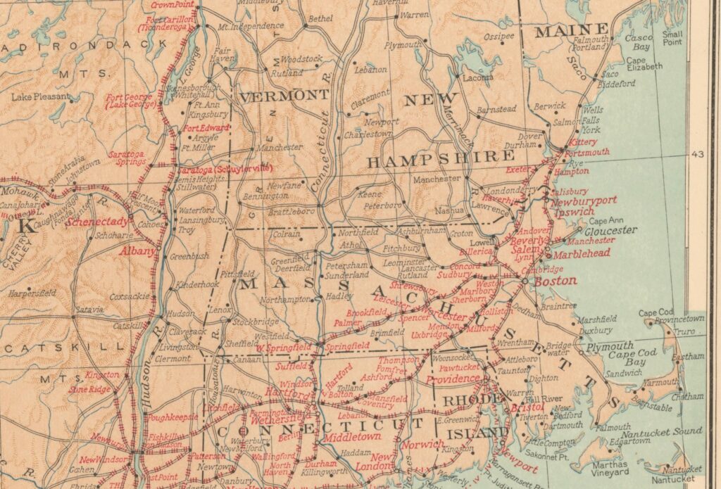
Washington in Kittery, Maine
Washington toured New England as president in the fall of 1789. On November 2, he crossed the Piscataqua River from Portsmouth, New Hampshire, and wrote in his diary, “I stopped at a place called Kittery in the Provence of Main.”
Maine was still part of Massachusetts then, and Kittery was his one stop there.
Sources
- National Geographic Society, “A Map of the Travels of George Washington,” compiled for the National Geographic Magazine, copyright 1931, published January 1932 (Portal to Texas History catalog record)
- Princeton University Library, Historic Maps Collection, scan of the 1931 map (catalog record)
- George Washington’s diary, November 2, 1789 (Founders Online, National Archives)
Liked this one? Get more tomorrow.
Lost Washington stories in your inbox most mornings: the newest, plus a few from the archive.
 Senator John Stennis Shot in Northwest Washington in 1973
 Chateau Bonaparte: The Bonaparte Family’s K Street Home
 Japan’s First Embassy to America Arrives in 1860
Free. Unsubscribe anytime.
We use AI to help research, write and edit stories across our sites. Here’s how we use AI.Suggest a correction