
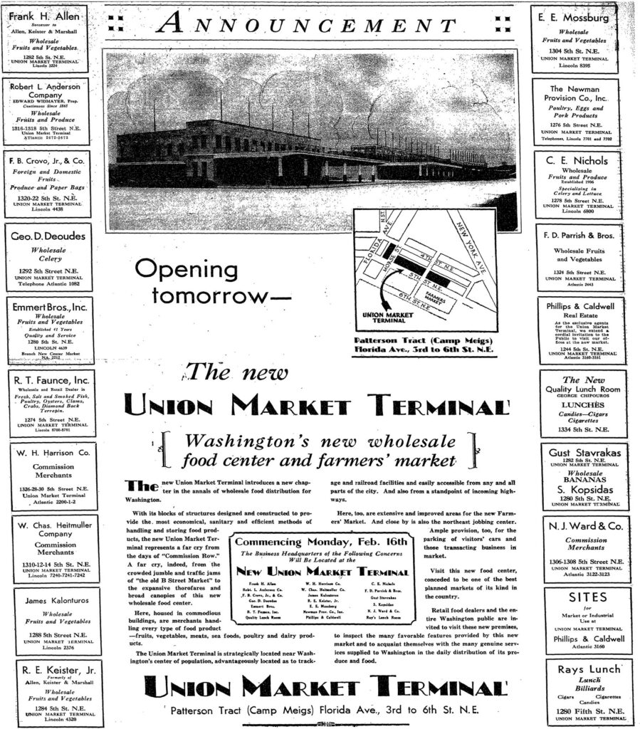
On Sunday, February 15, 1931, the Washington Post ran a full-page ad for a brand-new food market in Northeast. Check out the address line at the bottom: “Patterson Tract (Camp Meigs) Florida Ave., 3rd to 6th St. N.E.”
Camp Meigs. That was a World War I army camp. By 1931 it was better known as the city’s circus lot, and before all that it was a country estate with a mansion on the hill.
The market that formally opened the next morning, Monday, February 16, 1931, is the reason the whole neighborhood around 5th Street and Florida Avenue NE is called Union Market today. And it was built by produce men who had been pushed out of downtown to make room for the Federal Triangle.
Here’s how the ad sold it:
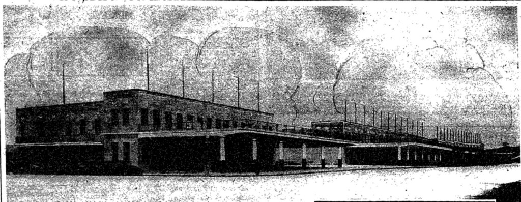
With its blocks of structures designed and constructed to provide the most economical, sanitary and efficient methods of handling and storing food products, the new Union Market Terminal represents a far cry from the days of “Commission Row.” A far cry, indeed, from the crowded jumble and traffic jams of “the old B Street Market” to the expansive thorofares and broad canopies of this new wholesale food center.
The Post’s news story that same morning put it more simply:
The new Union Market terminal, at Fifth street and Florida avenue northeast, will be formally opened tomorrow by leading wholesale fruit and produce merchants who had been doing business at the old B street market place.
Take a close look at the ad itself. Down both sides are the business cards of the first tenants, nearly all on 5th Street NE. There’s W. H. Harrison Co., commission merchants, at 1326-28-30. Geo. D. Deoudes sold wholesale celery at 1292. R. T. Faunce offered fish, oysters, crabs and “Diamond Back Terrapin” at 1274. And Rays Lunch at 1280 promised lunch and billiards.
Pushed out by the Federal Triangle
To understand why a market showed up in an empty field in Northeast, you have to start downtown. For decades Washington’s food trade revolved around Center Market on Pennsylvania Avenue, with the commission merchants, the wholesalers who sold farmers’ produce for a cut, packed into the blocks around it, along B Street NW. (B Street became Constitution Avenue.)
Then the federal government decided it needed that land. The Public Buildings Act of 1926 and the plans for the Federal Triangle doomed Center Market and the commission houses around it. The city studied possible new sites, and Congress debated them for years before settling on one in Southwest in 1929.
A big group of the produce men didn’t wait for it. On August 12, 1928, the Sunday Star reported that they had a plan of their own for the Patterson tract in Northeast:
…the group of commission merchants comprising approximately 75 per cent to 85 per cent of the total volume of green fruit and vegetable commission business, have completed arrangements for the development of their new unit on the Patterson tract in the central section of the city.
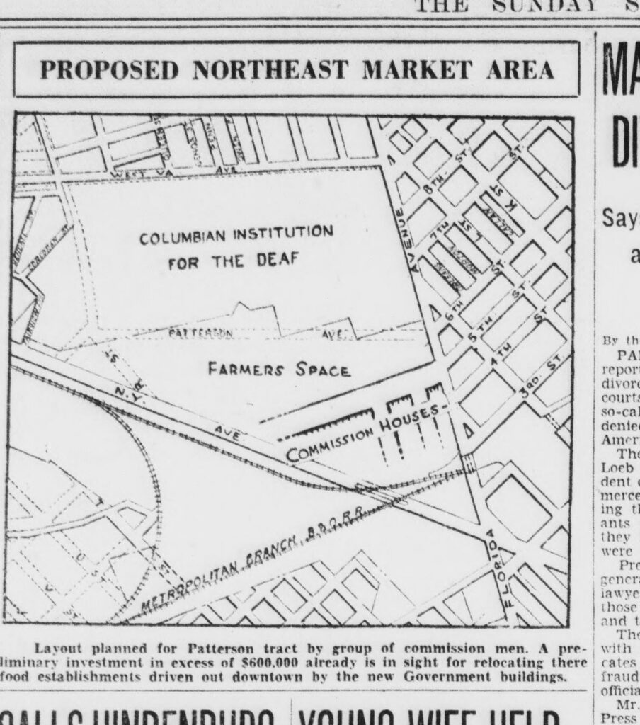
The plan called for 40 stores in a row along a new, extended 5th Street, with space set aside for farmers.
By July 29, 1929, the Star was calling it a “$1,000,000 market center.” The land, it said, was “about 85 acres acquired from the Winslow estate by the commission merchants now located at Center Market.” Later stories put the market itself at 42 to 45 acres.
What was here before Union Market?
So what was the Patterson tract? For most of the 1800s it was country. Florida Avenue was still called Boundary Street, the edge of the city, and the land north of it was fields and woods.
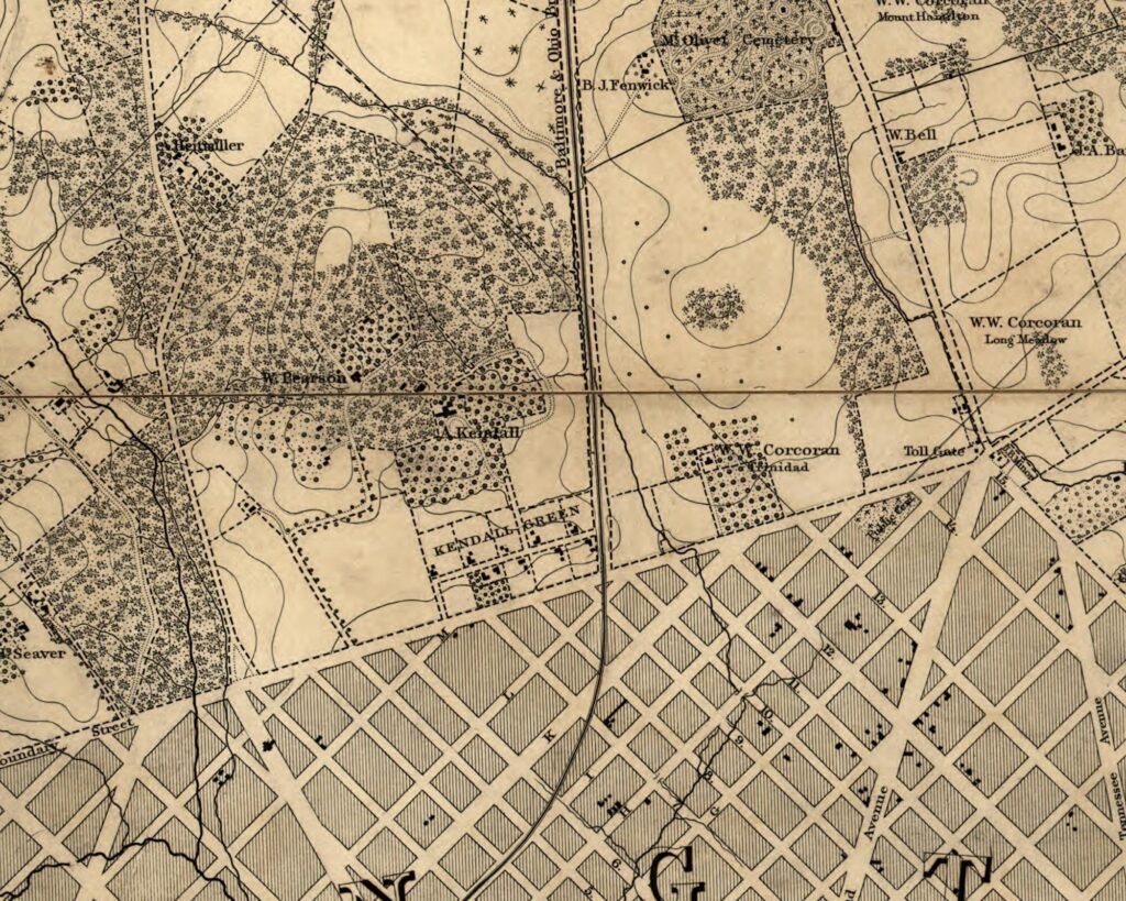
According to the National Register nomination for the Union Market Historic District, the big house on the hill was Brentwood, a Greek Revival mansion designed by Benjamin Henry Latrobe and built in 1817. It was home to Eleanor Brent, daughter of Mayor Robert Brent, and her husband, Congressman Joseph Pearson of North Carolina.
The Pearsons’ only daughter married a man named Patterson in the 1830s, and the land became known as the Patterson tract. It stayed in the family through the 19th century.
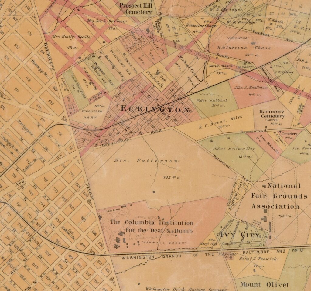
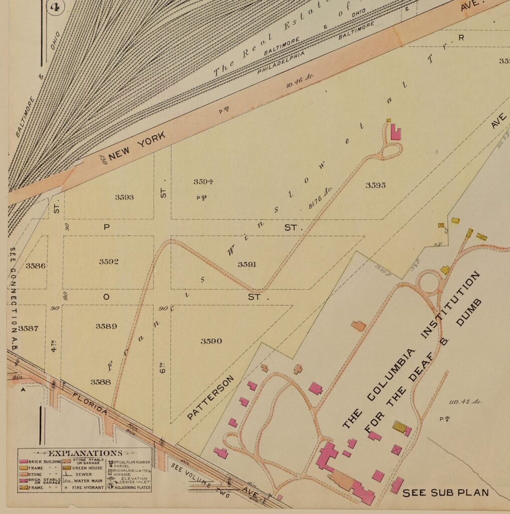
By 1913 the real estate atlases called it the Winslow tract: 81.76 acres, with a grid of streets drawn on paper but never built. The only building was a brick house at the end of a long, winding drive from Florida Avenue.
Then came World War I. In 1917 the federal government leased the land for Camp Meigs, which opened that October with rows of temporary barracks and mess halls. The nomination says it was a mobilization point for about 1,163 carpenters, chauffeurs, machinists, electricians and other specialists bound for France.
A Washington Post headline in December 1917 called it a “Camp in Heart of City.”
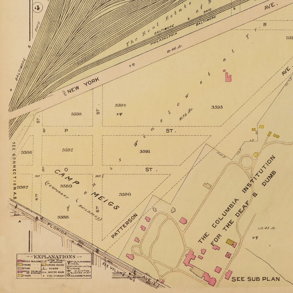
After the war, the nomination says, the Hechinger Building and Plumbing Company, the forerunner of the hardware chain, took over the site in 1919. It razed the barracks and what was left of the mansion, which had burned around 1915, and used part of the ground for storage and warehouses.
The rest stayed an open field. It kept the Camp Meigs name and became the place where traveling circuses set up when they came to town. In 1930 the Star described the market site as “site of the Camp Meigs circus grounds at Florida avenue between Third and Sixth streets northeast.” The Post’s 1931 opening story still called it “formerly the Camp Meigs circus grounds.”
Building the Union Terminal Market
The opening ad would call it the Union Market Terminal, but most papers flipped the name to the Union Terminal Market. Work got going in the summer of 1929, with the Charles H. Tompkins Co. as builder. The Star’s July 29, 1929 story listed the first building permits on 5th Street NE, and the names will look familiar from the opening-day ad: Nathaniel J. Ward, James Kalonturos, William A. Cannon, W. H. Harrison, Raymond T. Faunce, George D. Deoudes and Henry J. Klein.
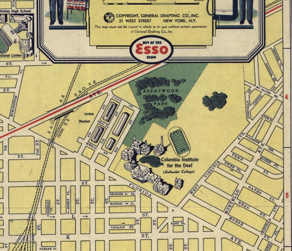
Not everyone was thrilled. Even with construction under way, the market still needed a zoning change, and Gallaudet, right next door, fought it. Here’s the Star’s map of the fight on June 3, 1930, along with its caption:
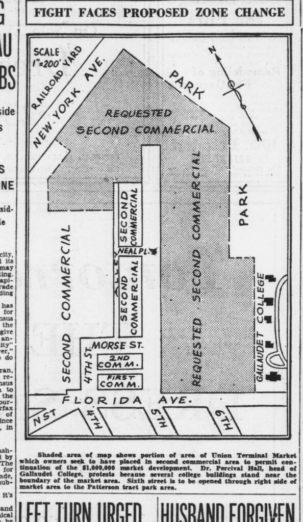
Shaded area of map shows portion of area of Union Terminal Market which owners seek to have placed in second commercial area to permit continuation of the $1,000,000 market development. Dr. Percival Hall, head of Gallaudet College, protests because several college buildings stand near the boundary of the market area.
The Star expected a compromise to be offered: a 100-foot strip along Florida Avenue and Sixth Street would get a lighter commercial zoning, as a buffer.
That September the first tenant moved in. From the Evening Star on September 20, 1930:
Washington’s new wholesale and retail market center in the Patterson tract, site of the Camp Meigs circus grounds at Florida avenue between Third and Sixth streets northeast, was tenanted for the first time since its completion this week, when the Joseph Phillips Co. occupied its $150,000 meat packing and distributing plant.
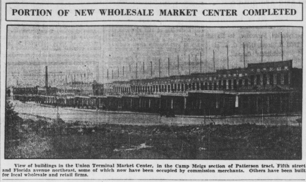
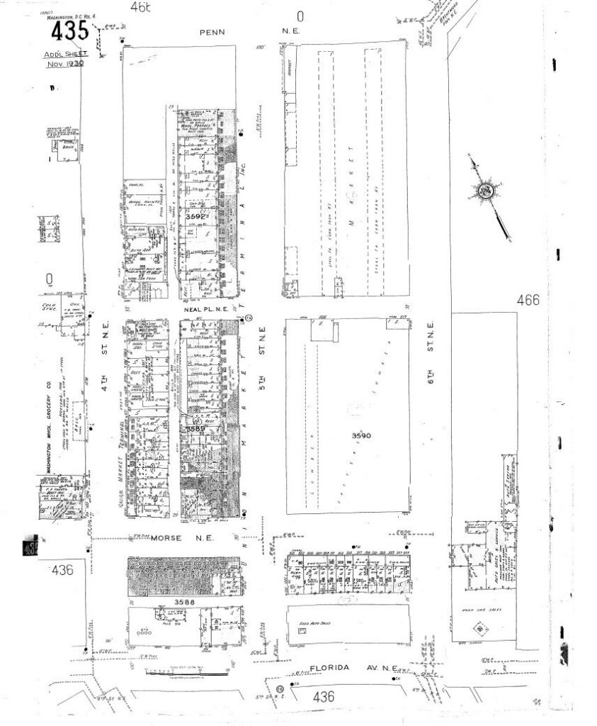
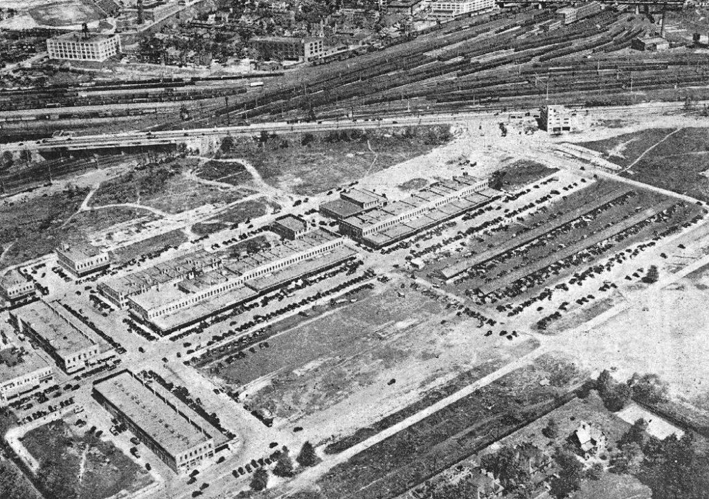
The Star counted 42 fireproof buildings in four blocks on 5th Street, each with its own elevator and long canopies over the loading docks. Those two-story buff brick rows, with their columned loading bays and flagpoles on the roof, are the same ones you can still see on 4th Street, 5th Street and Morse Street today.
The farmers move in
The farmers who had sold from the sheds near Center Market came too. From the Evening Star on February 14, 1931:
Two hundred and fifteen farmers in nearby Maryland and Virginia, meeting last night in the National Museum, signed applications for 300 stands in the new Union Market Terminal, at Fifth street and Florida avenue northeast.
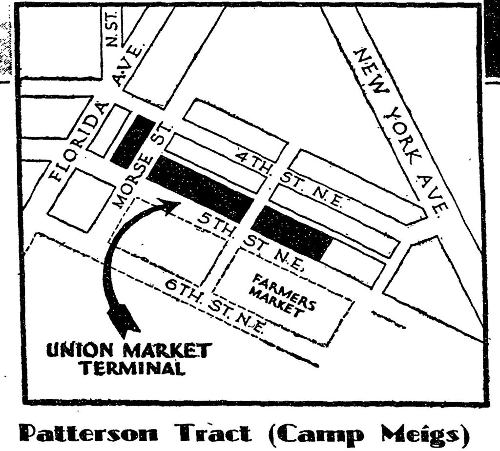
Their market sat across 5th Street from the wholesale rows. According to the nomination, it opened as two steel sheds, each 560 feet long and 30 feet wide.
A stranded Wild West show on the market lot
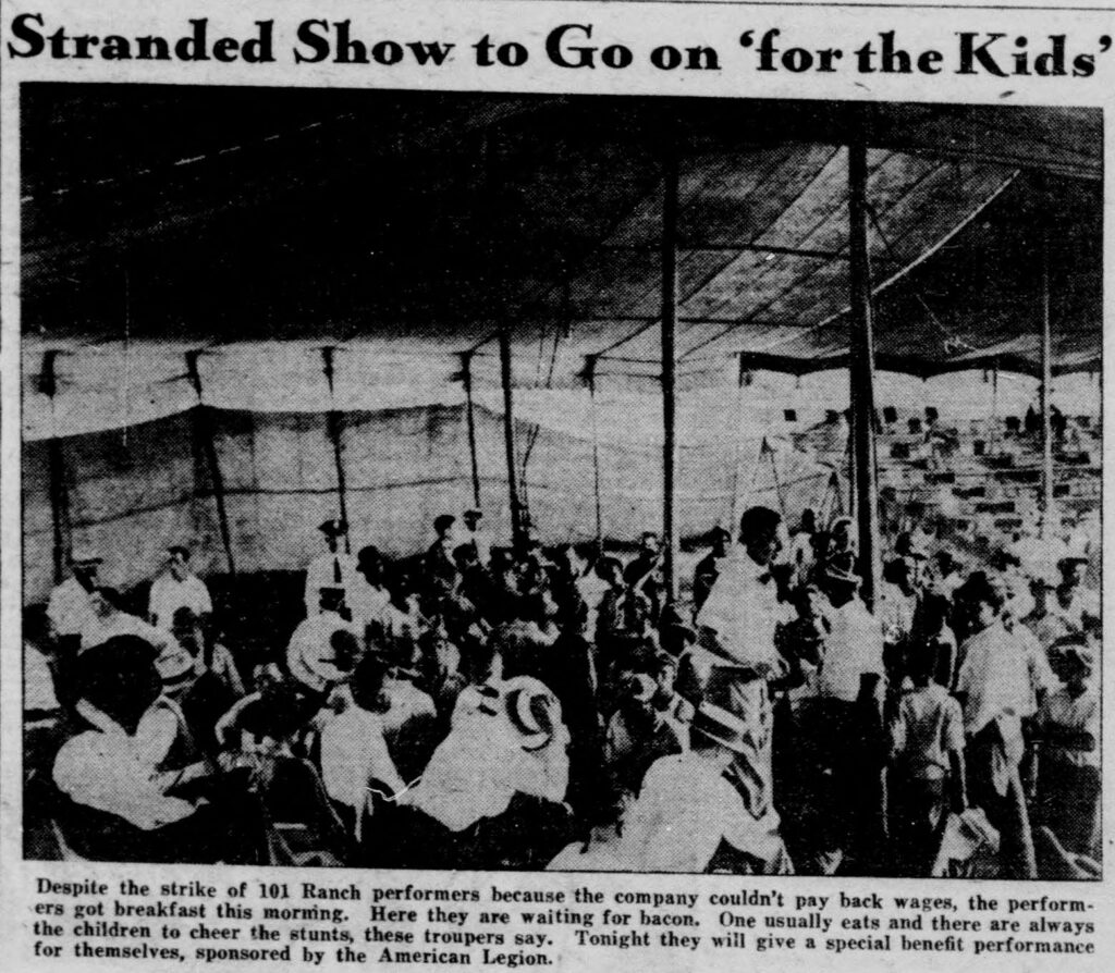
The old circus grounds had one more show in them. On August 3, 1931, the 101 Ranch Wild West Show set up its tents on the Union Market grounds, and then it couldn’t leave. The company couldn’t pay its back wages, the performers went on strike, and the whole outfit sat on the lot for about two weeks.
The Washington Daily News found the troupe waiting on breakfast on August 6:
Eighteen gangling cowboys, most of them from Wyoming or Oklahoma, 16 cowgirls and 29 Indians nodded their heads to the sizzling of frying bacon.
“The show’s the thing,” they said. “Listen to the bacon fry. We’re still eating, aren’t we?”
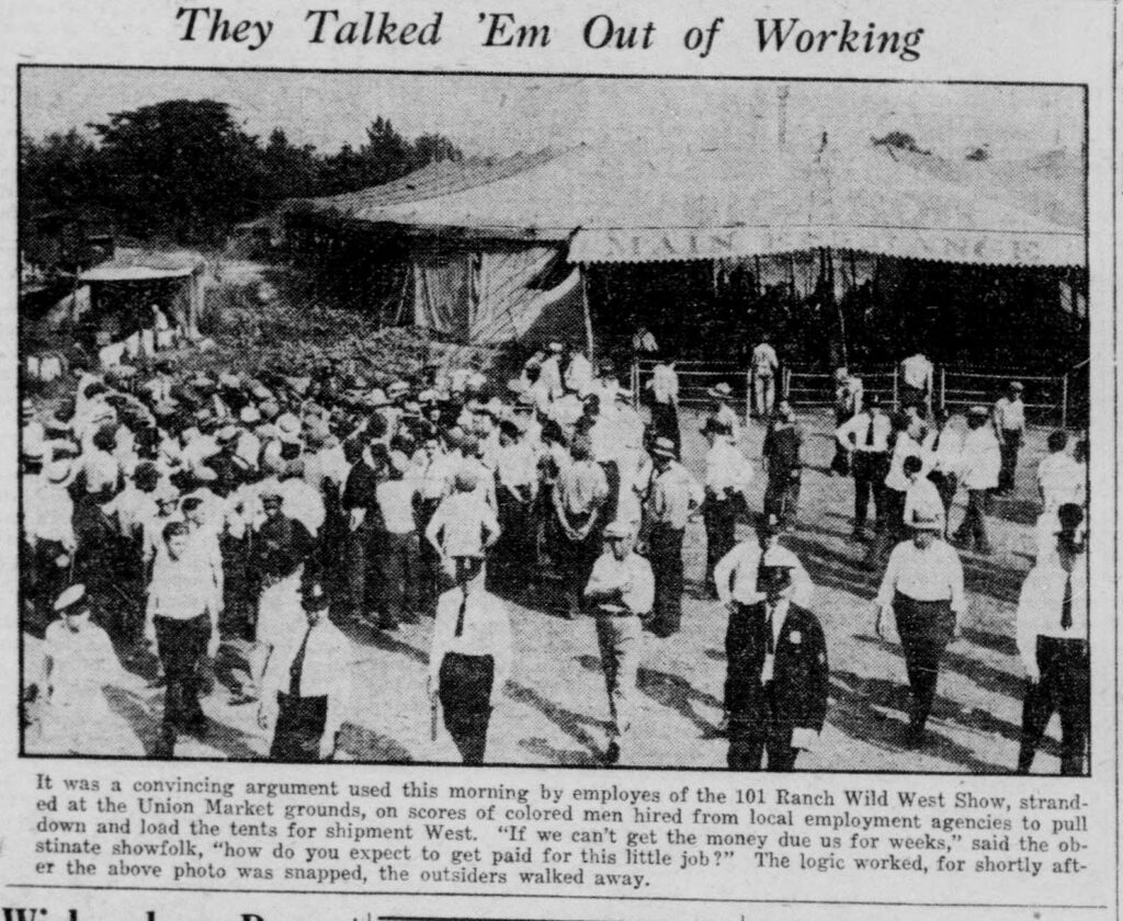
When local laborers were hired to take down the tents, the troupers talked them out of it. From the Daily News photo caption on August 8:
“If we can’t get the money due us for weeks,” said the obstinate showfolk, “how do you expect to get paid for this little job?”
It finally ended with a crew brought down from Baltimore. The Post’s count covered the whole unpaid company, not just the performers the Daily News had tallied. The Washington Post, August 19, 1931:
One by one the tents that since August 3 have dotted the Union Terminal Market lot, fell yesterday before energetic, if unskilled, assaults of a crew of 40 men brought here from Baltimore. Unpaid employes, their ranks now dwindled to 374, stood by and watched.
Steaks, sanitation and the 4 a.m. market
By the late 1930s the market was humming. In time it became best known as the Florida Avenue Market.
It had a restaurant scene all its own. In 1942 a Daily News restaurant-guide advertisement sang the praises of Cannon’s steak house at 1270 5th Street, in a building on one of the original 1929 permits:
Cannon’s is in the Union Terminal Market; you wend your way around sacks of potatoes and crates of oranges to a busy, well organized restaurant, clean as a whistle from stem to stern.
Clean as a whistle was not how the city saw the rest of the market. In 1952 the Health Department called in the marketmen, and the Star reported that William H. Cary Jr., the department’s director of public health engineering, told them “the sanitation conditions around the market were a disgrace to the city and if they did not co-operate, ‘they would have to tell it to the judge.'”
The bigger threat was the supermarket. In a July 2, 1963 column, Star columnist George Kennedy described riding along at 4 a.m. with Gilbert Campos, the fruit and vegetable buyer for Giant:
The darkness made candles of the street lights in the market. Quiet absorbed the noise of the big trucks which lumbered and loomed through the market streets.
Campos didn’t sugarcoat it: “These big city markets are dying and it’s the chain stores are doing it.” A dealer named Asriel Berry agreed:
“I’ve been on the market for 43 years,” he said. “It’s a dying business. One store closes and then another. It’s not that supermarkets are cheaper but women like the big assortments of fruits and vegetables.”
And over at the Florence Banana Company, Kennedy was told that “a big tarantula had just dropped out of a bunch.”
“A sight for sore eyes”
On May 28, 1964, the city’s health director toured the farmers’ market, and the Post’s Phil Casey went along. He found two men looking at the same shed and seeing completely different things.
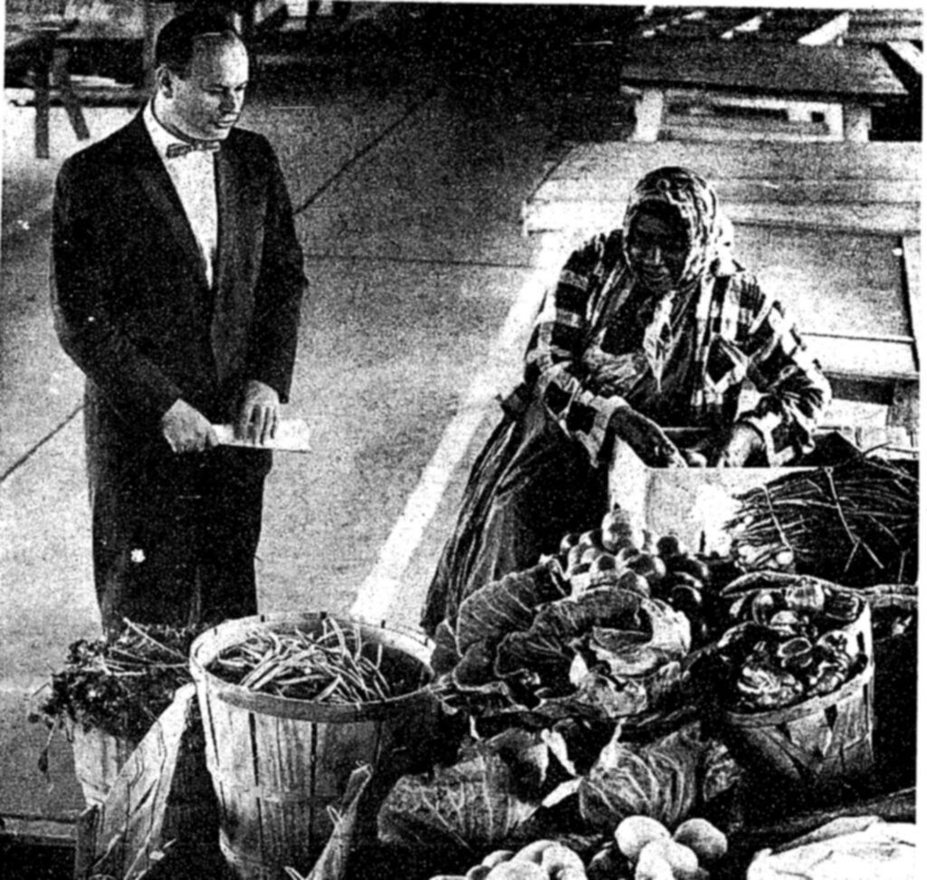
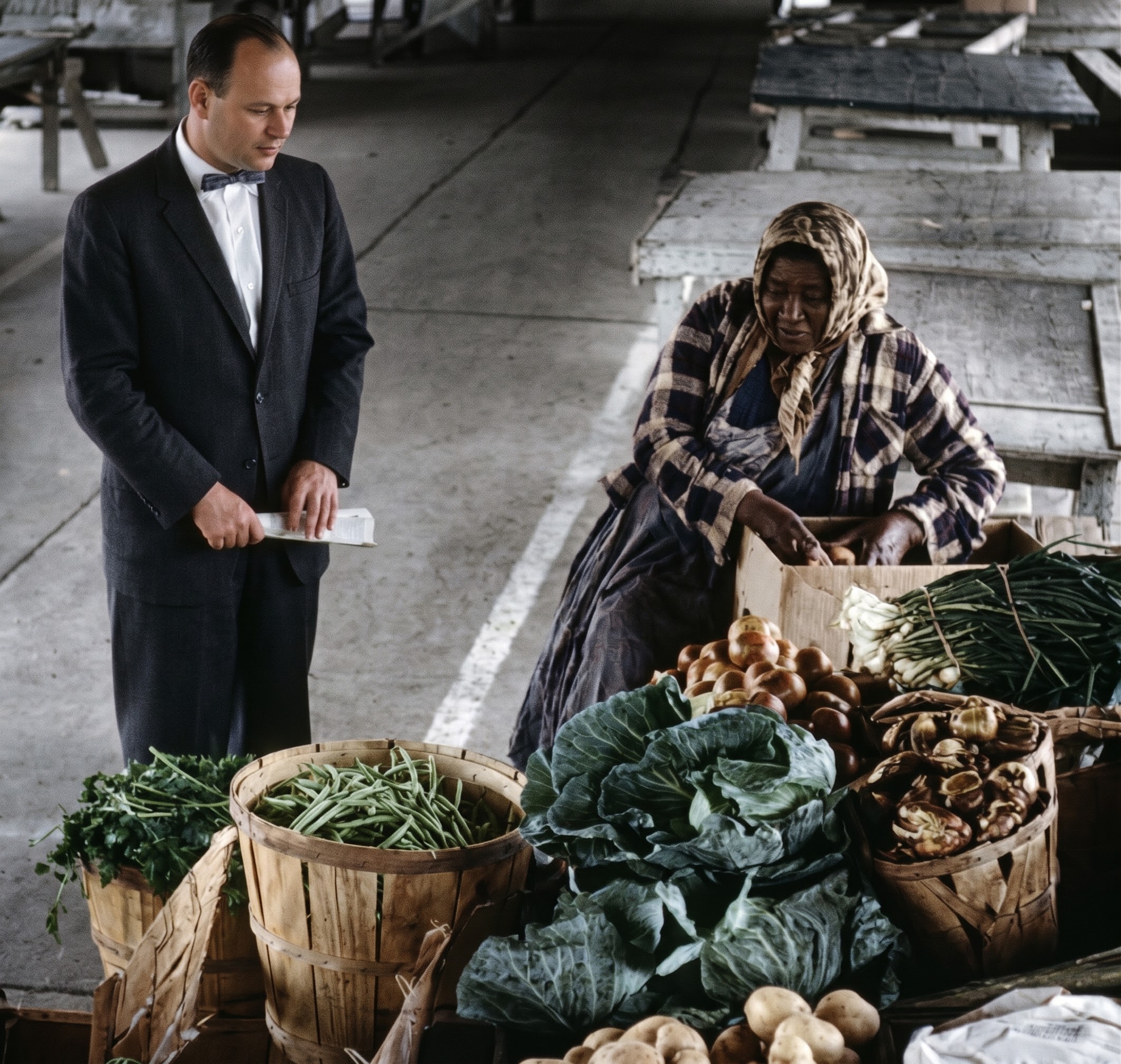
Delaware Barbour, who sold vegetables outdoors for 69 years, stood in the middle of the open-air Farmers Market at Union Terminal Market, 5th and Neal sts. ne., and said the place looked great, a sight for sore eyes.
Barbour told Casey how he got there:
“I started selling vegetables when I was eight years old,” he said. “I had a billy goat and a cart. Then, when I was 13, I got a horse. Then, in 1921, no more horses. I went to the old market on V st. sw. and then I came here, more than 30 years ago. I quit a couple of years ago, but now I’m coming back. I like it here. I’m 78, and I’m going to sell some vegetables.”
Dr. Murray Grant saw inadequate refrigeration, too few places to wash, dirt and flies. “The way this is now,” he said, “we can’t control it. We can’t prevent disease. Something has to be done about this.”
Casey summed it up:
The Farmers Market is a long steel shed, open at the sides and ends. Birds nest in the beams. It’s a picturesque place and there’s no wonder that Barbour loves it and no wonder either that Dr. Grant doesn’t.
From the Florida Avenue Market to Union Market
Dr. Grant won in the end. According to the nomination, the open-air farmers’ market closed in the urban renewal era over health code violations, and its owners chose to sell the land rather than fix them. An indoor retail market building, the D.C. Market, went up in 1968.
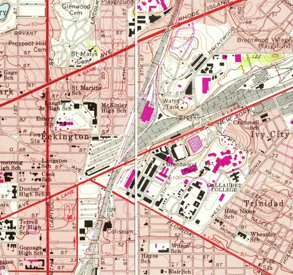
The wholesale side kept going. In the 1980s the District bought 8 acres along the western edge of the market and partnered with developers on a 200,000-square-foot building to keep wholesalers in the city. Many of the new firms were owned by Chinese and Korean immigrants, the nomination says.
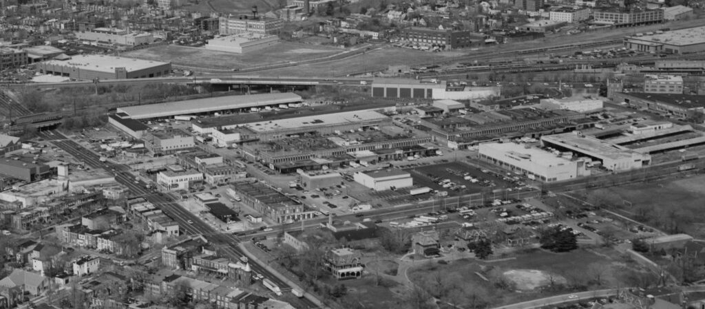
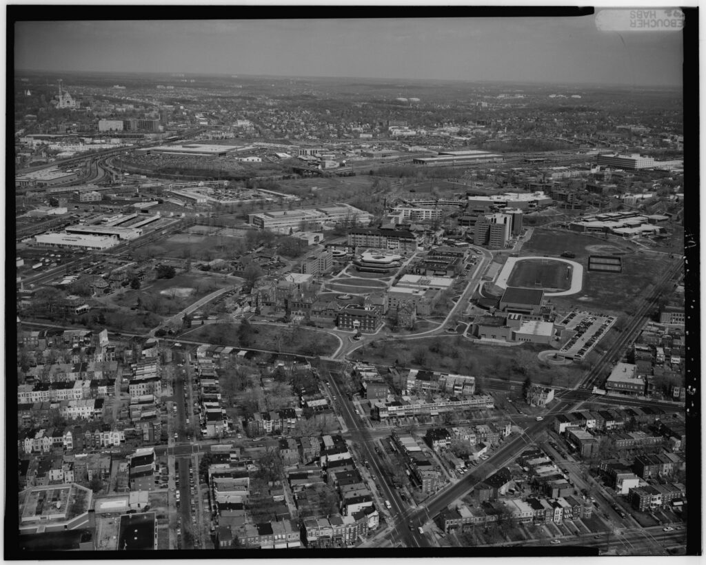
That’s the market photographers found in 2011 and 2012: meat and produce wholesalers still working out of the 1930s rows,, which by then were looking run-down.
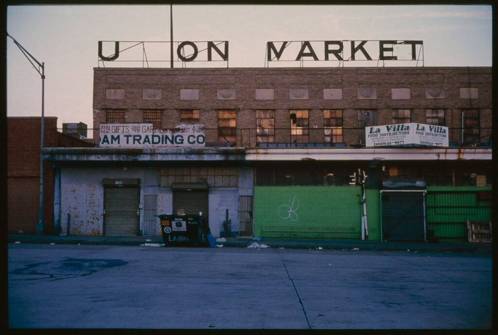
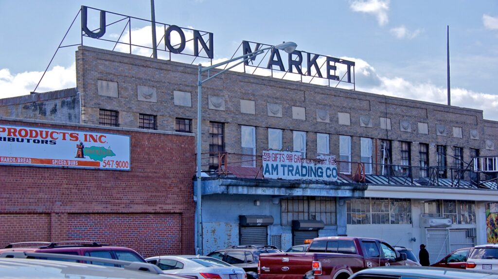
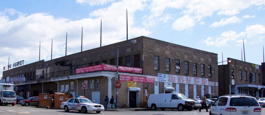
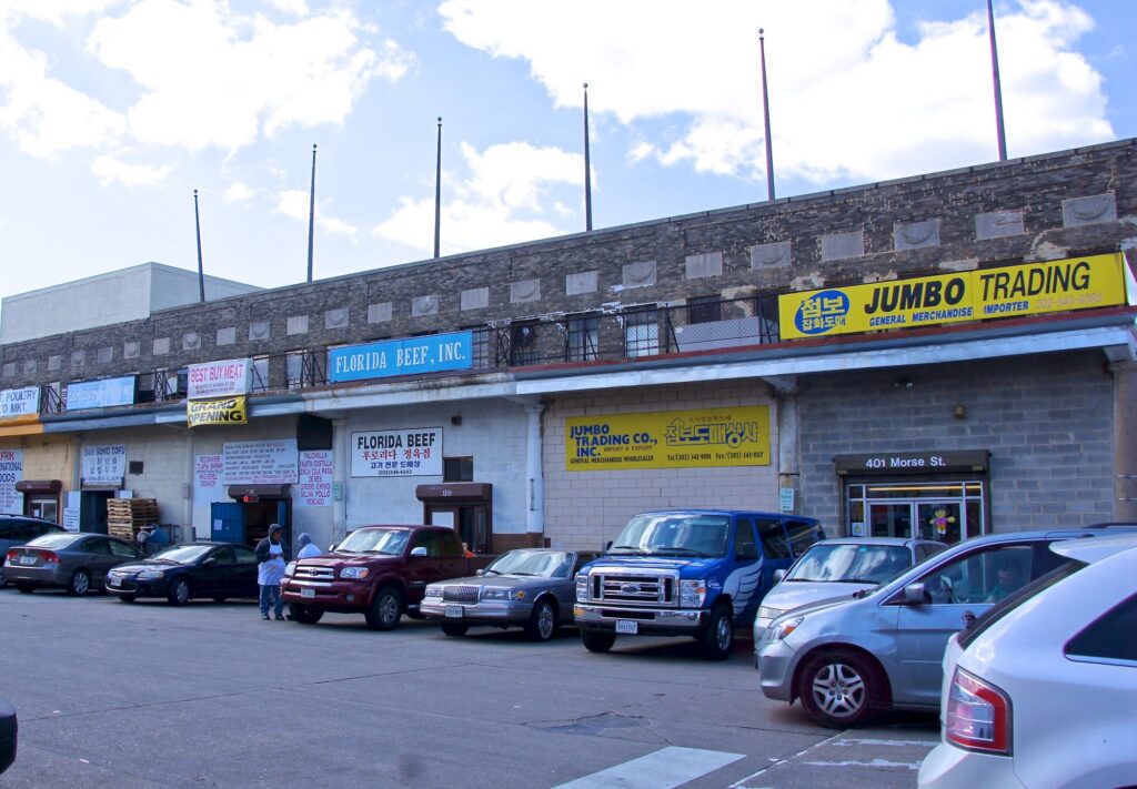
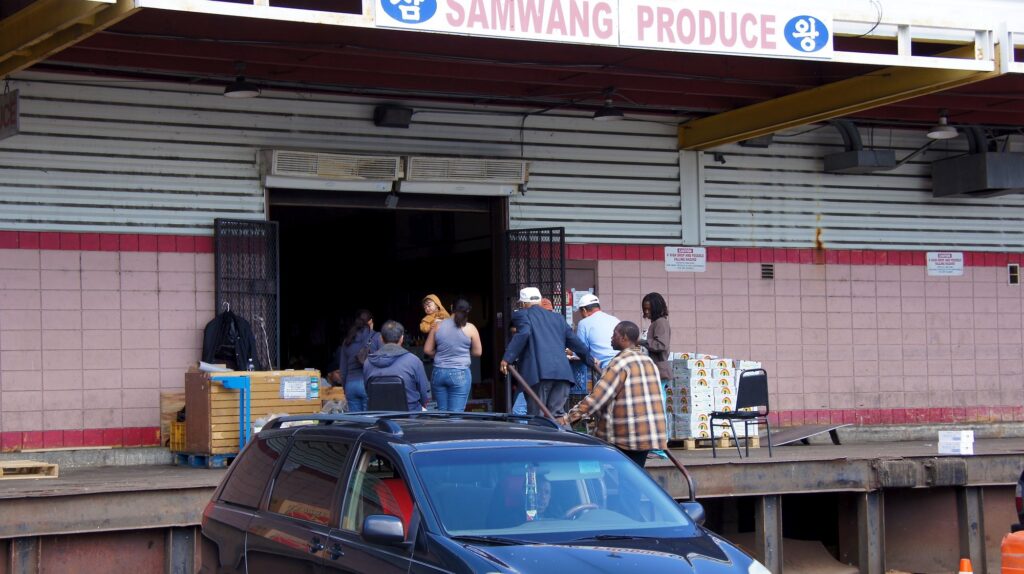
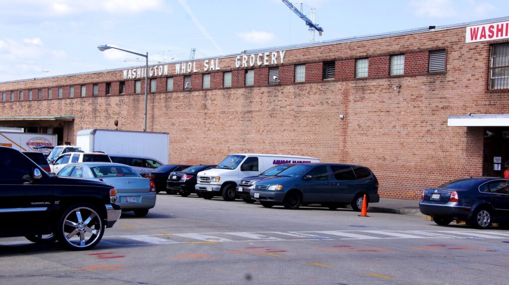
Then in 2012 the developer EDENS opened Union Market, the food hall, in the market’s old indoor building on 5th Street. The Historic American Buildings Survey notes that it replaced “the Florida Avenue Market’s enclosed venue of small stalls for butchers, fishmongers, and fruit vendors.”
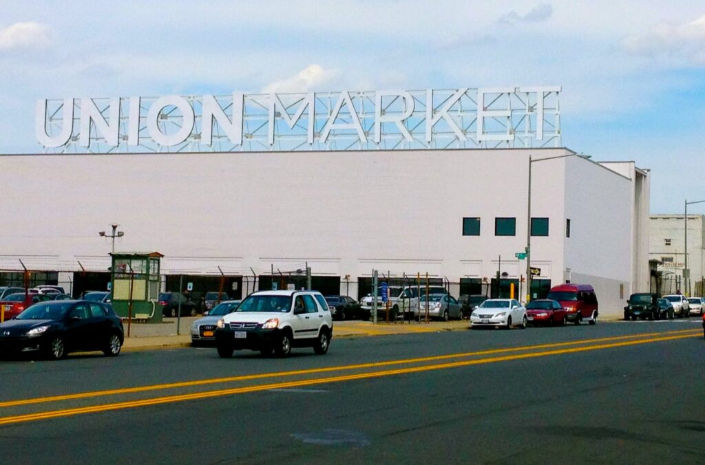
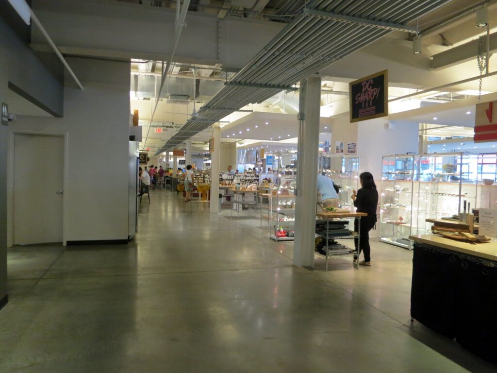
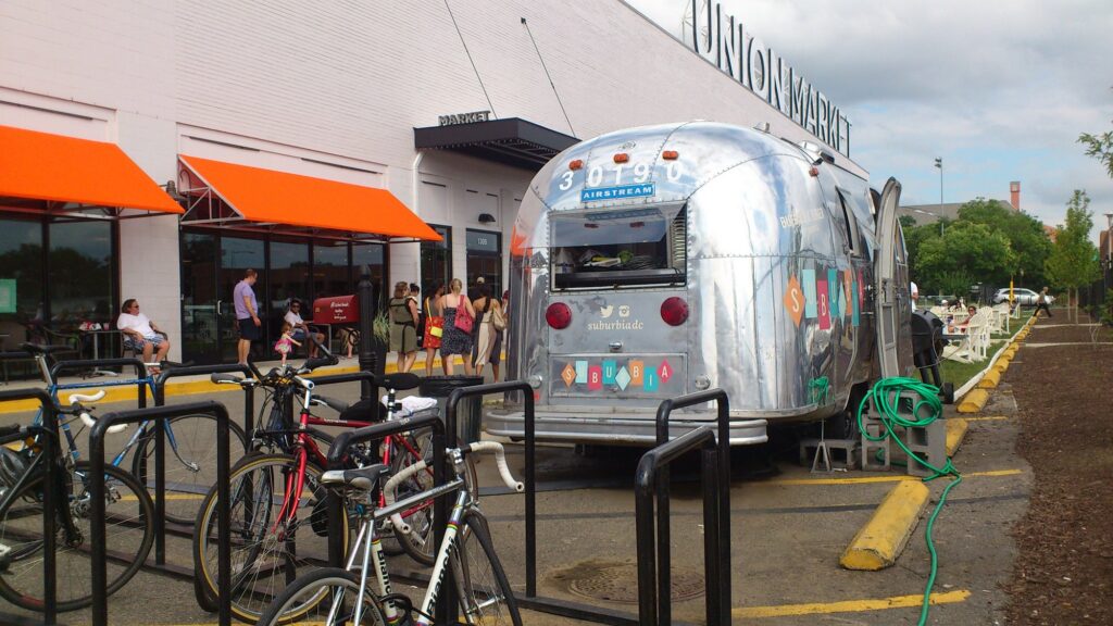
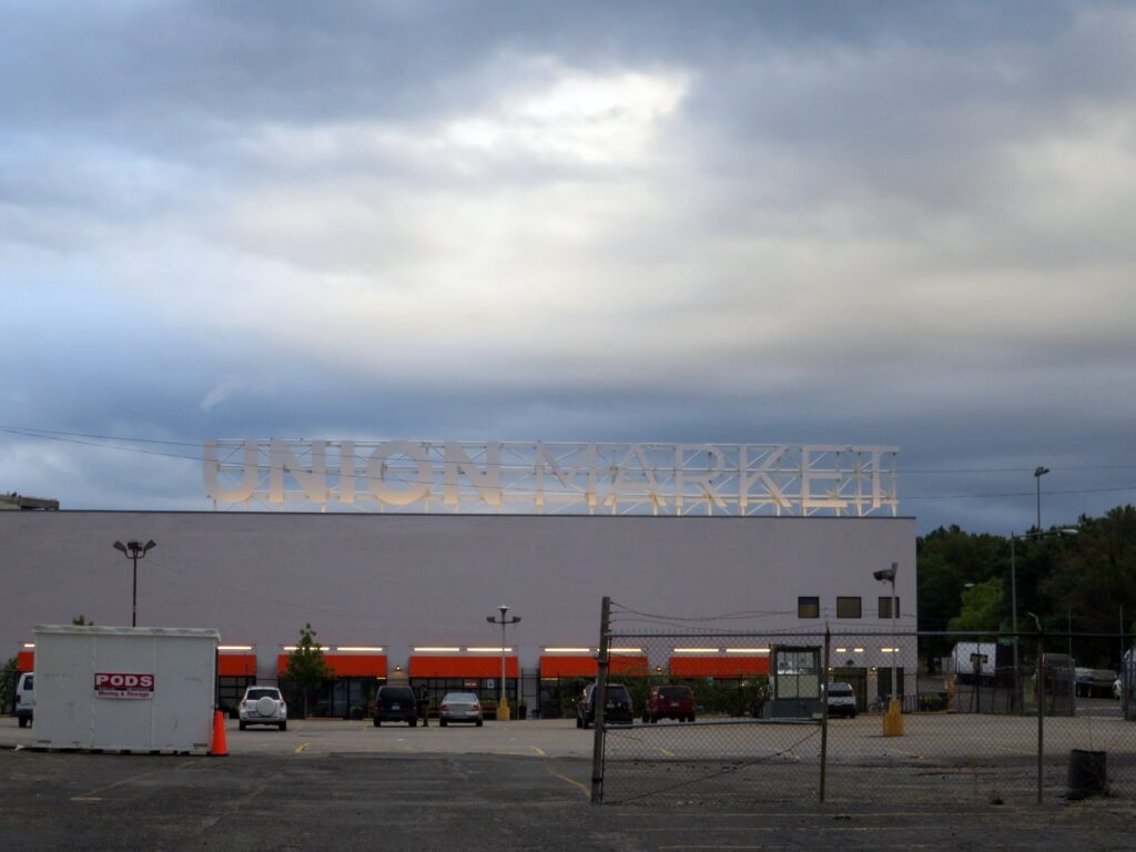
The original rows got their due too. The city designated the Union Market Historic District in 2016, and it was added to the National Register of Historic Places on January 31, 2017.
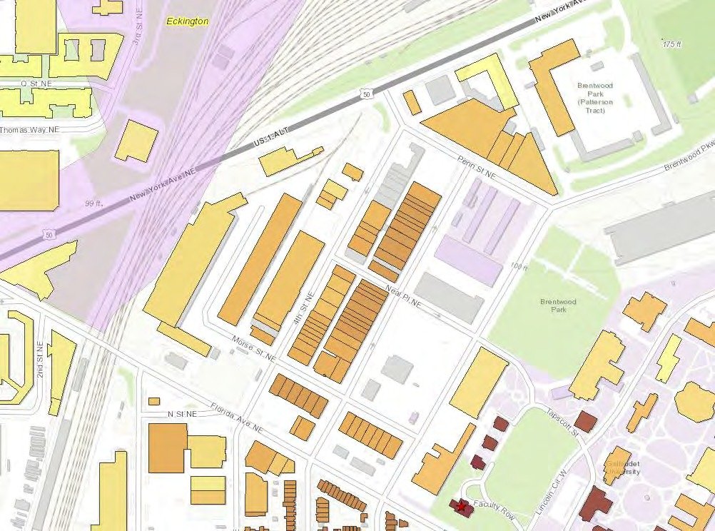
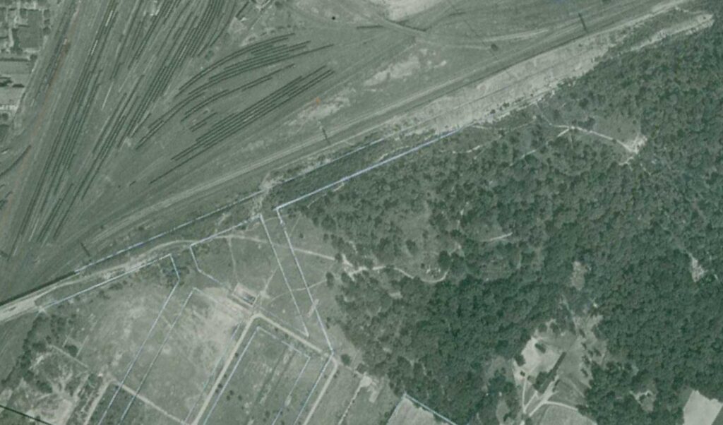
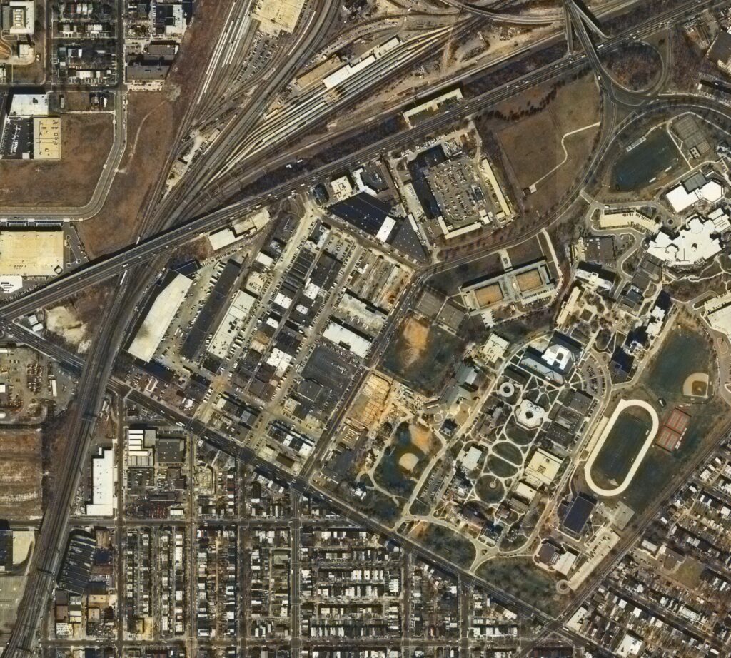
Compare the 1995 aerial above with the same view today. The new apartment towers have filled in the empty lots, but the 1930s market blocks are still there in the middle.
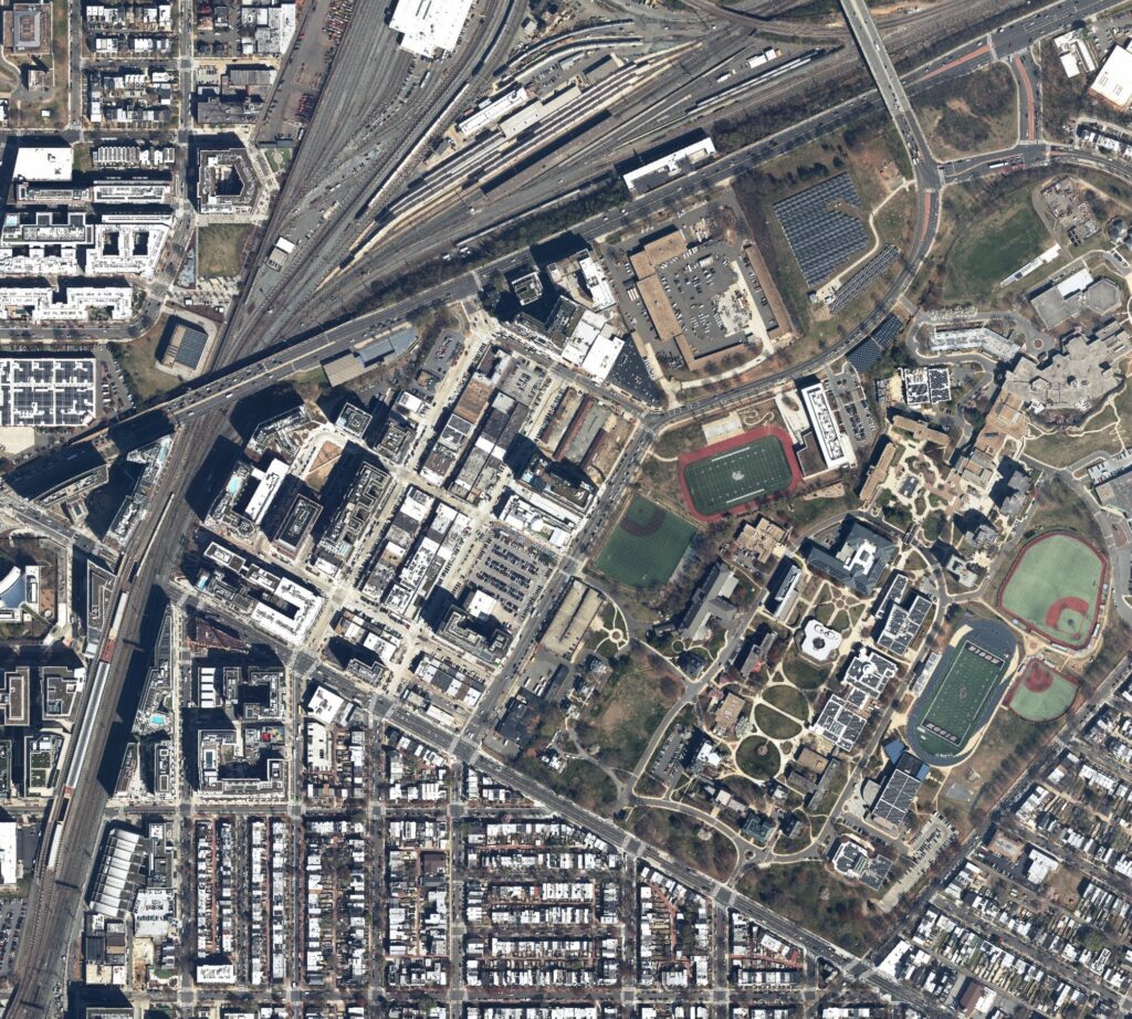
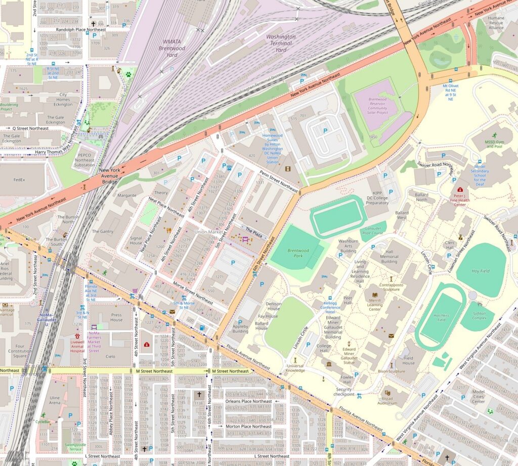
So the next time you’re in line at Union Market, look across 5th Street at those buff brick rows with the flagpoles on the roof. They went up between 1929 and 1931, built by the produce men the Federal Triangle pushed out of downtown, on an old army camp that had become the circus lot.
We use AI to help research, write and edit stories across our sites. Here’s how we use AI.Suggest a correction