
-
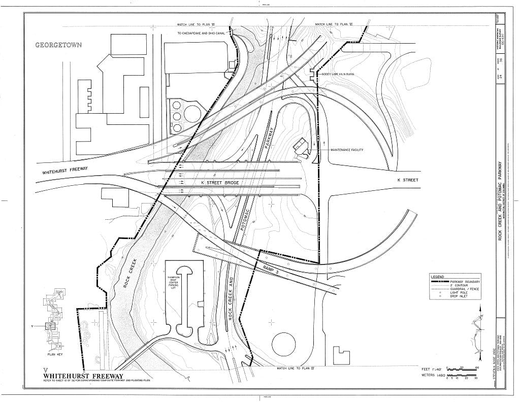
The Duo Who Built D.C.’s First Freeway: Archie Alexander, Maurice Repass, and the Whitehurst Story
In 1949, Washington opened its first elevated freeway—but the real story is the interracial engineering duo behind it. Discover how Archie Alexander and Maurice Repass built the Whitehurst Freeway and…
-
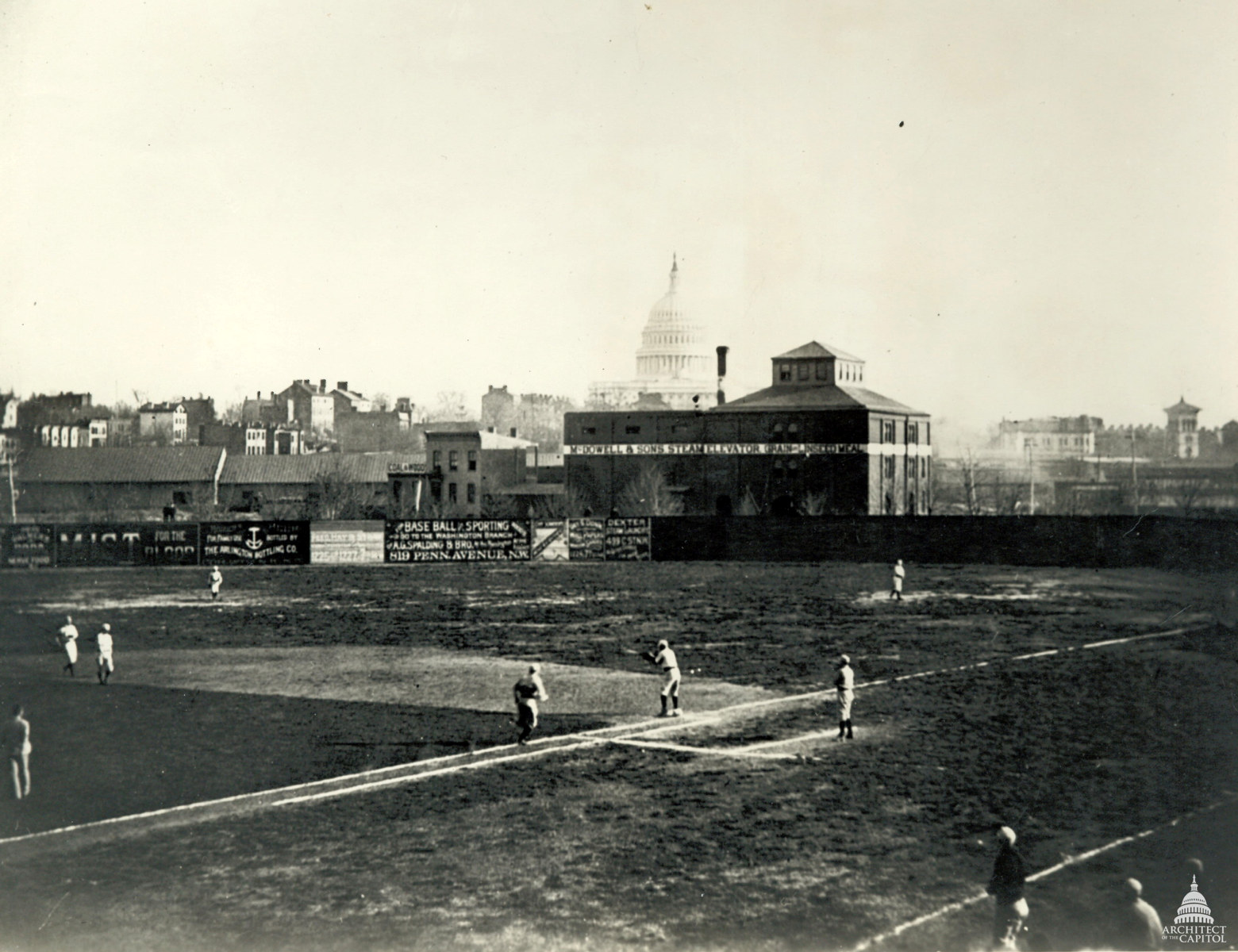
A Tragic Game at 14th and A: The 1912 Death of George S. Hiett
A fatal pitch during a 1912 church baseball game at 14th and A Streets NE claimed the life of George…
-
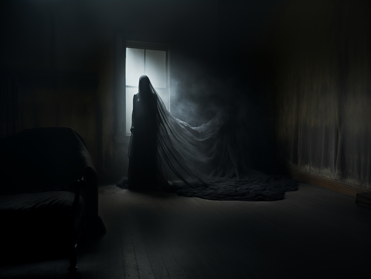
The Tragic History of a Potentially Haunted Home in Adams Morgan
A peek into the tragic history of a purportedly haunted home in Adams Morgan: could the tormented spirits of the…
More Featured Stories
-
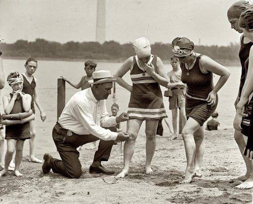
Bathing Suit Police at the Tidal Basin
-
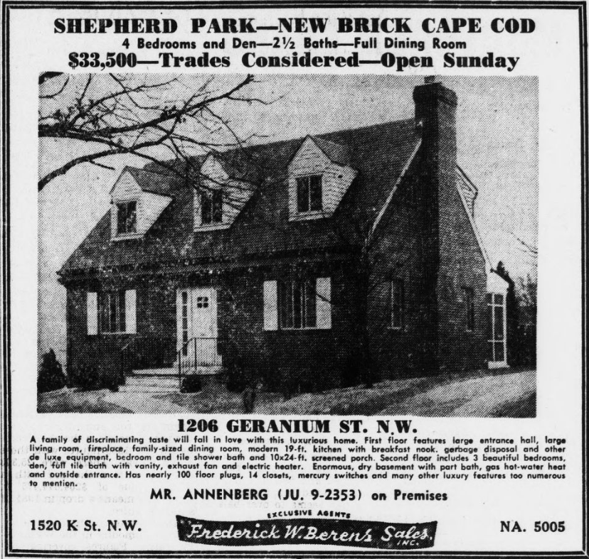
Three Homes for Sale 70 Years Ago
-
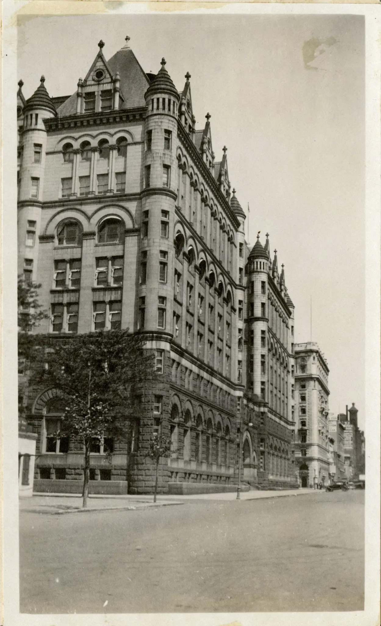
A Historical Look at the Old Post Office Pavilion, Now the Waldorf Astoria
-
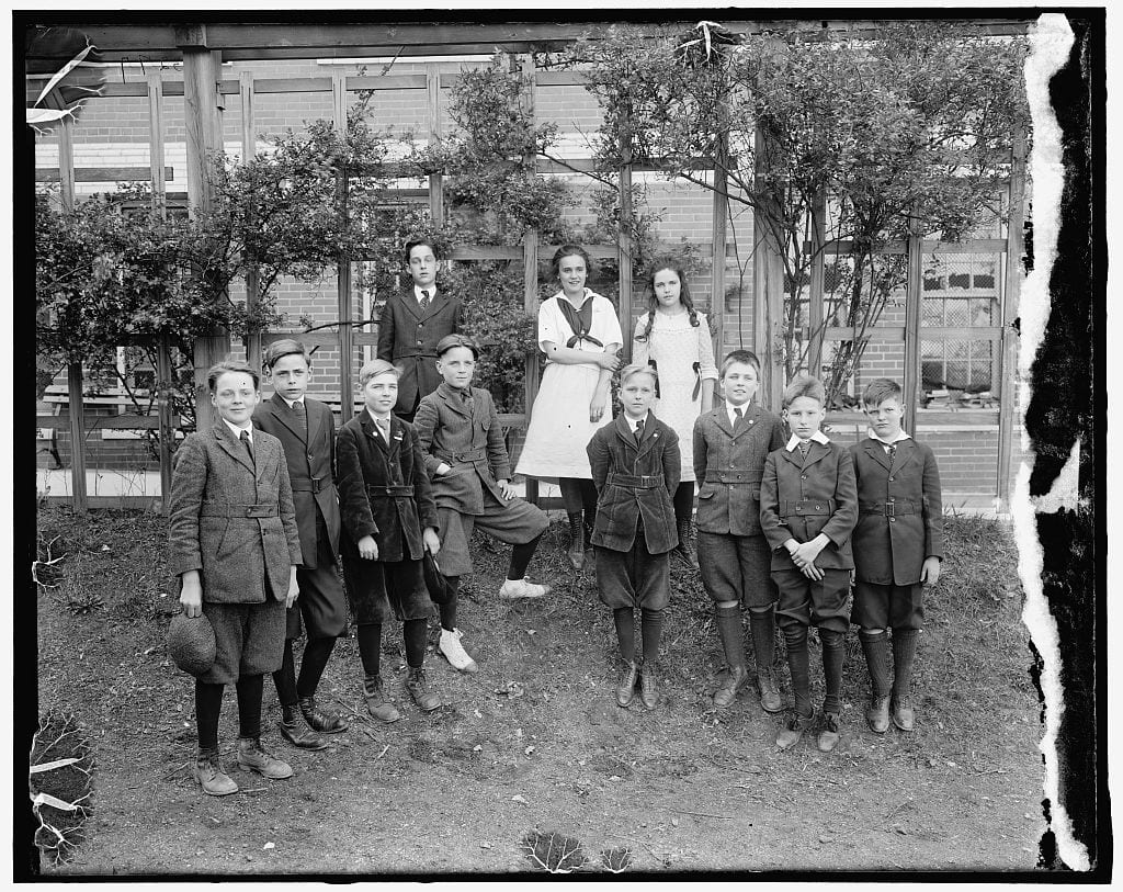
Exploring the History of D.C. Public Elementary Schools: Janney, Gibbs, Eaton and Watkins
-
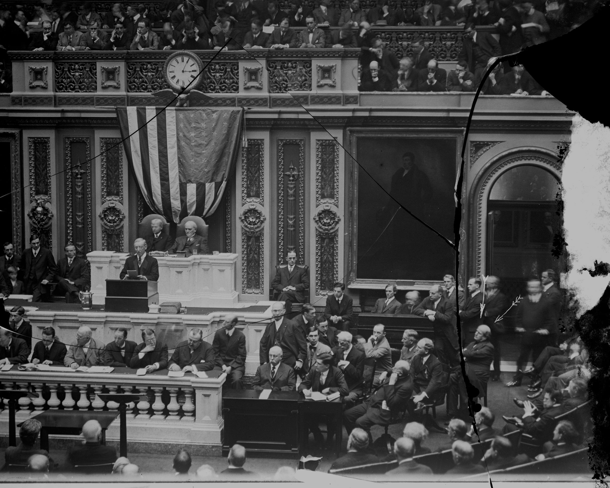
Woodrow Wilson’s 1913 State of the Union
-
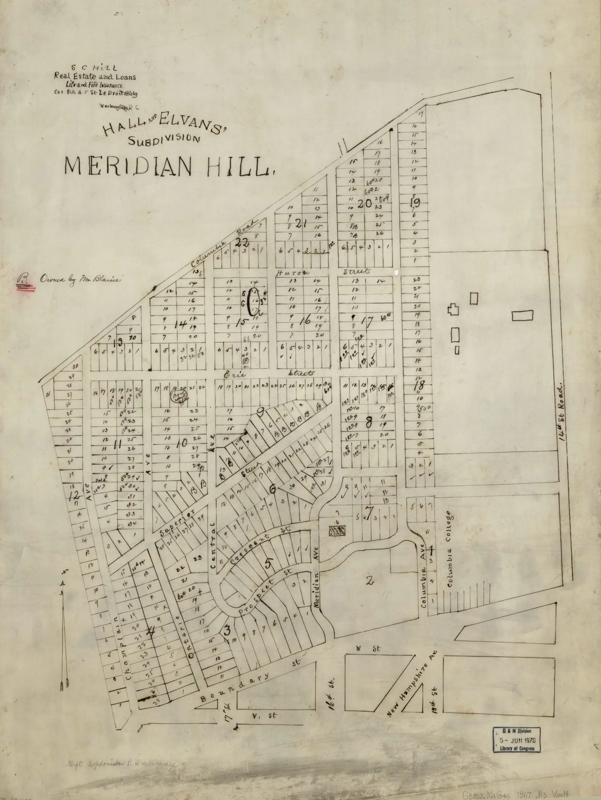
An Alternate View of Meridian Hill in 1867