
Ghosts of DCThe lost and untold stories of Washington

Try an address, a neighborhood, a name or a year, like “14th and U” or “1968.”

Not sure where to start?

Arlington County Map From the 18th Century

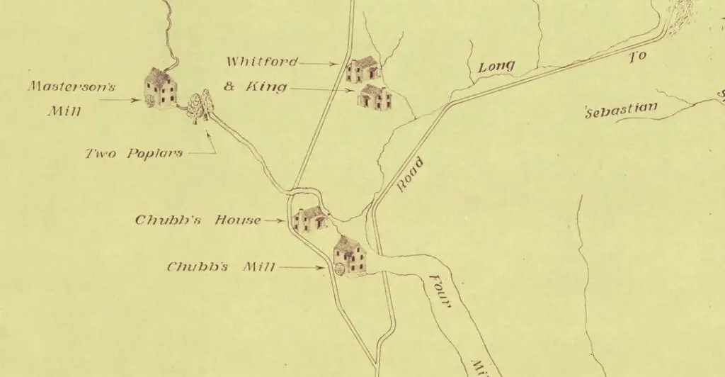
How cool is this? A Library of Congress map showing Arlington County as it looked in the 18th century, plus a link on why it’s named Arlington.

Posted 1 min read

How cool is this old map of Arlington? It shows Arlington County as it looked in the 18th century. By the way, do you know why it’s named Arlington?

Arlington County in the 1700s
Arlington County in the 1700s (Library of Congress)
The Email

Lost Washington stories, in your inbox.

The newest story, plus a few from the archive.

Free. Unsubscribe anytime.

We use AI to help research, write and edit stories across our sites. Here’s how we use AI.Suggest a correction

Filed underGoDCers Love Maps

Topics1790s · Arlington

Pass it on

Know someone who’d like this?

Send it to them.

Email it
Read nextThe Ball Family Behind Ballston’s NameBallston’s name goes back to the Ball family and a crossroads tavern, long before the Metro station and office towers arrived in Arlington.Keep reading8 min read