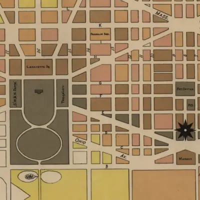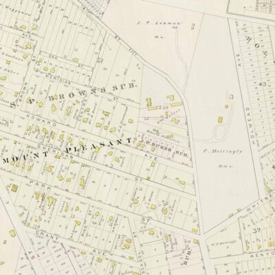
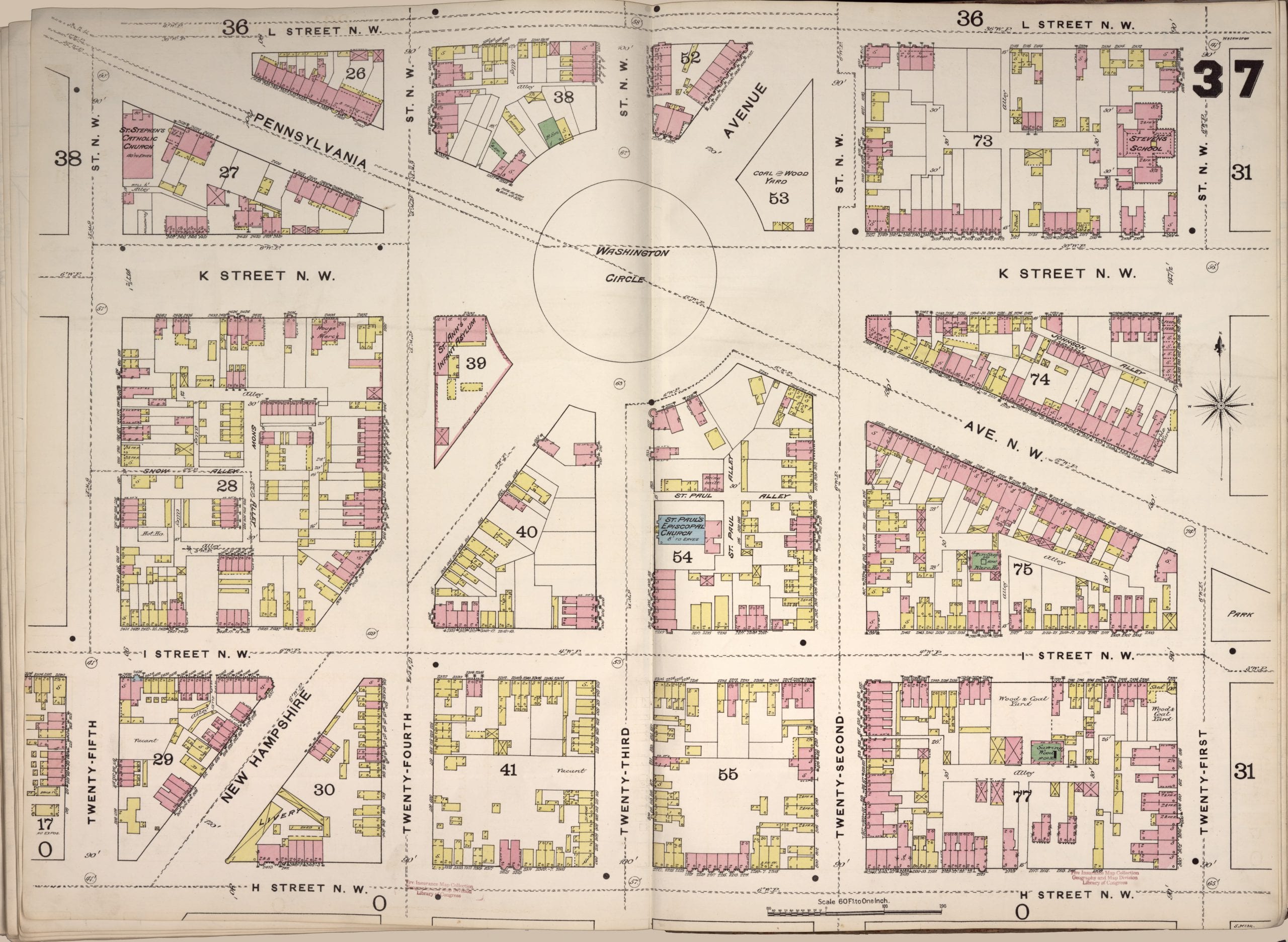
Below is the Sanborn fire map for Washington Circle in 1888. It’s pretty amazing to see how many residential structures there are at the time. Not only that, but quite a few of them were frame structures (in yellow).

Below is the Sanborn fire map for Washington Circle in 1888. It’s pretty amazing to see how many residential structures there are at the time. Not only that, but quite a few of them were frame structures (in yellow).