
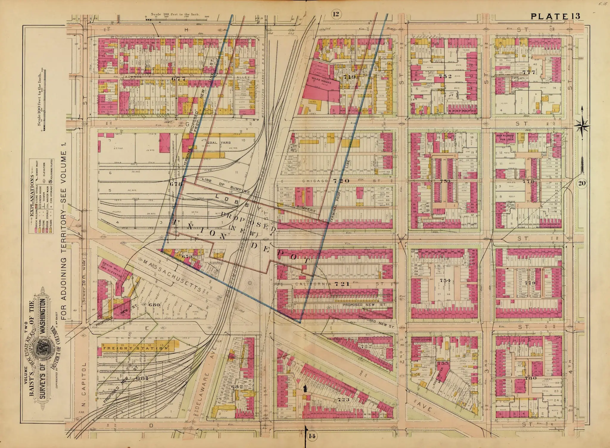
Here’s another map of Swampoodle from 1903. Make sure you check out the 1888 one and compare them. This has the proposed Union Station superimposed over the neighborhood and you’ll see some familiar street names which appear to have been recycled in different neighborhoods.
Was this considered a disregard for the Irish Community at the time?
I hate to be a nudge but its hard to compare the two when they only overlap by one block.
FWIW, the plat map depicted above is available for free on Library of Congress’ website. they have a ton of maps, many as a very large high resolution scans, including three editions of Baist’s plat atlases that are great indicators of a changing DC landscape.