-ad 189-

Exploring the Origins of Columbia Heights: A Look at an 1885 Map

Discover the origins of Columbia Heights in this 1885 map. It shows what would become the northern part of Columbia Heights and points to the street name changes that took place. Click through to view the full-sized map!
-ad 188-

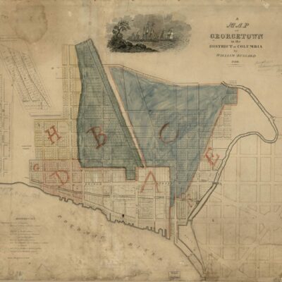
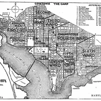
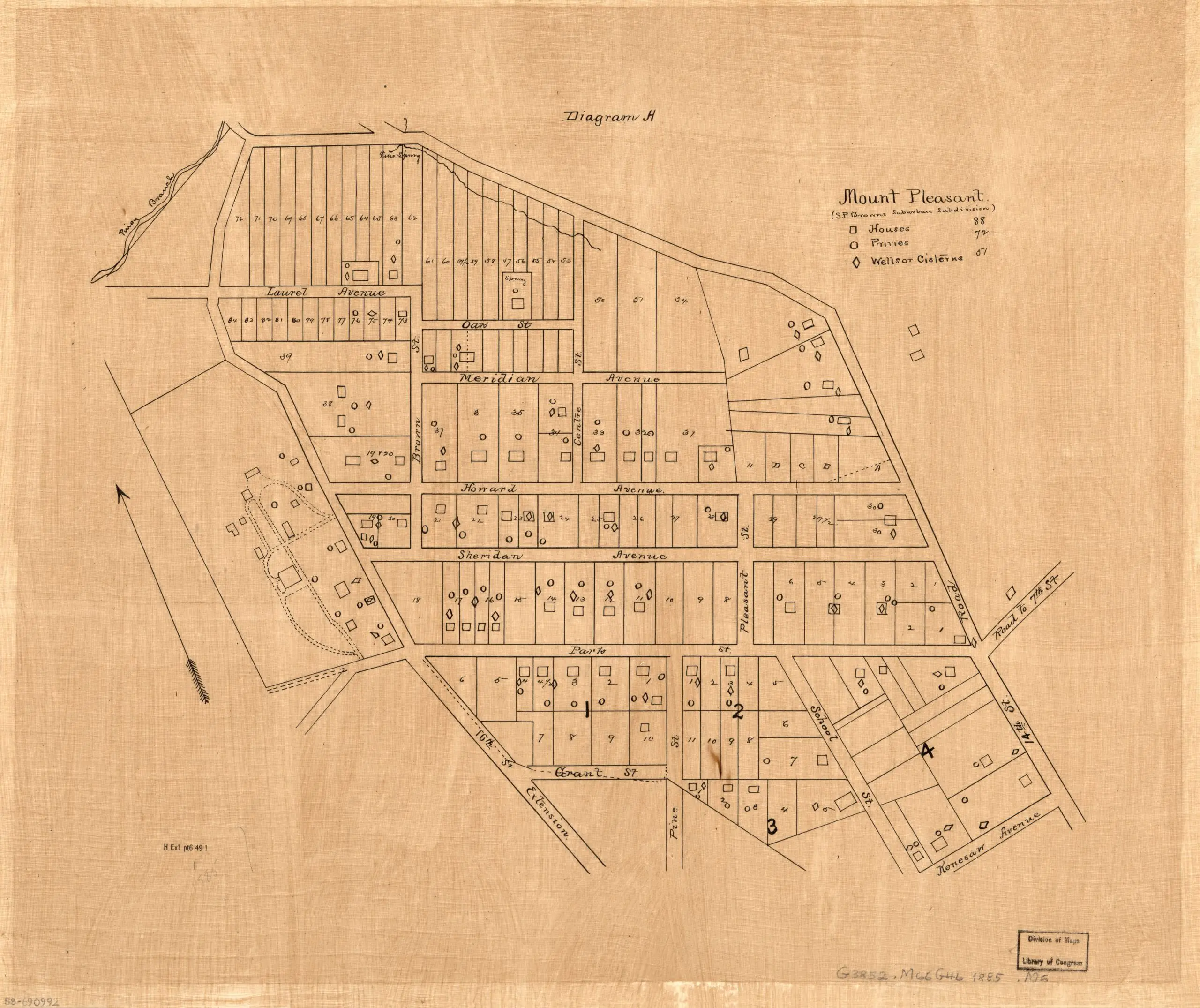
This 1885 map shows what would become the northern part of Columbia Heights. At the time, it was still referred to as part of Mt. Pleasant. The arrow at left points to north. Also, some street names were renamed, so Howard became Newton and Sheridan became Monroe. Click on it for a larger version.

1885 map of Columbia Heights

Source: Library of Congress

-ad 617-

Enjoy daily

Ghosts of DC stories.