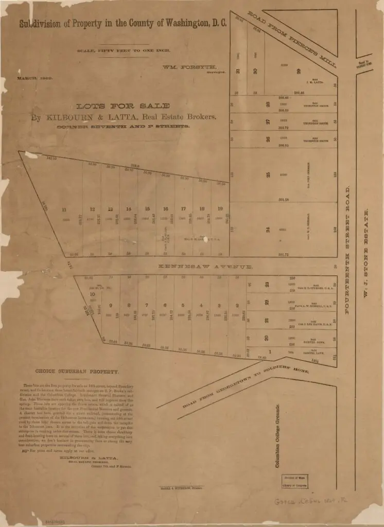
Take a look back in time and explore Columbia Heights in 1869 with John Sherman's Subdivision. This property map is full of interesting details, like old street names and the location of Pierce's Mill. Click to learn more!
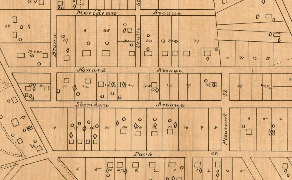
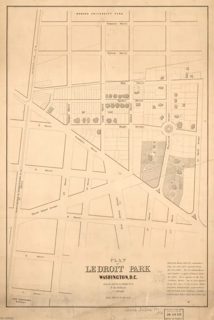
Discover the origins of Columbia Heights in this 1885 map. It shows what would become the northern part of Columbia Heights and points to the street name changes that took place. Click through to view the full-sized map!
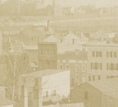
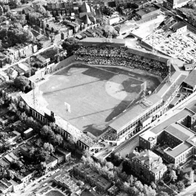
Take a look at this incredible 1922 photo of Washington, D.C. taken from the air. Click on the image for a larger version and explore the city's history up close!
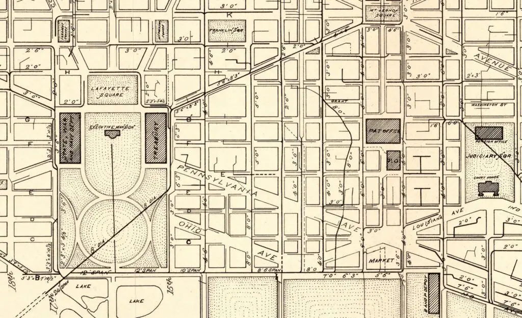
Explore these fascinating maps of Washington DC from 1885, which may not seem interesting to you at first, but are sure to draw your attention once you click on them and see the details.
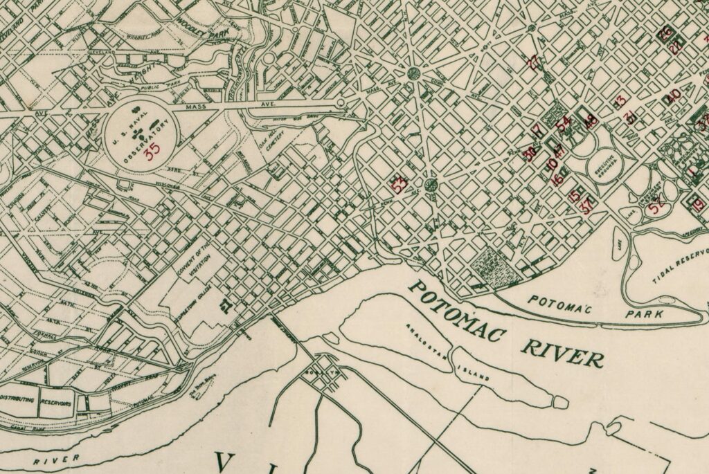
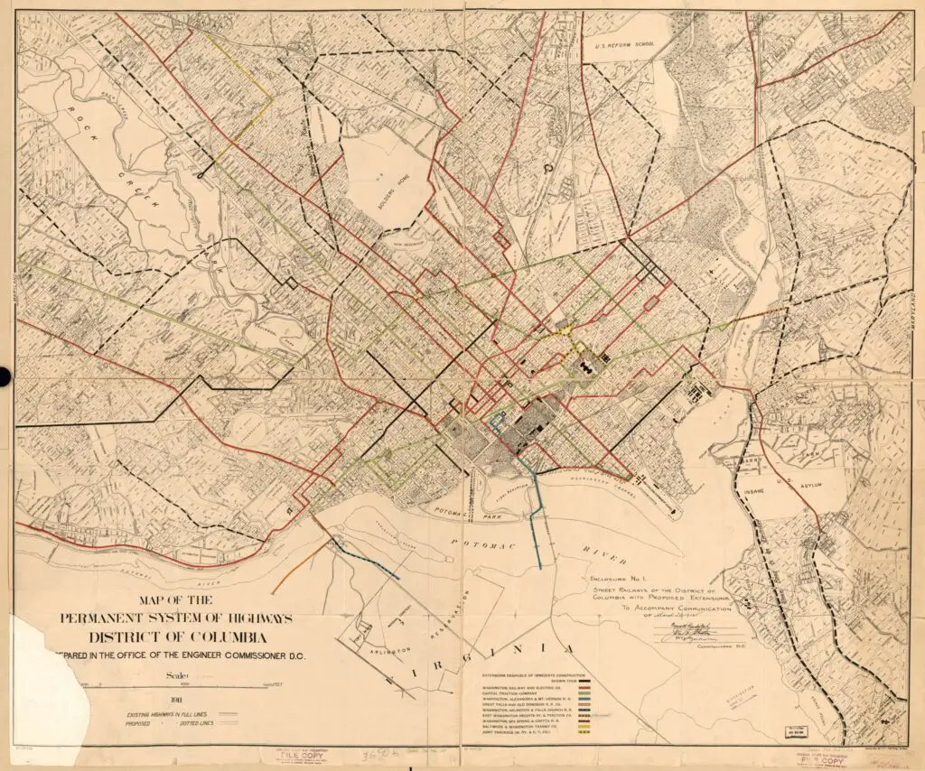
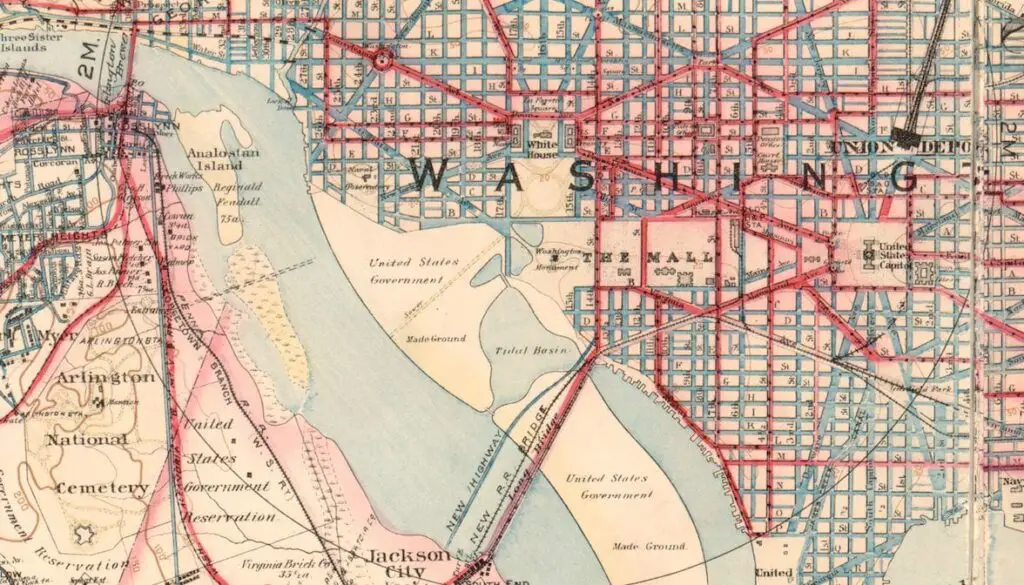
Explore the highways of Washington, D.C. in 1911 with this historic map from the Library of Congress. See roads, routes, and more from over 100 years ago.
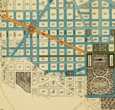
Take a look at this historic map of the Washington streetcar system from 1912, courtesy of the Library of Congress! Click to see a bigger, detailed version of this fascinating map.
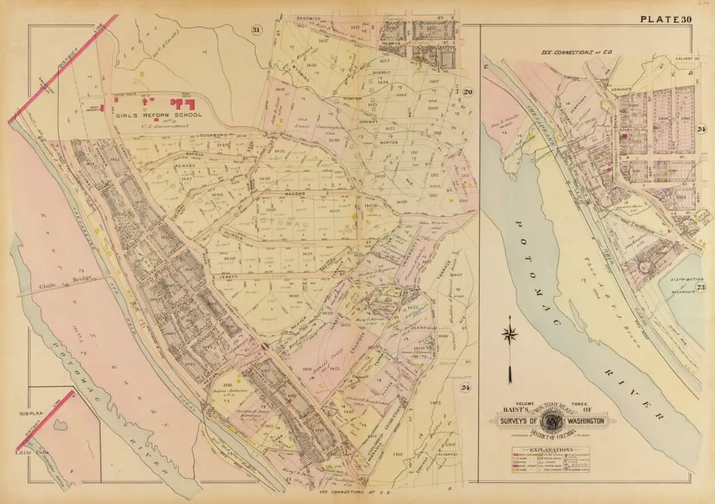
Mrs. Ghost, Ghost Baby and I spent a nice Saturday afternoon celebrating a birthday at a lovely home in the Palisades. We found an old 1909 map of the area. Check out the results and the source of the map in our blog post!
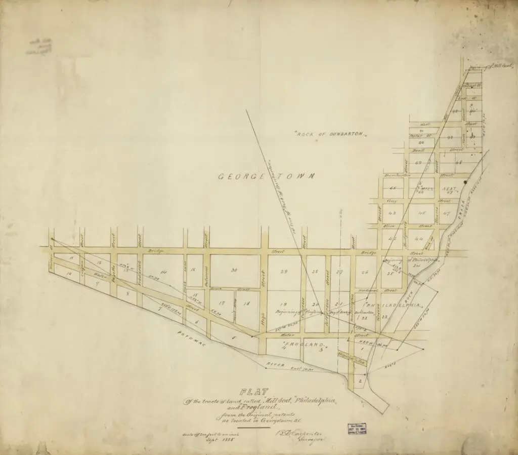
Take a journey back in time and explore the old Georgetown neighborhoods of 1885 with this map. Learn about the history of the area and discover the original patents of Mill Seat, Philadelphia, and Frogland.
Explore Washington, D.C. in 1904 with this amazing map from the Library of Congress. Click on it to zoom in and see the incredible amount of detail. Don't miss this chance to explore the city's past!