-ad 189-

Posted In GoDCers Love Maps

Lincoln Park Baist real estate map in 1903
Exploring Lincoln Park with an Amazing 1903 Map
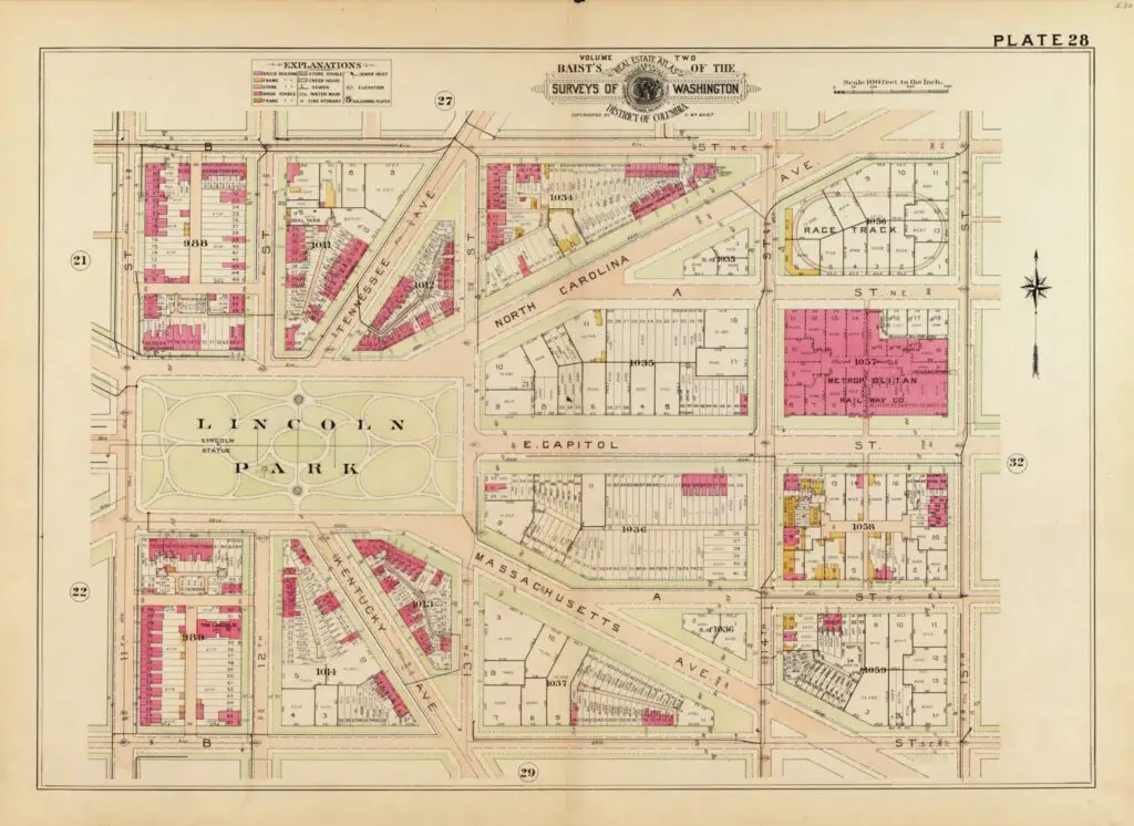
Explore the historic Lincoln Park neighborhood with an amazing 1903 map. Look at the many vacant lots and the race track at 15th and North Carolina Ave. GoDCers love maps! #LincolnPark #GoDC #GhostsofDC
map of Georgetown in 1915 (Baist real estate atlas)
Explore Georgetown in 1915 with this Baist Real Estate Atlas Map
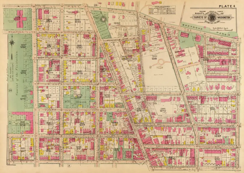
Explore Georgetown in 1915 with this Baist Real Estate Atlas Map. See what the area looked like over 100 years ago with this fantastic map featuring streets, buildings and more.
Old plat of Georgetown (gutenberg.org)
Two Incredible Old Maps of Georgetown
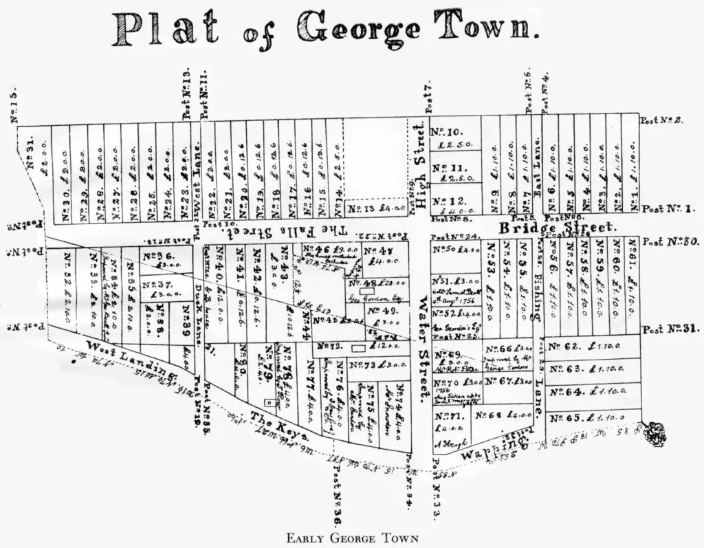
Check out these two incredible old maps showing Georgetown! We know how much GoDCers love maps, so here you go. A street map and a detailed plat of Georgetown.
2375082552_cec54ea234_b
Exploring the History of St. Matthews Episcopal Chapel at the Navy Yard
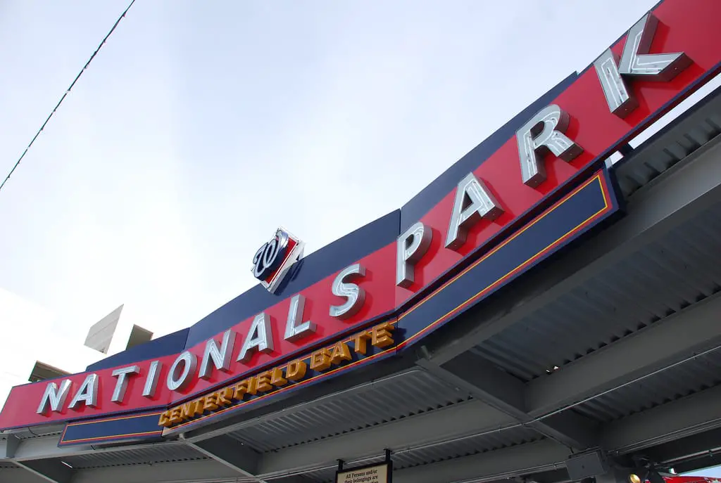
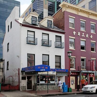
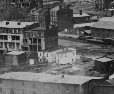
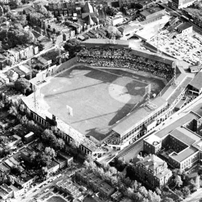
Take a closer look at St. Matthews Episcopal Chapel at the Navy Yard in 1921 and today. Learn more about the history of the area around Nationals Park and the stories of its former residents.
Baist map of U St. and Shaw (1921)
Exploring the U Street and Vermont Ave. NW Area Through Real Estate Maps
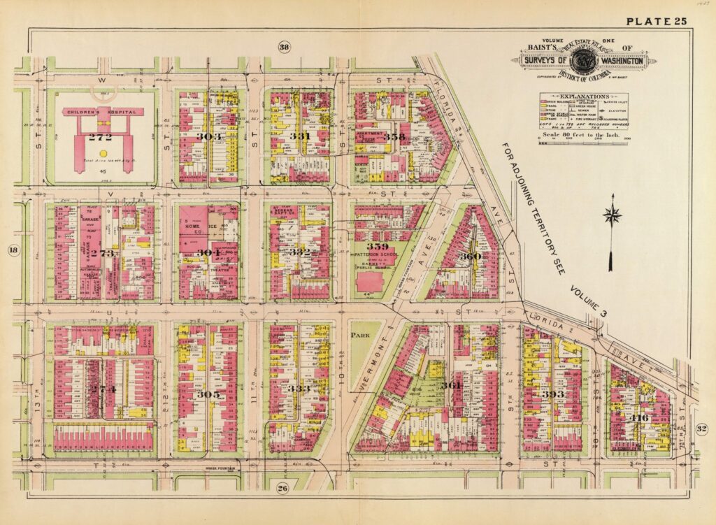
Check out the Baist real estate maps of the U Street and Vermont Ave. NW area to see how the neighborhood has changed over the years. See what Dodge City, Nellie's, and Brixton looked like in 1903 and 1921!
Map exhibiting the property of the U.S. in the vicinity of the Capitol : colored red, with the manner in which it is proposed to lay off the same in building lots, as described in the report to the Sup't of the city to which this is annexed / BHLatrobe, one of the surveyors of the city of Washington, Dec. 3d 1815.
Explore a Rare 1815 Property Value Map of Washington, DC
Check out this rare 1815 property value map of Washington, DC. Click on the map for greater detail and discover the city's history.
City of Washington, statistical maps / compiled by Lieut. F.V. Greene, assistant to the Engineer Commissioner, July 1st 1880 ; compiled by Lieut. F.V. Greene, U.S. Eng'rs ... to accompany the annual report of the Commissioners of the District of Columbia for the year ending June 30th 1880 ; Wm. T.O. Bruff, del., Eng'r Dept., D.C.
Shaw, Mt. Vernon Square, and Dupont Circle: A 19th-Century Property Value Comparison
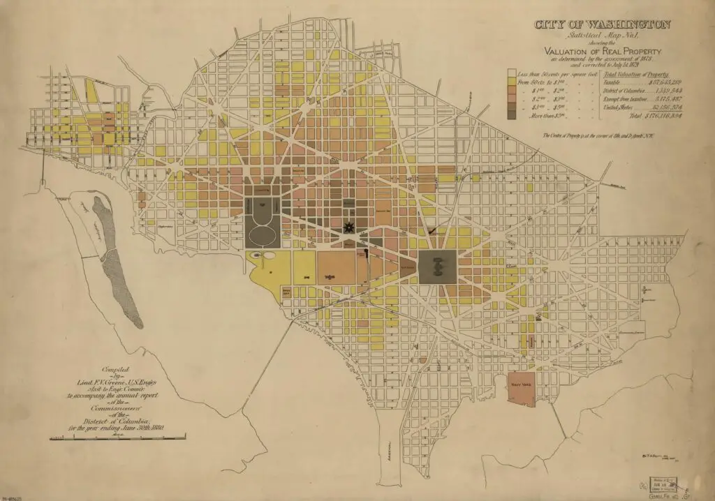
Property in Shaw and Mt. Vernon Square is worth three to four times more than in Dupont Circle. This is a fascinating map from the Library of Congress. Click the map for greater detail and learn more about this amazing piece.
1907 Baist real estate atlas for Ledroit Park and Bloomingdale
Explore the 1907 Baist Real Estate Map of Bloomingdale and LeDroit Park
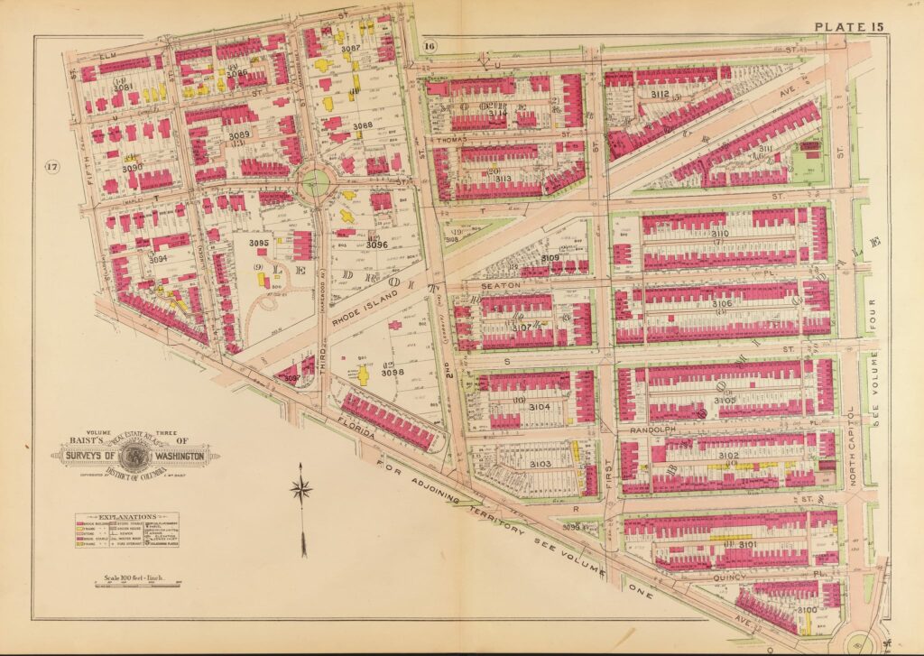
Discover the 1907 Baist Real Estate Map of Bloomingdale and LeDroit Park. See how the area has changed over the years and explore popular establishments like Big Bear Cafe, Rustik, and Boundary Stone.
Isometrical view of the Presidents House, the surrounding public buildings, and private residences - 1984 (LIbrary of Congress)
An Isometrical View of the White House and Surrounding Area in the 1850s
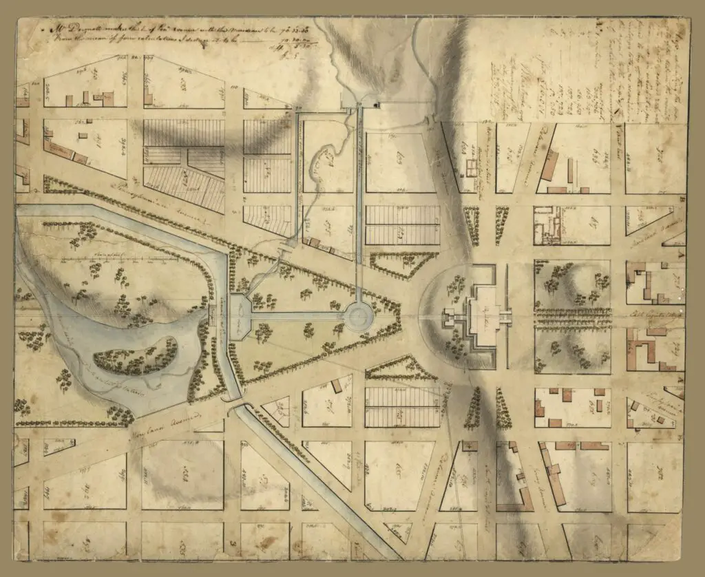
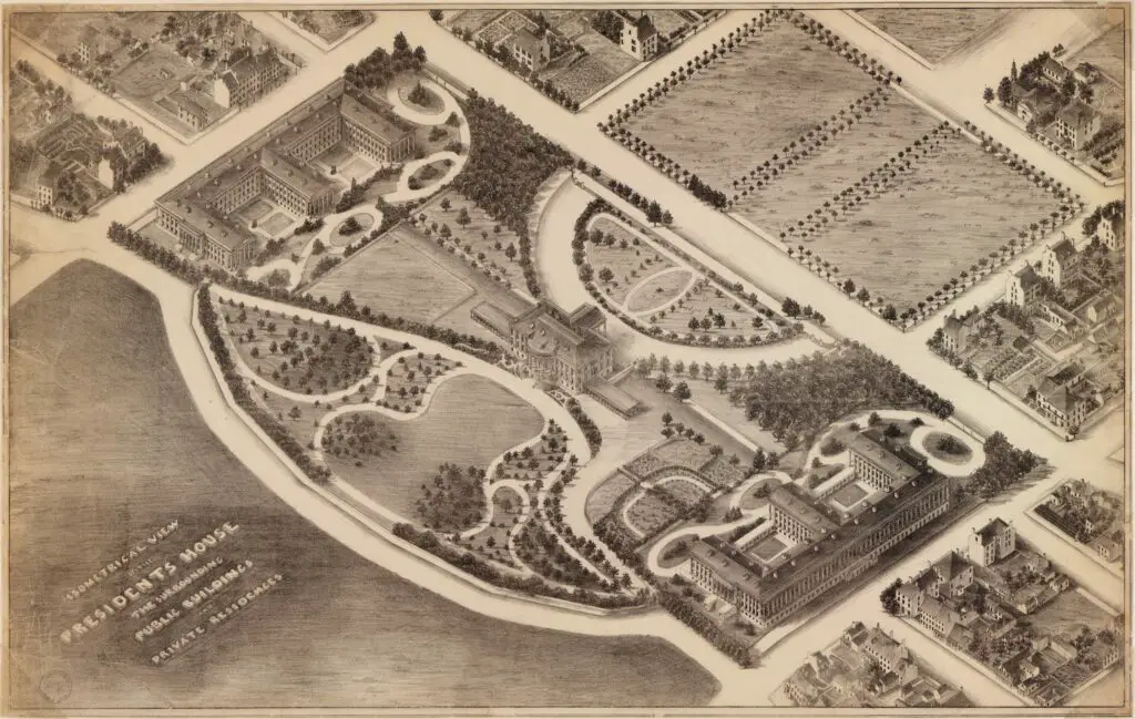
Take a look at an isometrical view of the White House and the surrounding area in the 1850s. This unique view was found in the Library of Congress archives and was done in 1984.
Map of the city of Washington D.C. : established as the permanent seat of the government of the U.S. of Am. / James Keily, surveyor. - 1851 (Library of Congress)
Discovering an Amazing Old Map of Washington, D.C. from 1851
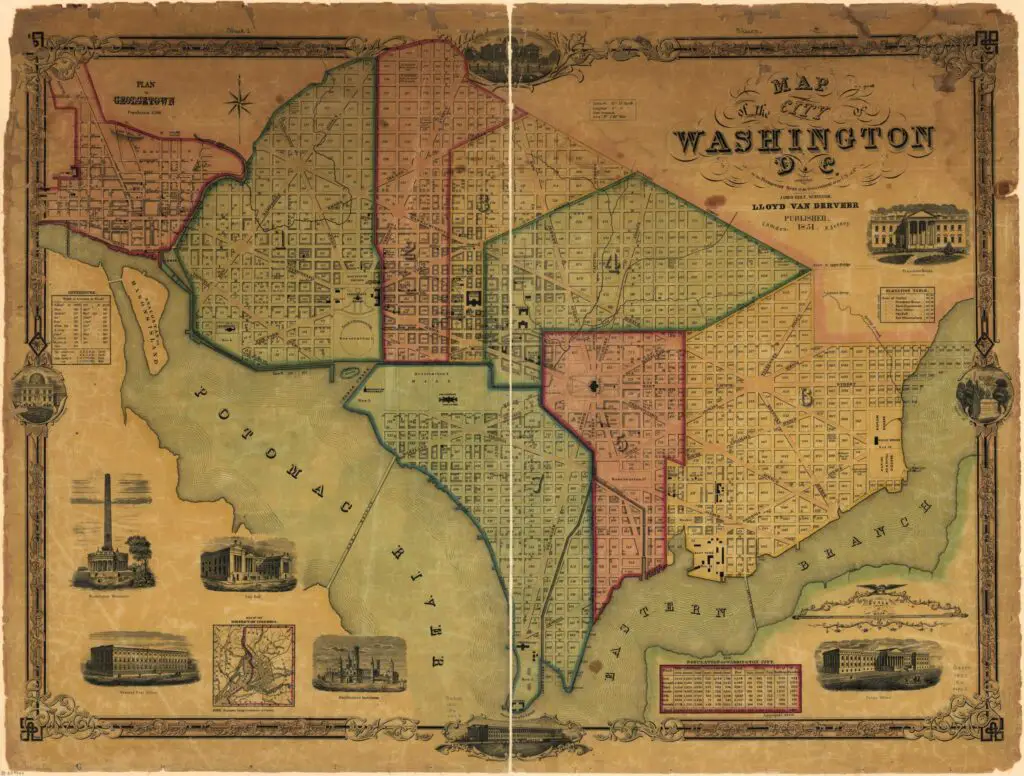
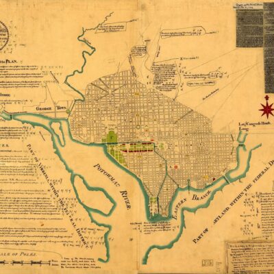
Check out this amazing 1851 map of Washington, D.C.! I found this gem on the Library of Congress' website. Sign up for our updates and follow us on Facebook for more discoveries from Ghosts of DC.

Enjoy daily

Ghosts of DC stories.