-ad 189-

Posted In GoDCers Love Maps

Fairfax
Cool! Rural Mail Delivery Routes for Fairfax County
1912 map of rural mail delivery routes in Fairfax County, Virginia.
PG County
Detailed 1861 Map of Prince George's County
Detailed 1861 map of Prince George's County, Maryland.
1865 Civil War map of D.C.
Exploring the 1865 Civil War Map of Washington, D.C.
Explore the 1865 Civil War Map of Washington, D.C. from the Library of Congress and discover road and fort locations at the end of the war.
1795 Plan of the City of Washington
Exploring the 1795 Plan of the City of Washington
Explore the first official plan of Washington D.C., published by Andrew Ellicott in 1792. Courtesy of the David Rumsey map collection.
1921 map of Foxhall Crescent
Exploring Foxhall Crescent in 1921: A Map of a Very Rural Area
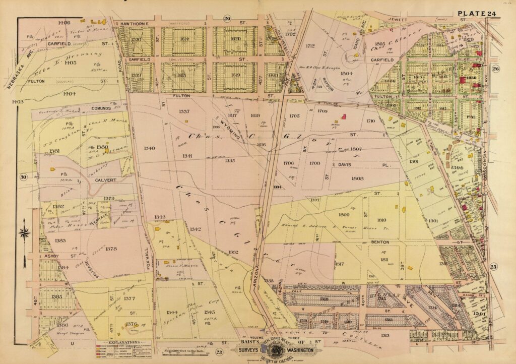
Take a look at this 1921 map of Foxhall Crescent, a very rural area in Washington, DC. Learn more about the history of this area and explore the map to see what it looked like in 1921.
1907 map of Petworth
A Look at a 1907 Map of Petworth
Check out this amazing 1907 map of Petworth, and then look how rural it was to the west. Amazing.
1907 map of Mount Pleasant
Exploring the Undeveloped Mount Pleasant of 1907 Through a Fascinating Map
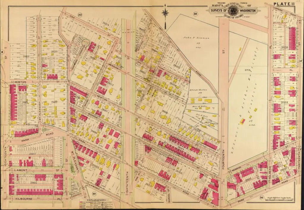
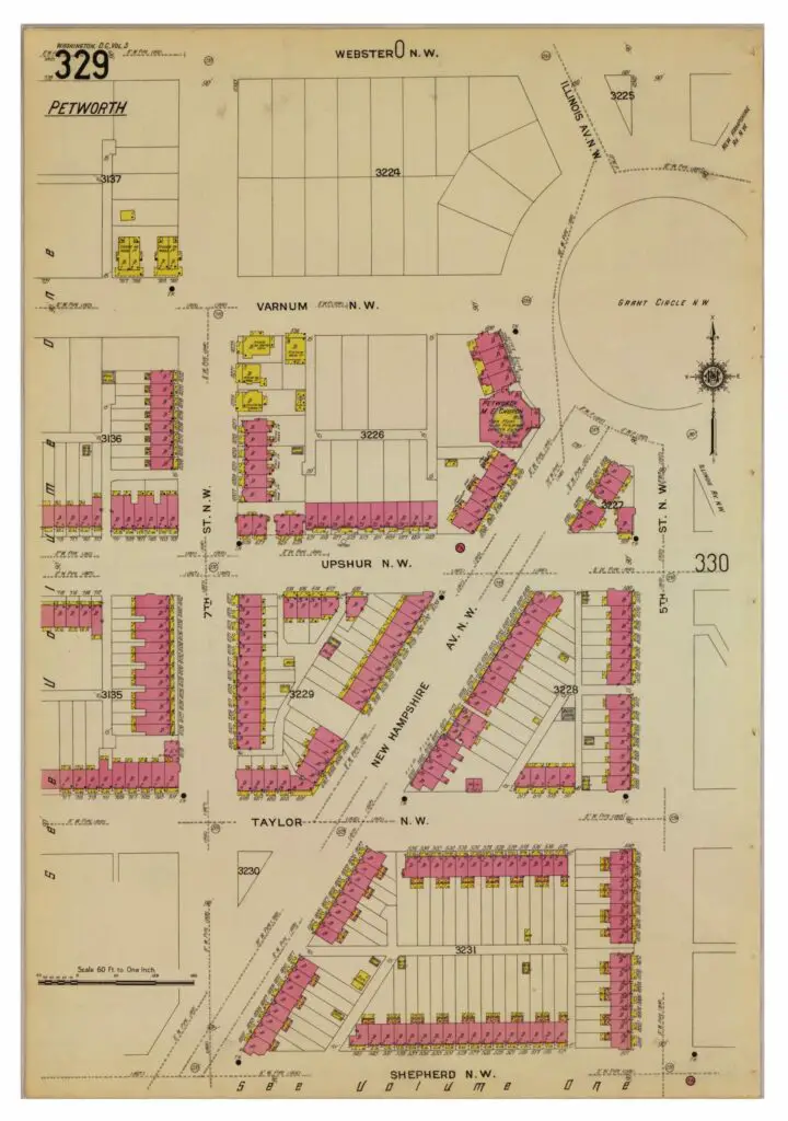
Take a journey back in time to explore the undeveloped Mount Pleasant of 1907 through a fascinating map. You can also see across 16th St. into what is now better known as Columbia Heights.
map of SW in 1909
Remembering the Homes Lost During the Redevelopment of the Southwest Quadrant
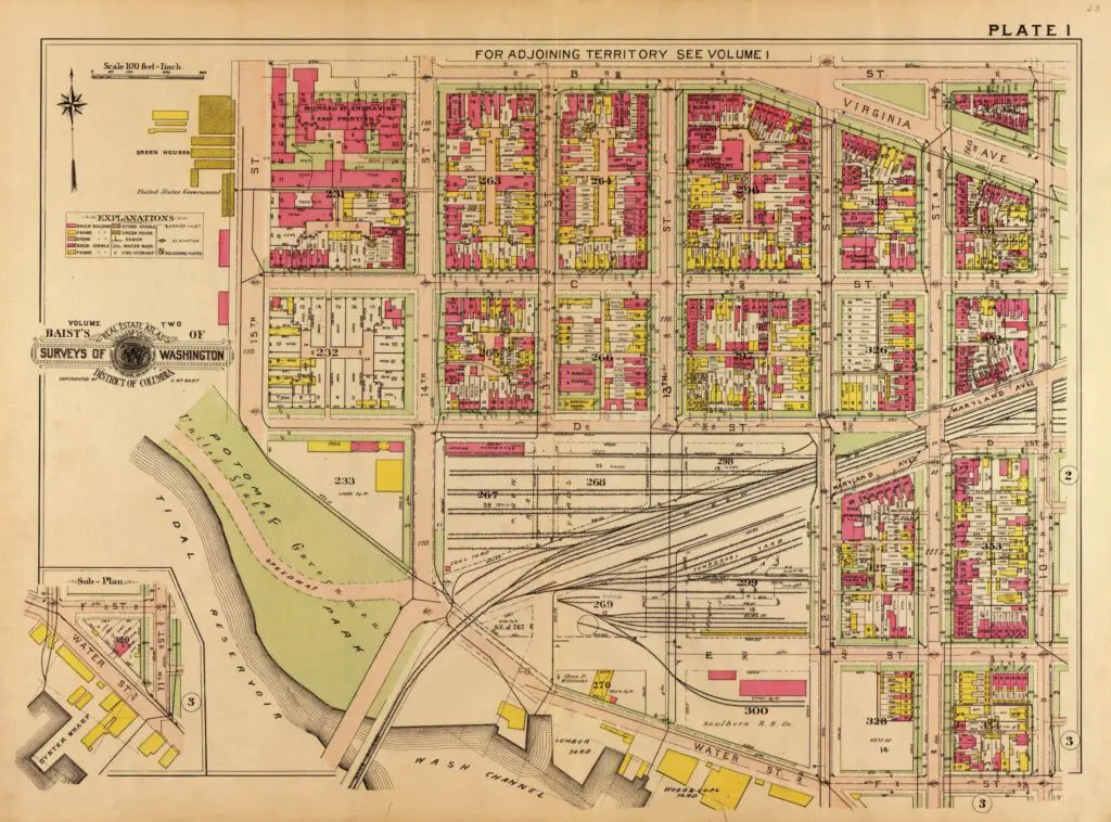
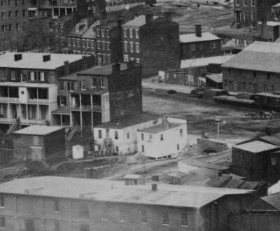
Remembering the homes that were bulldozed to make way for the "modern" Southwest Quadrant in DC. Take a look back at the history of the area and the impact of the redevelopment on the local community.
map of Grant Circle in 1916
Grant Circle and Petworth in 1916
1916 map of Grant Circle and surrounding neighborhood of Petworth.
1907 Map of Randle Highlands
Map of Randle Highlands in 1907
1907 map of Randle Highlands in Washington, DC.

Enjoy daily

Ghosts of DC stories.