-ad 189-

Posted In Faces & Places of Yesterday

Thomas Circle in 1943
A Look at Thomas Circle in 1943, Plus Historical Photos and a Map
Take a look at Thomas Circle in 1943 and see what it looked like in 1920, 1888, and 1921 with photos and a map from the Library of Congress.
Hyattsville Hardware in 1940
A Journey Through Time: Hyattsville Hardware in 1940 and Today
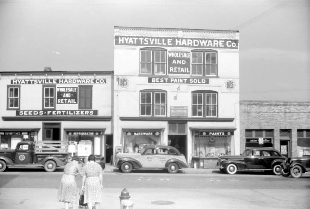
Journey through time and explore the history of Hyattsville Hardware - a building that has stood since 1940. See the old photo and view the building today on Google Street View.
Washington, D.C. Corner store which is patronized by Mrs. Ella Watson, a government charwoman
GoDCers, Check Out This Photo from 1942 Showing Two Buildings on 11th St.
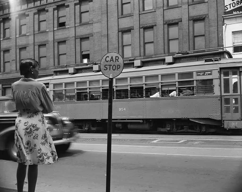
GoDCers, check out this amazing photo taken in August of 1942 showing two buildings on 11th St. NW, DC. You can still visit the store on the right today and compare the photos to see how the city has changed over the years!
F Street in the 1910s - Harris & Ewing
Take a Trip Back in Time to See F Street in the 1910s
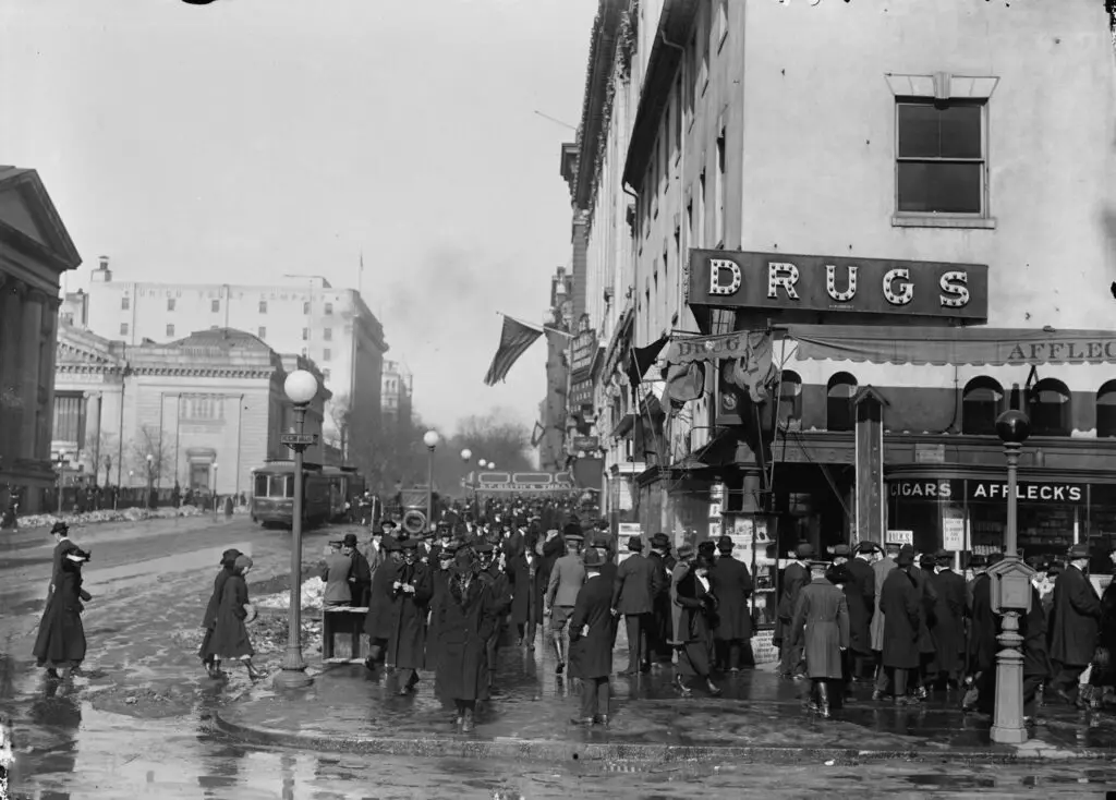
Take a trip back in time to see F Street in the 1910s with this incredible old photo. Also, check out photos of F Street from different eras, such as the 1870s, 1860s and the Civil War.
Screenshot 2015-02-19 at 7.41
Frank White of North Dakota and His Former Home in 16th Street Heights
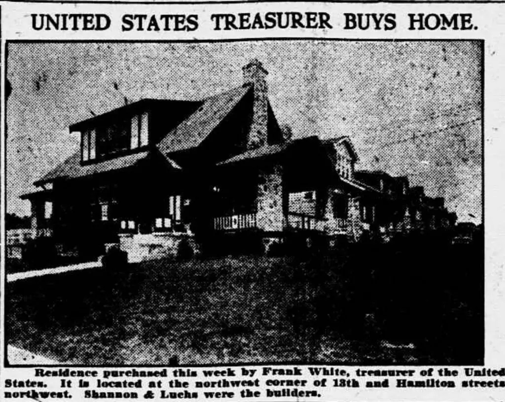
Explore the home formerly owned by U.S. Treasurer and former North Dakota Governor Frank White at 16th Street Heights. See what it looks like today and the history behind it.
Washington, D.C. Scott Circle
A Look Back in Time: A Night View of Scott Circle in April 1943
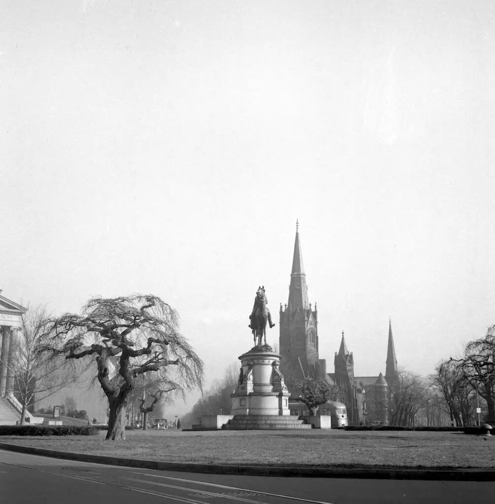
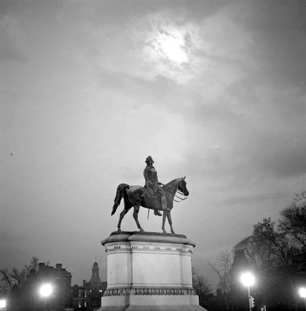
Take a look back in time and explore Scott Circle in Washington, D.C. in April 1943. Check out this great post and aerial view of the circle, as well as a hand-drawn map by Alexander Graham Bell.
Washington, D.C. Street corner, 7th Street and Florida Avenue, N.W.
From 1942 to Now: Revisiting a Street Corner in Washington, DC
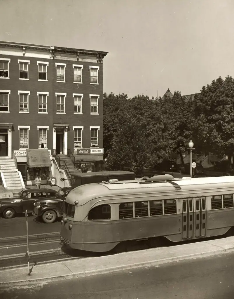
Revisit a street corner in Washington, DC from 1942 to now with this blog post and Google Street View. See how the building across the street has changed from 1942 to now.
AERIAL VIEW OF WEST/FRONT AND NORTH/SIDE FACADES, LOOKING SOUTHEAST (FROM LEFT TO RIGHT): VA-1272 Ball Building, 1437 N. Court House Road. VA-1273 Jesse Building, 1423-27 N. Court House Road. VA-1276 Jesse-Hosmer Building, 1419 N. Court House Road. VA-1275 Moncure (Adams, Porter, Radigan) Building, N. 1415 Court House Road. VA-1274 Rucker Building, N. 1403 Court House Road. - Lawyers' Row Block, North Court House Road between Fourteenth & Fifteenth Streets, Arlington, Arlington County, VA
A Trip Down Memory Lane - Exploring the "Lawyers' Row Block" in Arlington from the Early 1990s
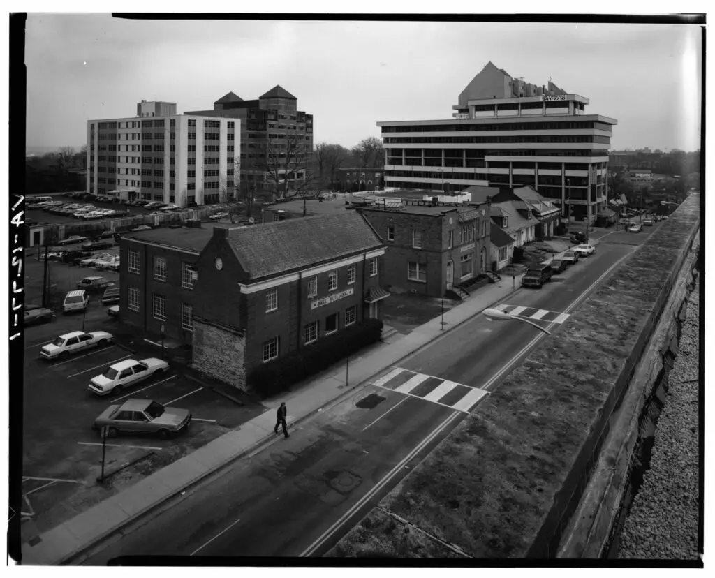
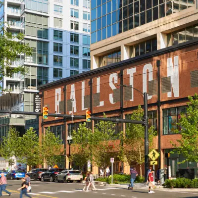
Take a virtual trip down memory lane and explore the "Lawyers' Row Block" in Arlington during the early 1990s. See how this area has changed from then to now with a comparison of images from the Library of Congress and Google Street View.
Tysons Corner Center sign in 1969
Old Photos of Tysons Corner: From the Air, Parking Lots and Stores
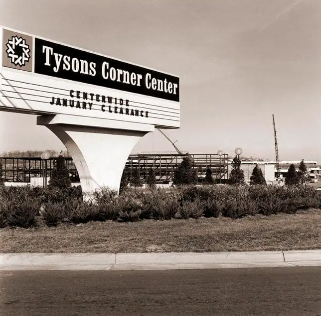
Take a journey back in time with us and check out some old photos of Tysons Corner from the air, parking lots and stores. Click on the images for a larger version!
Washington, D.C. Passengers, drivers, and dogs were tired by the time they reached the gas pumps on the day before stricter gasoline rationing went into effect
The Long Gas Lines of Washington, D.C. in 1942
Take a look back at World War II-era Washington, D.C. with these photos of the long gas lines in the city on June 21st, 1942, the day before stricter gasoline rationing went into effect.

Enjoy daily

Ghosts of DC stories.