-ad 189-

Posted In Faces & Places of Yesterday

Looking east at construction on Arlington Memorial Bridge over the Potomac River in Washington, D.C., in the United States. Note the statue on the partially-constructed pedestal just to the right of the abutments (bottom center). The U.S. Commission of Fine Arts erected this mock-up to determine how high statues on the piers of the bridge should be.
A Look Back: Building Memorial Bridge in Washington, D.C. - May 15th, 1928
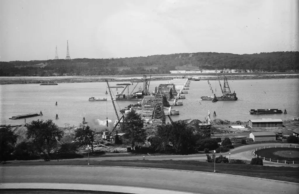
Take a look back in time with this beautiful old photo showing the construction of Memorial Bridge looking from D.C. towards Arlington National Cemetery. The photo is dated May 15th, 1928. Source: Flickr user Tim Evanson.
Corner store at 4th and M Streets SW, northwest corner, looking up 4th Street toward L, 1100 block
A Look Back at Life in Southwest Washington in the 1950s
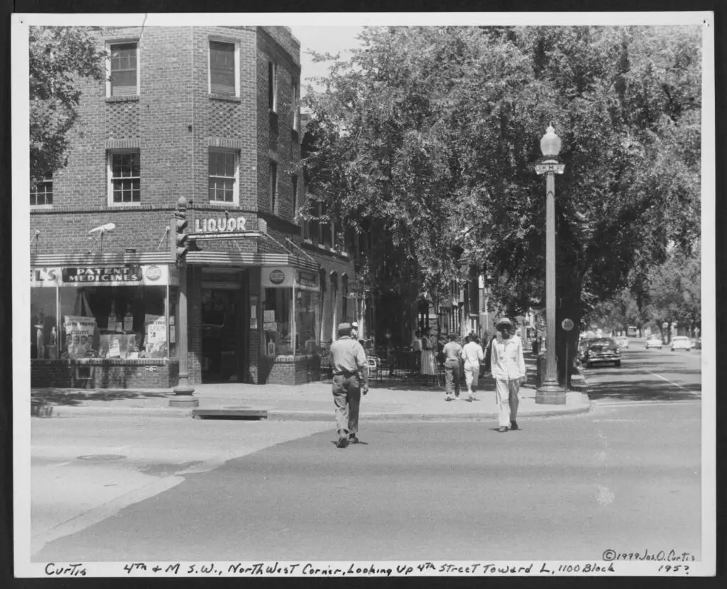
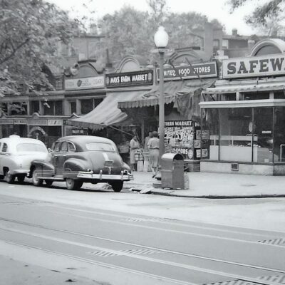
Take a look back at life in Southwest Washington in the 1950s with this photo of a corner store at 4th and M St. SW. See how the same corner looks today with a Google Maps embed.
Circa 1911. "Washington from Washington Monument." Points of interest in this panoramic view include B Street (today's Constitution Avenue), running diagonally from the Potomac Electric powerhouse at lower left; Louisiana Avenue, branching off in the general direction of Union Station at upper right; the Old Post Office and its clock tower at left-center across Pennsylvania Avenue from the Raleigh Hotel under construction; the Agriculture Department greenhouses in the foreground with a corner of the Smithsonian "National Museum" at far right, just below Center Market; Liberty Market at upper left, below what looks to be a vast tent encampment; and, at right-upper-center, the Pension Office north of Judiciary Square and the District Court House. 8x10 glass negative, Detroit Publishing Co.
A Rare Look at Downtown DC in 1911: A Photo From the Air
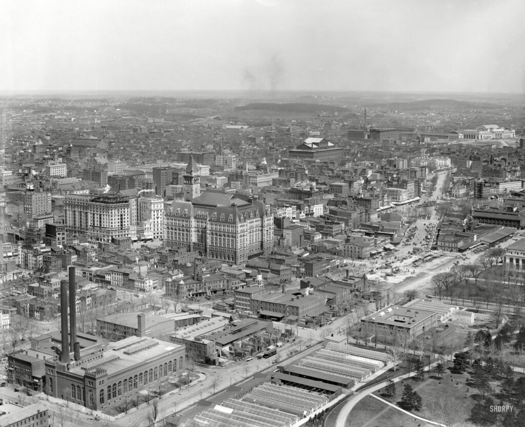
Get a rare glimpse of downtown DC in 1911 with this photo taken from the air. See the amazing details of the Old Post Office and other points of interest in this panoramic view.
Parking lot in DC, April 1938
Can You Identify This Parking Lot in DC from 1938?
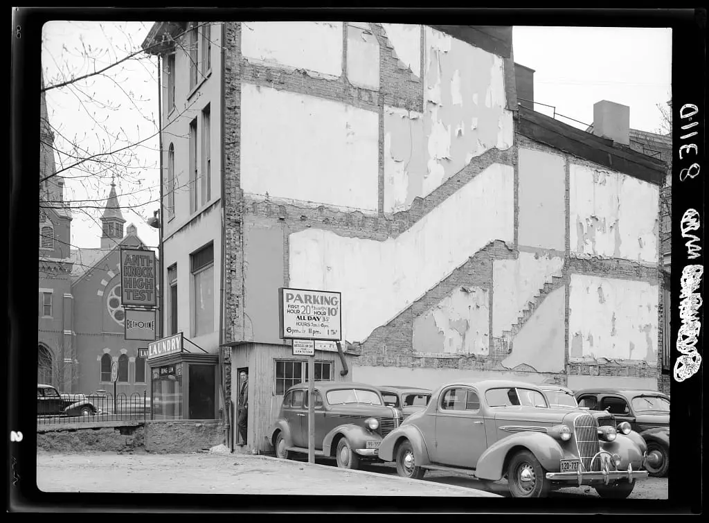
Take a look at this old photo taken in 1938 of a parking lot in DC. Can you identify where this is? Join the GoDC community and add your thoughts in the comments.
Bridge spanned the Potomac River from Georgetown to Rosslyn, Virginia and was demolished after construction of the Key Bridge
Discovering a Cool Old Photo of Aqueduct Bridge 105 Years Later
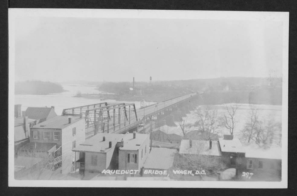
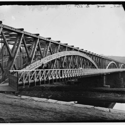
Take a trip back in time 105 years and explore the Aqueduct Bridge as seen in a cool old photo. Discover what the bridge looked like before it was demolished after the construction of the Key Bridge.
Washington, D.C., circa 1931. "Fifteenth Street at Pennsylvania Avenue." Note the traffic lights, which made their D.C. debut in 1926, as well as the traffic-cop gazebo at center ("NO LEFT TURN") and streetcar switch tower to its left. Harris & Ewing Collection glass negative.
A Look Back at 15th Street and Pennsylvania Avenue in Washington, D.C. Circa 1931
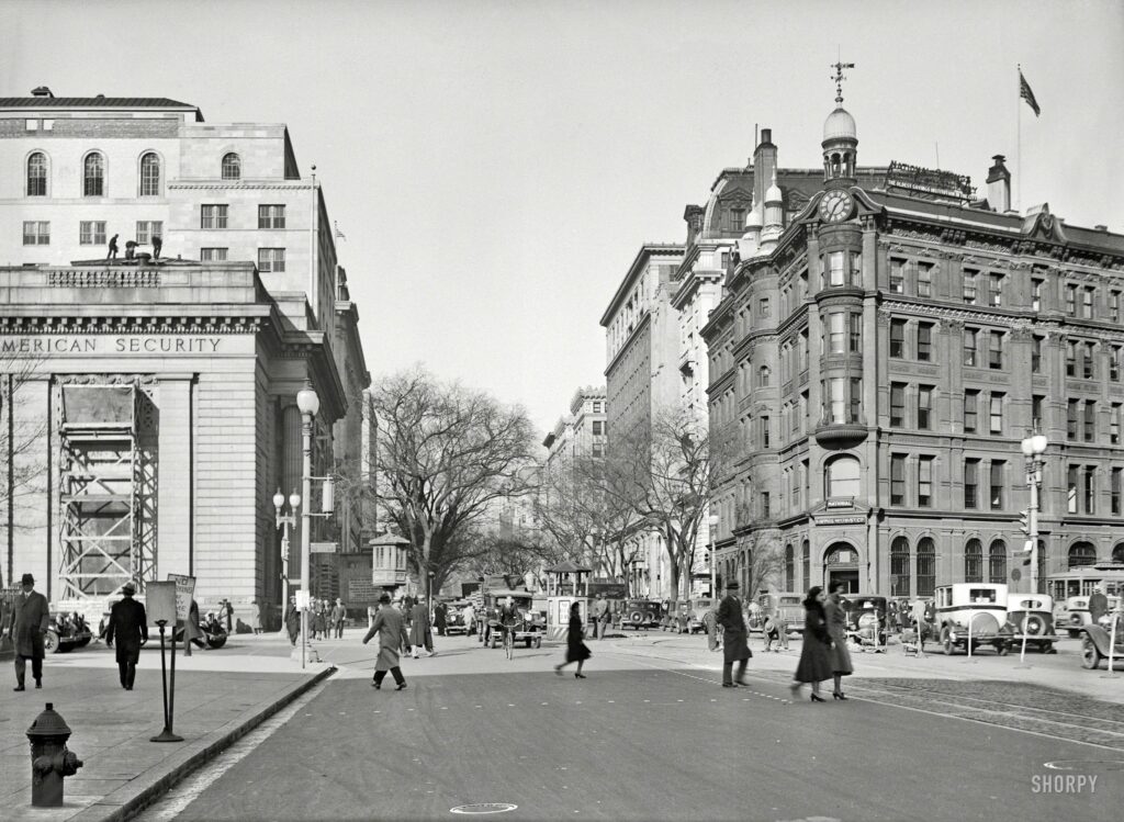
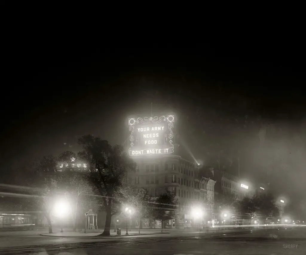
Take a look back at 15th Street and Pennsylvania Avenue in Washington, D.C. circa 1931. See the traffic lights, traffic-cop gazebo, and streetcar switch tower in this amazing old photo. Source: Shorpy.
1940s. "Arlington County, Virginia. War Department. Pentagon, aerial view." Safety negative by Theodor Horydczak.
A Rare Photo of the Pentagon From Above
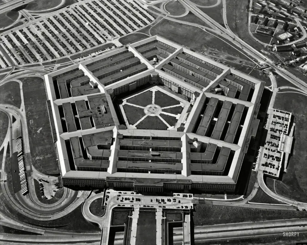
Get a birds-eye view of the Pentagon from the 1940s with this rare photo. Enjoy a glimpse of a bit of history and the War Department with this aerial shot captured by Theodor Horydczak.
1942. "Effect of gasoline shortage in Washington, D.C." Note the streetcar control tower. Photo by Albert Freeman, Office of War Information.
A Look Back: Washington D.C. During the 1942 Gas Shortage
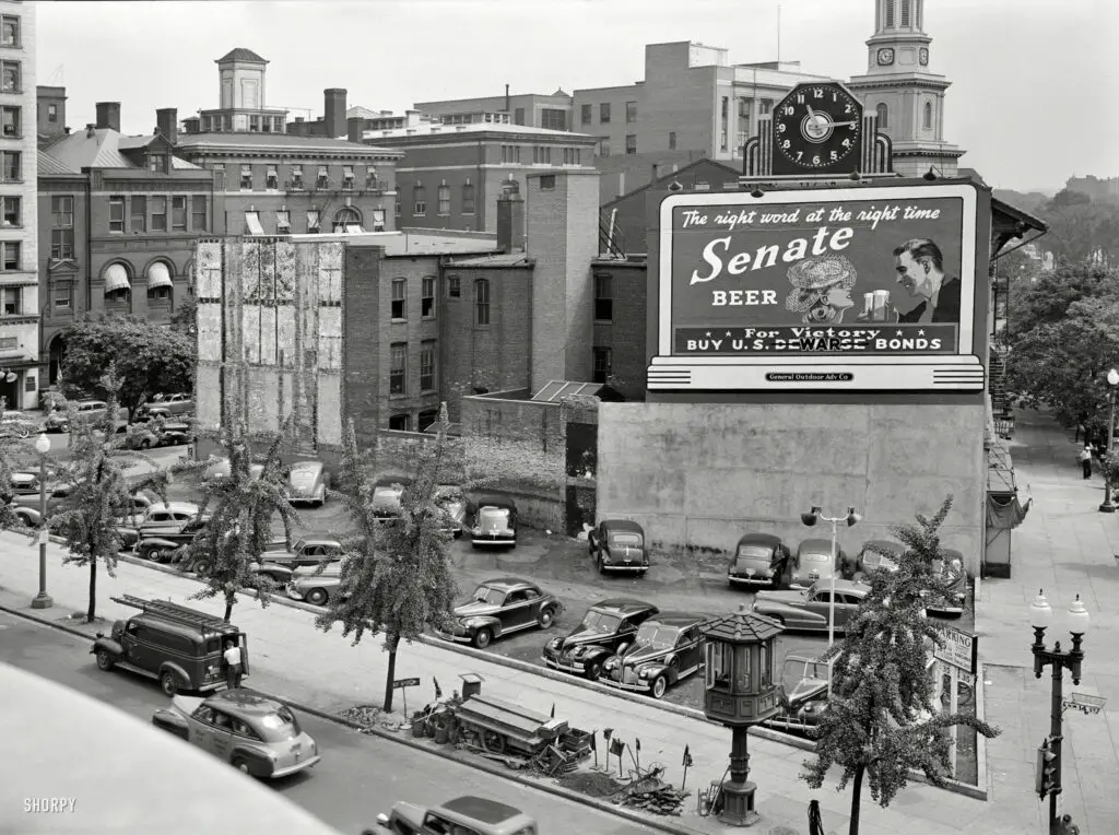
Explore a captivating 1942 photograph of Washington D.C. during a gasoline shortage, revealing the city's resilience and adaptation to wartime challenges through a focus on its streetcar control tower and altered transportation habits.
Aerial view of the Washington Navy Yard, looking east (top). This shot shows the Navy Yard’s borders: M Street on the north (left); the waterfront on the south; 11th street on the east, and 2nd street on the west (foreground). On the right bank of the river is Anacostia, September 1963. NHHC Photograph Collection, Navy Subject Files, Washington Navy Yard. (214).
Aerial Views of the Washington Navy Yard Before, During, and After President Kennedy's Assassination
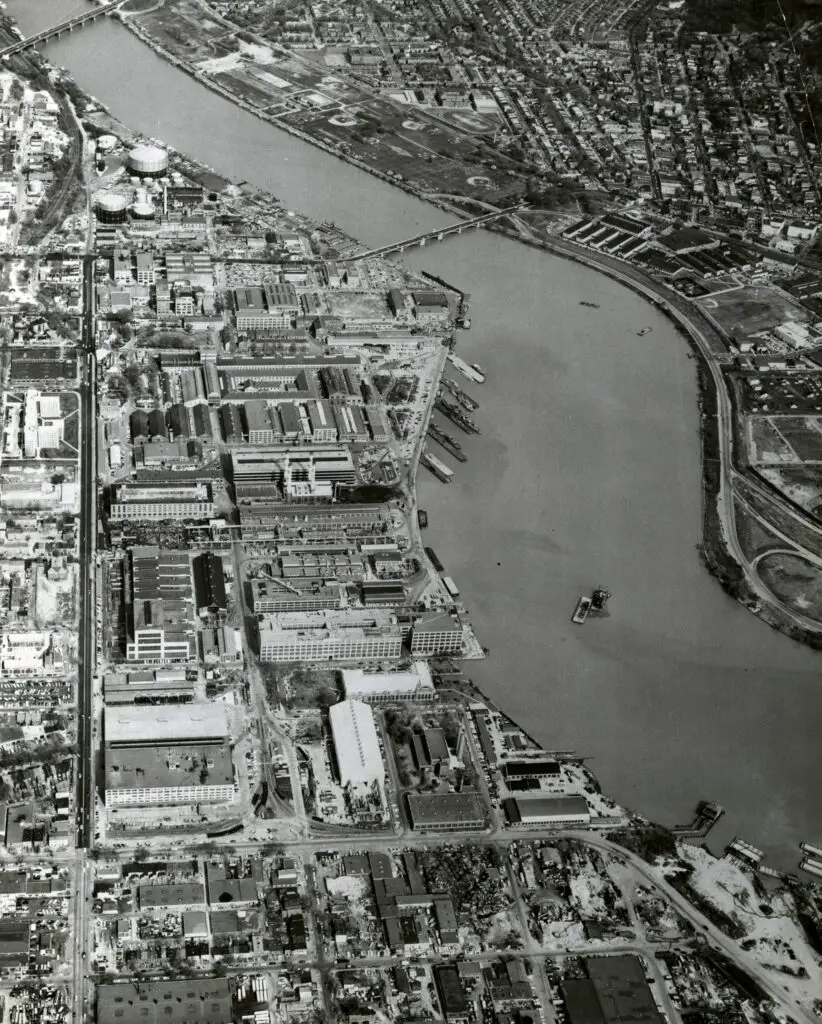
Take a look at the Washington Navy Yard before, during, and after President Kennedy's assassination with these aerial views from the 1960s, 1970s, and 1980s.
Washington, D.C., circa 1918. "World War I. Food Administration electric signs, 7th Street and Pennsylvania Avenue N.W." National Photo Co.
A Blast from the Past: 7th and Pennsylvania Ave. During World War I
Take a step back in time with this incredible old photo of 7th and Pennsylvania Ave. during World War I. Get a glimpse of what the streets of DC looked like during the war! #WWI #DC #History

Enjoy daily

Ghosts of DC stories.