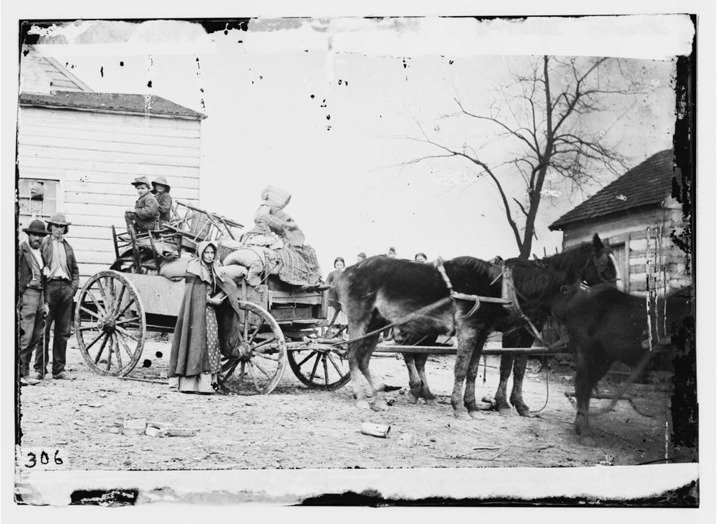
Centreville, VA was established in 1792 by local landowners with the intent of creating a center point between the more established towns: Alexandria, Colchester, Dumfries, Middleburg, Georgetown, Warrenton, and Leesburg. Learn more about its fascinating origin story here.
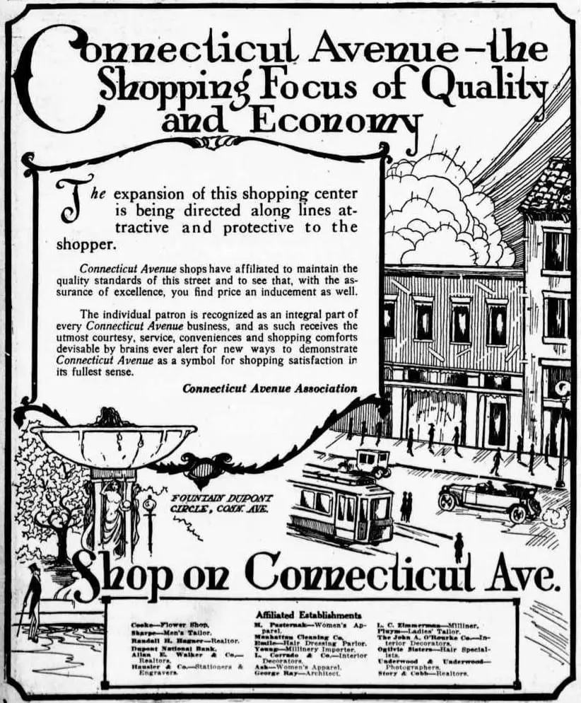
This is a great advertisement from the early 1920s. The Connecticut Avenue Association was promoting retail up and down Connecticut Ave., near Dupont Circle, including the Dupont National Bank.
Can you help us in our investigation to identify where President Wilson's 1919 Pierce Arrow is parked? Take a look at the photo we've shared and see if you can figure it out. Happy sleuthing!
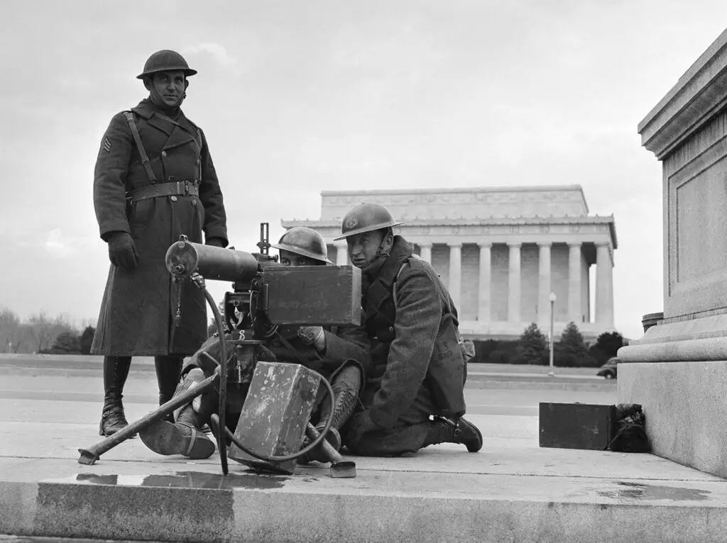
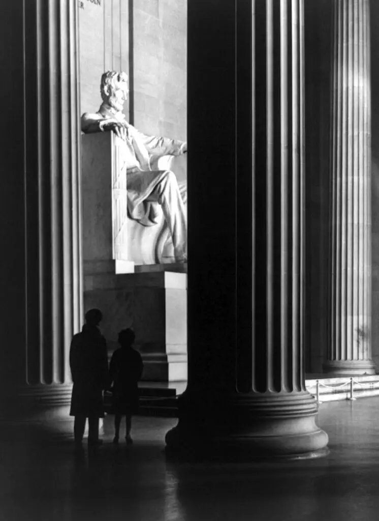
Take a look at what the Lincoln Memorial in Washington, D.C. looked like the day after Pearl Harbor was attacked. Reminiscent of the day after 9/11, this historic moment in history is remembered and honored here.
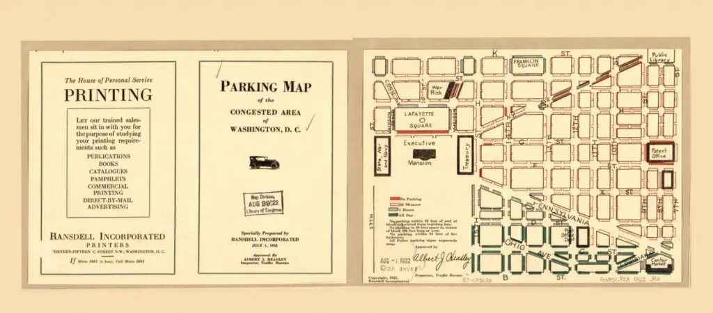
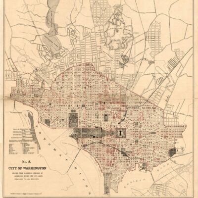
Take a look at this fascinating map of Washington, D.C. from 1922, showing where you could and could not park in the congested city. Click on it to zoom in on the details. Source: Library of Congress.
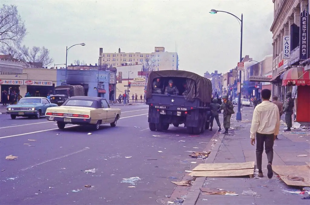
This is an unexpected and disappointing article from 1977 about a small group of sixth-graders and a third-grader smuggling marijuana and liquor to and from an elementary school in Montgomery County. Interestingly, this occurred just a few days before President Jimmy Carter implemented the first civil rights law for people with disabilities.
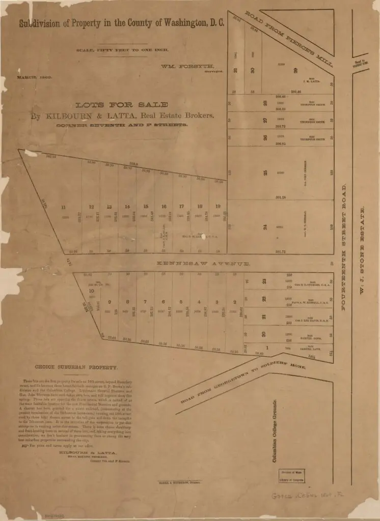
Take a look back in time and explore Columbia Heights in 1869 with John Sherman's Subdivision. This property map is full of interesting details, like old street names and the location of Pierce's Mill. Click to learn more!
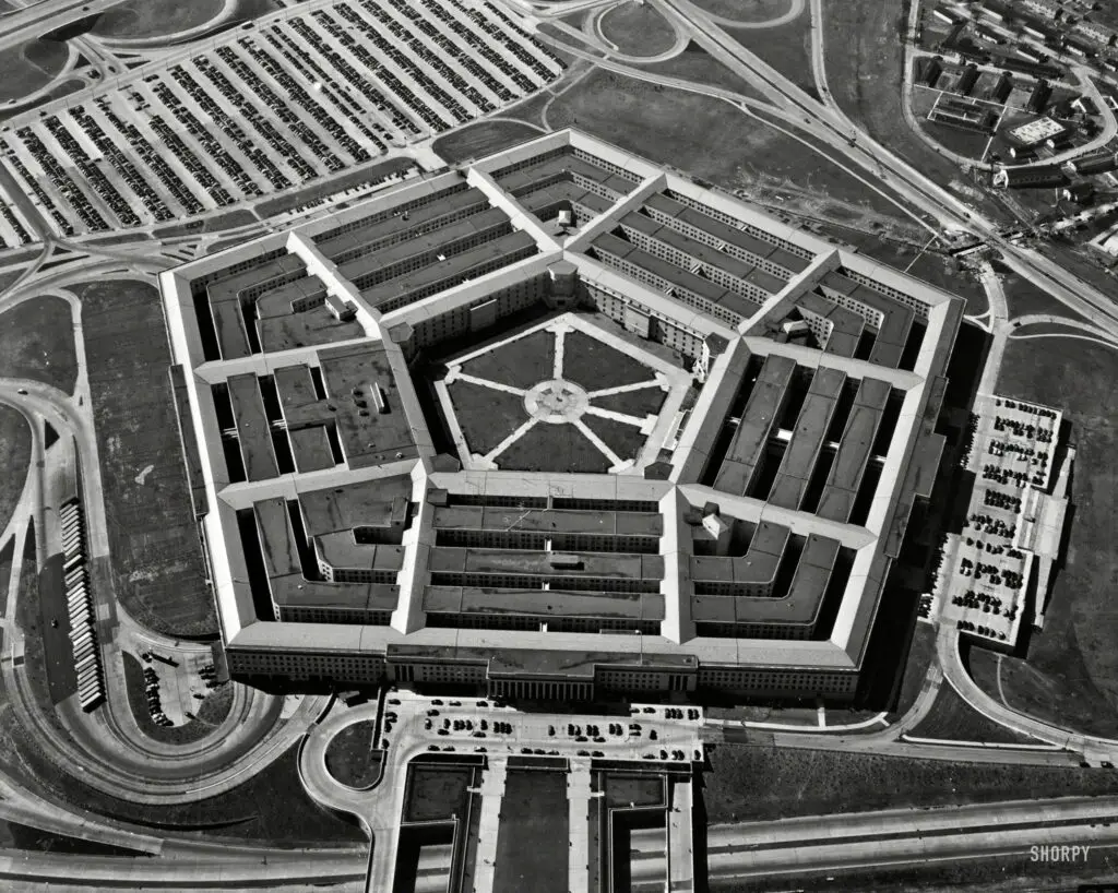
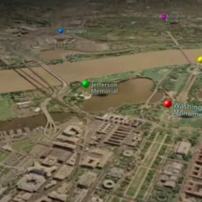
Get a birds-eye view of the Pentagon from the 1940s with this rare photo. Enjoy a glimpse of a bit of history and the War Department with this aerial shot captured by Theodor Horydczak.
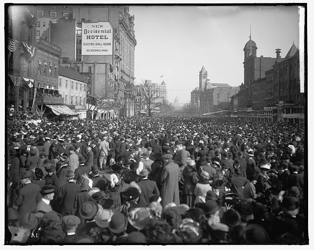
Remembering the Women’s Suffrage March of 1913 and the efforts of suffragettes in the United States to gain the right to vote. This magnificent parade and rally on March 3, 1913 was designed to gain the attention of the public and the president of the United States.
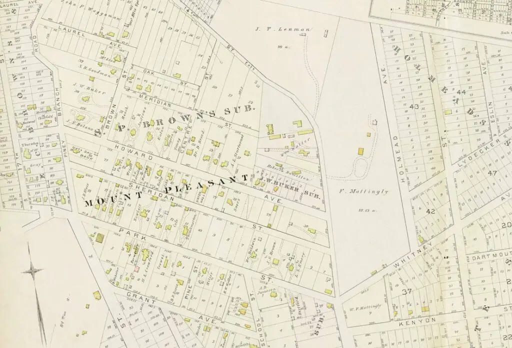
Explore an incredible old map from 1887 of Mt. Pleasant and Columbia Heights. See old street names and the Columbia College Subdivision. Click through to see greater details.
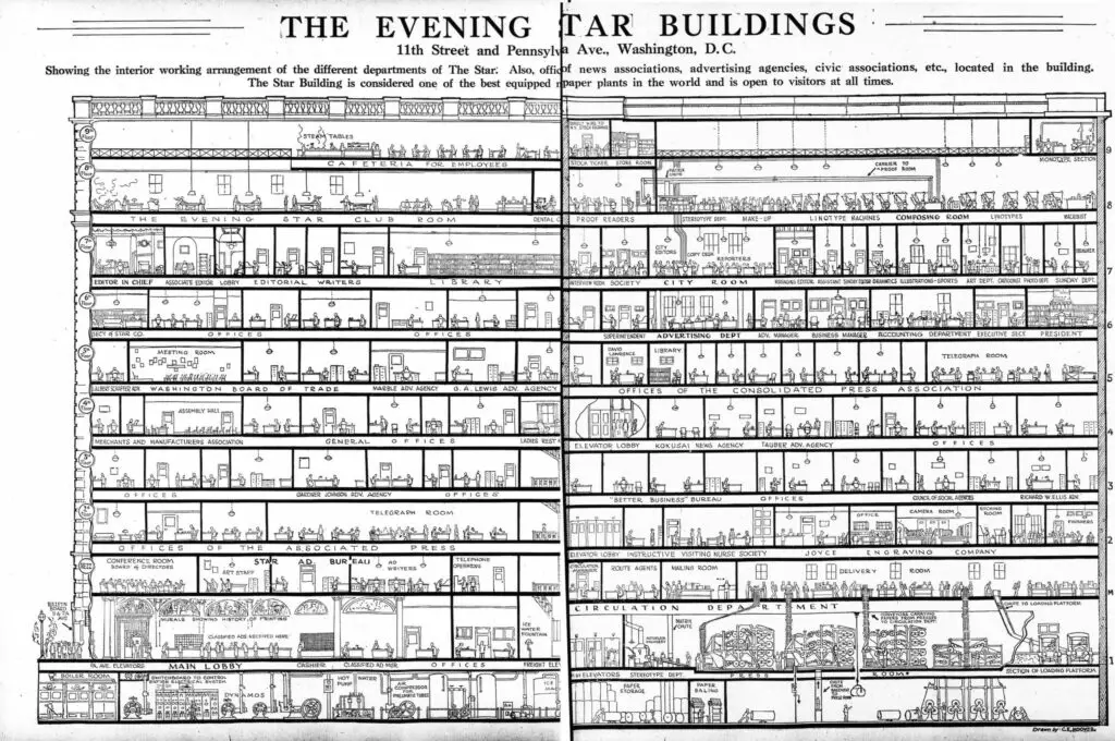
Check out this amazing cutaway drawing of the Evening Star Building at 11th and Pennsylvania Ave. NW. We posted a great photo of it some time ago, but this was something we had to share. The image was printed in the Evening Star on May 10th, 1922.
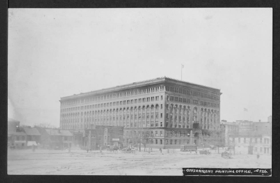
Take a look back at a really cool old photo of the Government Printing Office off of North Capitol St. Don't miss this great story about a man who worked at the GPO and his family!