-ad 189-

A Look Back at the 1971 Maps Showing I-95 Cutting Through D.C.

Take a look back at 1971 maps of what could have been I-95 cutting through D.C. Today, what is now 395, ends at New York Ave. NW. Get a glimpse into what could have been with these fascinating maps from 1971.
-ad 188-

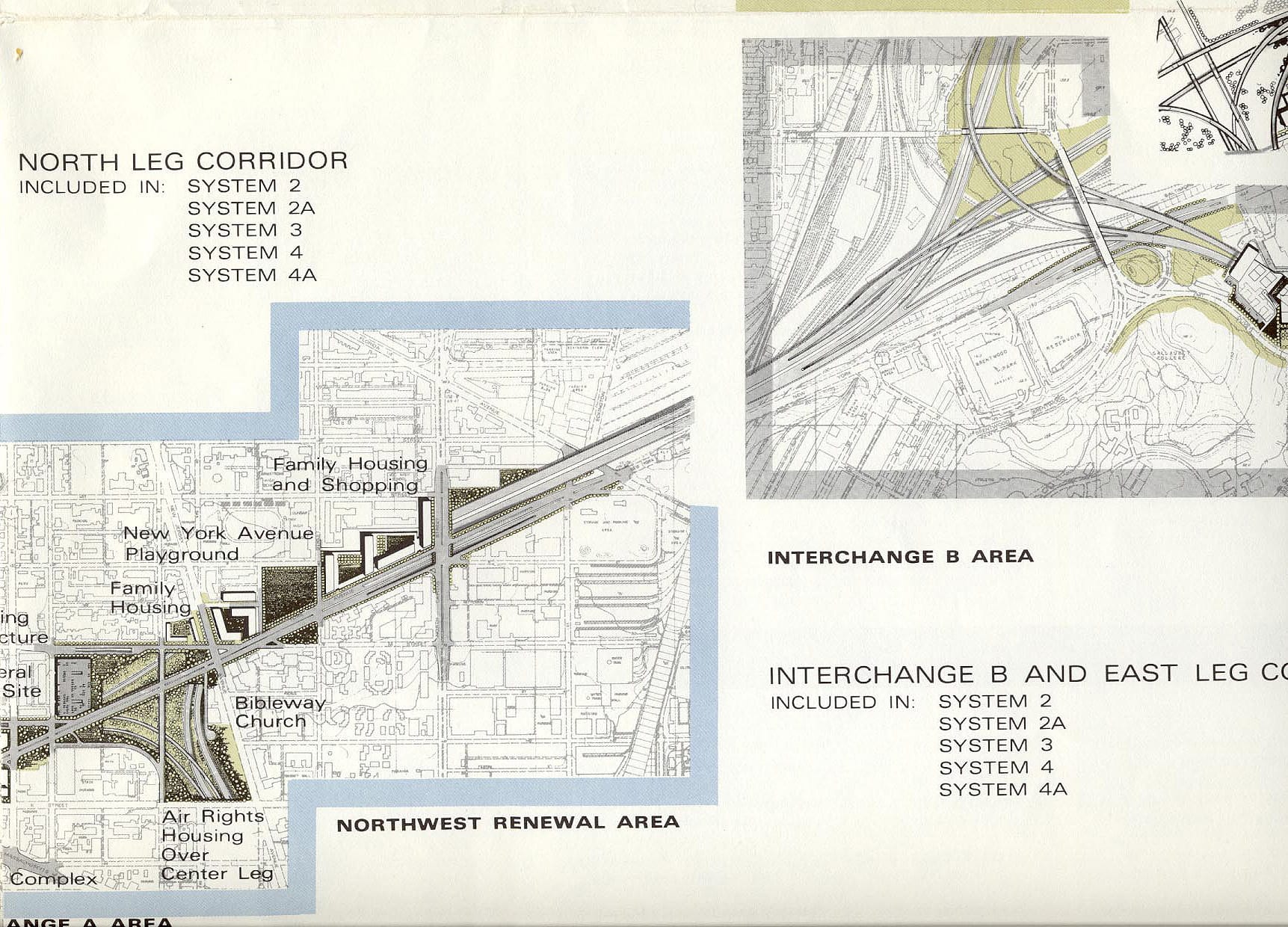
Here are some terrific old maps from 1971 showing the remainder of what would have been I-95 cutting through D.C. Today, what is now 395, ends at New York Ave. NW.

Notice the decked/tunneled section south of Fort Totten, then the over 90-degree turn to the east, then the decked/tunneled section between Galloway Street and Gallatin Street, with the Metrorail Glenmont Route (Red Line trains) following the North Central Freeway (I-95 south of Fort Totten and I-70S north of Fort Totten), and with the Metrorail Greenbelt Route (Green Line trains) following the Northeast Freeway (I-95 east of Fort Totten). The area between Galloway Street and Gallatin Street where the Northeast Freeway was proposed was mostly open fields then and still is now.
Notice the decked/tunneled section alongside the B&O Railroad (CSXT today).
Notice the decked/tunneled section along New York Avenue.

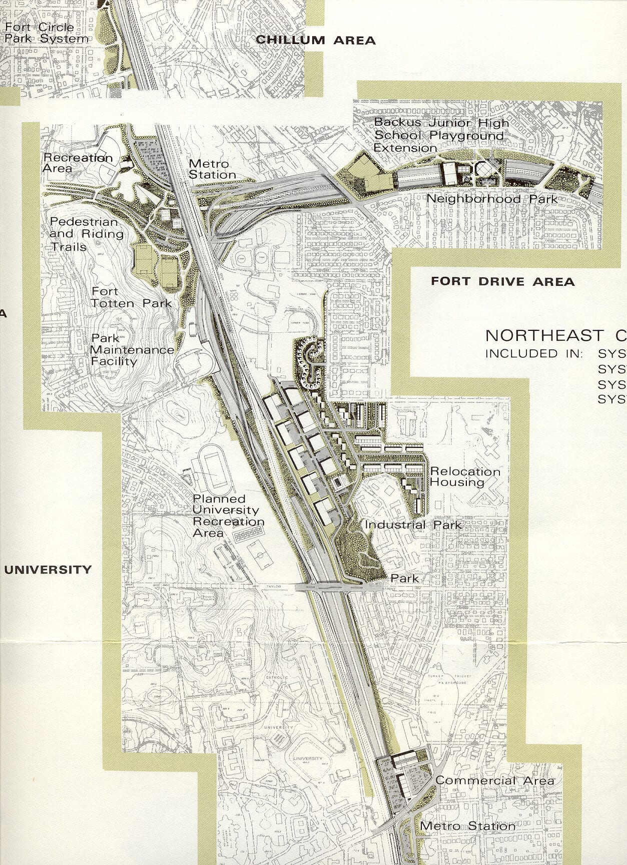
Source: Roads to the Future
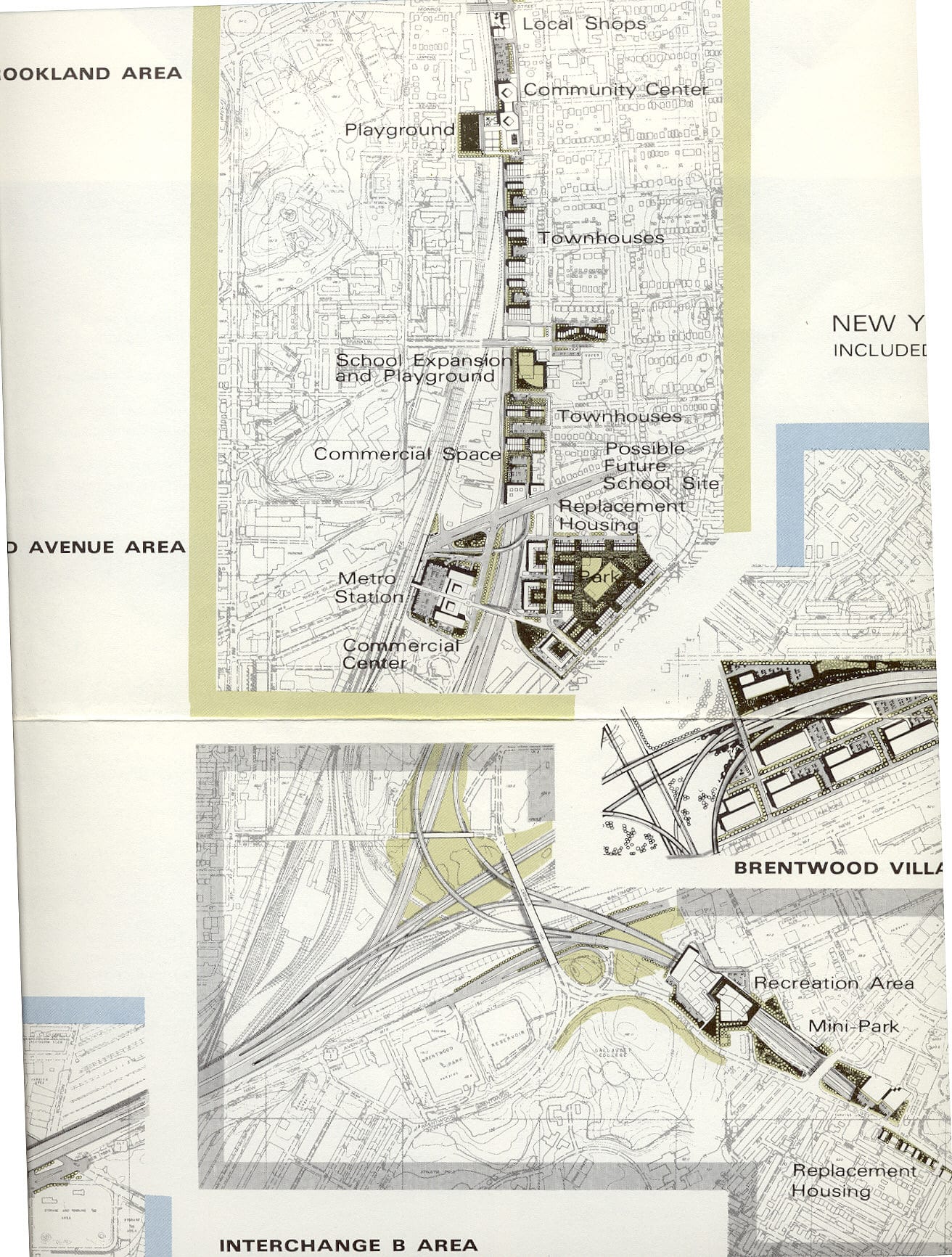
-ad 617-

Enjoy daily

Ghosts of DC stories.