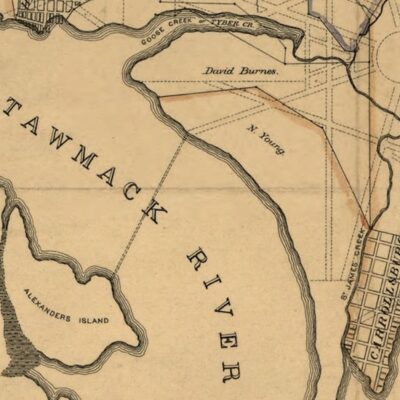
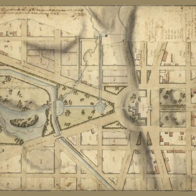
This is a great old map that we dug up at the Library of Congress. It shows Fairfax County and the surroundings near the end of the Civil War.
![A map of Fairfax County, and parts of Loudoun and Prince William Counties, Va., and the District of Columbia] / copied by J. Paul Hoffmann, Top'l. Office, A.N.Va. ; approved S. Howell Brown, 1st Lt. Engs. Troops, in chg. Topl. Dept. A.N.V., March 29th 1864.](https://ghostsofdc.org/wp-content/uploads/sites/7/2013/09/cwh00030.jpg)
Source: Library of Congress

This is a great old map that we dug up at the Library of Congress. It shows Fairfax County and the surroundings near the end of the Civil War.
Source: Library of Congress